3/18 - Rob Knight's "SEVERE THREAT/TORNADO WATCH" Friday Morning Forecast
A vigorous system is in the area moving to the east. The area is under a TORNADO WATCH until 10 AM. All form of SEVERITY will…
A vigorous system is in the area moving to the east. The area is under a TORNADO WATCH until 10 AM. All form of SEVERITY will…

Today is looking like a very nice day as high-pressure shifts to the east and return flow begins ahead of the next system. Timing is a virtue…
Quiet conditions through St. Patrick's day with linger cloud coverage and mild temperatures In the 70s. The forecast gets active again Thursday night and early Friday. Our next…
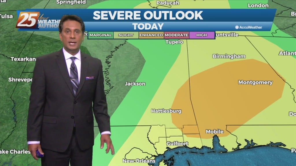
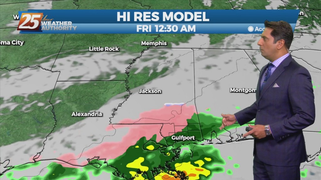
Instability is still not impressive with this system as it moves east across the Mississippi Gulf Coast this morning. Scattered showers/t-storms will move across the area this morning…
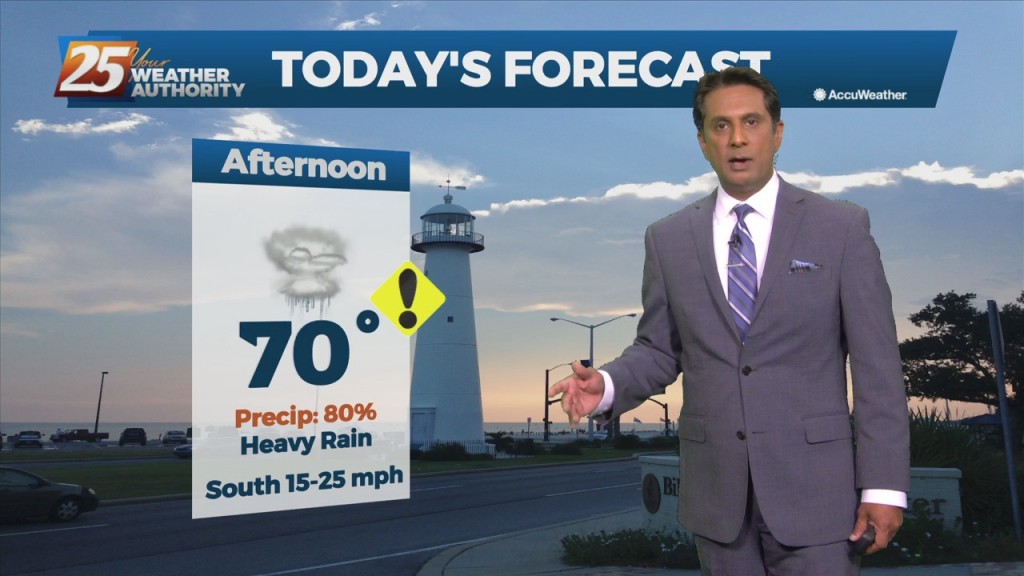
Today, an upper level disturbance/frontal boundary is expected to influence the area. Scattered to numerous showers and storms will be possible, mainly in the afternoon hours looking…
A stationary front to the east will continue to be the focal point for showers and t-storms again today. The development over land will be elevated…
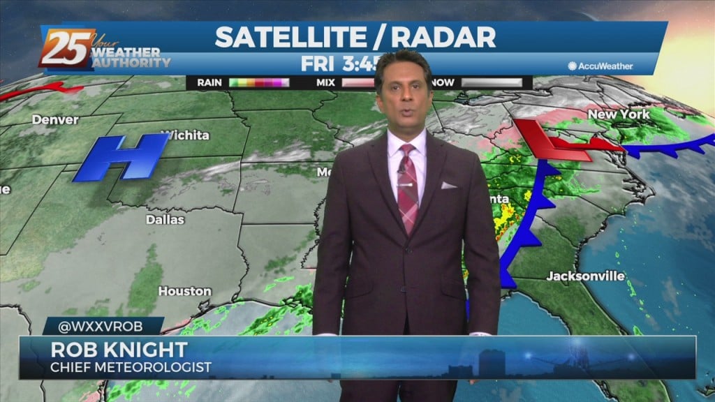
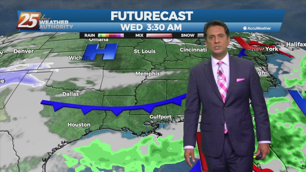
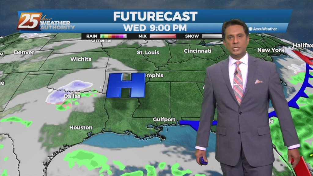
Low pressure is currently over southern Indiana with a cold front southwestward to near Memphis and Shreveport. As the surface low continue to lift northeastward, the cold…
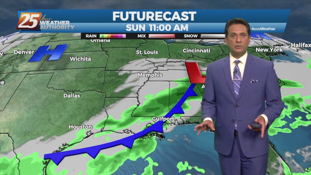
High-pressure currently over the Rockies will move eastward across the Gulf of Mexico Friday and Saturday. This will gradually allow our surface flow to turn onshore and allow moisture…
It's a rather quiet forecast the next few days with cool and dry conditions today slowly moderating over the next few days. High-pressure will quickly move…
A cold front is no east of the area with light precipitation behind the front expected to be out of the area by moon. Forecast guidance…
A lovely sunny day ahead with warm temperatures topping out around 70 degrees. Main forecast concern will be the cold frontal passage on Saturday. Somewhat of a…
Although the front is now east of the area, post frontal rain will continue this morning, spotty rain this afternoon. It will take most of the day for…
A cold front west will slowly move east and through the area this evening. This afternoon will bring the biggest potential for impactful weather to…
A disturbance along the four Corners will weaken over the next 36 hours as it moves eastward. The Canadian trough behind it will move into…
An area of low-pressure to the south along with a cold front north will continue to bring rain to the area. May not see a lot of movement…
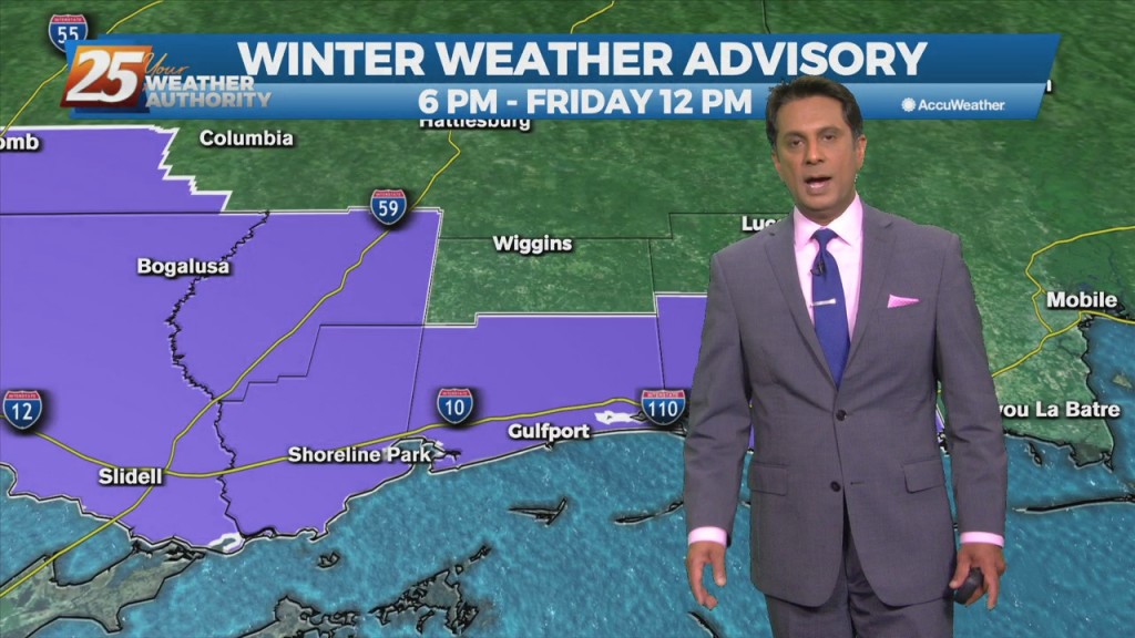
A surface high-pressure has given us the coldest temps so far this season and year will quickly shift east today and clouds will begin to invade from…
A cold front will continue to shift southeastward today with temperatures slowly dropping. Rain should be ending during the afternoon across the area, at least temporarily. Another spoke…
A rather complex forecast scenario will play out over the short term period. High pressure will remain centered east of the area, and this will…
The first 24 hours of the forecast is rather benign, as the high pressure shifts eastward, with perhaps 5 degrees of warming of high temperatures today from…
The first 36 hours of the forecast is pretty straight forward as high-pressure moves eastward across the area, with onshore flow returning Tuesday. Abundant sunshine will…
One more comparatively nice day before the local area gets back on the weather roller coaster tomorrow. Surface high shifts eastward today, with surface…
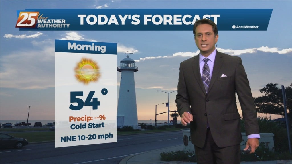
Surface high-pressure extended from Illinois to east Texas. This high-pressure will shift eastward today and Wednesday. Expect sunny skies and cool temperatures today with winds continuing from…
A cold front is barreling down from the northwest thanks to a re-enforcing push of cold air diving south over the central US. This will help…
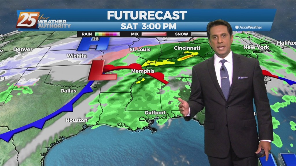
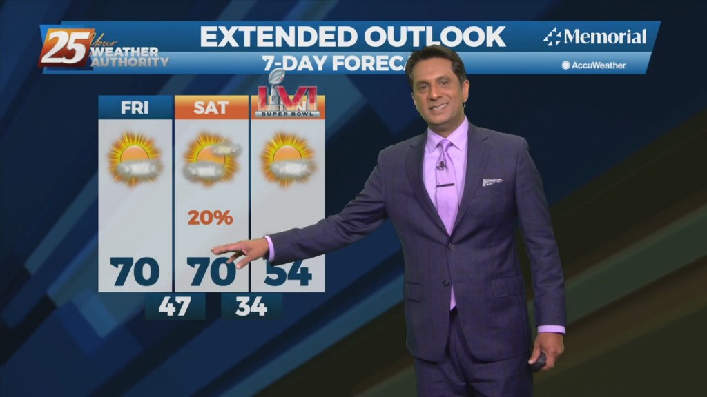
Today will bring continued warm and humid conditions with partly to mostly cloudy shies, a bit more sunshine this afternoon. The main impact for the weekend still comes…