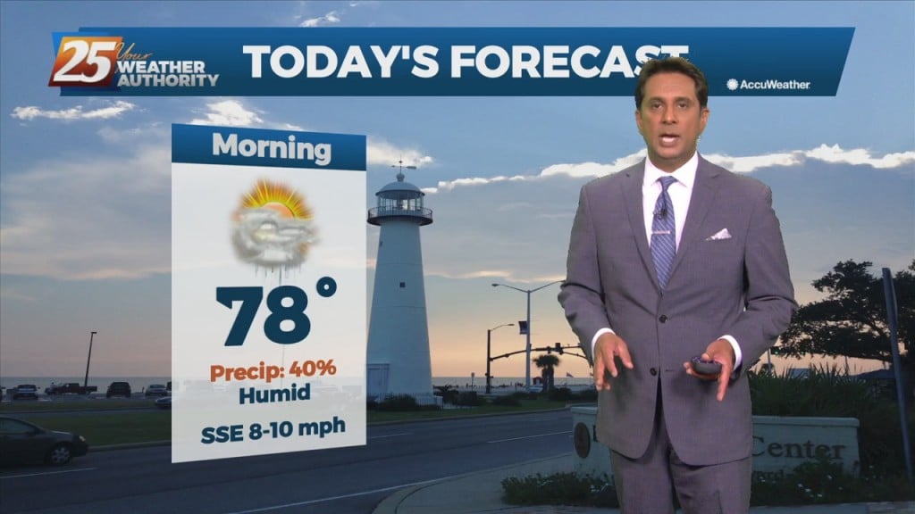
11/1 - Rob Knight's "Monday Morning/1st Workweek of November" Forecast
A very dry and stable airmass in place will affect the Mississippi Gulf Coast through mid-week. Overall, the pleasant period of weather experienced over the weekend…
A very dry and stable airmass in place will affect the Mississippi Gulf Coast through mid-week. Overall, the pleasant period of weather experienced over the weekend…
An area of low-pressure rotating over the lower Tennessee valley will be slow to move NE. Cloud cover has been tricky to forecast as there have been…
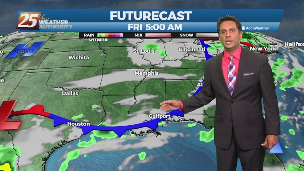
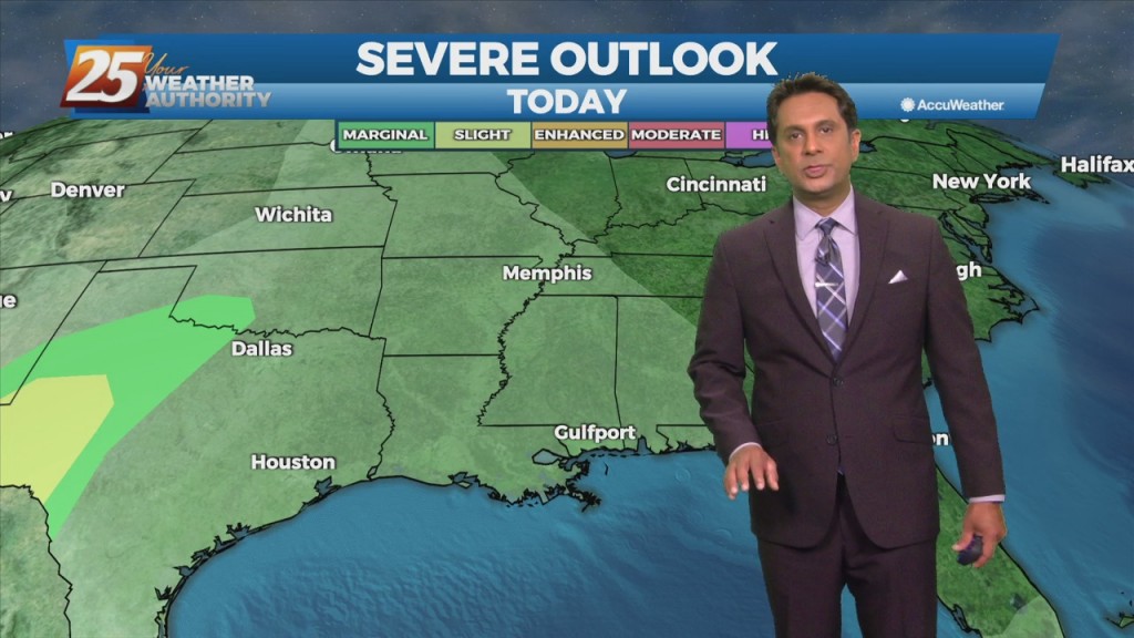
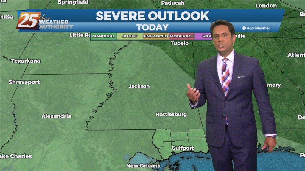
Rapidly changing weather conditions will be the rule over the next 24 hours, with the threat of severe weather and heavy rainfall continuing to be a…
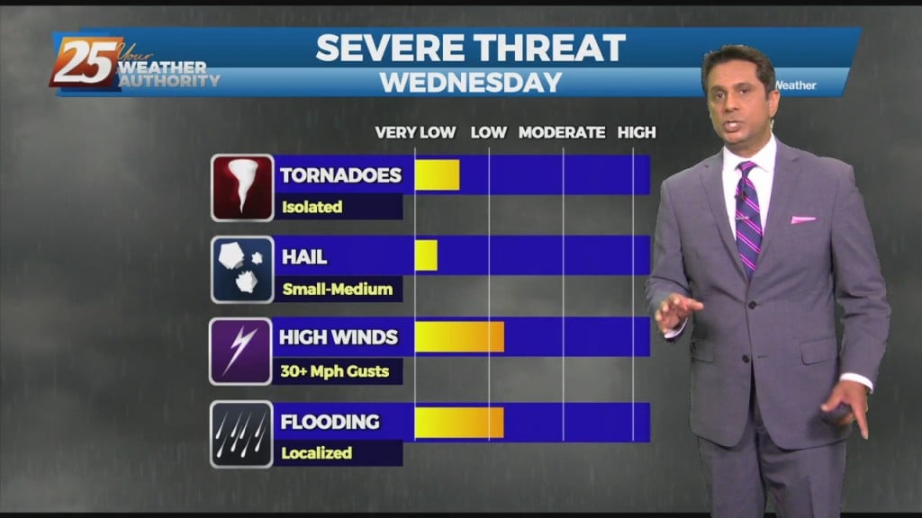
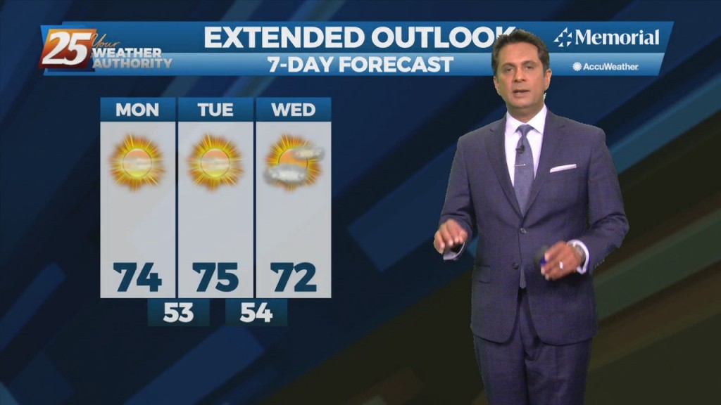
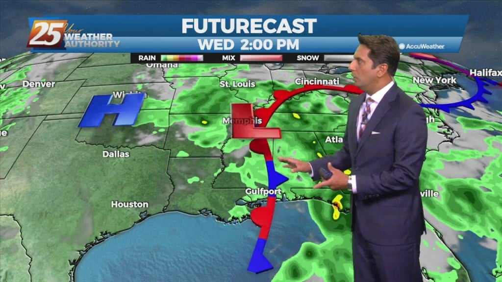
A lovely day today post dry frontal passage last night. We continue to see a severe weather/heavy rain threat Wednesday afternoon and Wednesday night with much cooler weather…
A weak cold front overhead will linger along the coast until later afternoon before getting an additional push to the SE. Areas of patchy dense fog this…
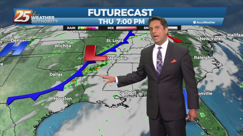
The upper level pattern shows a trough racing eastward through the upper Mississippi Valley towards the Great Lakes. It will be too shallow to bring the associated…
A broad upper level high-pressure extends from the Gulf Coast to the Great Lakes. A trough of low-pressure off the east coast of the country will sag southwest today. In doing so, the flow will shift to more onshore which…
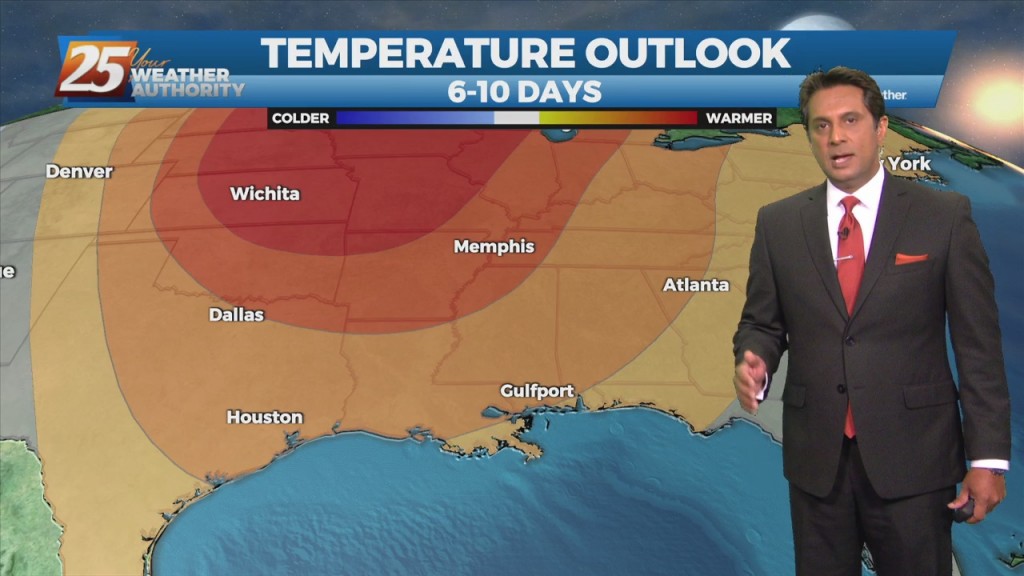
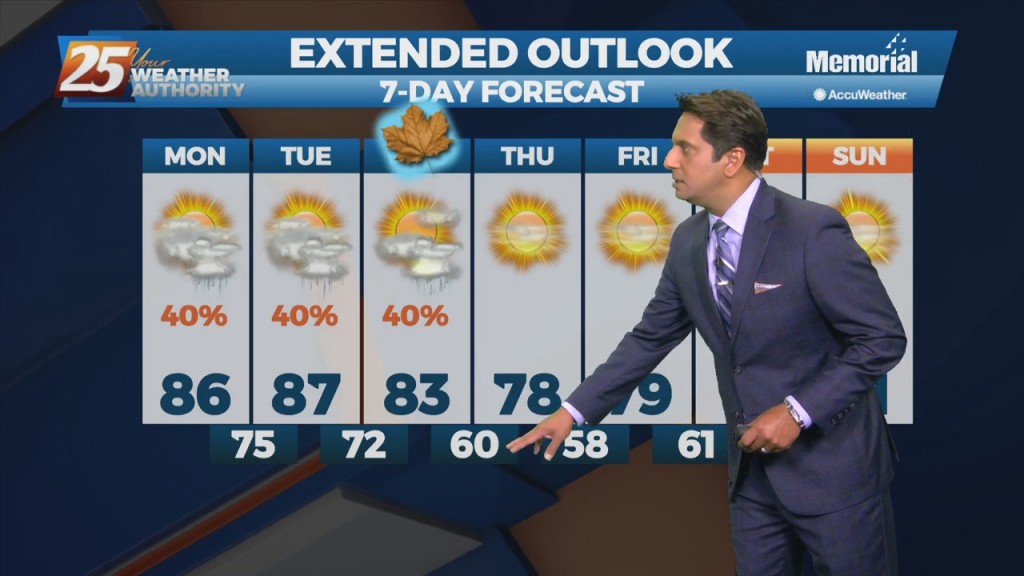
Fairly benign weather continues a couple more days with just temps and dew-points to consider. A fairly weak high-pressure system will be tracking across the Mississippi Valley today and Tuesday. This will be the start of some moderating temps. Highs…
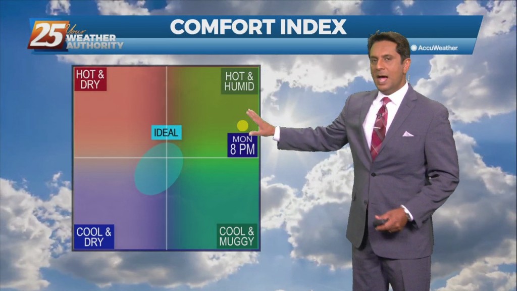
Warm & humid will continue today as an area of low-pressure along a cold front near Wichita Falls will race northeastward toward Lake Ontario by midnight tonight. The associated cold front is expected to reach northwest Louisiana by mid to late…
Today will bring advance moisture flow to the area in advance of a front now moving east across the southern plains. As instability slowly decreases, a few showers will be possible through tonight. A few showers will also affect the…
High pressure will remain anchored along the eastern seaboard and northern Gulf Coast region through most of the period. Southerly return flow around the high will keep us in the same weather pattern we have been in for the past…
Upper level high-pressure is expect to pretty much remain in place through the short range portion of the forecast. An approaching cold front to the NW will slowly move E/NE and ride north of the Hattiesburg area. By late Tuesday…
The persistent mid/upper low-pressure over the mid-Mississippi Valley will finally lift northeast to the Great Lakes region through tonight. This will be replaced by an upper level high-pressure building in from the southern plains into the Gulf Coast region. Surface…
Moisture flow will continue to fall off over the next few days. As we fall back into a drier regime, a more October like pattern should show itself. But with no good cold fronts moving through at least through Friday,…
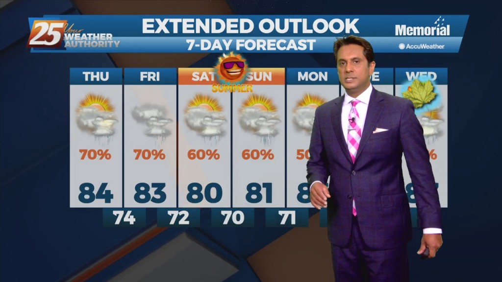
Closing out the workweek into the weekend will bring lower rain chances. Pulses of weak Energy from the west are expected to continue to aid a wet environment favorable for more isolated showers and thunderstorms. Isolated showers and thunderstorms may…
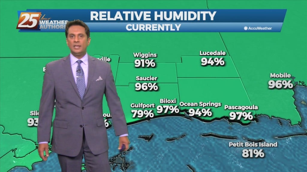
The airmass remains very moist, with climatologically above the 90th percentile for this time of year. No real indications of any significant drying through Saturday, as even then, moisture levels remain elevated. A disturbance coming out of the base of…
Weak upper-level high pressure currently extends along the Mississippi Valley from Canada to the Gulf of Mexico. The ridge isn't particularly strong enough to keep the low-level moisture flow out of the area however. The main concern for today will…
An upper level high-pressure is developing along the Mississippi Valley from Canada to the Gulf of Mexico. The moisture recovery has occurred since yesterday evening. A disturbance in the NW'tern GOM will continue to slowly move to the NW towards…
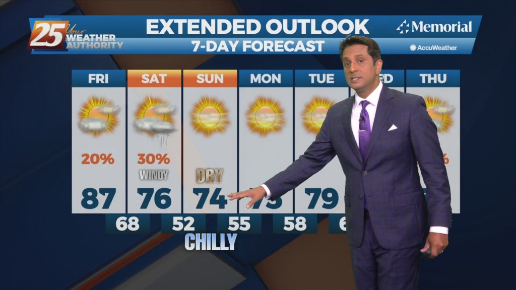
Very pleasant and comfortable conditions will continue through the weekend. With the less humid flow, morning low temperatures will continue to be a good 10 to 15 degrees below climatological lows. Afternoon high temperatures will max out in the upper 70s…
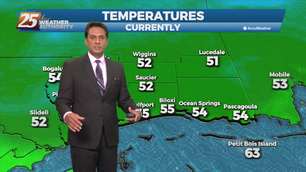
The strong cold front from yesterday has already exited the area and is moving further southward into the Gulf. Temperatures as well as dew points have dropped and while there are still some gusty winds currently, that should begin to…
There is one last day of uncomfortable weather before a welcome changes. The disturbance moving through the Great Plains this morning will be over the Ohio River Valley by midday tomorrow. The cold front associated with this disturbance is expected…
Not a lot of movement with the disturbance along the Mississippi Gulf Coast through Tuesday. That will change Tuesday evening as the northern stream disturbance over the Rockies shifts eastward. This disturbance and the associated cold front are expected to…

The low level remnants of Nicholas continue to spin across the region producing scattered showers and thunderstorms. Expect the scattered precip to continue with increased activity this afternoon coupled with daytime heating. Activity will become more isolated overnight with areas…
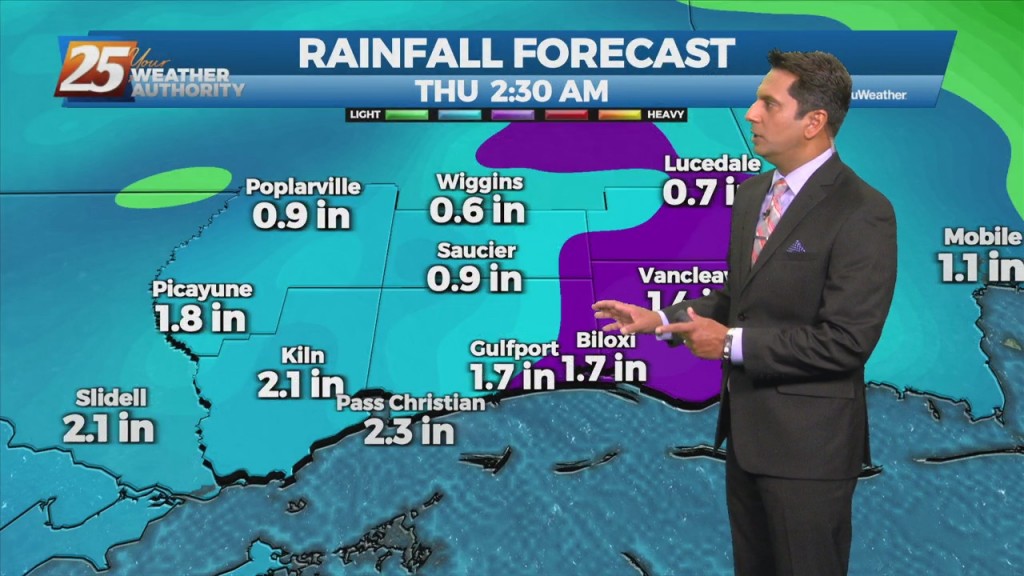
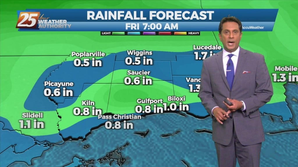
Focus will become more toward rainfall rates and not as much on totals area wide. Rates could be around 2 to 3 inches per hour today through Saturday and isolated areas could see 3 to 5 inches over that time frame.…