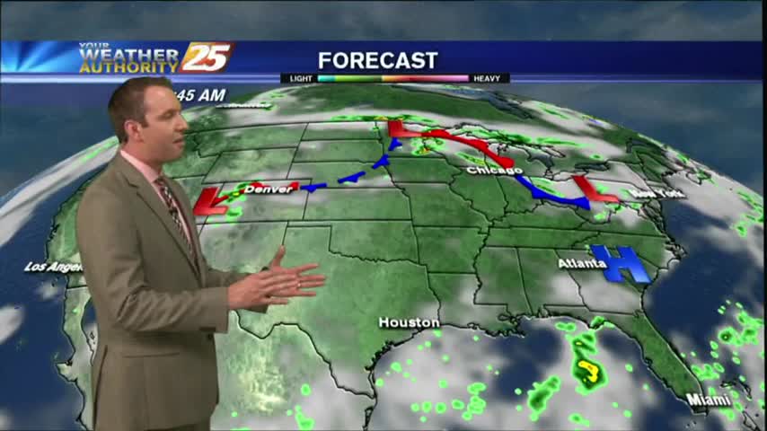
07/17 Ryan's "Wet Start" Monday Forecast
Slow-moving storms dominated this afternoon, but drier weather is in store for South Mississippi! Watch the full forecast for details.
Slow-moving storms dominated this afternoon, but drier weather is in store for South Mississippi! Watch the full forecast for details.
We had fewer thunderstorms over South Mississippi today, but I feel we'll make up for that tomorrow. Click on the forecast link for more information.
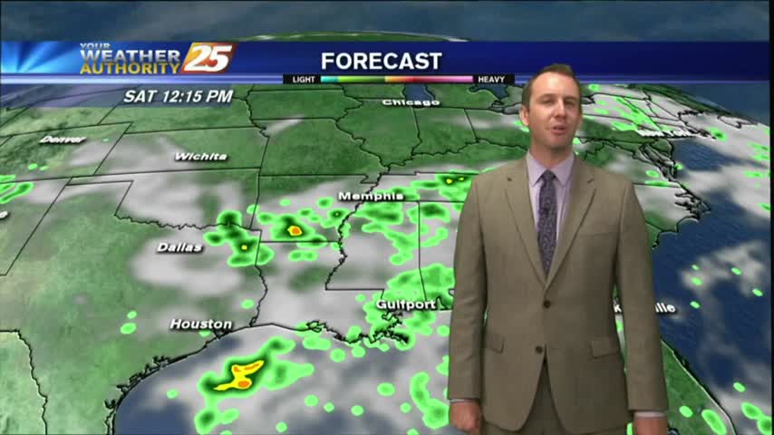
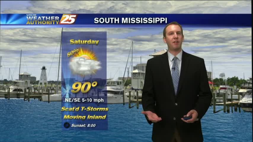
Very predicable weather patterns continue through the weekend, but rain chances/totals should receive a small bump from tropical influences. Watch the full forecast for details.
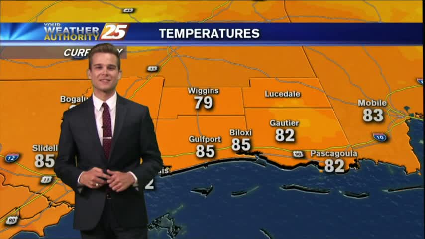
Afternoon highs were about a degree cooler than the last few days, but we still saw plenty of summer thunderstorms pushing inland. Click the forecast link for more details.
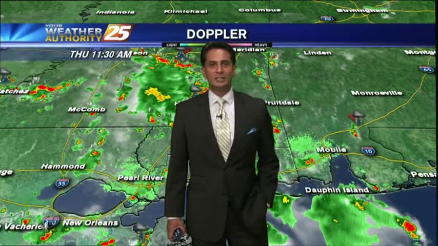
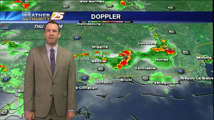
Showers have been hugging the coast since prior to sunrise...with the activity moving onshore, continuing to develop...
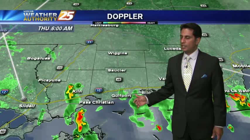
Another warm/humid start to the day with overnight showers/t-storms over the n'tern GOM/Sound moving north into the Southern 6...
Our warm and humid afternoons are leading to sea breeze showers and thunderstorms, but we aren't seeing much rain after sundown. Expect more of the same for tomorrow, full forecast details inside.
Today was just another day in a long string of very similar summertime conditions, but we will see a few changes to the pattern that will make it a bit rainier. Click the forecast link for details.
Our afternoon showers have now all but disappeared, but at least a few clouds will remain. Be ready for more showers all the way through the weekend. Click link for details.
Our current "mostly sunny & hot days become cloudy & rainy evenings" weather pattern will continue through the week, and will receive a boost of tropical moisture from the remnants of TD 4 over the weekend. Details inside.
Our afternoon showers have finally cleared, but the rain will return each afternoon into the weekend. Watch the full forecast for more.
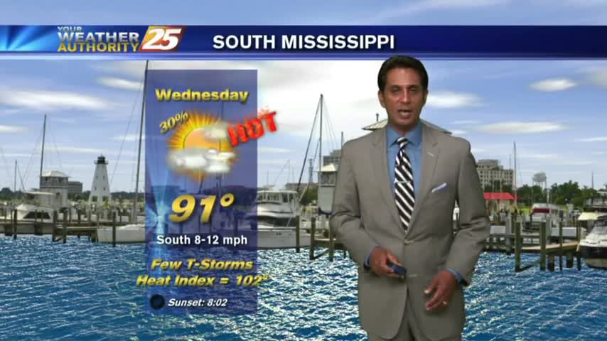
Today ended up a very "average" summer day! Expect to see more hot & humid days with afternoon showers, though temperatures will continue to increase through the week. Click for details.

Expect more hot and humid days with afternoon showers and thunderstorms, but a front is expected to move in over the weekend. Watch the forecast for details.
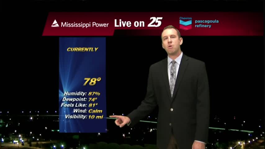
Earlier showers and storms gave way to a drier, and slightly more clear evening. It's still warm & humid though, and the rain returns quickly. Details within.
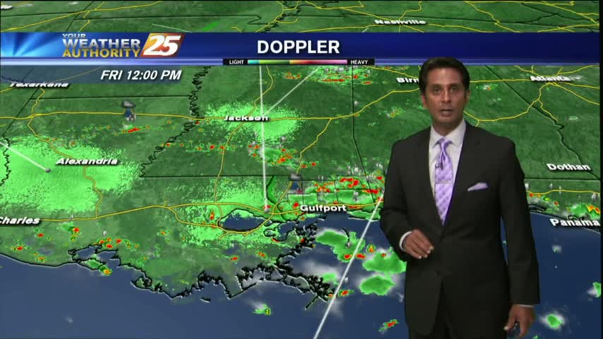
After overnight and early morning activity over the sound, showers/t-storms continue to flare-up along the viewing area...
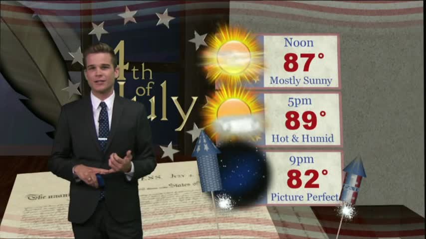
The fireworks went off without any issues from mother nature last night, but the pattern will begin to change...
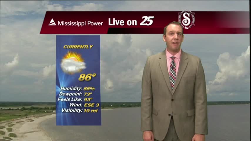
Today has been hot and humid. There have been very light isolated showers, but most of the area was dry and will remain that way tonight.
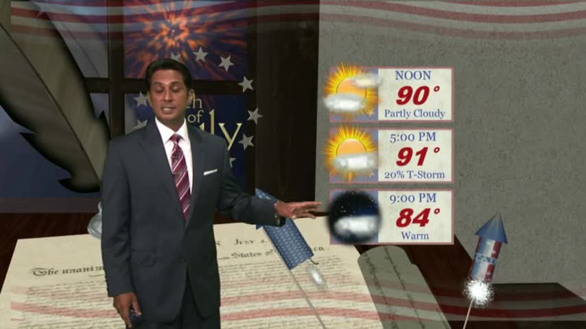
Another warm/humid start to the day (Independence Day) with VERY HOT conditions on-tap through the region...
The forecast is stuck on repeat, at least for the next few days.
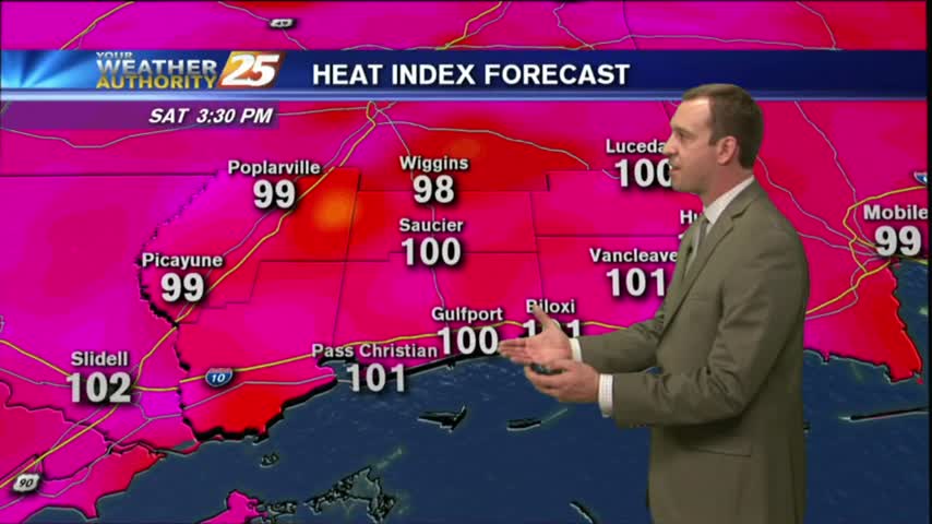
A warm/humid start to the day/workweek with DANGEROUS HEAT INDICES to affect the Mississippi Gulf coast...
We are ending the month as the wettest June on record.

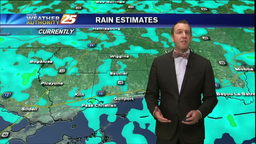
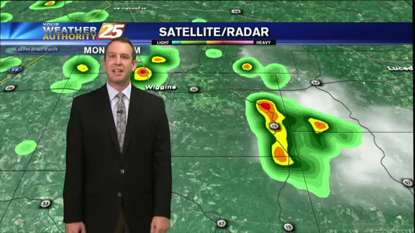
After a rain-free start to the day, minimal activity has been popping up along the Southern 6/northern Gulf of Mexico...
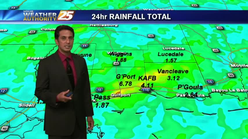
After torrential rainfall yesterday with as much as 6" of accumulation, it's a drier (rain-free) start to the final day of June. ..
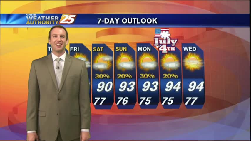
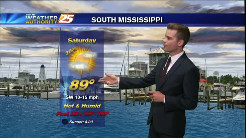
Storms moved in earlier today, but will wait until the early morning overnight hours before bringing in round 2. Best to get it out of the way now, leading to a sunny holiday! Details inside.