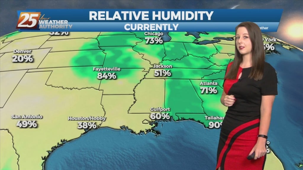
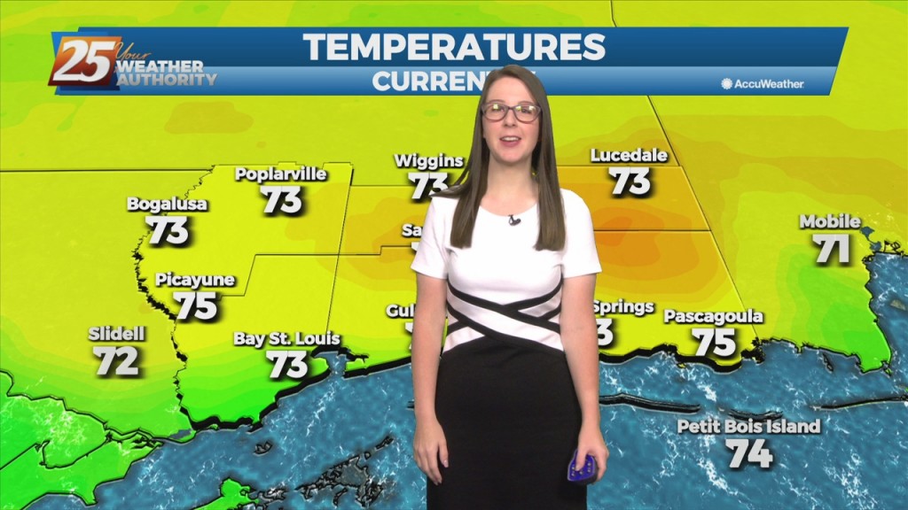
6/8 - Brittany's "Warm Start" Wednesday Morning Forecast
An upper level ridge that is centered over Texas and spreads across the Gulf Coast will continue to dominate the forecast over the next couple days. This suppresses…
An upper level ridge that is centered over Texas and spreads across the Gulf Coast will continue to dominate the forecast over the next couple days. This suppresses…
Current upper level analysis shows a ridge centered near the Appalachian Mountains and a trough encompassing nearly half of the western US. A slither of that…
Current upper level analysis shows a ridge centered near the Appalachian Mountains and a trough encompassing nearly half of the western US. A slither of that ridge…
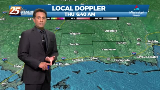
Impulses associated with the weak upper low over the northeast Gulf will work their way westward over the next 48 hours. One will approach the Mississippi coast overnight tonight,…
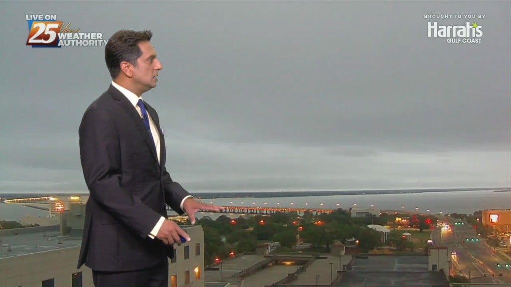
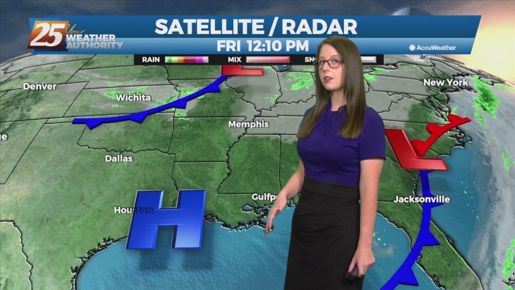
The cold front is now eat of the area with a few linger showers (even an Isolated t-storm) expected early this afternoon. Skies will begin to slowly…
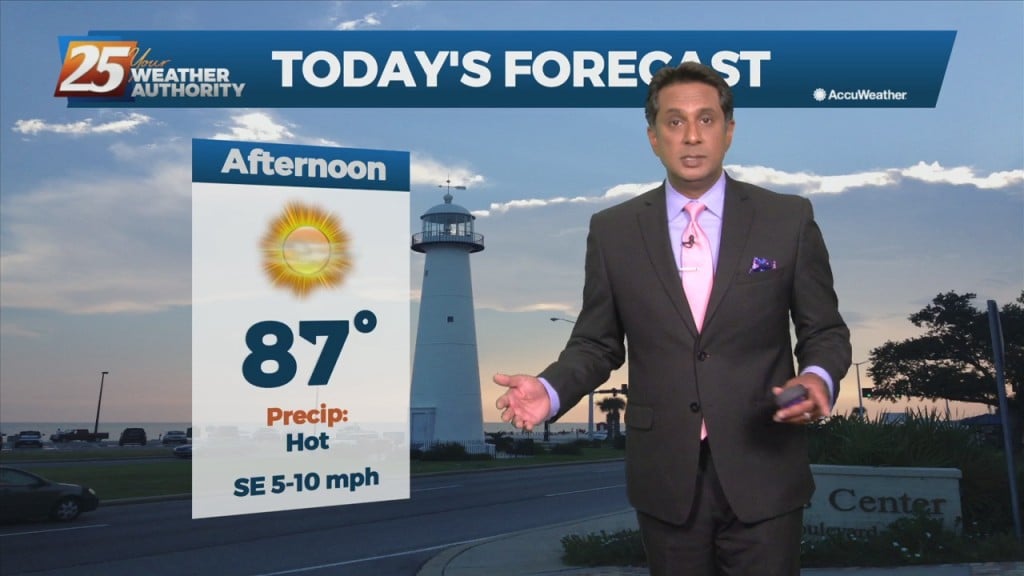
Hot and dry pattern continues as high-pressure extends SW to NE from the western Gulf of Mexico to the Great Lakes. This will easily support…
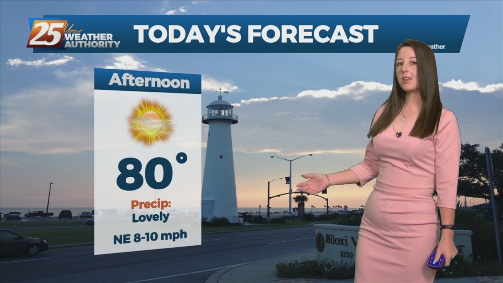
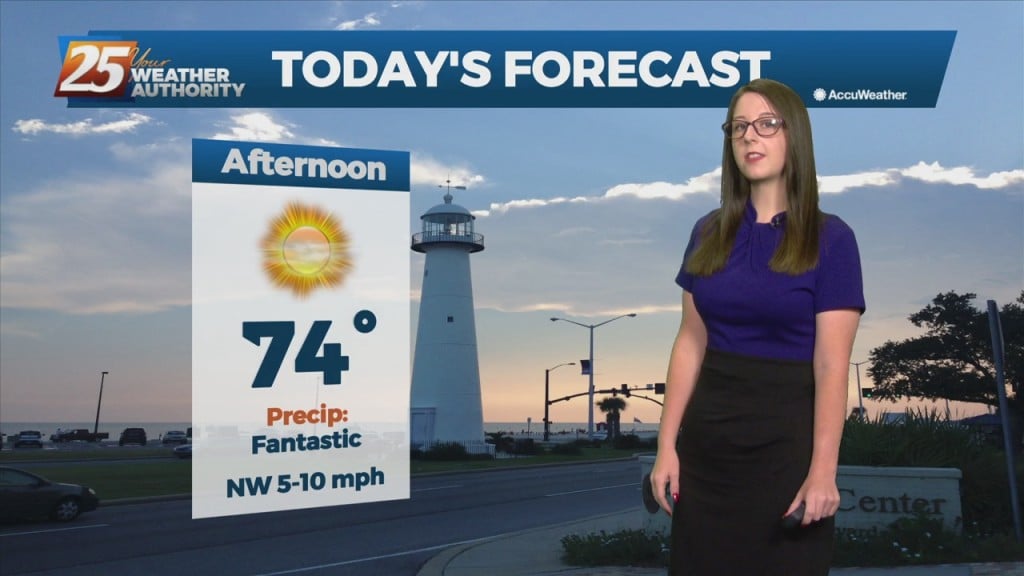
A less humid air mass will make afternoon high temperatures right around 80 degrees rather comfortable. With strong high pressure over the East Coast and a strengthening storm…
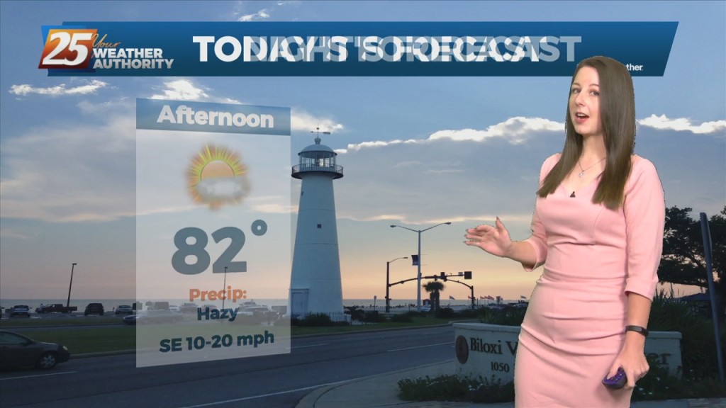
An upper level ridge is building in and across the southeastern CONUS with the center passing across the CWA today. As a result, onshore flow becomes well established and…
The disturbance that tried to bring showers to the region yesterday is quickly moving farther away from the area. As it does so, an upper level high-pressure will begin building in and across the southeastern CONUS today through Saturday. As…
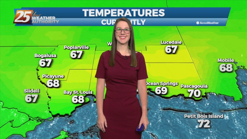
Post front airmass continues to push in today as upper level high-pressure to the NW shapes the short term forecast. This will bring another below normal temperature day with…
The cold front will make its way through the entire area this morning bringing some very nice conditions once again. Cloudy coverage will clear by late morning…
The cold front has moved east of the area but will continue to be a factor in the forecast through the Easter weekend. We could still be…
An upper low-pressure is going to move only very slowly eastward over the next several days, from the Mid-West, reaching Maine on Sunday. A minor disturbance rotating…
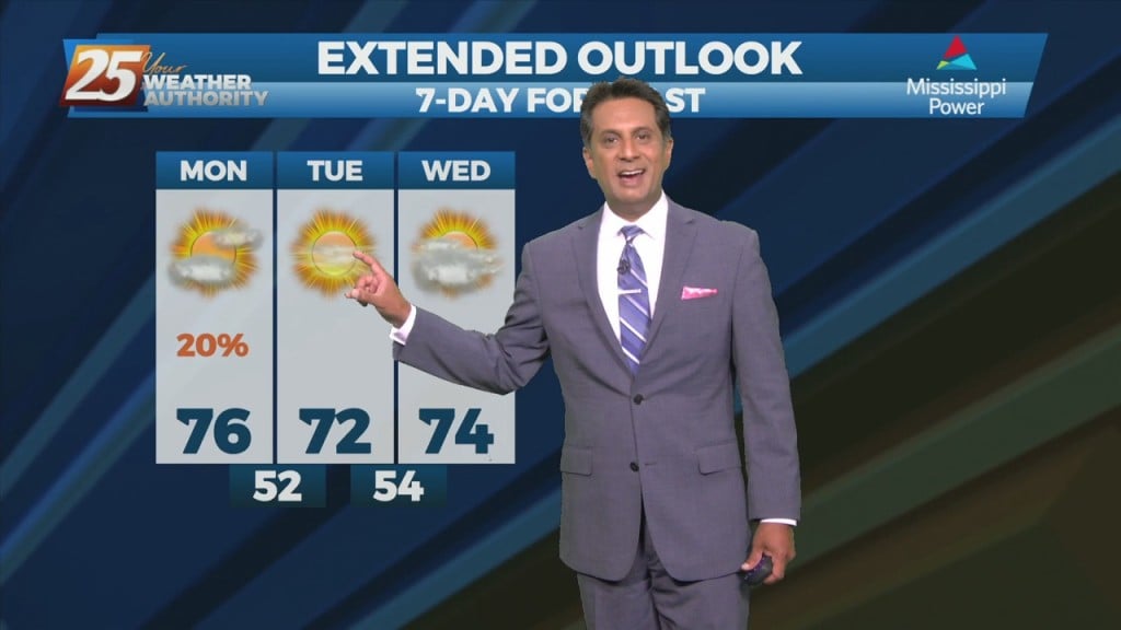
High pressure continues to shape the forecast. Clear skies are area-wide with comfortable spring conditions. As we head into the new workweek though, changes are ahead. We will…
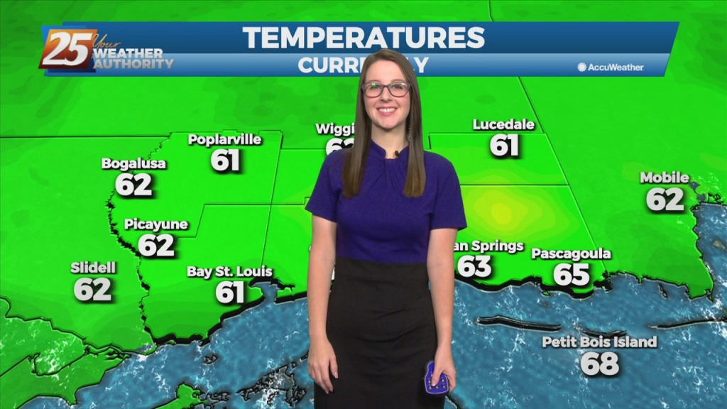
The short term forecast is going to be quiet with dry cool conditions over the area today and this weekend. At the surface, high pressure will dominate the…
The short term forecast is going to be quiet with dry cool conditions over the area today and this weekend. At the surface, high pressure will dominate the region…
Overall much more benign with cool and dry weather is in store for the area through the short term as the upper level trough currently in the…
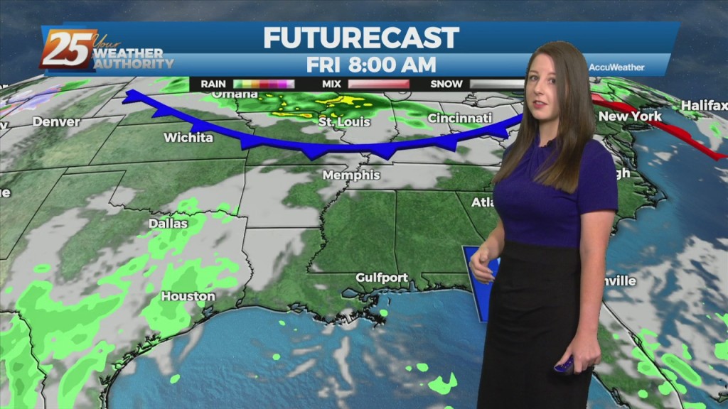
Quiet conditions through St. Patrick’s day with linger cloud coverage and mild temperatures In the 70s. The forecast gets active again Thursday night and early Friday. Our next disturbance is…
The primary forecast concern through Wednesday will be the passage of a potent upper level low-pressure and associated surface cold front across the Lower Mississippi Valley tonight into Tuesday.…
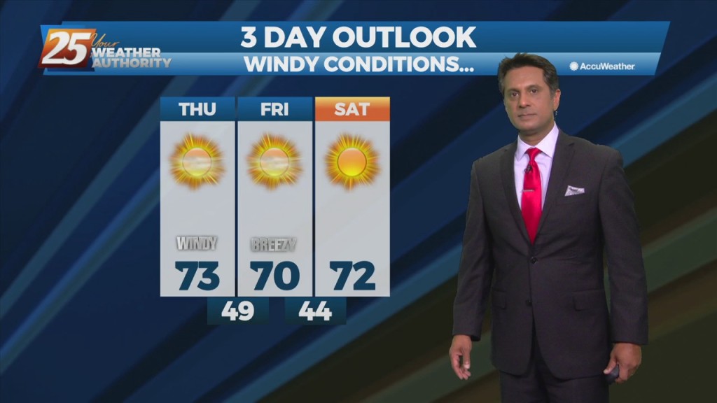
High-pressure currently over the Rockies will move eastward across the Gulf of Mexico Friday and Saturday. This will gradually allow our surface flow to turn onshore and…
Southwest flow aloft will slowly break down leading to zonal flow by tonight as a weak disturbance to our west continues to fill in. Thursday, an area…
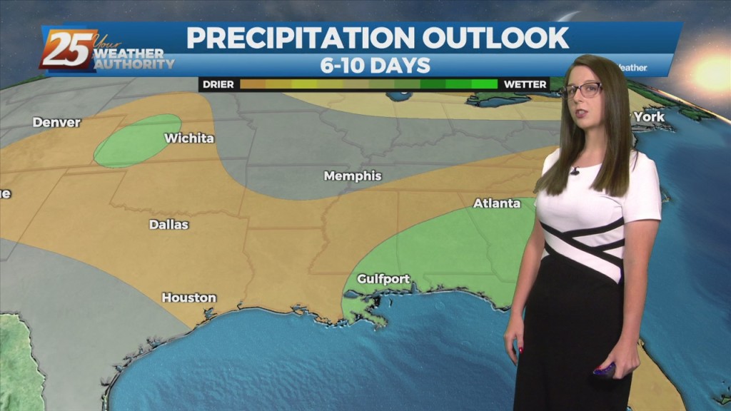
The next few days will be mainly a temp and dew-point forecast. No rain anywhere in sight during the workweek with the greatest impacts likely to the fire weather…
It's a rather quiet forecast the next few days with cool and dry conditions today slowly moderating over the next few days. High-pressure will quickly move in later today…
Cloud coverage will linger through the evening with slow clearing late tonight into early tomorrow. Overnight lows will be in the low to mid 40's. High pressure…