12/26 - The Chief's "MUCH WARMER TEMPS AHEAD" Monday Morning Forecast
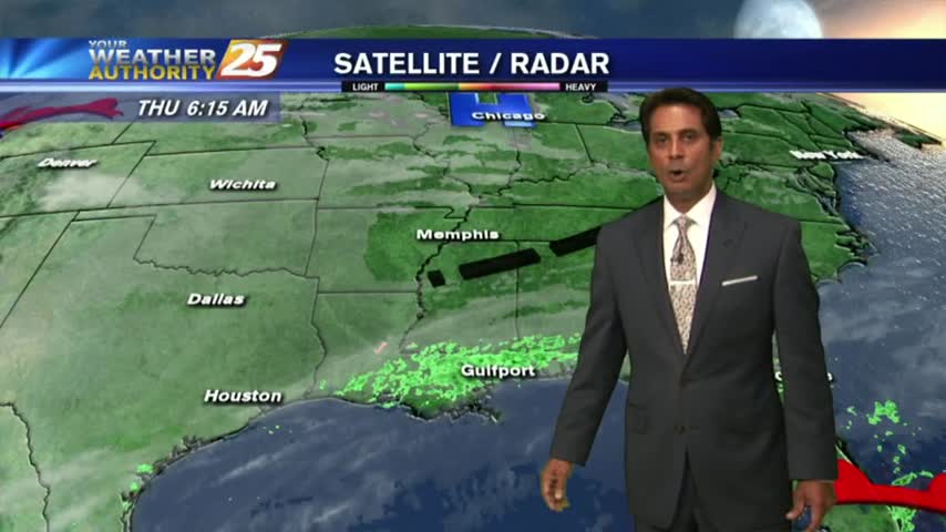
While the main upper level disturbance is moving off the East Coast, another minor feature is diving down the west side of the trough over…
While the main upper level disturbance is moving off the East Coast, another minor feature is diving down the west side of the trough over…
Upper level moisture and clouds will move across the area this morning with more sunshine this afternoon. Tonight into Wednesday, zonal flow will continue to dominate the upper…
Another FRIGID start to the day but the air mass will begin to modify later today...
With an area of high-pressure closer to the area, a north wind continues to bring frigid temperatures to start off the day...
It's a FRIGID start to the day under clear skies and light winds, but the warm-up will begin this afternoon...
After a FRIGID start, major changes will occur as an area of high-pressure to our east brings the return flow back to the region...
A FRIGID start to the day/workweek as a cold front from the central plains continues to move to the SE and into our area Tuesday...
Another FRIGID start to the day as clear skies are in the area, Bundle up the kiddos as they head back to the bus stop...
Another FRIGID start to the day with slightly warmer temperatures as light rain is moving across the northern GOM...
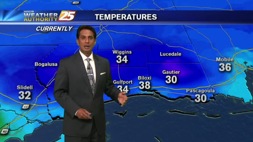
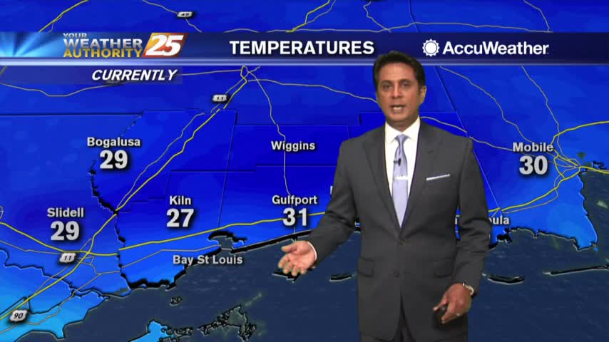
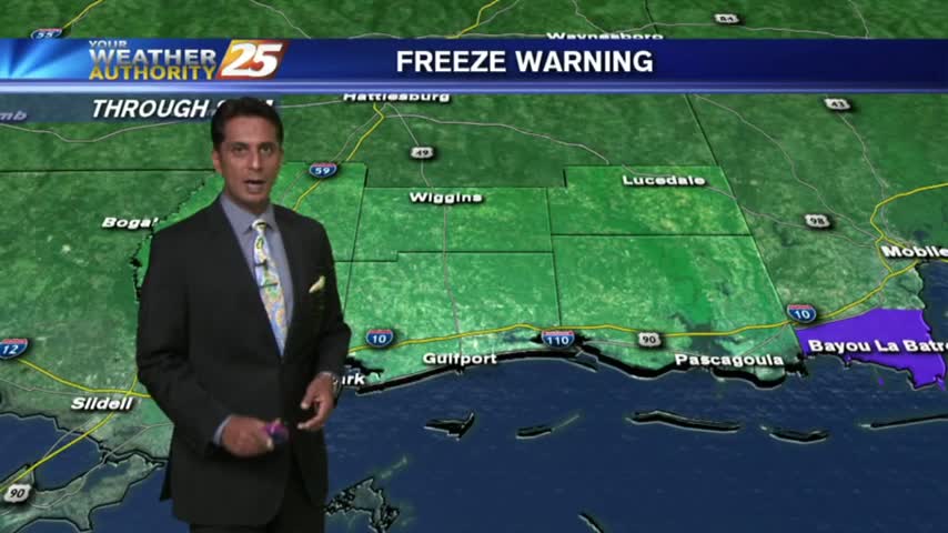
Bundle up heading outside this morning, its' another VERY COLD start to the day with several locations below freezing...
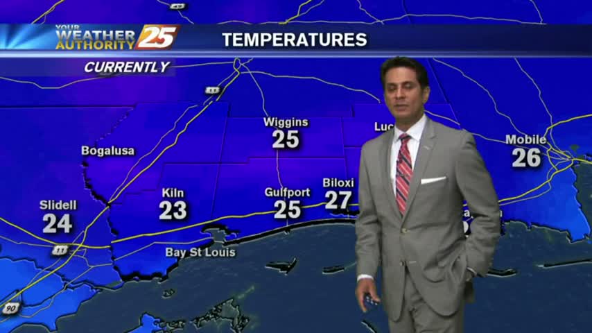
A COLD/FRIGID start with a north wind and a few upper-level clouds linger along the southern 6...