Ryan's "Final Countdown" Friday Night Forecast
We've yet to see any significant weather moving into the area, but the rain will begin soon, and strong storms early tomorrow....
We've yet to see any significant weather moving into the area, but the rain will begin soon, and strong storms early tomorrow....
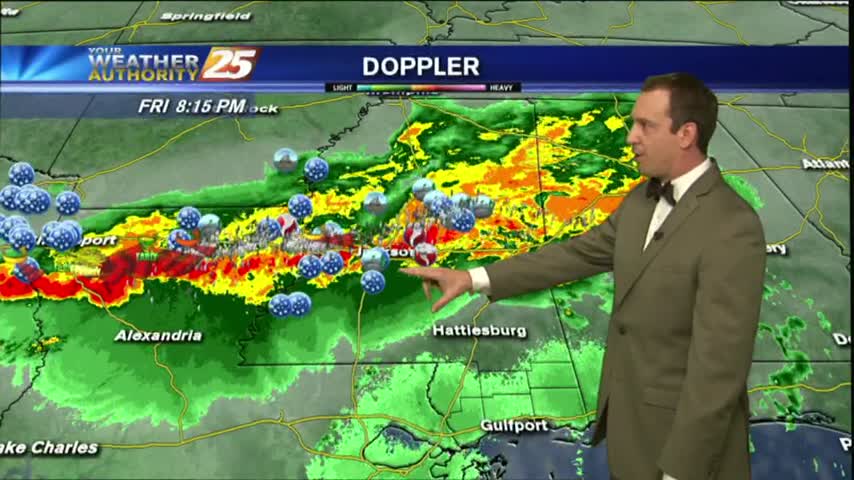
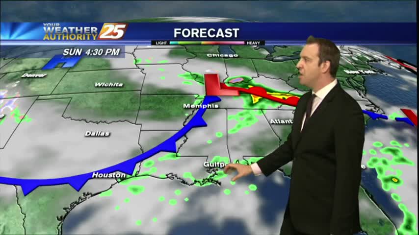
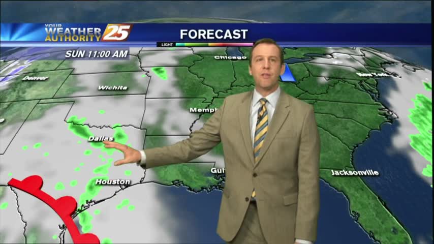
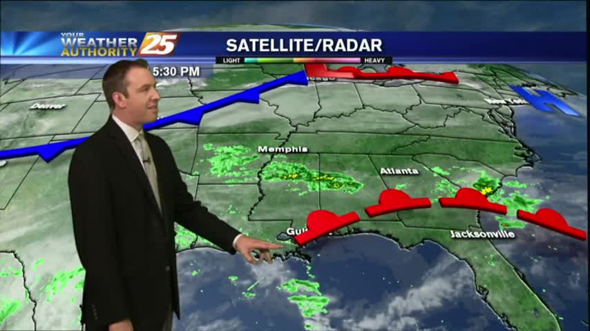
The potential severe weather we've been talking about all week long is almost here, and will be arriving during the early morning hours....

Rain has moved on, and while skies cleared a lot today, tomorrow will be much better!

We may have had a rough day yesterday, but today cleared up nicely and it's looking even cooler/drier tomorrow!
This week's weather was too good to last forever, so now we're seeing warm and humid conditions moving in and lingering through the weekend. It clears up again next week though!
After a gloriously long week of sunshine and dry air, rain and humidity has moved in quickly today. It does get better next week though....
Clouds are finally building overhead after a long string of clear days, and we'll see rain as early as tomorrow afternoon....
One last sunny and dry day before a rainy, potentially stormy weekend, but another beautiful work week is ahead....
Tonight will be the first of several chilly nights in the 40s this week, and this weekend is looking gorgeous. It gets even cooler and drier next week though, so watch the full forecast for details.
It ended up being just as beautiful today as forecast, but just a little bit warmer. Expect more great days and nights ahead, but you'll have to watch the full forecast for the details.
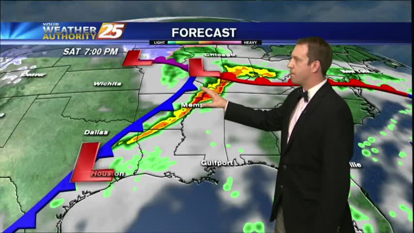
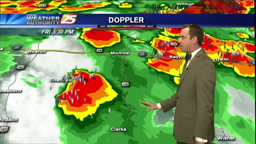
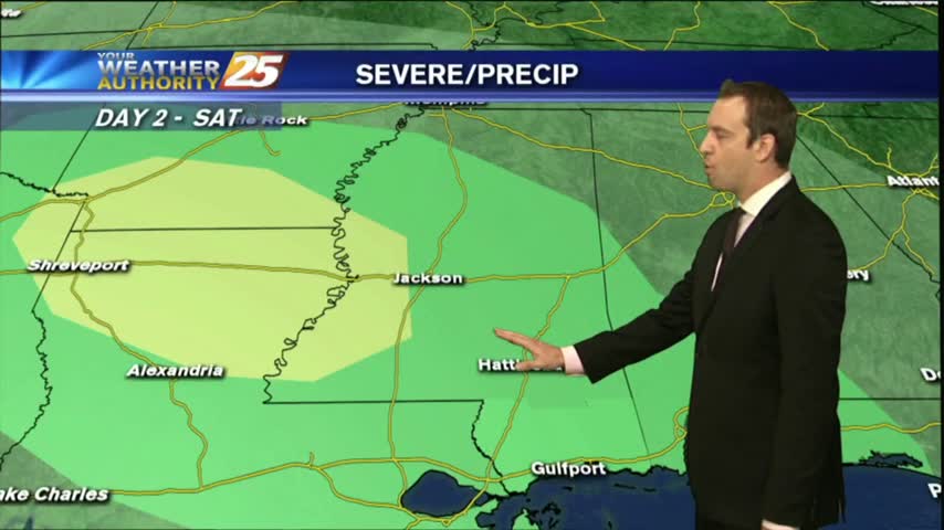
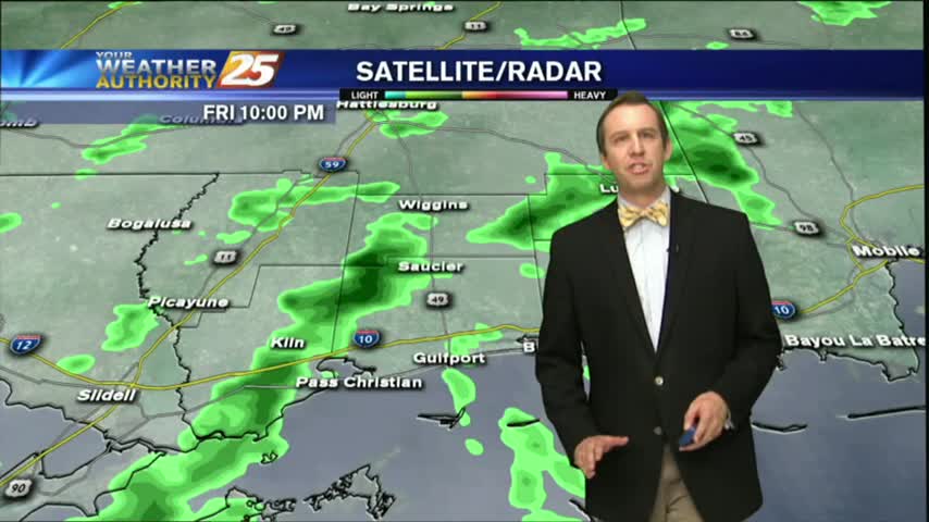
Showers will continue off and on for the next few hours, but stronger storms move in over the weekend. Watch the full forecast for more.
A few showers have moved across the area, but much more rain is expected this weekend. Watch the full forecast for details.
Another high temperature record down today, and I'm expecting another potentially record breaking day tomorrow. Click the forecast link for details.
We beat another record high temperature this afternoon, and there's a good chance we'll beat tomorrow's as well with more dense fog in between. Watch the full forecast for details.

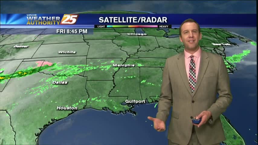
We haven't seen much active weather in South Mississippi today despite the increase in humidity and cloud cover, but expect to see it move in quickly after midnight. Click here for the full forecast.
The clouds and humidity moved in today as expected, and while showers will build in overnight, the storms won't pick up until tomorrow. Watch the full forecast for more.

Happy Groundhog Day everyone! Today's weather was nice, but we'll see drastic changes as we head into tomorrow evening. Click the forecast link for more.
A cold front moved through last night and brought very little rain, but cleared our skies and cooled things down a bit. These changes don't last long, so be sure to watch the full forecast for details.
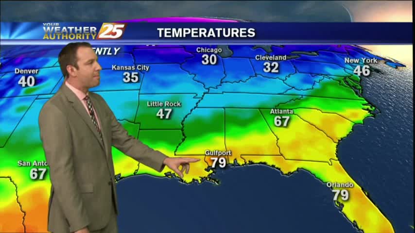
Today was the warmest and most humid day we've seen all week, but after a rainy weekend we'll get back to those cooler and dry days. Click here for the full forecast with Meteorologist Ryan Mahan.
The humidity has been rising throughout the day and rain is expected overnight. Expect a few thunderstorms tomorrow, but you'll have to click this link for the full forecast.
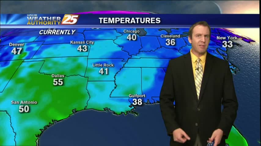
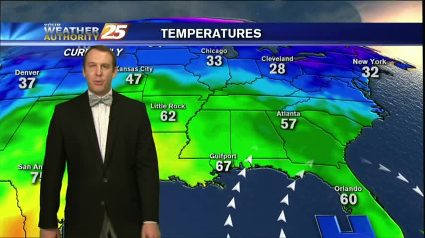
It's been a brutal week of cold, dry, and often dangerous weather; but we're finally seeing a warming trend that will carry us all the way through the weekend. Click here for the full forecast.
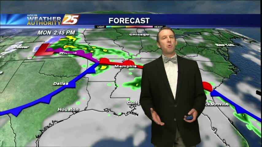
The warming trend that began yesterday continues through today, tomorrow, and into next week. We'll see another cold front by Monday though, click the link for details.
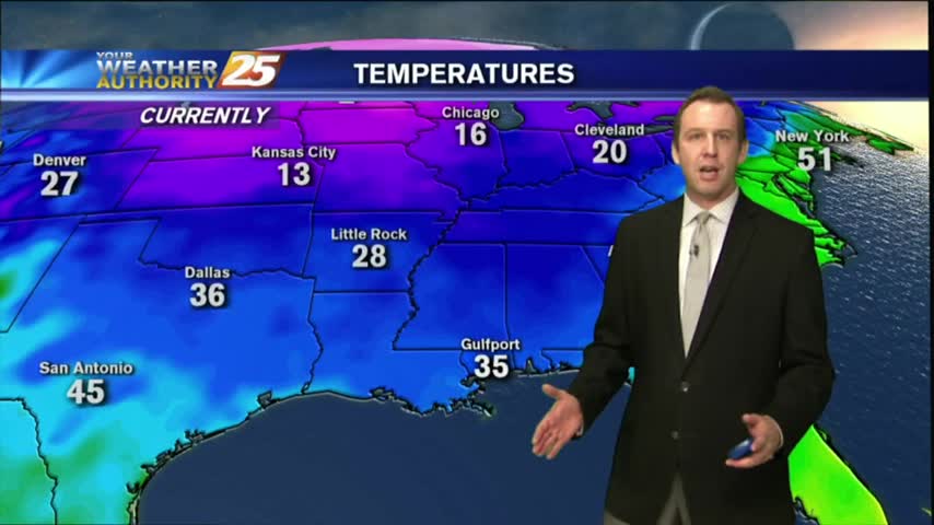
We've had several days of warm and humid weather, and we're making up for it tonight as last night's cold front has brought wind chills as low as 20 degrees. It only gets colder this weekend, click the forecast link for more.
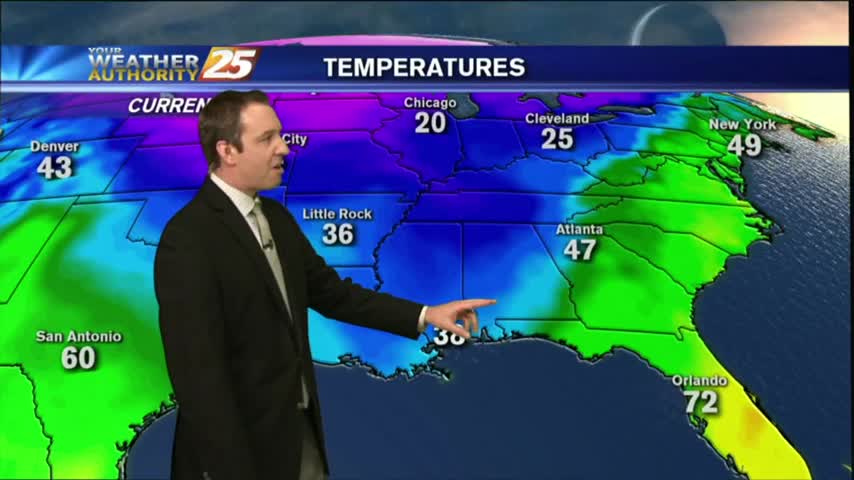
Last night's cold front has moved on, but it's Arctic airmass is moving in quickly. Click the forecast link for the details.