2/22 - Rob's "Hump Day" Forecast
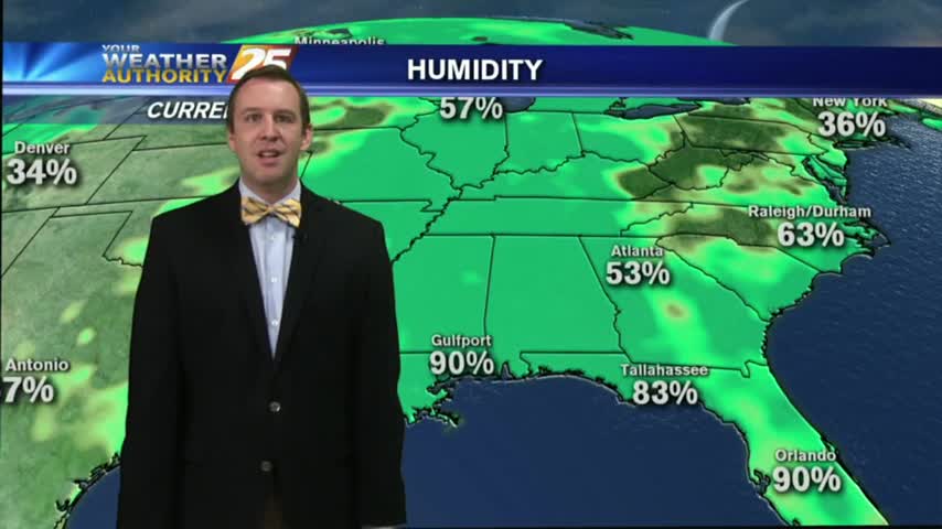
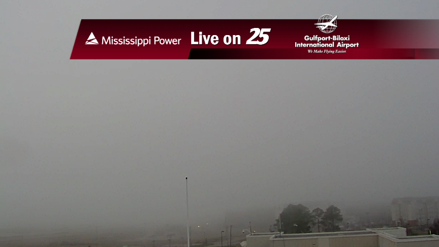
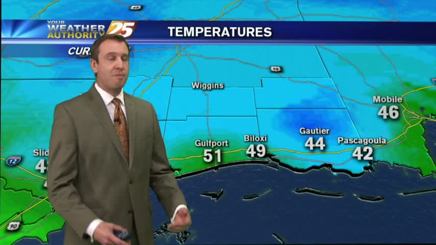
As low-level humidity continues to stay very high...areas of PATCHY DENSE FOG has developed along the southern 6...

As low-level humidity continues to stay very high...areas of PATCHY DENSE FOG has developed along the southern 6...
Morning rain cleared for a decent afternoon, but clouds are moving back in for the evening. Everything is looking good for the parade festivities this weekend though. Details inside.
Another round of rain and thunderstorms will affect the area later this afternoon.
Clouds moved in earlier, but storms are expected overnight. Watch the forecast for details about the rest of the week.
I hope you enjoyed your sunny & warm weekend, because starting tonight we'll see a few days of overcast skies and rain. Click link for forecast details.
Rain and storms will return to the area tonight, through Wednesday morning.
Rain and storms increase across the area tonight, giving way to a wet forecast early this week.
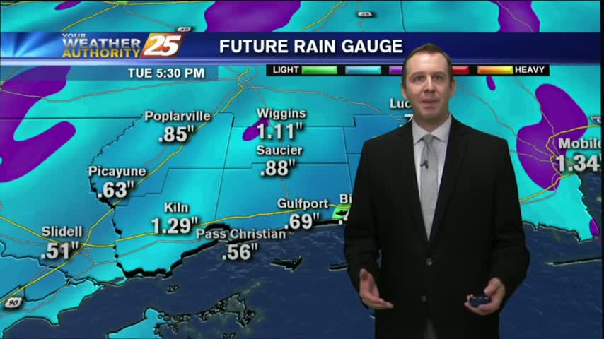
Rain showers return to the Coast late Monday through early Wednesday.
The showers have continued into the evening, and some slightly stronger storms are still expected through the night. Click the link for forecast details.

We've seen a few light-to-moderate showers so far this afternoon, but stronger storms moving in soon. Check out the forecast for details.
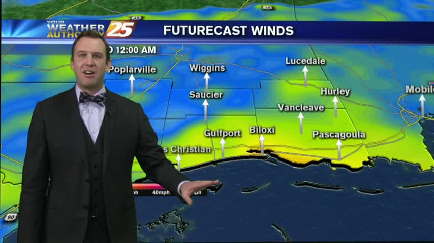
Rain chances ramp up this afternoon to near 80% tonight with a few thunderstorms possible.
Last night I promised a beautifully clear & cool day, and the weather did not disappoint. We'll start seeing warming and increasing clouds by tomorrow afternoon; full details within.
Clear skies and calm winds have lead to another chilly evening, but we'll begin our warming trend in the early morning hours, which will continue into the beginning of next week. Watch the forecast for details.
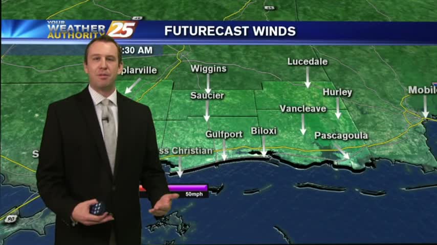
Rain and storms (some severe) will affect the Coast tonight.
Last night's very subtle cold front helped make this afternoon beautiful, but another front is forming and storms are on the horizon. Watch today's forecast for details.
We're starting to see some clouds move in after our clear and warm afternoon, but clear and dry conditions return quickly. Watch the forecast for details.
There's an offhand risk off severe storms coming up Tuesday night for the Coast.
A few showers are possible overnight as a weak cold front passes into the area.
After a clear and cooler afternoon, we're heading for a warm and more humid evening. Watch the forecast for details.
Clear skies carry us into the afternoon with excellent weather forecast for the rest of the day.
Today cleared up nicely after last night's cold front, and tomorrow will be even better. That's were things start to change though, so watch the forecast for details.
Much cooler and breezy weather carries us into the afternoon, with a great forecast heading into the weekend.
We've had warm and humid weather over the last several days, but we'll begin seeing changes as early as tonight. Watch the forecast for details.
Rain showers will still be possible through early tonight, but clearing conditions and excellent weather are in store for the Coast for the last half of the week.