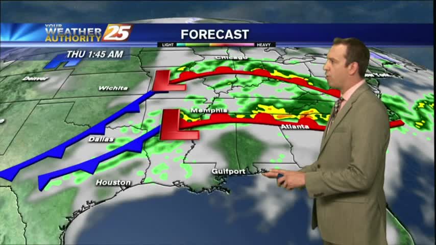
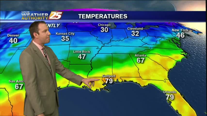
02/27 Ryan's "Warm Front" Tuesday Evening Forecast
Cooler today as expected, but an approaching warm front will bring much higher humidity and temperatures tomorrow. Watch the full forecast for details.
Cooler today as expected, but an approaching warm front will bring much higher humidity and temperatures tomorrow. Watch the full forecast for details.
Only flood warnings near the Biloxi and Pearl Rivers remain from the weekend's rain, and today was much drier. Watch the full forecast for more.
There's some flooding left after the weekend's rain, but it was much drier today. Watch the full forecast for details.
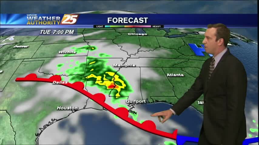
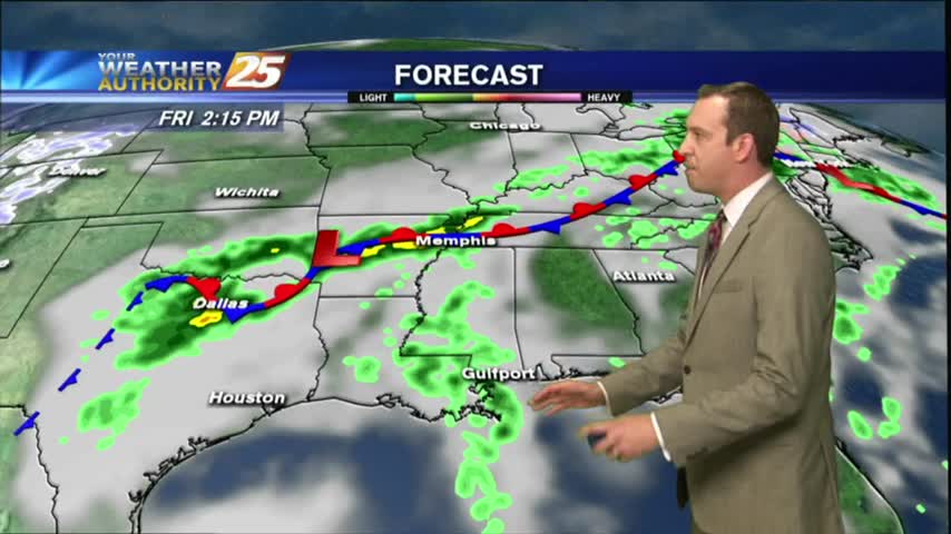
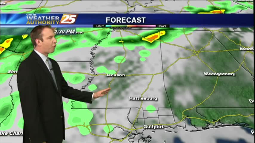
Showers will continue off and on for the next few hours, but stronger storms move in over the weekend. Watch the full forecast for more.
A few showers have moved across the area, but much more rain is expected this weekend. Watch the full forecast for details.
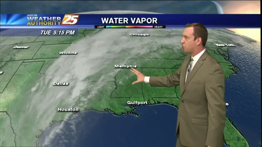
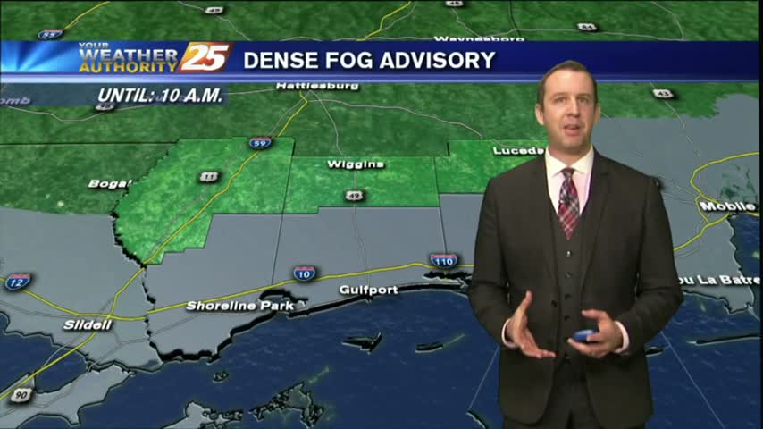
Another evening of widespread, locally dense fog ahead, and rain will move in again tomorrow after our slightly clearer afternoon today. Watch the full forecast for details.
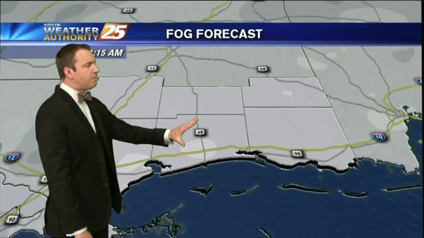
This afternoon's skies did open up a bit, but there were still plenty of clouds and enough humidity to lead to more overnight fog. Watch the full forecast for details.
We had another record high temperature today, with more expected through the rest of the week. Watch the full forecast for more.
Another record breaking day in South Mississippi, and with much less rain than expected. The front will move further away helping to clear our skies, but you'll have to watch the forecast for details.

We've tied or broken temperature records every day, with the exception of last Sunday, since last Friday; a trend I expect to continue through the rest of this week and the weekend. Watch the full forecast for details.
Another day down, and another high temperature record tied or exceeded. Expecting more of the same ahead with a little rain mixed in, so watch the full forecast for the details.
We've broken temperature records 3 out of the last 4 days, and I expect tomorrow to be another. Watch the full forecast for details.

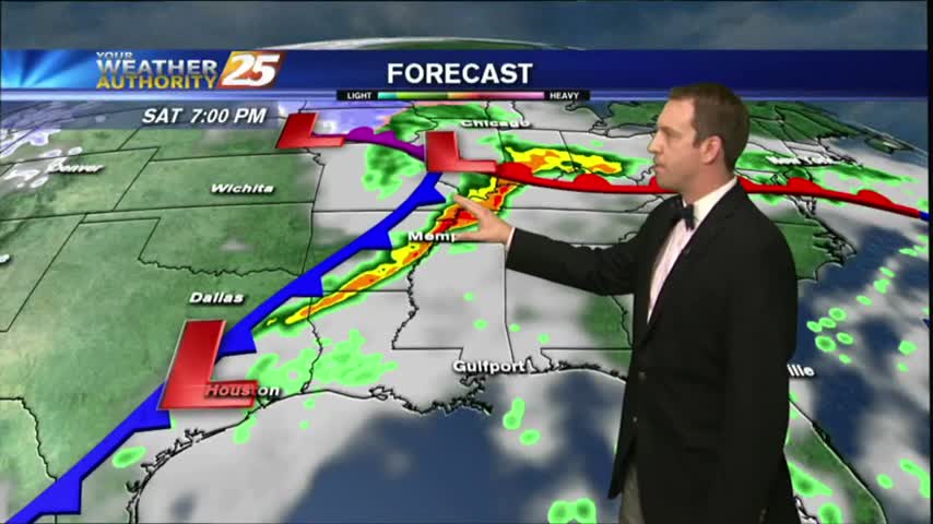
More hot and humid conditions expected over the next several days, but we will see a good bit of rain by mid-week to help cool things off. Watch the full forecast for more.
Another high temperature record down today, and I'm expecting another potentially record breaking day tomorrow. Click the forecast link for details.
We beat another record high temperature this afternoon, and there's a good chance we'll beat tomorrow's as well with more dense fog in between. Watch the full forecast for details.
We broke a long standing temperature record this afternoon and I'm expecting to break a few more over the next couple of days. Watch the full forecast for details.
While still unofficial, it seems we beat the record high temperature for today and will likely do so tomorrow as well. Get ready for several hot and humid days in a row, click here for the full forecast.

I hope everyone made the most of their gloomy Valentine's day, and unfortunately these warm & humid conditions aren't in a hurry to leave. Click here for the full forecast.
Happy Valentine's Day South Mississippi! Unfortunately it's a little foggy, and that's not changing tonight, so be sure to watch the full forecast for the details.
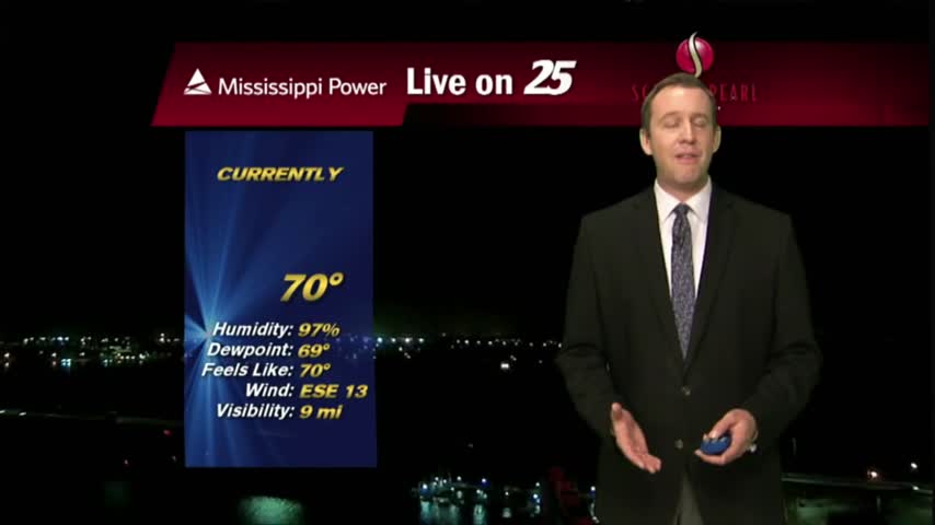
After last night's chilly conditions we're in for a few days of warm and humid weather and mild, foggy nights. Watch the full forecast for details.
It was a much nicer day than expected this afternoon, but clouds will move in through the night and the humidity remains high. Watch the full forecast for details.
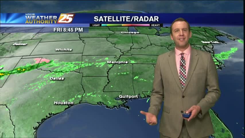
Happy Lundi Gras everyone! It's going to be just as cloudy as today was, but considerably warmer for tomorrow. Watch out for a few showers, and watch the full forecast for the details.
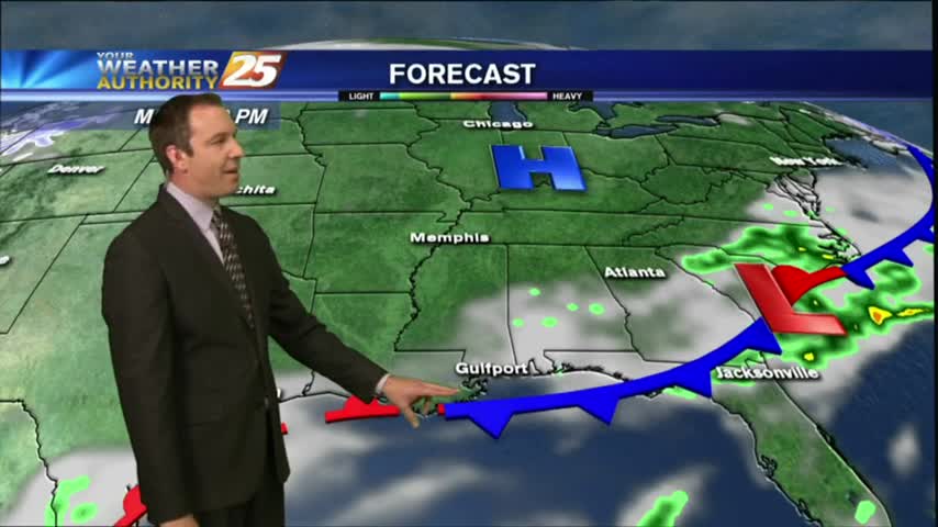
The rain has moved on but the cloud cover and humidity remain. It's chilly today, but we'll warm significantly through the week so watch the full forecast for details.
We haven't seen much active weather in South Mississippi today despite the increase in humidity and cloud cover, but expect to see it move in quickly after midnight. Click here for the full forecast.