9/24 - Chris's "Elevated Rain Chances" Sunday Night Forecast
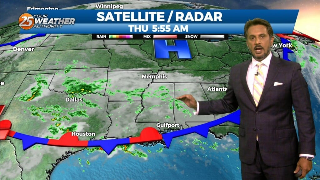
The pattern across the country remains complex. There's a high pressure system extending from northern Mexico to the Great Lakes and areas of low pressure over the…
The pattern across the country remains complex. There's a high pressure system extending from northern Mexico to the Great Lakes and areas of low pressure over the…
The upper level trough that brought the current stalled front across the area is currently east of the Ohio River Valley and quickly moving eastward.…
An upper level trough of low pressure currently moving across the Great Lakes will continue to move through the Ohio River Valley today. With the base…
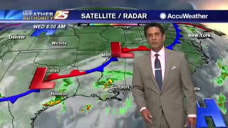
An area of low pressure has formed along a stalled frontal boundary west of the area. We can expect much needed showers and thunderstorms, as activity will…
An area of low pressure has formed along a stalled frontal boundary west of the area. We can expect much needed showers and thunderstorms this morning,…
A weak cold front to the north will aid in showers and thunderstorms. Temperatures will stay lower this afternoon due to rain cooled air and the…
This morning a weak cold front to the north is causing an abundance of cloud coverage and a few showers across the area…mainly in the N’tern…
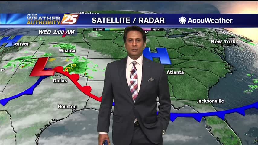
Not as much activity on radar when compared to this time yesterday morning. Expect things to continue to be fairly quiet throughout the rest of…

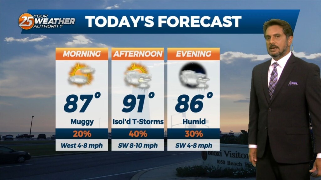
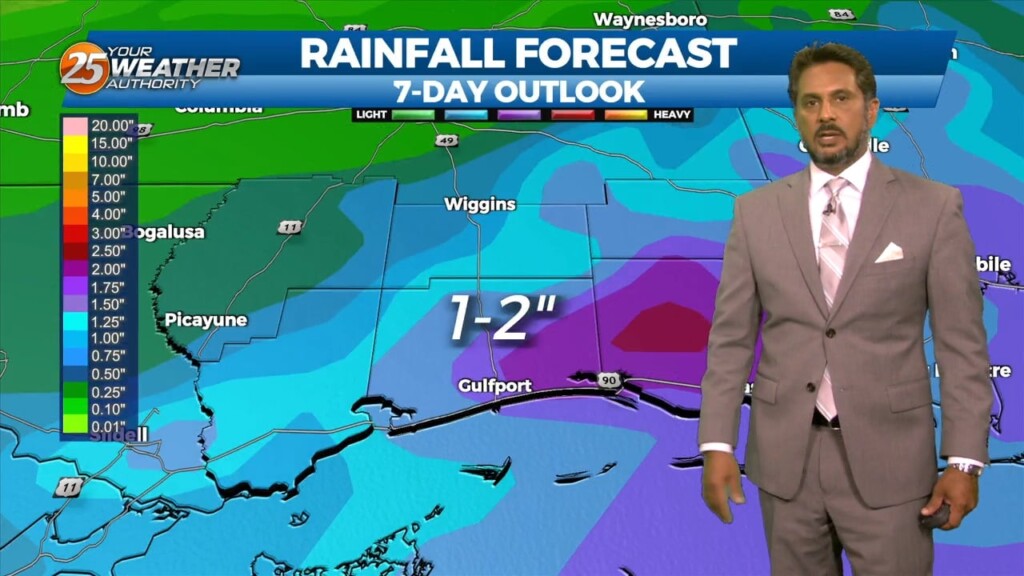
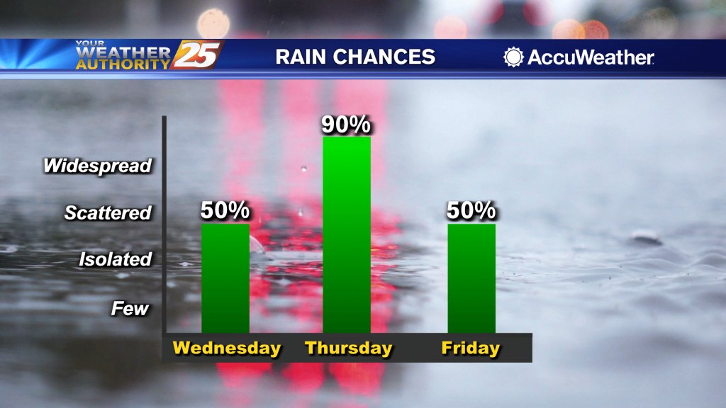
Another day... another high chance for rain. Conditions remain warm and muggy along the Gulf Coast as fog, showers, and thunderstorms continue. Rain chances stay elevated today at around 90 percent, mainly in the afternoon between 12 noon and around…
High pressure draped across Florida and portions of the Gulf of Mexico, with clockwise flow, is sending moisture from the northern Gulf into our region. This setup has been and will continue to produce muggy and warm conditions locally. Low-level…
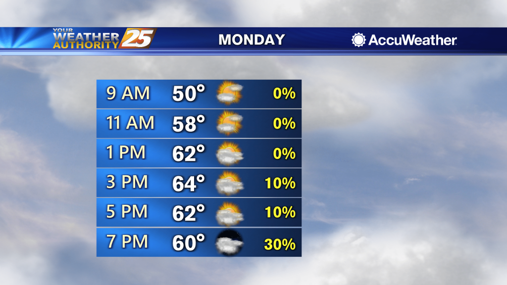
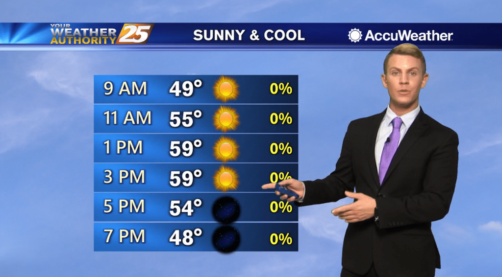
Highs today will likely climb into the mid to upper 60s and conditions will gradually become more humid. Partly cloudy skies are expected through the middle of the day, and then cloud cover starts to build once again moisture pushes…
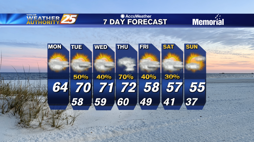
Dry and milder weather is expected for the start of the week, then moisture starts to flow back into the area Monday night into Tuesday. Today will be significantly warmer as southerly wind flow increases. Highs will likely climb into…
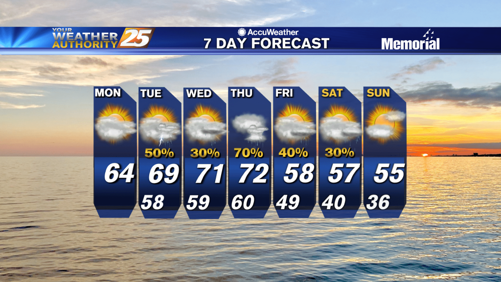
Clear weather and cooler air has moved over the area behind the cold front that came through yesterday. Dry and milder weather is expected for the start of the week, then moisture starts to flow back into the area Monday…
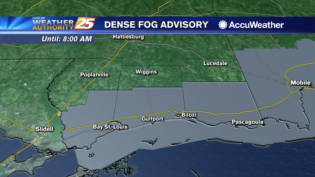
Dense fog will be the headlines for tonight and tomorrow night. Conditions continue to be favorable for sea fog, so the densest fog will likely be over the coastal zones. A Dense Fog Advisory is in effect for Hancock, Harrison,…
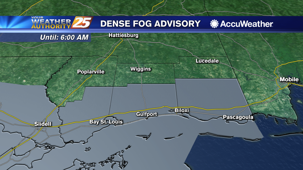
Dense fog will be the headlines for tonight and tomorrow night. Conditions continue to be favorable for sea fog, so the densest fog will likely be over the coastal zones. A Dense Fog Advisory is in effect for Hancock, Harrison,…
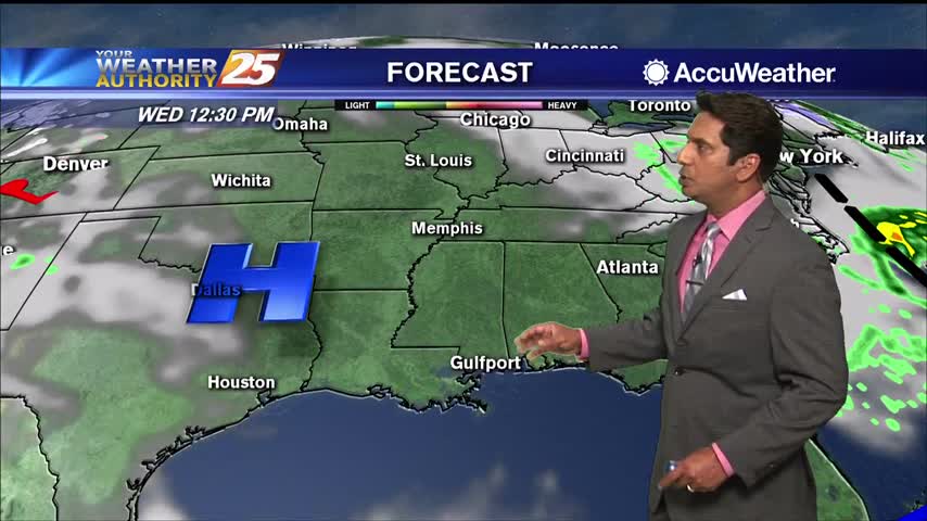
Conditions will rapidly improve after this batch of rain pushes east of the area late this evening. Expect to see clear skies in place across the area by tomorrow morning. Cooler and drier weather will persist through the middle of…
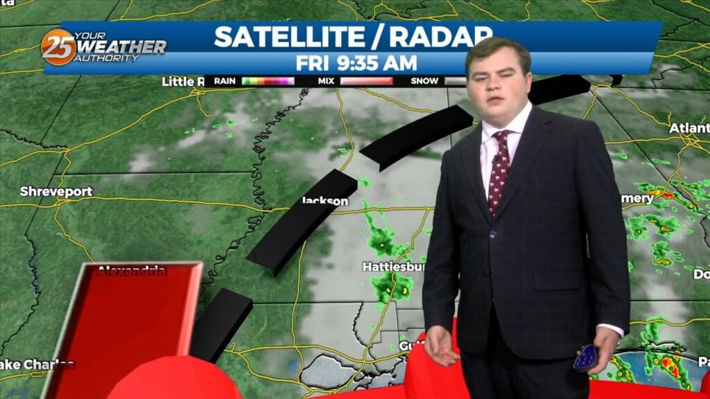
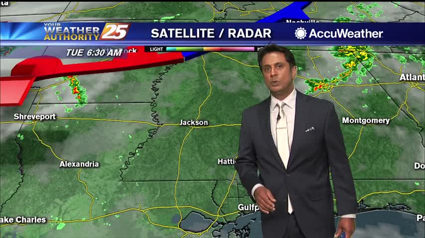
Light showers ahead of a cold front will slowly move across Louisiana today and Mississippi tonight. Rainfall amounts will generally be less than a quarter of an inch despite the high areal coverage. Limited instability will keep thunderstorms well offshore…
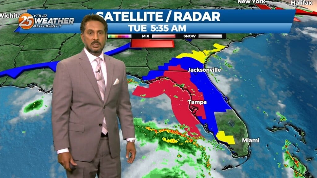
Deep tropical moisture continues to stream over the area this morning and this does not look to stop through at least Thursday. There is very good evidence that the environment is very supportive of training thunderstorms starting now through roughly…
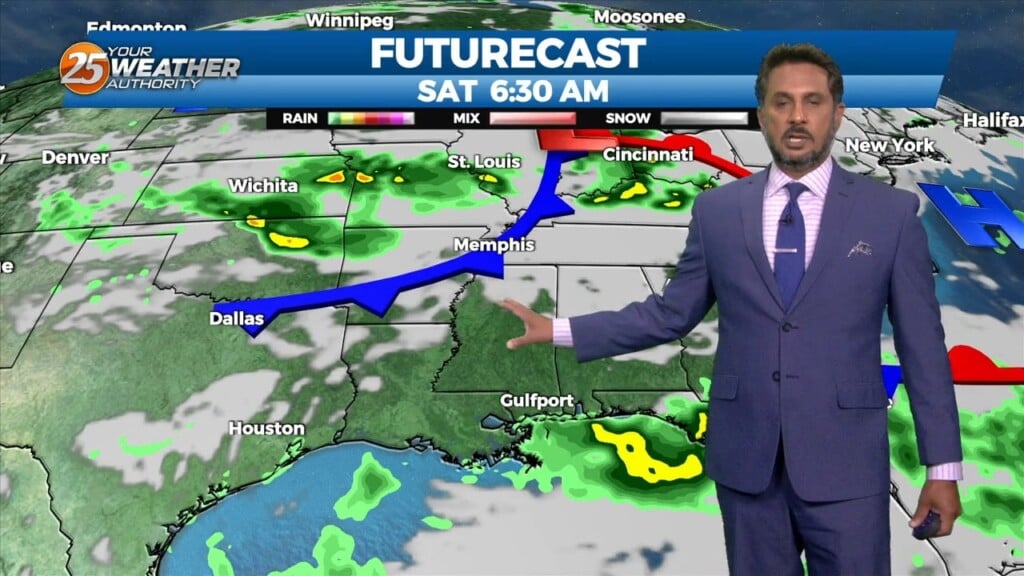
An area of high pressure near the surface will move off the Southeast U.S. coast through this evening as an upper level disturbance moves into the upper Midwest and middle Mississippi River valley. A weak associated cold front will slide…
The next 36 hours will deliver showers/t-storms to the area with some of these becoming strong to severe. The first of these looks to arrive after dark tonight and should be mainly reserved for the northern third of the area…
The low end threat for severity will move east as a cold front passes today. Some deeper and stronger t-storm cells could form this morning with strong wind gusts the primary concern. By this afternoon, dry air will move into…