6/5 - The Chief's "Another Round of T-Storms Ahead" Wednesday Morning Forecast
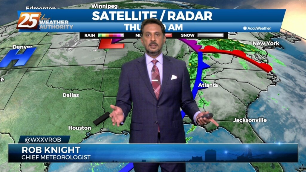
A cold front has a surface low-pressure system in Manitoba this morning with a front from there through Wisconsin to Missouri to around the…
A cold front has a surface low-pressure system in Manitoba this morning with a front from there through Wisconsin to Missouri to around the…
Some clouds move for this afternoon but the biggest change will be the wind direction. Gradually, our area will experience a moderating pattern with temperatures not as…
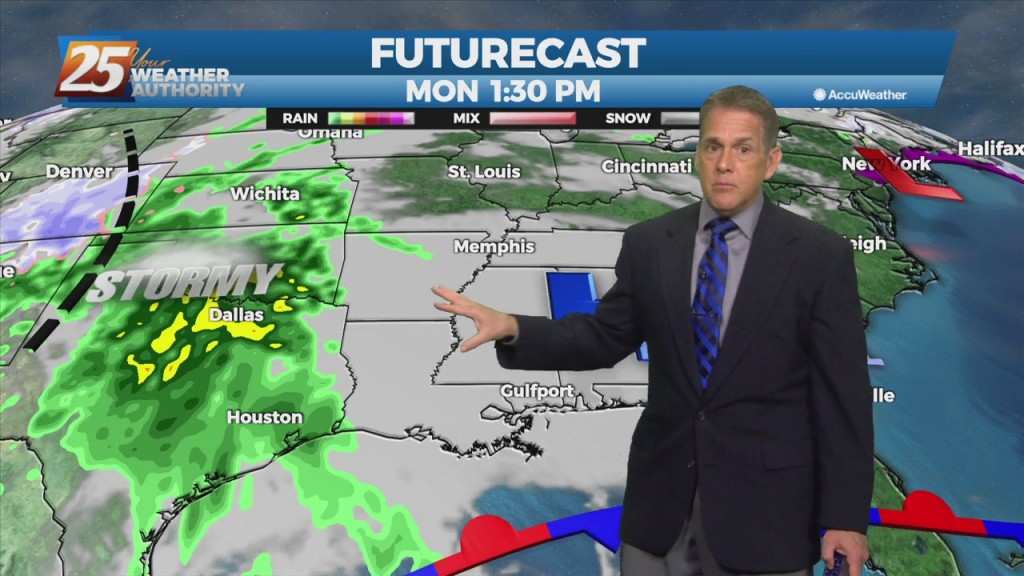
Scattered showers and thunderstorms will be possible this afternoon as temps warm into the upper 80s/low 90s within a fairly moisture regime. Although the latest…
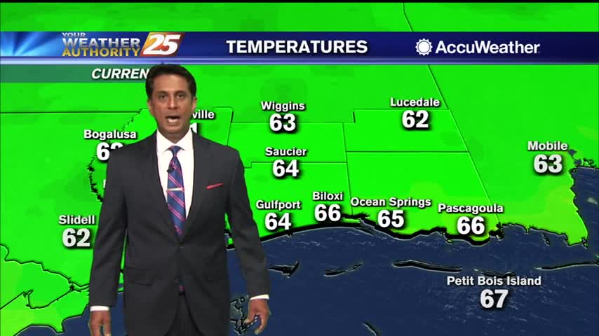
Models signal very similar activity during peak afternoon heating compared to yesterday. Temperatures today look to vary a good bit, as highs will max out in the lower…

An upper high pressure builds east rapidly, it will flatten an upper trough east of the Rockies and cause it to orient more west to east over…
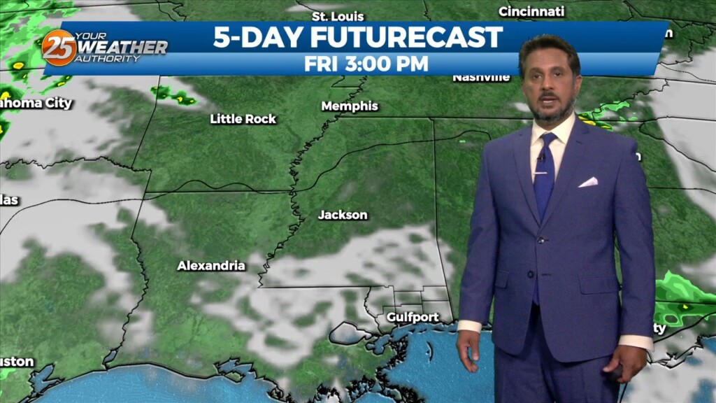
The front has made it to the coast and now just to the south of the area. Not a lot of changes from current thinking, more…
The cold front is now east with high pressure shifting eastward across the area today and Friday in a very progressive upper pattern. This will provide a mostly…
After a bumpy start to the day, the front is now east of the area and skies will rapidly clear this evening. Dry weather is…

High pressure to the north moving closer will provide for lovely conditions through the rest of the workweek. A less humid flow and cooler temperatures will continue…
A cold front will continue pushing through the area this evening with noticeably drier air behind it. Surface ridging will build in behind it which will allow…
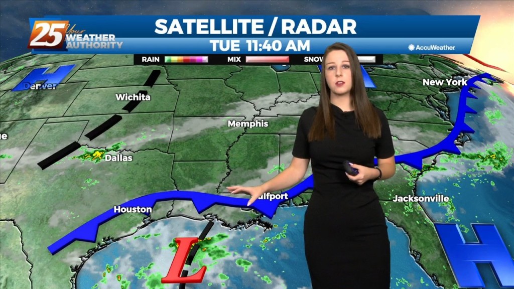
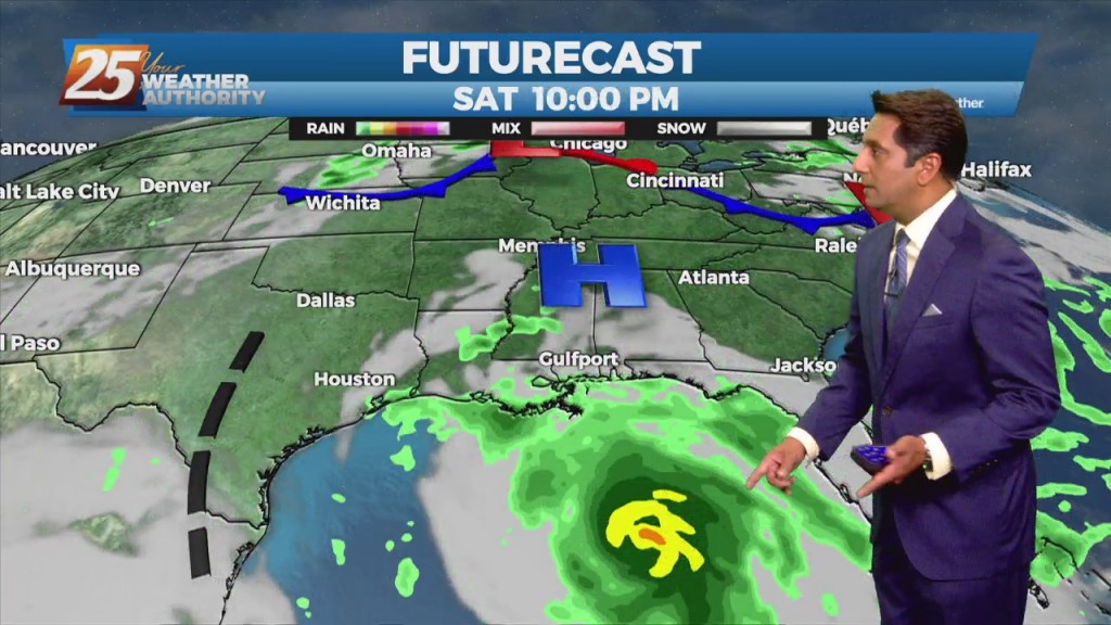
The area of disturbed weather over the Gulf of Mexico appears to be centered south of Lake Charles, which will drift slowly westward over the next…
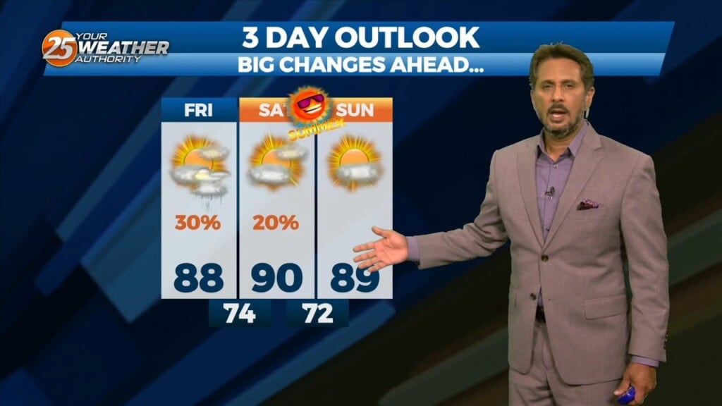
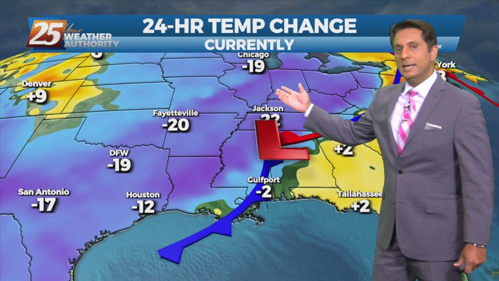
We actually had some record-high temperatures Friday afternoon after the storms moved on. Gulfport-Biloxi airport sky-rocked into the mid 80s, easily breaking the old record…
Rain chances will gradually decrease through this afternoon as a cold front moves east. An increase in northeasterly flow will become breezy this evening through Friday evening. Much…
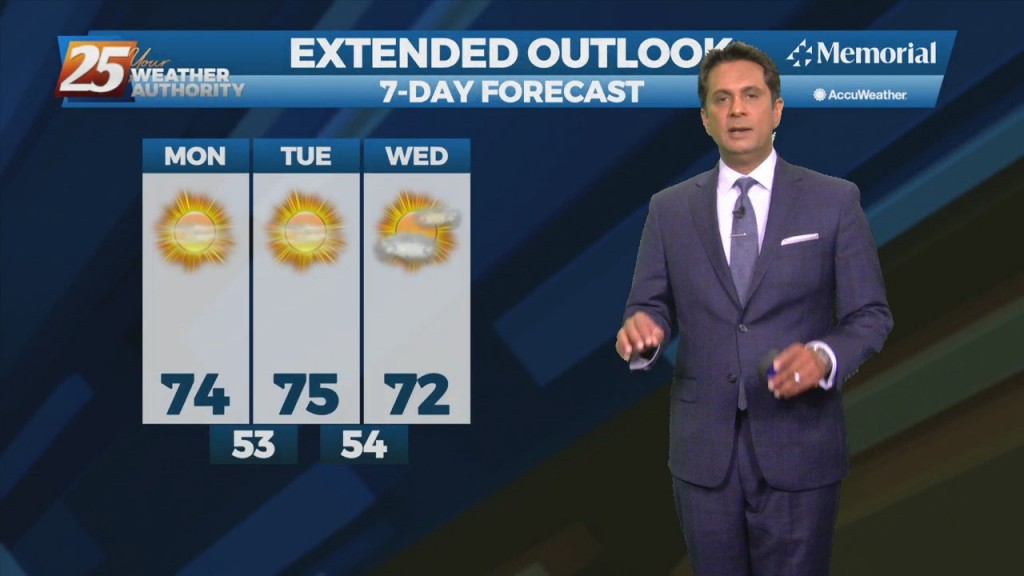
A very dry and stable airmass in place will affect the Mississippi Gulf Coast through mid-week. Overall, the pleasant period of weather experienced over the weekend…
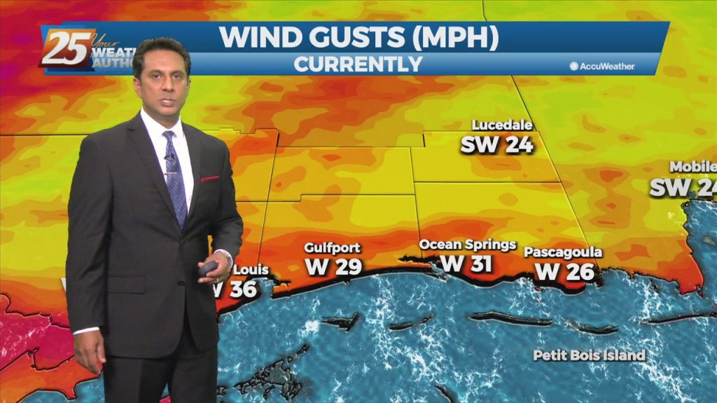
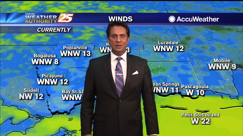
Windy conditions will remain in place today with winds sustained near 25 mph through tonight. A Wind Advisory is in effect for the entire area until 7 PM. An…
We will focus more on the less humid flow as a cold front slowly moves to the SE. This will at the very least be noticeable by most as the relatively dry air will make things feel a bit more…
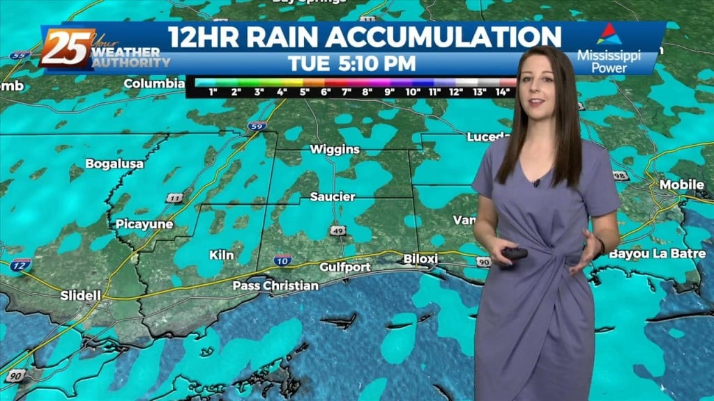
Easterly flow will continue to be a primary ingredient for increased rainfall across the area today. A strong tropical wave will move right across the area today and tomorrow bringing pretty adequate moisture to the area to assist in the…
Now that we've broken the back of the heat wave, our concern returns to thunderstorms and heavy rain. The frontal boundary currently along the interior counties will gradually work its way southward over the sound by tonight. The potential for another…
This stubborn active summertime pattern will continue throughout the middle of the workweek before a gradual drying trend expected by the end of the week. There's an area of upper level weakness over New England in place through the early…
lovely afternoon ahead with breezy conditions...
A lovely start to the day with cool temperatures and clear skies...
Post frontal passage will continue to bring a less humid air mass into south Mississippi...
Sunshine and nice temperatures with breezy conditions heading into this afternoon...
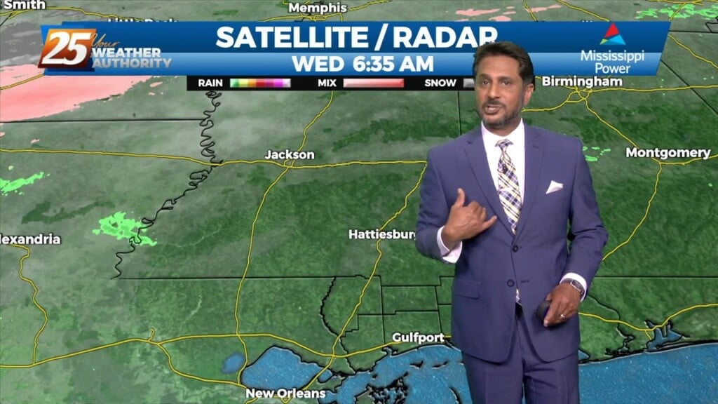
Clouds continue to move east with spotty light rain beginning to dissipate...