3/29 - The Chief's "Brief Dry Period" Wednesday Morning Forecast
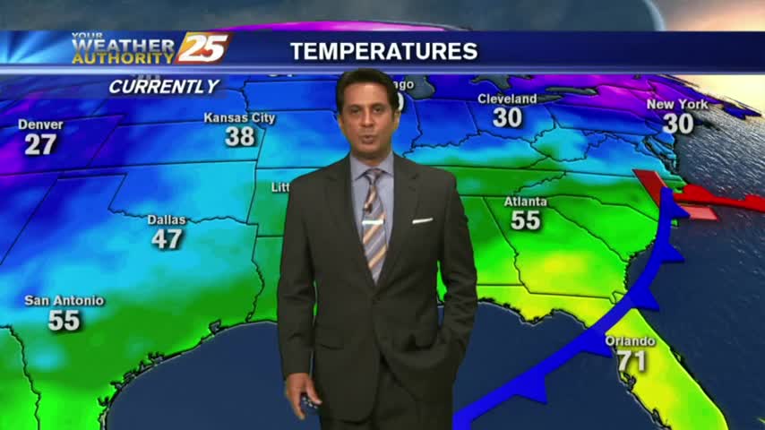
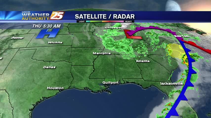
Last night’s cold front has moved well out into the central Gulf of Mexico, ushering much cooler and drier air into the area. A disturbance moving…
Last night’s cold front has moved well out into the central Gulf of Mexico, ushering much cooler and drier air into the area. A disturbance moving…
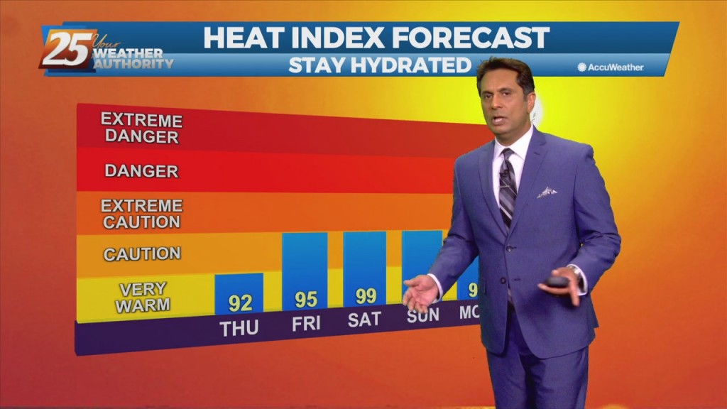
The main story will become the heat again after today. That’s not to say today won’t be hot just not when compared to the next several…

A zonal flow regime will remain in place across the Gulf South both today and tomorrow in the mid and upper levels. In the low levels, a departing high-pressure…
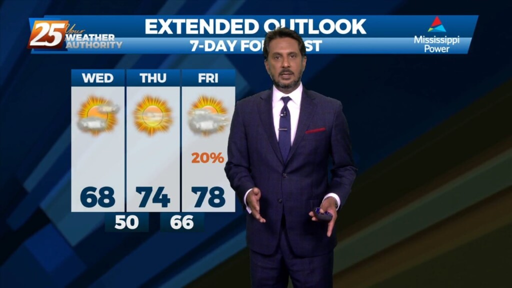
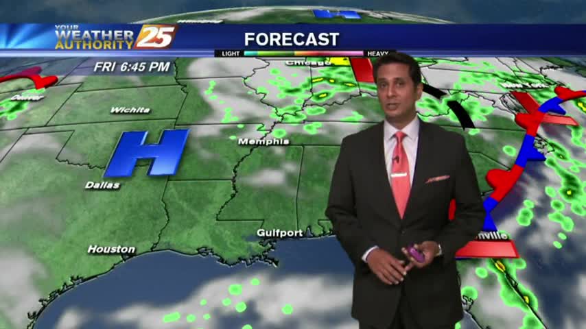
Today and Friday, the lingering frontal boundary will continue to move southward into the open Gulf waters. Upper level high-pressure will build in on Thursday followed by a short wave upper level weakness moving through Friday overnight. Overall rain chances…
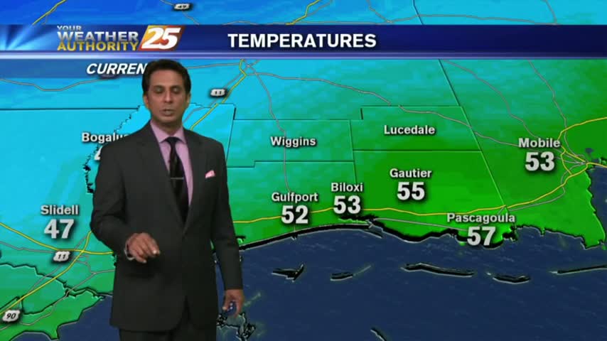
A cooler start to your Friday morning as high-pressure and drier air continues to move into the region...
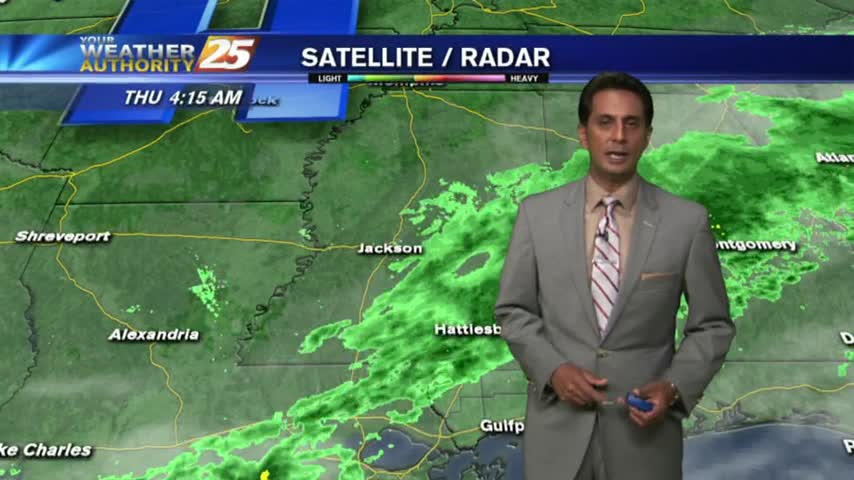
VERY LIGHT drizzle overnight has dissipating as upper-level clouds continue to move across the viewing area...
Quite a different start to he day from 24 hours ago, with rain-free conditions, cooler temps and lower humidity...
A cooler and cloudy start to the workweek, with areas of patchy fog along the coastal counties...
With cloudy skies and light rain moving across the region, cooler temperatures have moved into the Mississippi Gulf Coast...
In the wake of yesterday’s cold front, BREEZY conditions will continue with a tightening gradient and high-pressure moving in from the NW...
It's an ABSOLUTELY beautiful start heading into the weekend. In the wake of a cold front...cooler and drier continues to move into the gulf south...