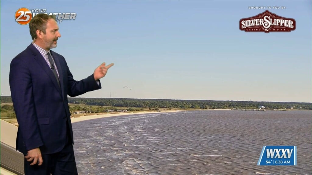
04/07 Ryan's "Chilly, Sunny Start" Tuesday Morning Forecast
We got off to a chilly, but sunny start to the day out there with our coldest weather we'll see with the last front that moved through.…
We got off to a chilly, but sunny start to the day out there with our coldest weather we'll see with the last front that moved through.…
Expect temperatures to be less cold overnight thanks to more clouds working in and more humidity working in. Clouds will increase ahead of daybreak and temperatures…
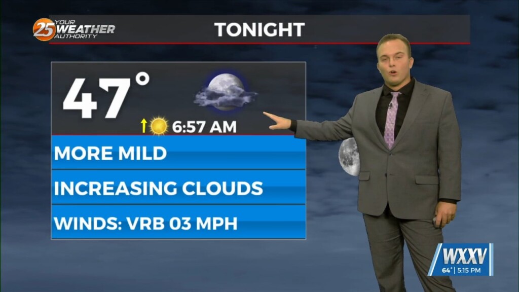
High pressure has scooted off to the east which is leading to return flow. Expect temperatures to be less cold overnight and skies to be partly…
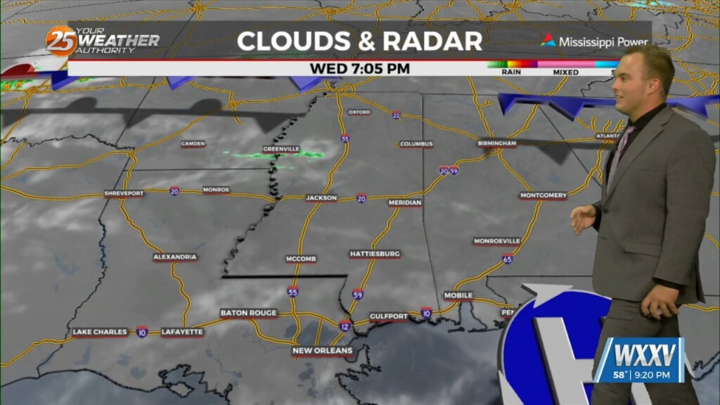
Temperatures will be cold again for your Wednesday morning. Frost development should not be too widespread north of the interstate due to some cloud cover moving in. The…
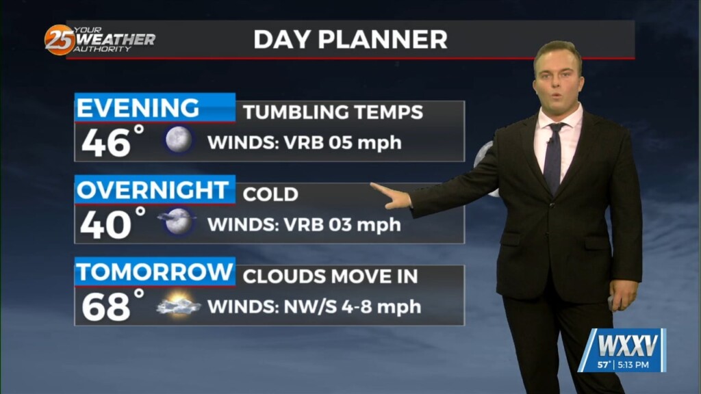
A cool evening will quickly give way to another cold night. One difference will be lighter winds which will eliminate a wind chill factor but also…
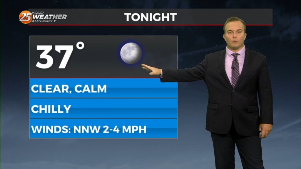
Skies will clear out for the most part tonight while temperatures remain cool if not chilly. Lighter winds and the clearer skies will yield efficient cooling so…
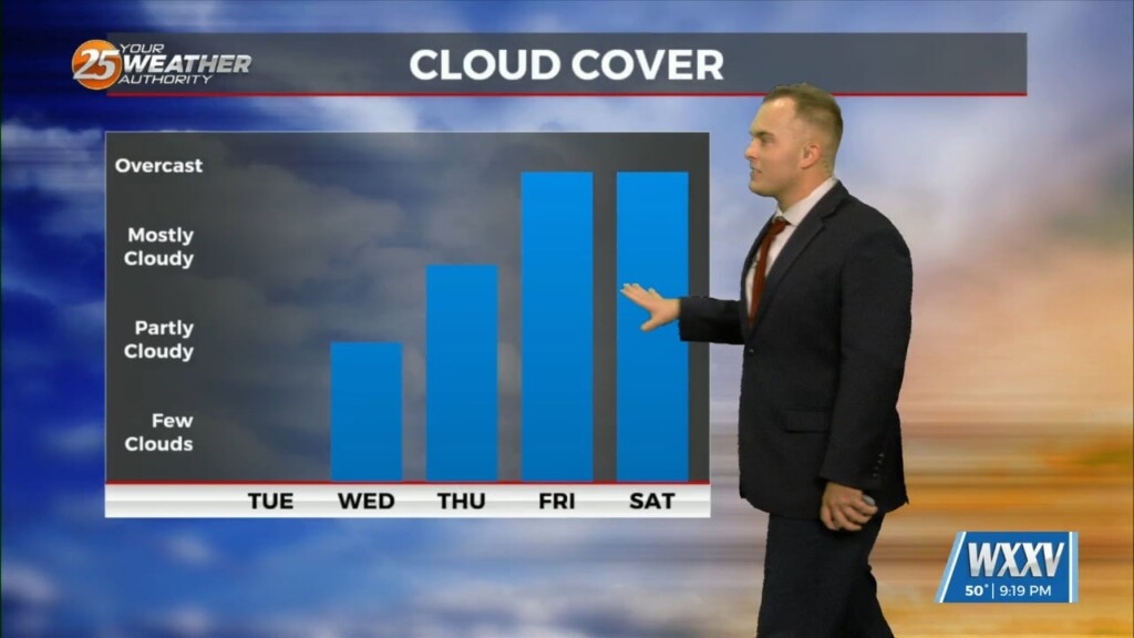
Temperatures overnight will be slightly below average so it will be chilly to start Ash Wednesday/Valentine's Day. Expect a few clouds to partly cloudy skies Wednesday as an active…
Expect temperatures to drop fairly quickly this evening as winds relax and skies remain mainly clear. It will be chilly if you have any remaining Mardi Gras…
Chilly conditions continue overnight but temperatures will not be too far off of the average low temperatures as you start your Wednesday. Sunshine will be dominant…
Sunshine dominated today and afternoon temperatures certainly overachieved with several spots in the 70s. Temperatures plummet fairly quickly this evening thanks to winds backing off and…
Temperatures will be chillier out the door for your Tuesday morning and northerly winds will make it feel like the 30s. Expect sunny skies and breezy conditions tomorrow…
Skies will rapidly clear out this evening as an area of low pressure departs our region. Temperatures will drop to chilly readings overnight thanks to northerly winds…
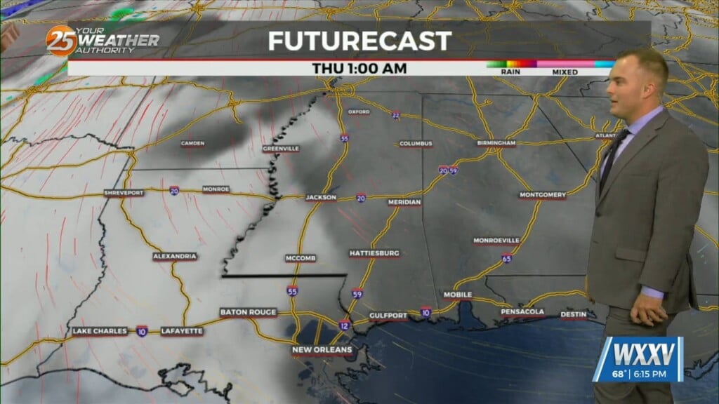
Temperatures will be colder overnight compared to what we started with Wednesday. Clouds will increase tonight into tomorrow as an active branch of the jet stream will stream…
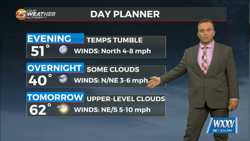
After a warm afternoon, temperatures will drop pretty quick this evening. Clouds increase overnight and temperatures will bottom out just below seasonal averages with 30s inland and…
It is chilly, but not frigid to start off this week. Morning temperatures a few degrees below average temperatures for the day will warm to near-seasonal averages…
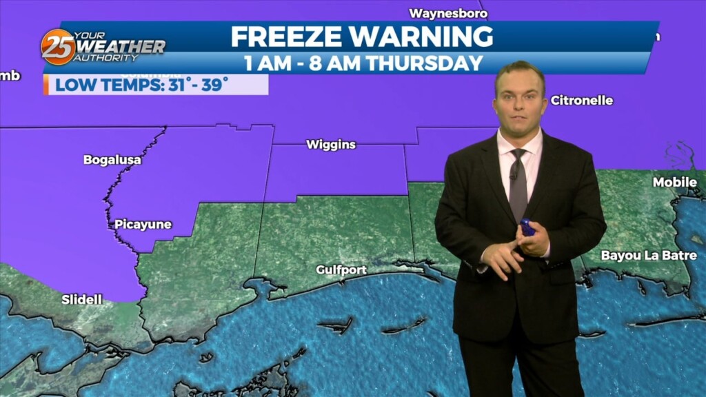
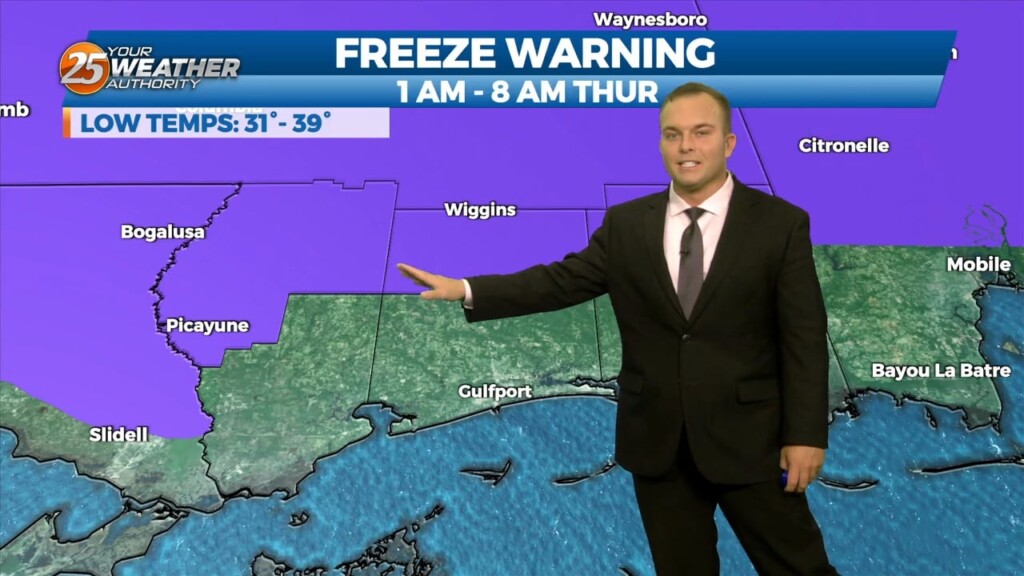
Temperatures will continue to plummet overnight as winds back off. Due to that and clear skies, tonight will be colder across the area. A Freeze Warning is…
Breezy conditions will remain tonight and already-cool temperatures will start to plummet shortly after sunset. Winds will back off enough overnight to allow for very quick…
It will be slightly less chilly overnight but overall, the same conditions will hold true with clear skies and light winds. Some spots could see fog develop…

The breeze will be less of a factor this evening as we will continue to enjoy nice conditions. Overnight, clear skies and light winds dominate and…
Skies will clear out overnight and winds will begin to pick up behind a cold front. Breezy and cooler conditions out the door tomorrow will turn windy through…
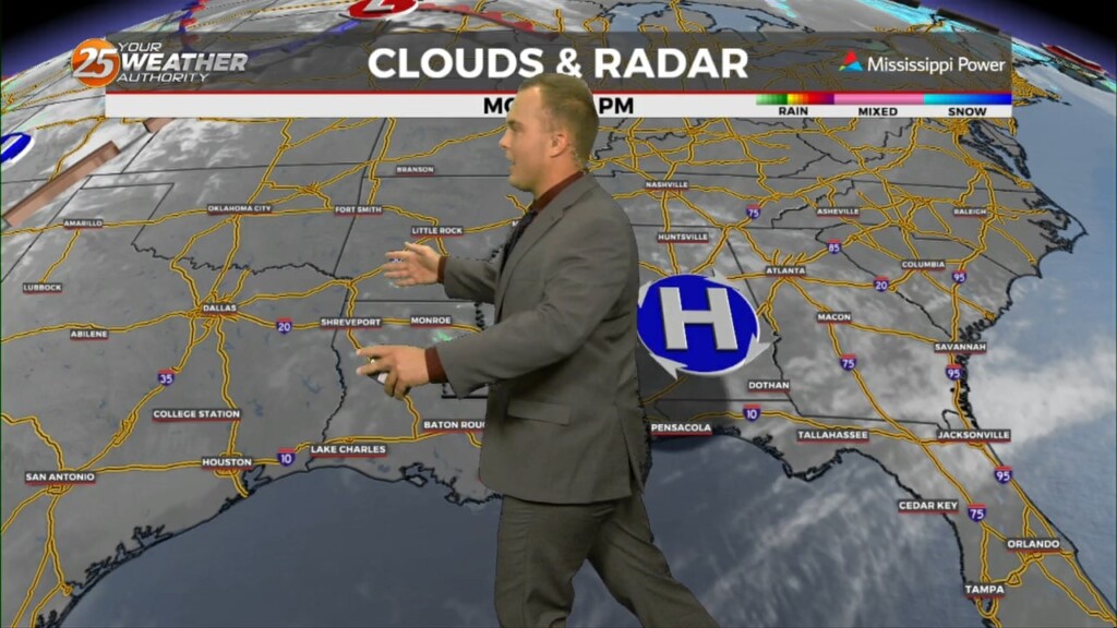
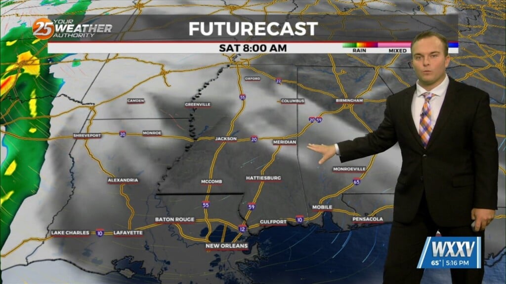
Isolated rain is heading out of the area this evening. Clouds will gradually clear out overnight as a cold front passes through South Mississippi. Winds will begin…
Cloud coverage has thinned tonight which will help temperatures fall. Temperatures will fall into the 50s across South Mississippi overnight with light northeasterly winds. Winds shift to southerly through…
Cloud coverage has remained across the area today. Clearing will come tonight and winds will relax somewhat which will allow for more efficient cooling. On and off cloud…
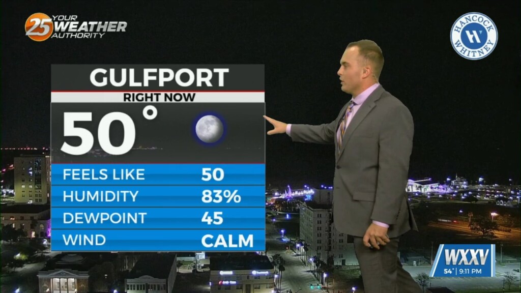
It’s cool, but pleasant this evening. Clear skies and calm-to-light winds will allow for efficient radiative cooling overnight. Temperatures around daybreak will be in the upper-40s to low-50s…