2/13 - Sam Parker's "Cool Come Back" Thursday Night Forecast
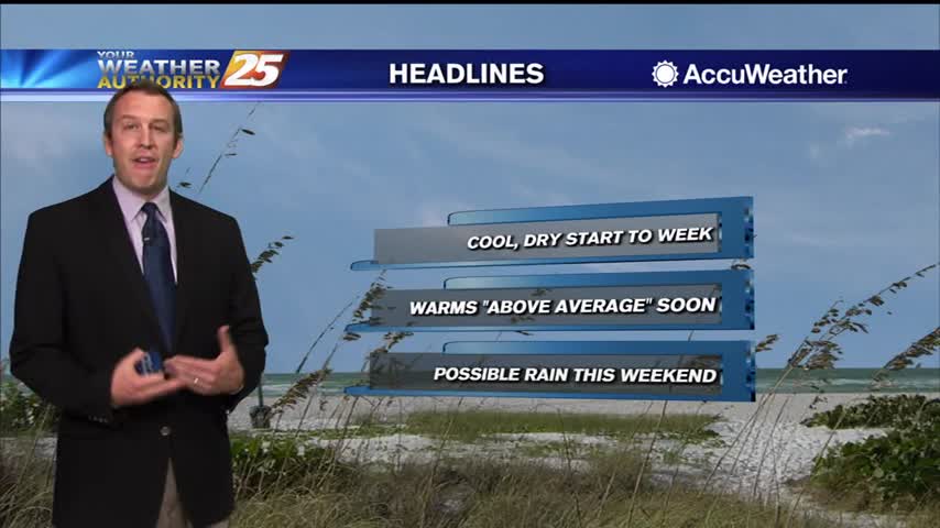
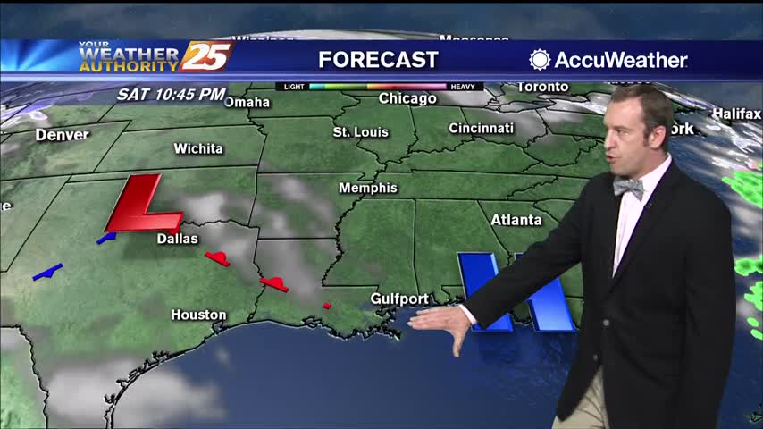
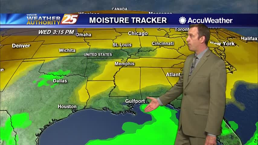
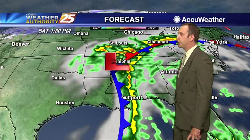
Cooler weather makes it back for the time being as severe weather returns Saturday night. The cool air will drop temperatures down into the low…
Cooler weather makes it back for the time being as severe weather returns Saturday night. The cool air will drop temperatures down into the low…
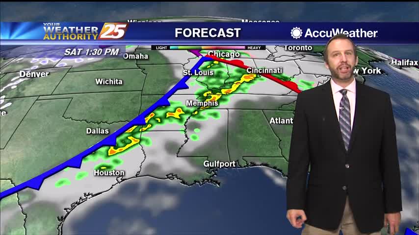
No real changes in the thinking regarding the short term forecast. Stationary front near the mouth of the MS River will continue to serve as…
This weekend will have quiet weather through the first half of the weekend with cool mornings and warm afternoons. High pressure will continue to shift…
Quiet weather through the first half of the weekend with cool mornings and warm afternoons. Only minor tweaks made to the forecast with this package as forecast reasoning…
It'll be another chilly evening with temperatures tonight bottoming out in the low 40's. We'll continue to see clear skies throughout the night and into tomorrow as…
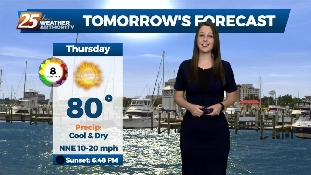
A bit cooler today, but overall a very beautiful day ahead across the lower Mississippi River Valley/North Central Gulf Coast. Aloft, a longwave trough resides over the…
After an active morning, we had a relatively quiet and warm day. We'll be on tap for a chilly night though. Given the clear skies and light winds, we'll…
Tonight through the rest of the week... Fall is in the air! No rainfall is expected for the next few days. We are still experiencing some impacts across the…

A northwest flow has plummeted humidity and cleared out the skies. We’re back to cool nights and seasonable, sunny days in the short term. This will…
Southwest flow aloft will slowly break down leading to zonal flow by tonight as a weak disturbance to our west continues to fill in. Thursday, an area of high pressure will strengthen across west TX and extend north over the…
The next few days will be mainly a temp and dew-point forecast. No rain anywhere in sight during the workweek with the greatest impacts likely to the fire weather community as relative humidity values could be quite low again this…
It’s a rather quiet forecast the next few days with cool and dry conditions today slowly moderating over the next few days. High-pressure will quickly move in later today but quickly transitions back to northwest flow through the middle of…
Weak high-pressure will track across the Mississippi Valley today and Tuesday. This will be the start of moderating temperatures. Highs to remain below normal this afternoon, reaching climatological normal tomorrow. Dew-points will be back in the 60s by the end…
Cold front moved through yesterday, but it won't really be chilly until much later tonight....
Not too bad of a weekend anyway, but then a front moved through yesterday bringing even drier air to start the week.
Yesterday's front brought true fall weather to South MS just in time for the weekend!
Today was the coolest day of the next seven with the lowest humidity, but both begin to increase in the days ahead.
Nice, sunny afternoon today and a quiet, chilly night ahead, though clouds move in again pretty quickly.
Not much changes from today's sunny, warmer weather through the weekend, but active weather moves in not long after.
Rainy start to the day, but we're already starting to see some clearing into a very nice weekend.
The cold front has arrived and temperatures are falling, but rain has so far been hard to come by.
Cold front only moved through a few hours ago, so it hasn't cooled much now but chilly nights lie ahead!
Much better weather on the other side of yesterday's front, so get ready for some cool afternoons and chilly nights!
Today was about as perfect as it gets during fall in South MS, but it won't last much longer.