08/23 Ryan's "Changing Pattern" Friday Morning Forecast
Things are changing noticeably on us now after a similar couple of days. We've now put our lowest temperatures and lowest humidity behind us, and while today will still…
Things are changing noticeably on us now after a similar couple of days. We've now put our lowest temperatures and lowest humidity behind us, and while today will still…
A slight amplification in the overall pattern with an area of high-pressure overhead allow for temps to moderate closer to climatological normal highs, albeit slightly…
Chilly conditions continue overnight but temperatures will not be too far off of the average low temperatures as you start your Wednesday. Sunshine will be dominant…
Sunshine dominated today and afternoon temperatures certainly overachieved with several spots in the 70s. Temperatures plummet fairly quickly this evening thanks to winds backing off and…
It will be cold overnight but outside of very patchy frost, temperatures will be slightly more manageable. Light winds will provide for a slight wind chill factor…
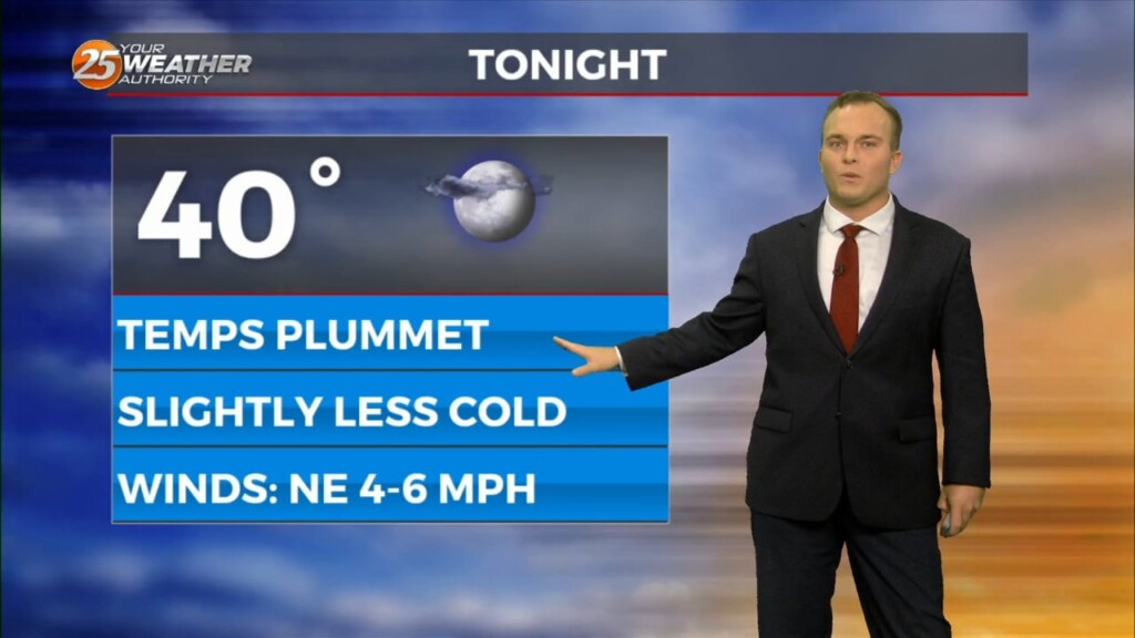
Skies clear out this evening which will help temperatures plummet again. Despite the overall moderating trend being underway, it will be a cold night again with some spots…
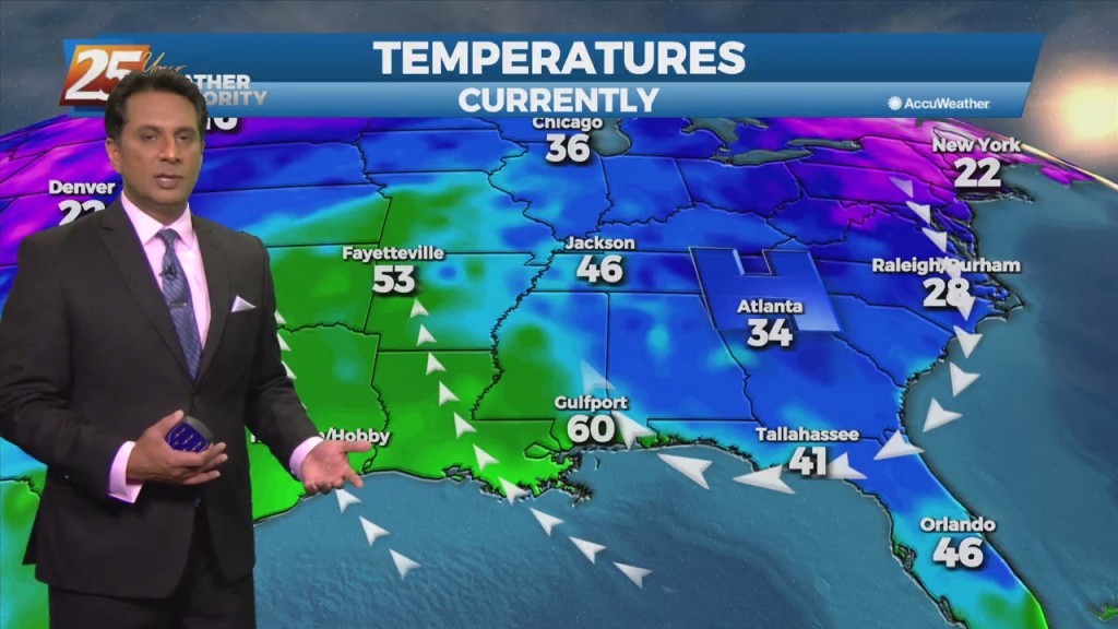
Tuesday will be a frigid start with a reinforcing shot of colder air making its way through the area. There will also be a slight wind…
Temperatures will plummet this evening as a secondary cold front will make its way through the region. Winds will pick up somewhat overnight which may offset the…
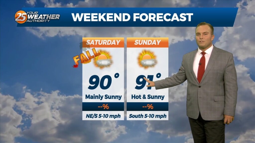
It will be mild to start off your weekend. Fall officially begins at 1:50 AM but it won’t necessarily mean much as our pattern won’t make any significant…
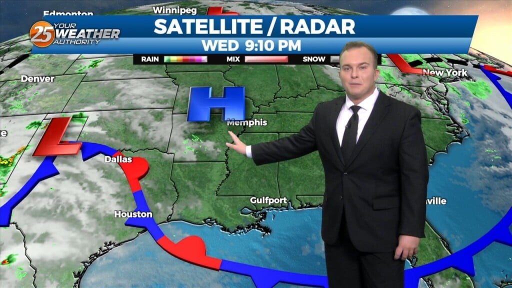
Some clouds this evening will clear out around sunset. Other than very stray showers, rain chances are put to bed for the next 48 hours or so. Passing…
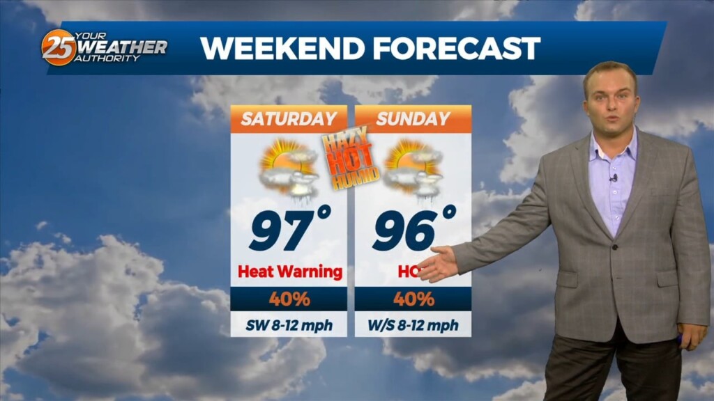
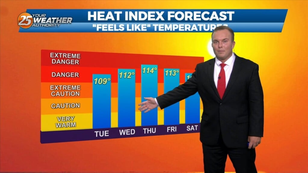
The humidity will be unrelenting tonight into this weekend. Temperatures will struggle to cool below 80 for much of you. This combined with another day of hot…
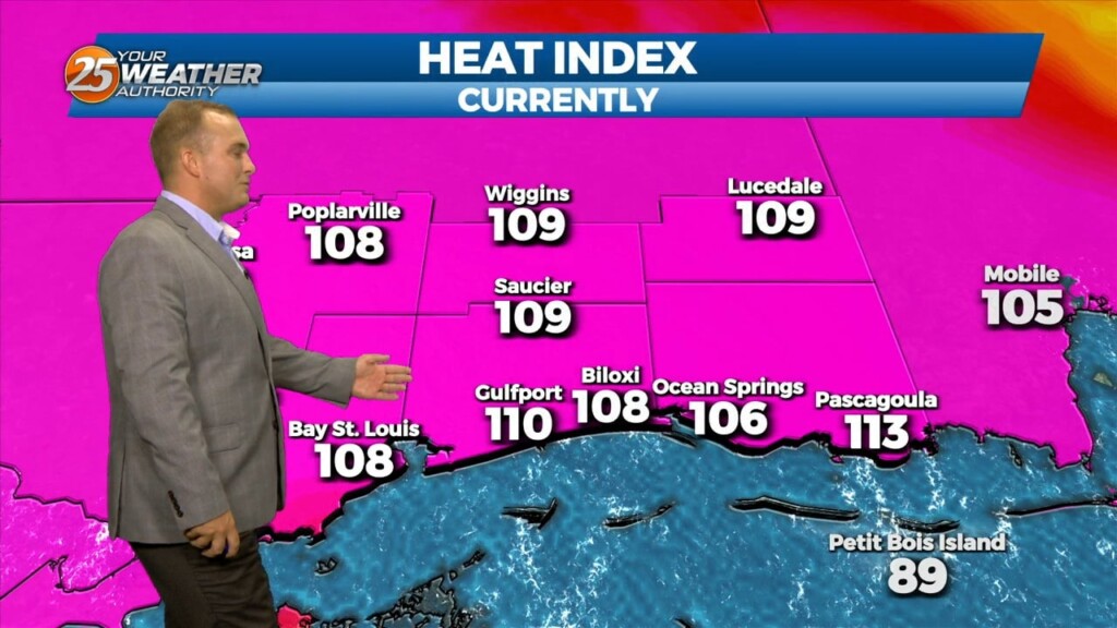
An Excessive Heat Warning is in effect for the majority of our area, with the exception of George and Stone County, until 7 PM. Regardless of alert, be…
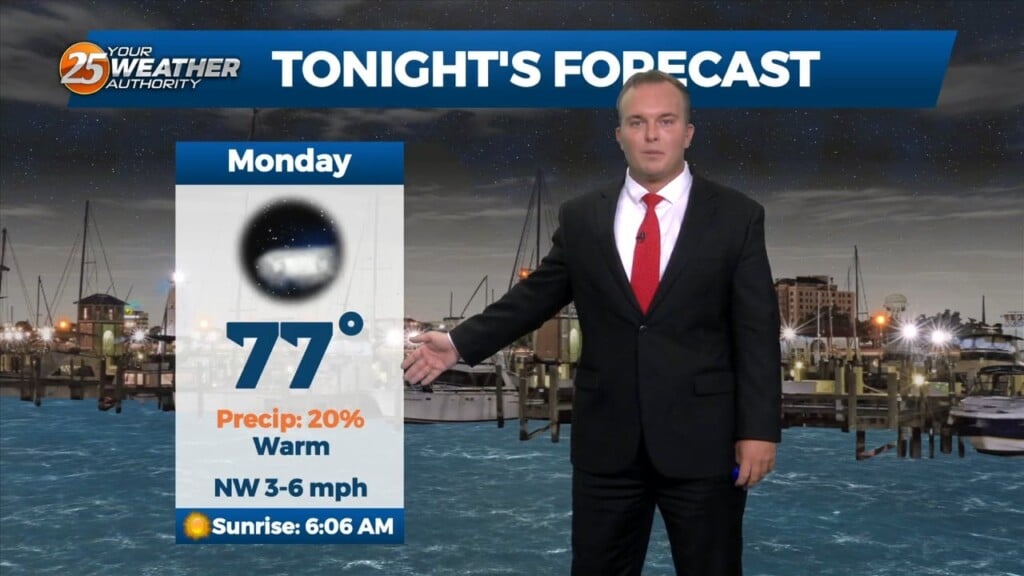
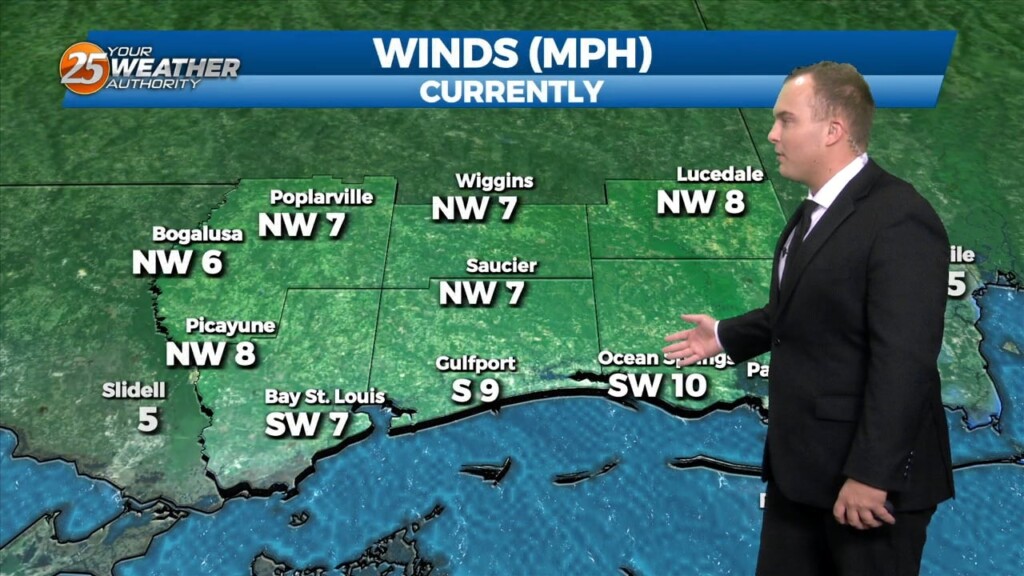
Skies will be mostly clear the rest of the night and temperatures will be somewhat mild. Northwesterly winds will keep the humidity bearable for a little…
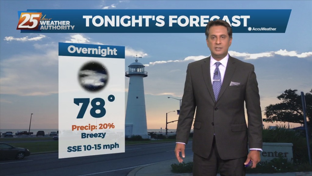
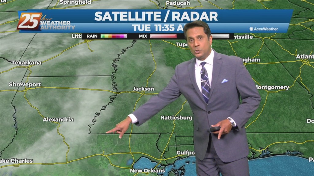
Spotty to isolated rain chances will be around this evening. Coverage will be around 20% or under partly cloudy skies. Skies will clear out overnight and winds will…
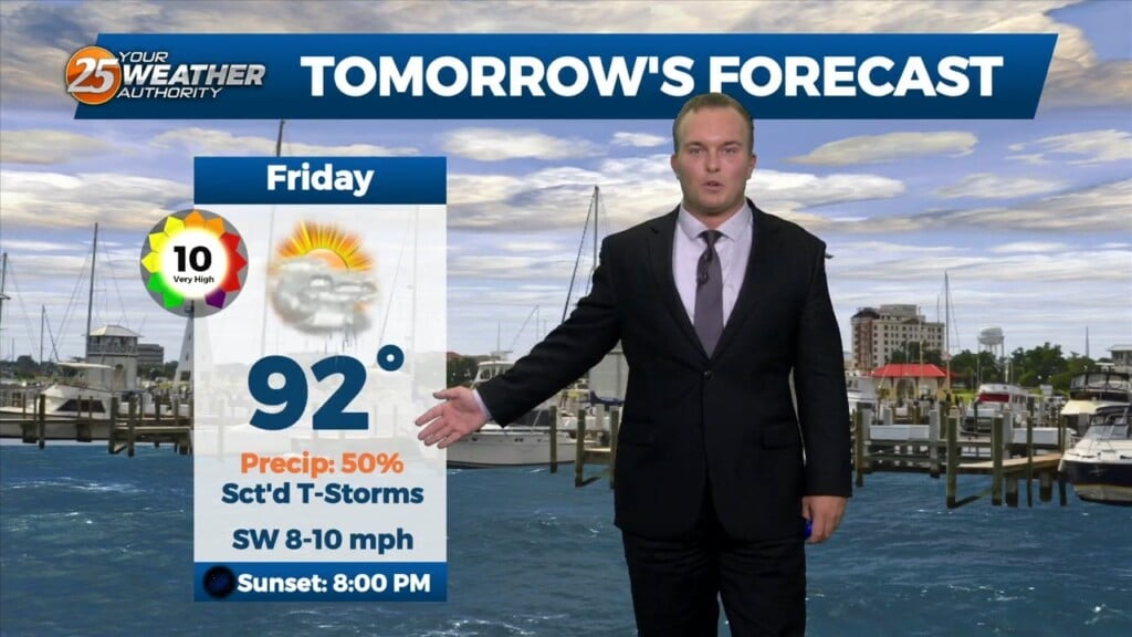
Humidity and cloud cover will remain dominant overnight. Rain chances should remain fairly isolated until the start of the day tomorrow. Friday will bring the potential for scattered…
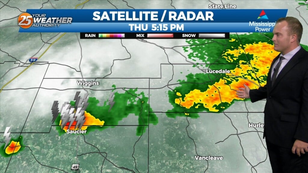
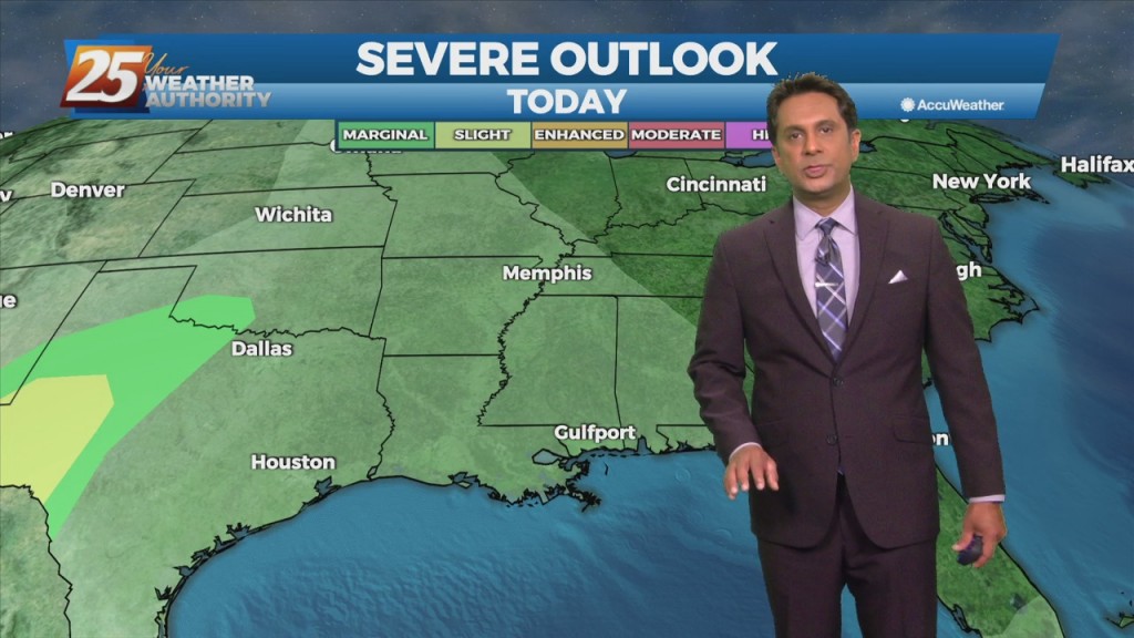
Scattered thunderstorms will be in our area for the early portion of this evening. Some thunderstorms could bring very heavy rainfall, and pack frequent lightning. A…
Winds have shifted behind a cold front that moved through the area this weekend. With that, there is some relief from the heat due to increased cloud coverage.…
Temperatures will be cool again overnight with mainly clear skies for the area. Dry air remains in place as high pressure has remained in control of the…
Splendid conditions continued for the area today with warm temperatures, low humidity content, and a light breeze. Expect a few clouds tonight and temperatures to…
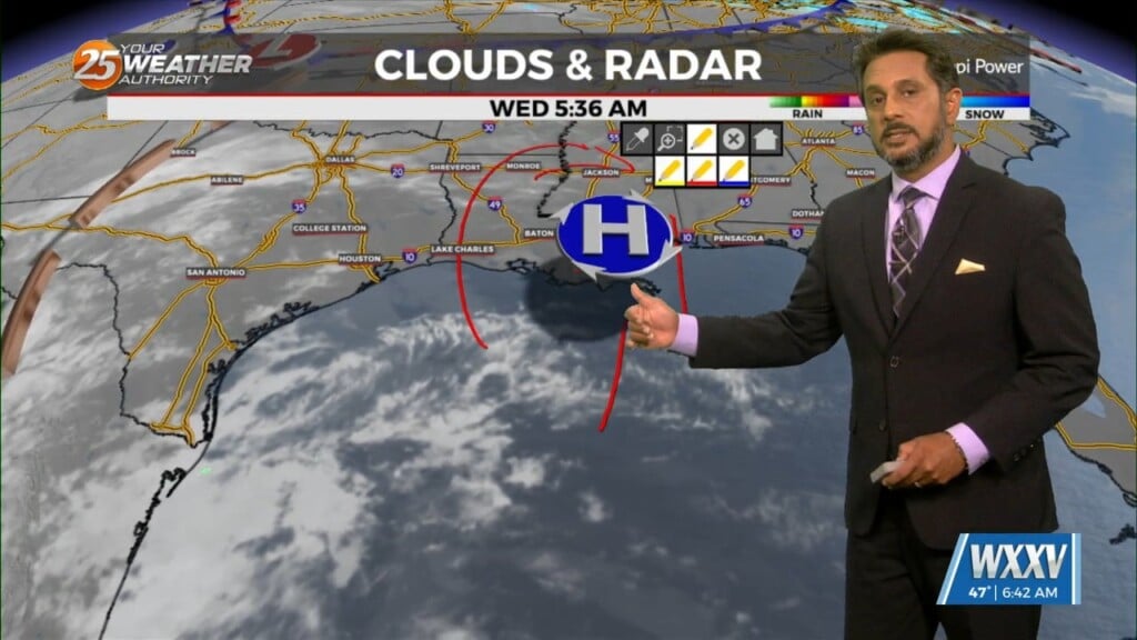
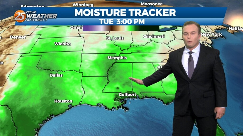
The same closed mid to upper-level low pressure remains parked over our area, centered generally over SE LA. The same corridor of deeper moisture continues along progressive…
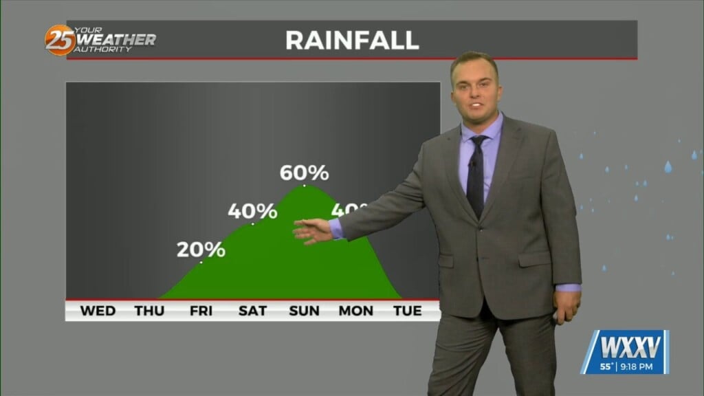
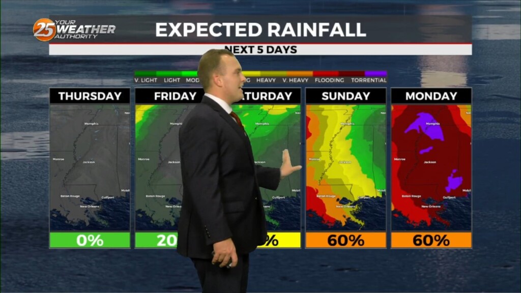
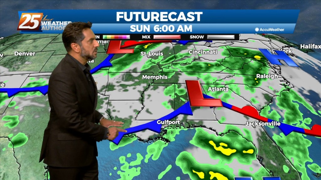
The hot and dry pattern will come to and end this weekend... The upper pattern will start the transition into a wetter one late in the…
High-pressure will slowly move east as a strong cold front will begin moving rapidly SE through the Red River Valley this afternoon, with the return flow…
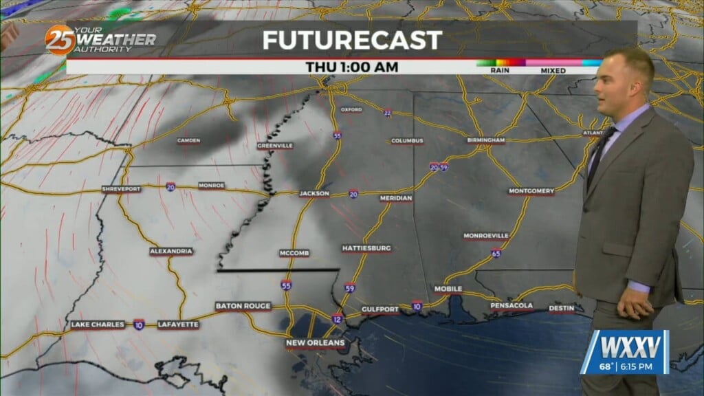
High-pressure will begin to shift off to the east tomorrow as an upper disturbance extends down into our area ushering in returned moisture. Though this disturbance is expected to…
The airmass remains very moist, with climatologically above the 90th percentile for this time of year. No real indications of any significant drying through Saturday, as even then, moisture levels remain elevated. A disturbance coming out of the base of…