10/17 - Rob Knight's "Post-Frontal Changes" Monday Midday Forecast
A cold front overhead will move southeast and continue to provide cloud coverage along with a few spotty showers. With a lack of atmospheric moisture and a…
A cold front overhead will move southeast and continue to provide cloud coverage along with a few spotty showers. With a lack of atmospheric moisture and a…
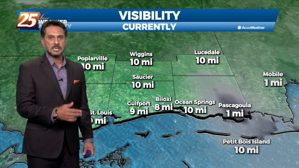
With an approaching cold front to the NW positioned to move through the area, widespread dense fog is affecting South Mississippi this morning. A dense fog…
Overall, a fairly tranquil day across the region with mostly sunny skies. Speaking of sun, plenty of insolation has occurred allowing for the boundary layer to mix…
After a warm and humid afternoon, a cold front will move into and through the area just before midnight. Winds will shift to a…
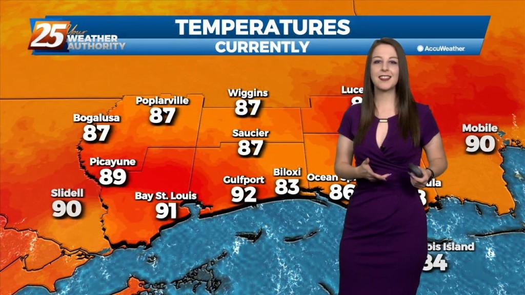
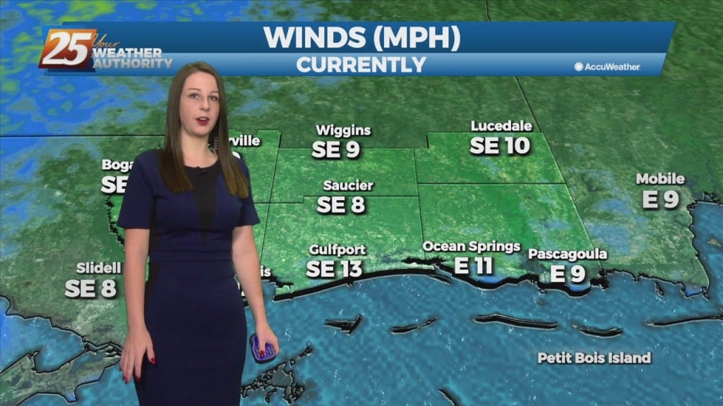
Temperatures will warm into the mid-80s across the viewing area ahead of a cold front. Winds will be out of the south, shifting to southwest around…
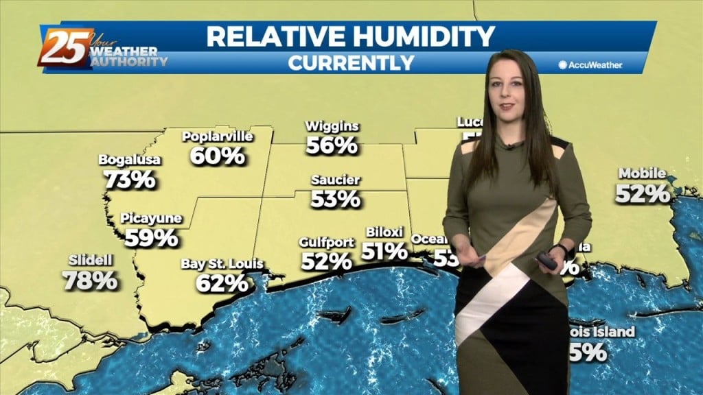
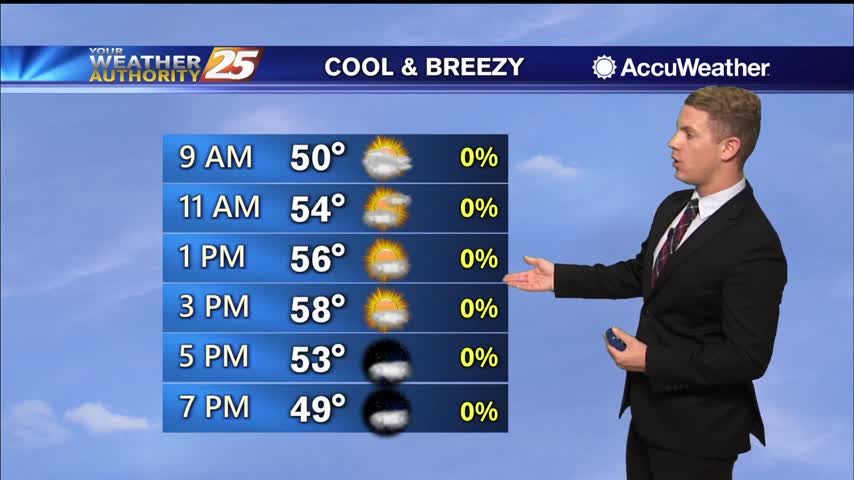
The pleasant, calm, and chilly conditions continue this evening. It has been breezy and dry with the min RH dropping from near 40% to as low as 25%. Lowest…
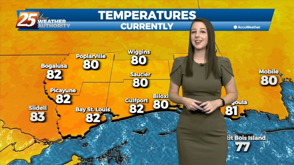
We could not ask for more pleasant weather right now. Honest to goodness Fall like weather out there and it should continue through the weekend and into…
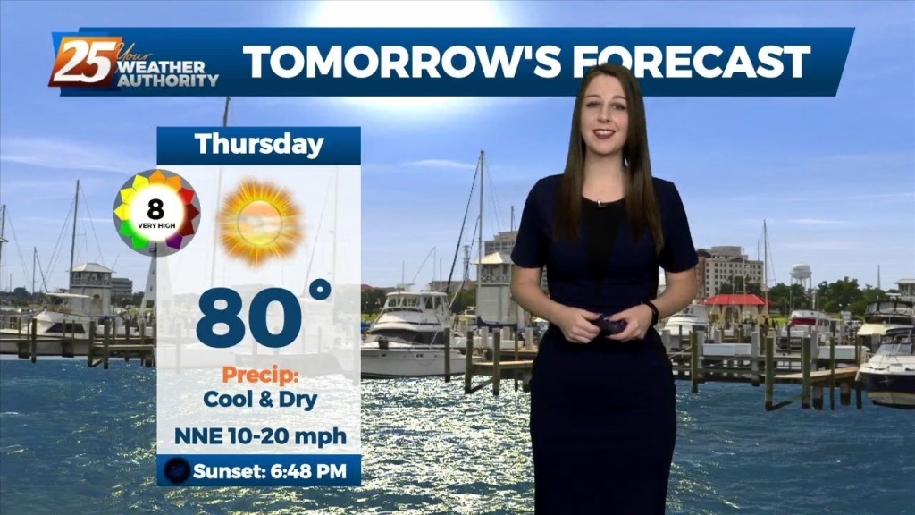
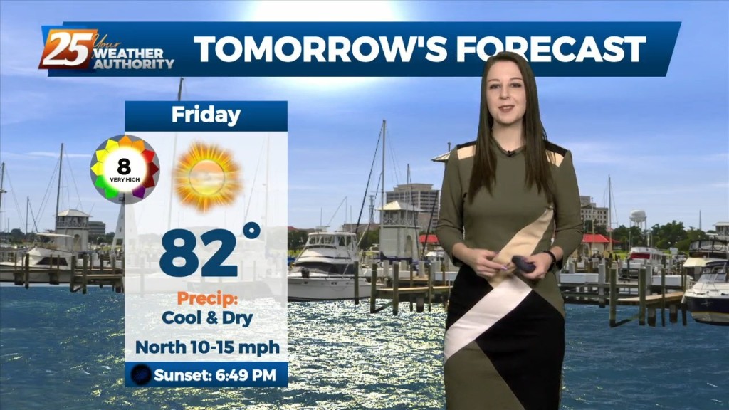
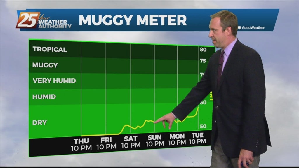
Tonight through the rest of the week... Fall is in the air! No rainfall is expected for the next few days. We are still experiencing some impacts across the…
Tonight through the rest of the week...The cold front will have moved through the area and off the coastal waters completely by this evening, bringing in…
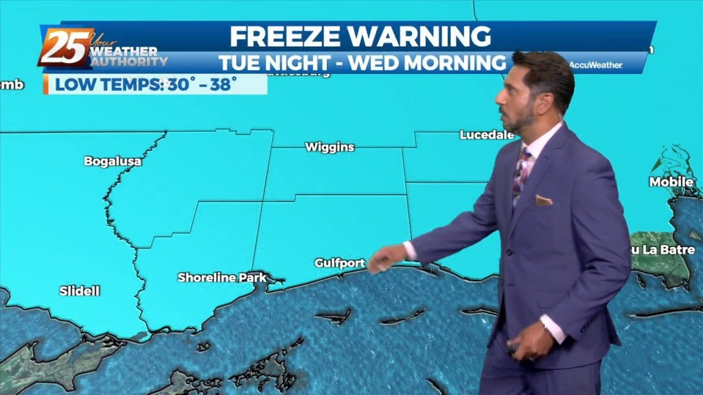
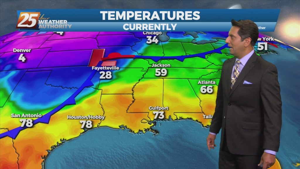
The primary forecast concern through Wednesday will be the passage of a potent upper level low-pressure and associated surface cold front across the Lower Mississippi Valley tonight into Tuesday.…
Low clouds will persist throughout the area as an approaching cold front moves into the extreme northwestern region. The warm and humid flow from the…
Cloud coverage and wind speeds will continue to increase throughout the day. The southerly component to our winds will bring warm, moist air from the Gulf of Mexico…
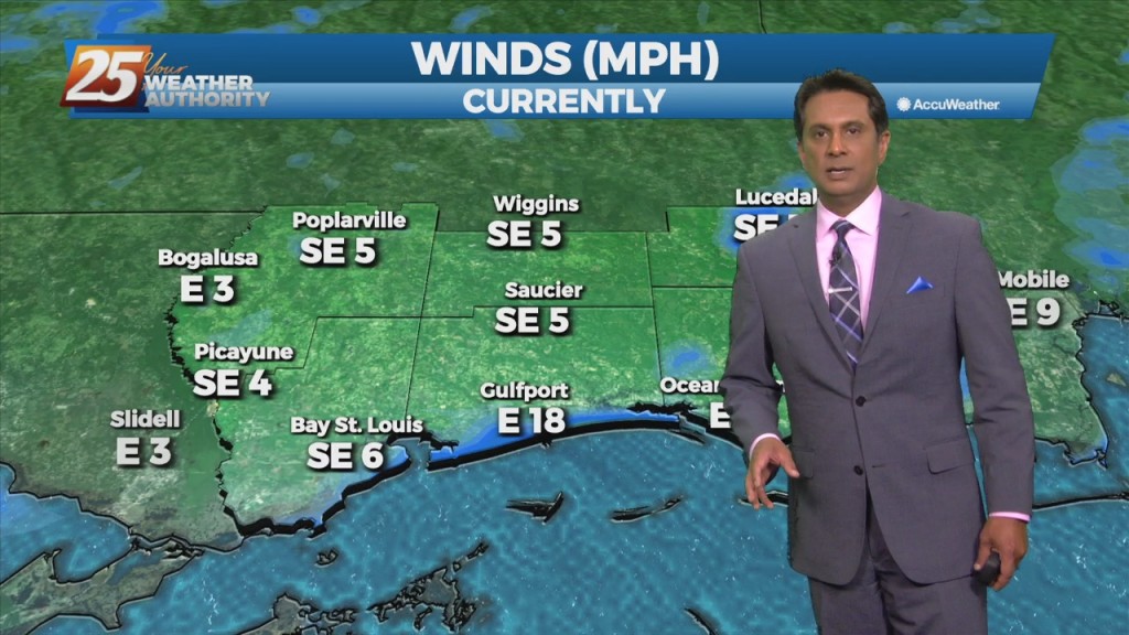
Cloud coverage and wind speeds will increase throughout the day. Winds are expected to be from the south, bringing warm, moist air from the Gulf of…

High pressure will continue to shape the forecast today, however cloud coverage will start making its way into the area beginning tonight. Patchy fog will be in the…
We saw some nice, windy weather this evening, and we're in for a chilly breeze later tonight. The wind will die down a tad after sunset, but will…
We saw some nice, windy weather this evening after yesterday's strong front stormed through South Mississippi. The wind will die down a tad after sunset, but will still be…
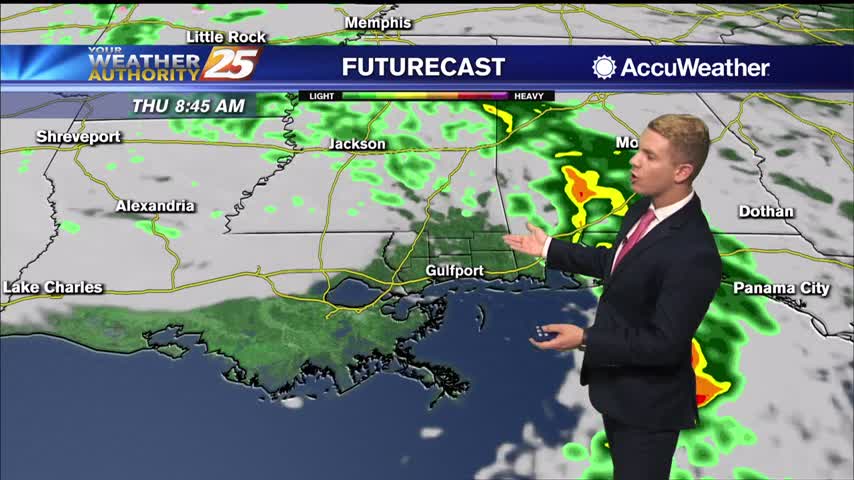
Rain will rapidly come to an end from west to the east by daybreak or shortly after for the entire forecast as low pressure tracks through north Louisiana bringing an associated cold front through the area this morning. Skies will…
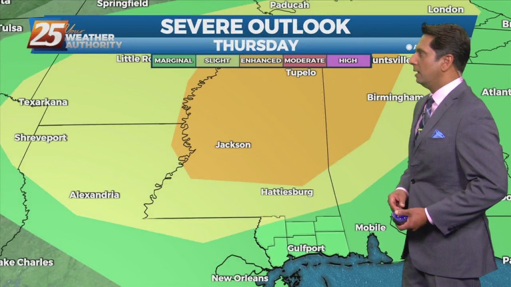
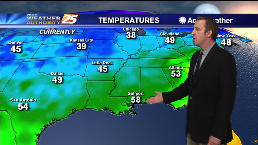
Cooler and drier conditions are expected for both Monday and Tuesday as high pressure dominates the region. As the next system drops southeast across the Rockies and into the Plains Tuesday, conditions will begin to moderate with highs expected to…
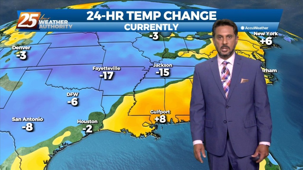
Zeta is gone and cooler, drier air is rapidly filling in its wake...
Tropical Storm Zeta is in the Gulf and expected to regain hurricane status before moving towards South MS tomorrow.
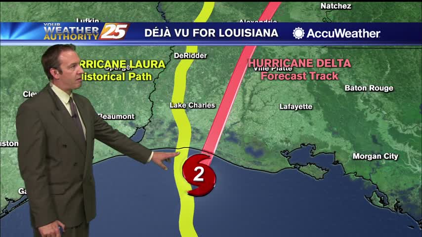
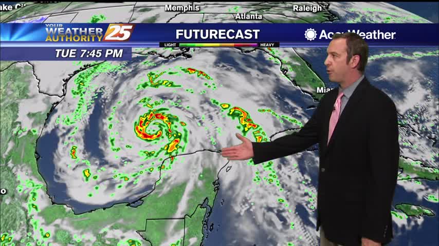
Delta is land falling in Southwest Louisiana, missing us but bringing at least a few issues to the South MS area.
We saw showers and thunderstorms through the evening, but the rain has stopped and even the skies will begin to clear into the weekend.

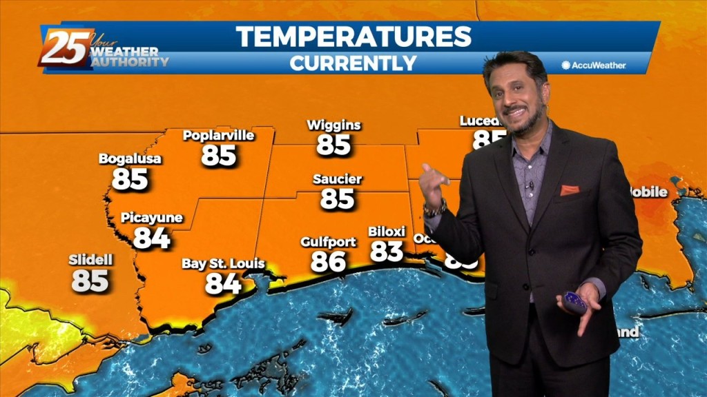
It's been quite hot over the last few days and still was today, but cooler air is on the way.
After a hot day yesterday, temperatures will be cooler today topping out only in the lower 80s this afternoon. Dry conditions are expected with very low humidity and gusty winds up to 25 miles per hour. Tonight, temperatures drop to…