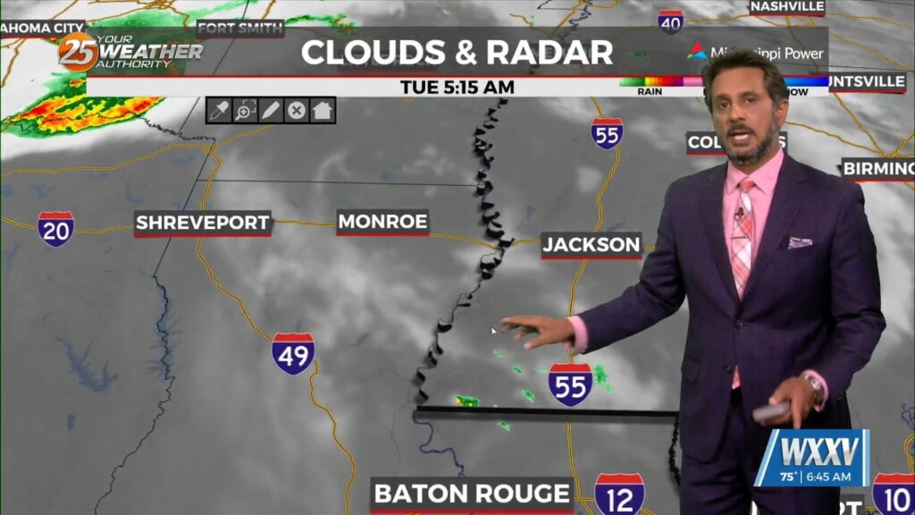
6/4 - The Chief's "Warming Trend" Tuesday Morning Forecast
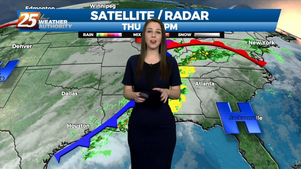
The next complex of showers/t-storms is getting started over central Oklahoma. This will move eastward and then down the same travel path as the one that just…
The next complex of showers/t-storms is getting started over central Oklahoma. This will move eastward and then down the same travel path as the one that just…
An are of upper-level low pressure will continue to move northeast over the next 36 hours as it gradually gets absorbed by a stronger system over…
A stalled stationary front in the northern Gulf of Mexico, continues to flare up showers well to the south. High pressure to the northwest will be the dominate feature…
A stalled stationary front in the northern Gulf of Mexico, continues to flare up showers well to the south. High pressure to the northwest will be…
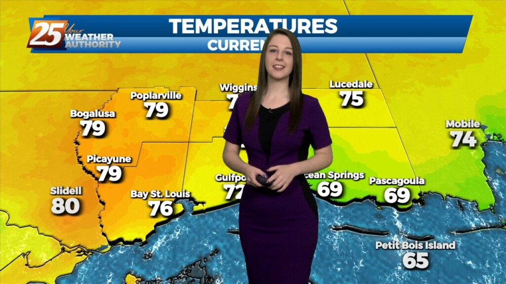
Well-above normal temperatures continue as we close out Mardi Gras with high temperatures in the low 80s across much of the area. Low stratus that developed overnight and held…
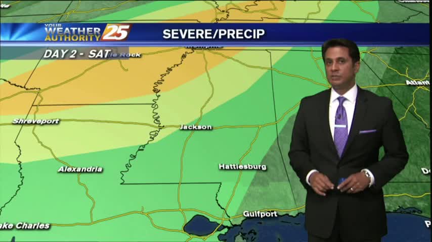
As far as threat timing is concerned, the tornado threat peaks this afternoon ahead of the cold front when SRH and surface-based instability is maximized while with…
The cold front that was moving toward the area yesterday slammed the brakes and stalled to the west. The next front will actually make it through…
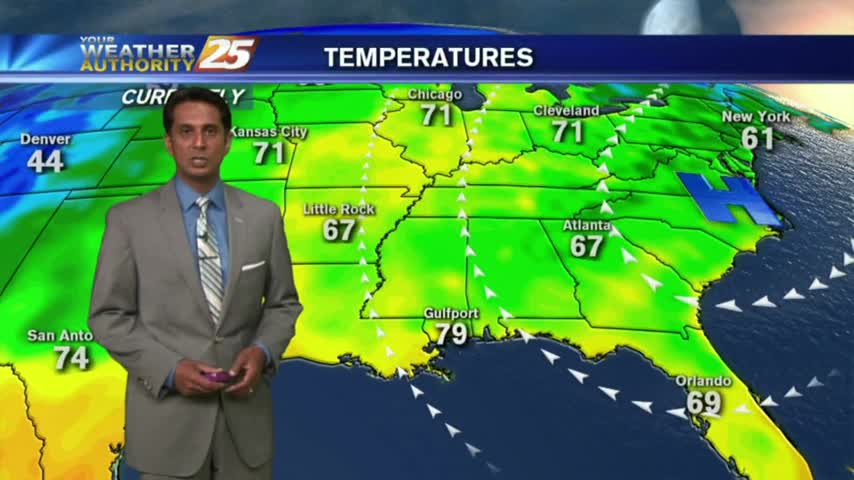
At the surface, high pressure was along the Atlantic Coast with an area of low pressure over western Ontario had a cold front to near Chicago, St. Louis,…
The area of low-pressure is now along the NE'tern GOM moving ENE. Rain is out of the area but clouds will longer today as low-level moisture flow…
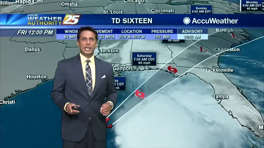
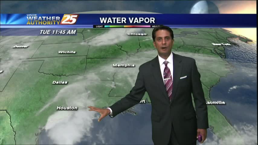
The primary forecast concern through Tuesday will be the progression of a fast moving low-pressure system along the northern Gulf. The low-pressure should continue to…
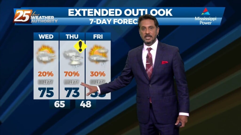
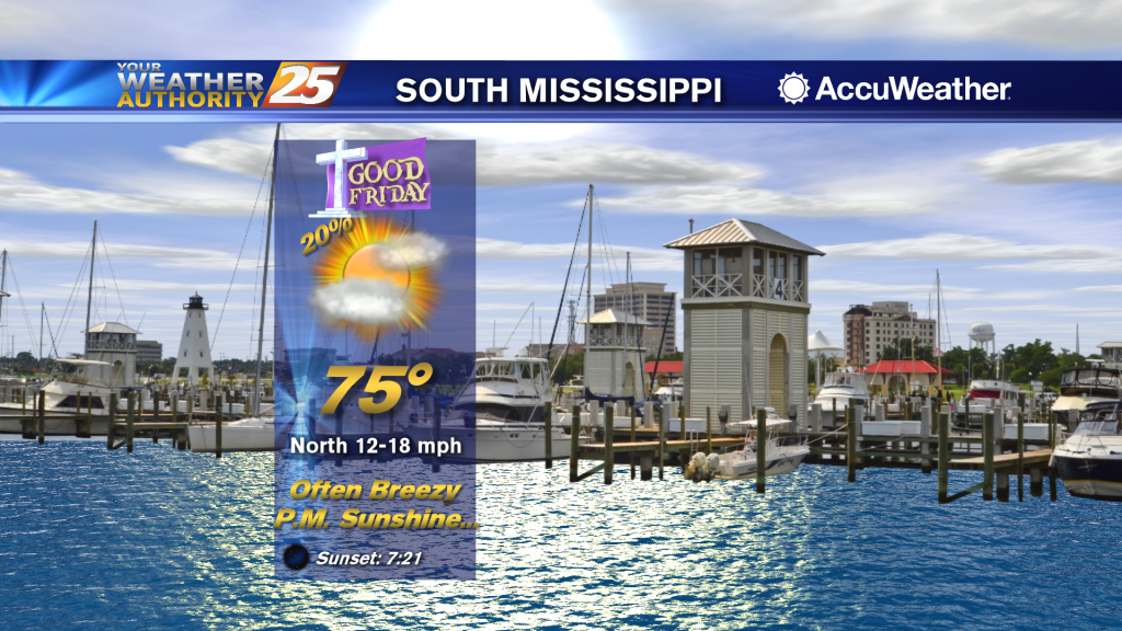
Rain chances will gradually decrease through this afternoon as a cold front moves east. An increase in northeasterly flow will become breezy this evening through Friday evening. Much…
The main focus of the short term will be the cold front that is still looking on track to slide down into our area later today. This…
A typical summer day is ahead with the exception of minor additional effects from TS Fred in the NE'tern GOM. With the trough in the upper levels moving south and the continued moist air mass; this should keep some convection…
Light rain lingering will move east and sky condition will begin to improve...
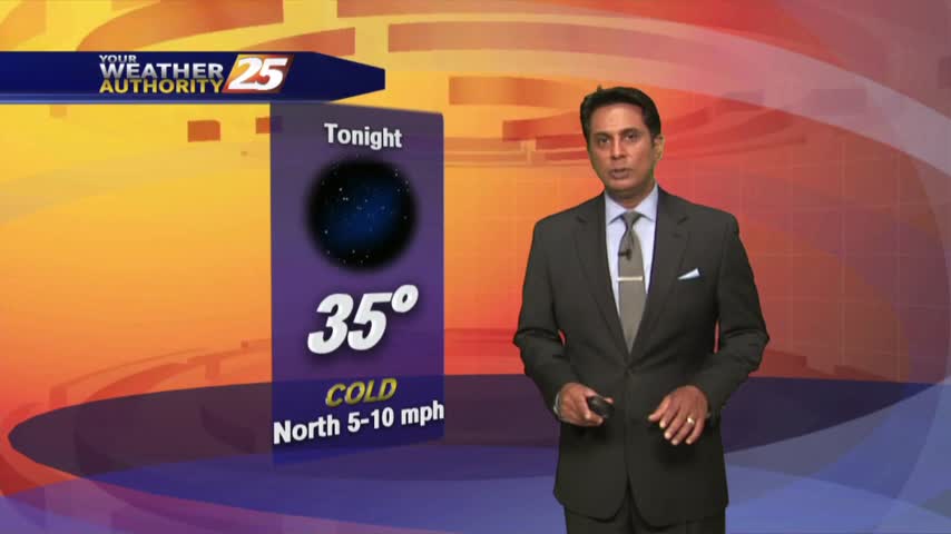
A VERY COLD start to the day with clear skies and lighter winds from yesterday...
Light rain continues to move in from the south with cooler temperatures this afternoon...
In the wake of last night's cold front, it's a chilly start to the day with the winds beginning to increase...
Clear skies overnight has brought a chilly start to the day, temps in the low 40s...
It's a warmer start to the day with isolated showers moving across the viewing area...
Isolated showers have been moving into the area with a few t-storms on-tap this afternoon...
Another Warm/Humid start to the day with areas of PATCHY DENSE fog along the coastal counties...
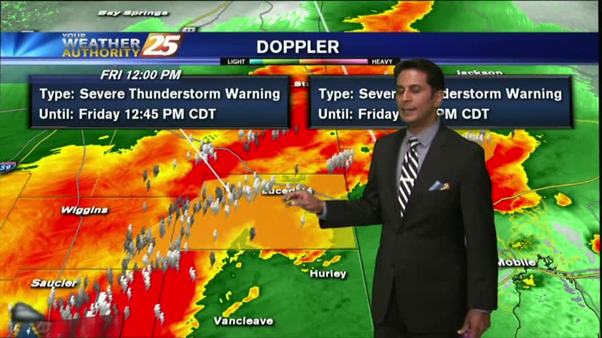
A line of T-Storms moving into the area in advance of an approaching cold front...
A warm/humid and BREEZY start to the day, along with areas of patchy fog along the coastal counties...
After a warm/humid start with patchy fog, warming temps continue to bring drier conditions to the area...