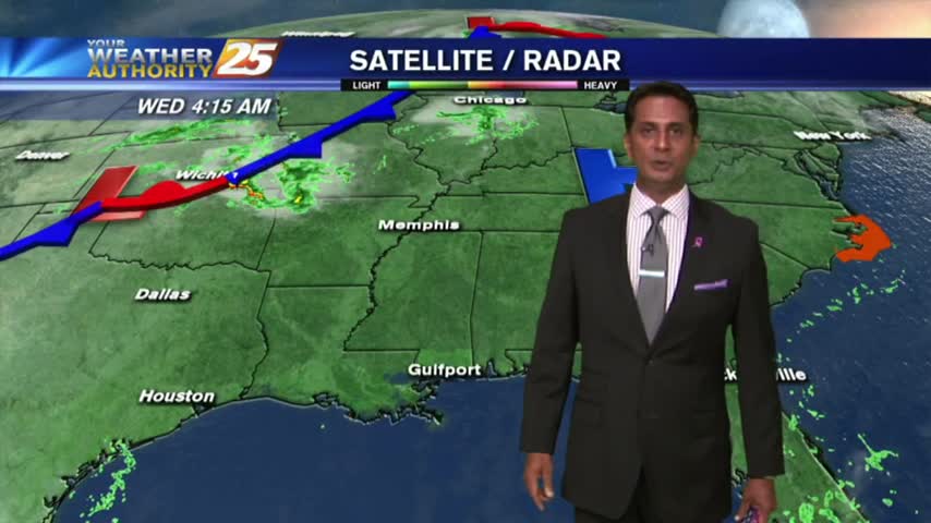
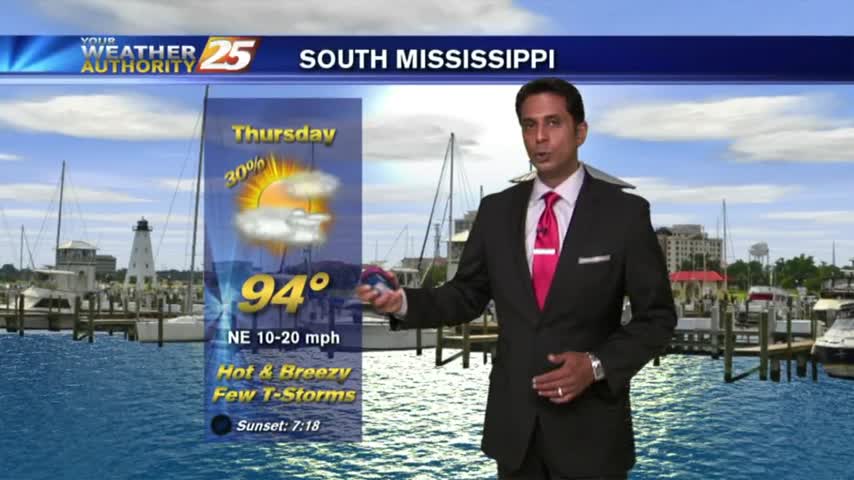
7/19 - The Chief's "Hot Temps/Low Rain Chances" Wednesday Morning Forecast
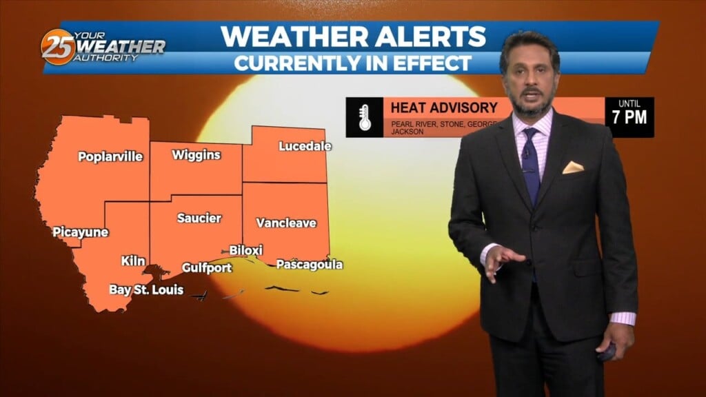
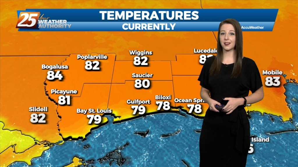
Another day of dangerous heat is expected across the area. A HEAT ADVISORY goes in effect from 12 pm until 7 pm as heat indices…
Another day of dangerous heat is expected across the area. A HEAT ADVISORY goes in effect from 12 pm until 7 pm as heat indices…
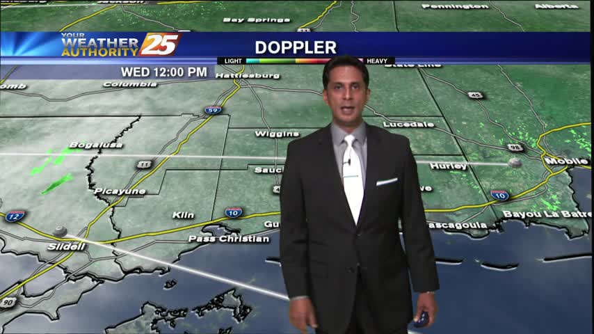
Warm and moist air advection continues as we stay ahead of the trough over southern Colorado. The advection as well as isentropic lift has created some showers…
More seasonable weather is underway today with drier air wrapping around the western periphery of Tropical Storm Nicole which made landfall overnight along the eastern coast of Florida…
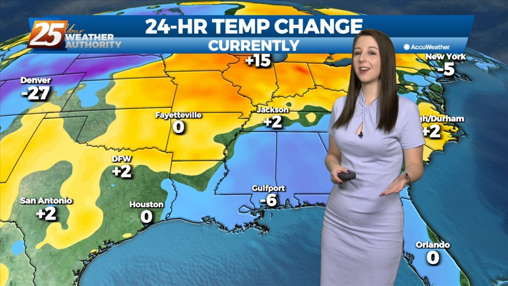
After record heat the past few days, more fall-like weather is underway today across the area as a drier air mass is advected in from the…
The quiet weather is expected to continue as high pressure continues to sit over the northern gulf coast. Temperatures will remain about the same as the…
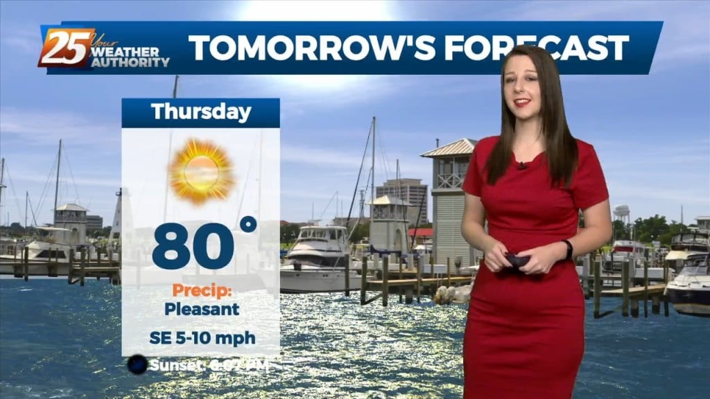
We're on tap for a clear, cool, and muggy night. Tomorrow, we'll have rain free and sunny conditions yet again with warm temperatures. Subtle changes will begin on Friday…
Zonal flow will continue to dominate the upper level pattern tonight. Southerly surface winds will continue to enhance warmer, moist air advecting into the area. Rain chances…
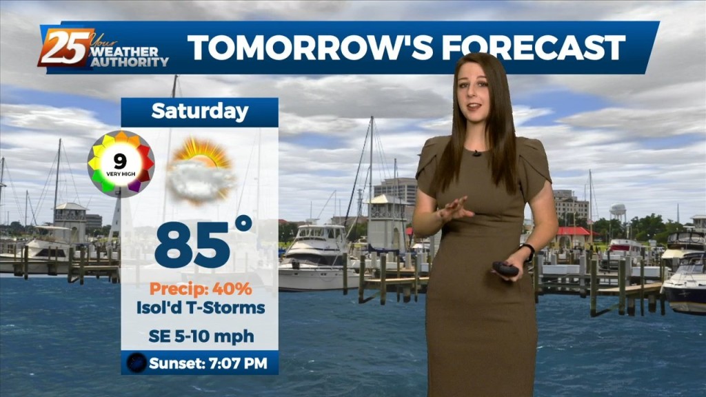
Tomorrow, we'll only see slight changes as the overall pattern shows little change. The upper low will still be in place overhead, but likely weakening at this…
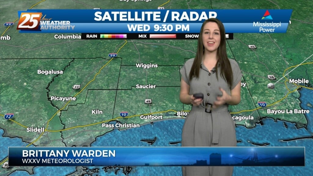
Patchy fog has developed once again as rain is now moving into the viewing area...
After a warmer start to the day, low-level clouds have been moving in and out of the area...
A warm/humid and very breezy afternoon is ahead in advance of an approaching cold front...

This morning brings MUCH WARMER TEMPS along with extensive cloud coverage and windy conditions in advance of an approaching cold front...
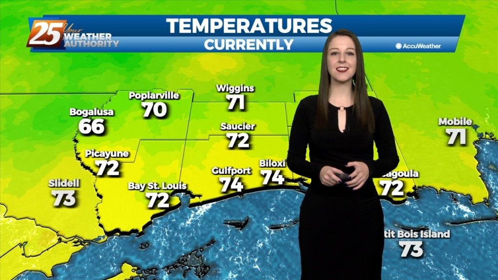
After temps in the upper 60s to 71 degrees yesterday afternoon, warm conditions continue this morning as low temps are in the mid-60s...
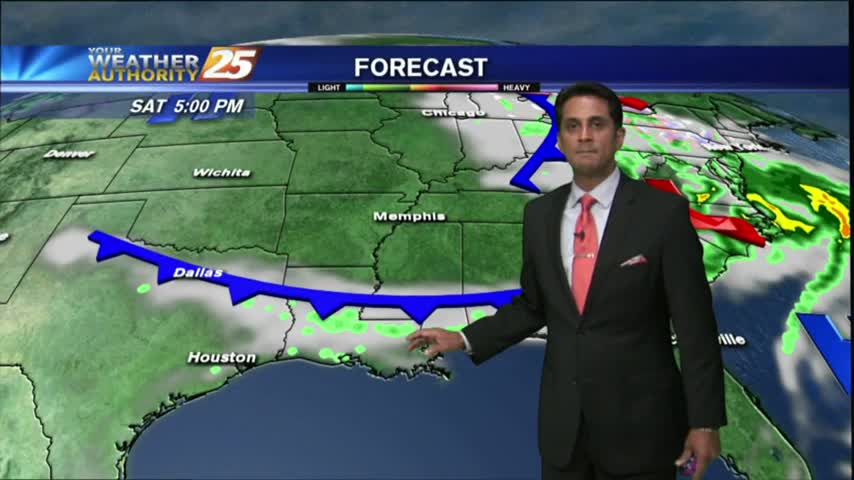
A cold front has moved into the Northern parts of the State, and will bring some cooler/drier conditions for the weekend. Click the link for the forecast details.
As the south wind from yesterday afternoon continues in advance of the approaching cold front, it's a WARMER more humid start to the day...

A WARM/HUMID air mass moving in from the GOM has mostly cloudy skies through the region...
After a mostly cloudy start, skies have cleared with sunny skies on-tap though this afternoon...

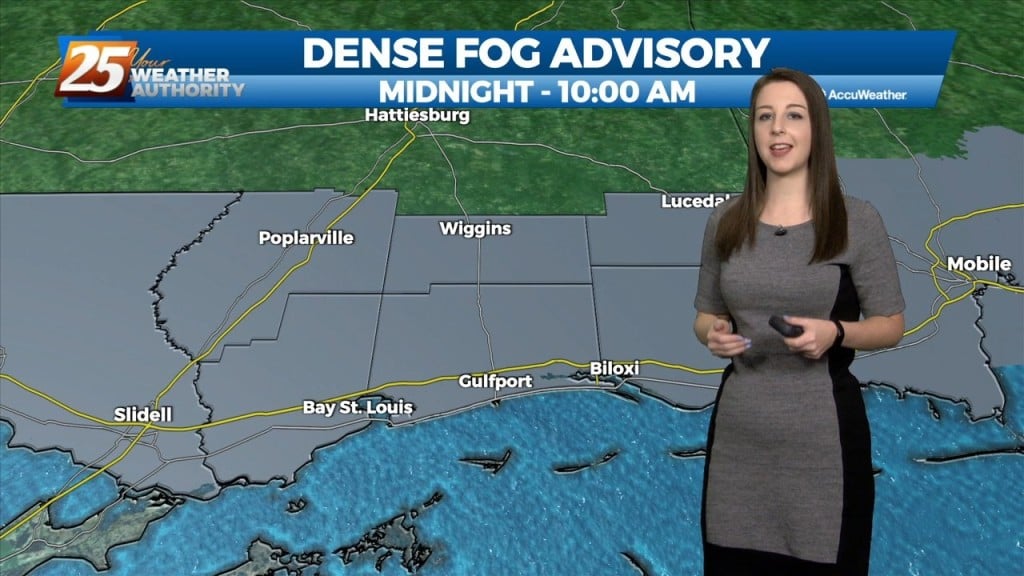
Mild and humid continues providing for areas of DENSE FOG...as changes are on the way with an approaching cold front.
It's a beautiful morning with clear skies and areas of patchy fog along the coast. Dense fog north of the southern 6...
A very nice start as TS HERMINE in the Eastern Gulf continues to provide a DRY NE/North wind for our area...
Partly cloudy skies along with BREEZY conditions associated with an approaching cold from our NW...