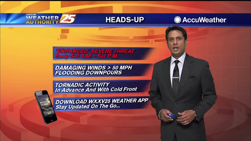
6/13 - Sam Parker's "Rain Free" Thursday Midday Forecast
Today will bring increasing subsidence through the area as high pressure begins to expand eastward from the southern Plains. Cumulus cloud development can be expected this afternoon…
Today will bring increasing subsidence through the area as high pressure begins to expand eastward from the southern Plains. Cumulus cloud development can be expected this afternoon…
Today can be best characterized as the transition day across the area/region. High pressure will continue to move downstream over the Mid-Atlantic States through today. As…
With no significant cold advection behind this morning's cold front, we should mix out deep enough to get temperatures back in the 70s today with much…
It will be a bit cooler today, but overall a very beautiful day ahead across the lower Mississippi River Valley/North Central Gulf Coast. Aloft,…
This afternoon will remain mostly quiet outside of a couple possible showers over the coastal waters. We see our first real warm-up day of the warming…
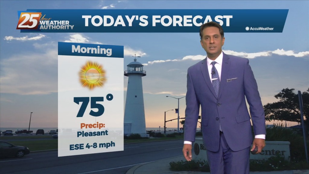
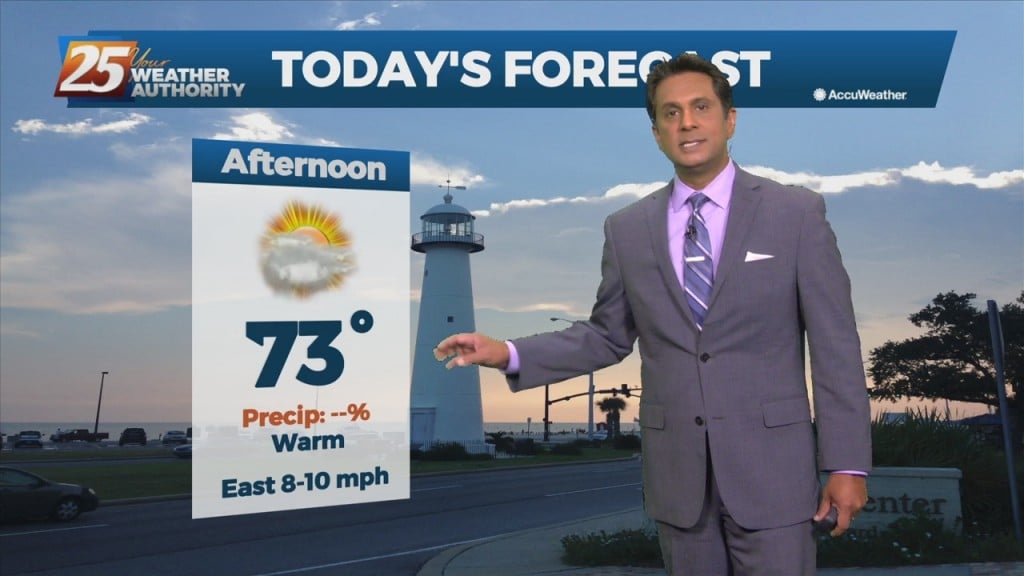
Following fog dissipating this morning, temperatures will soar again. It will be very warm again today with temperatures approaching the 80s in some areas. Partly cloudy skies…
All eyes begin to shift to the northwest later this afternoon and through the overnight tonight. The region will be situated between a high pressure over…
As the high pressure continues to shift east of the area today, winds will gradually come around to the southeast by this afternoon. Little in the…
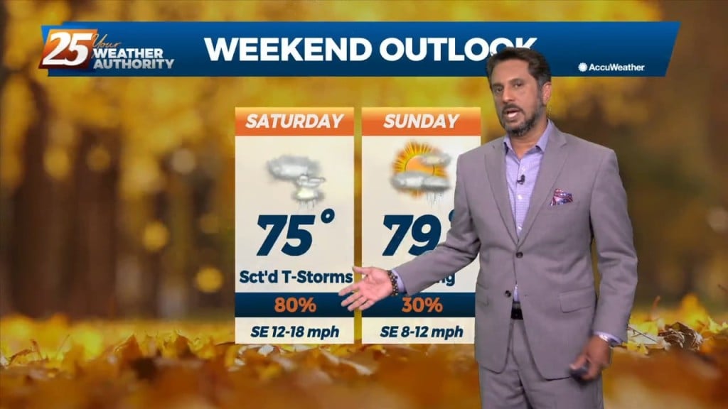
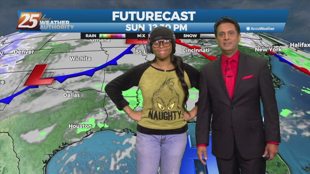
The first 24 hours or so of the forecast will be more of the same that we've seen over the weekend with partly to mostly cloudy skies…
We are on track to quickly warm up later this morning and into the afternoon hours. High-pressure along the region will shape the forecast through the weekend. Tonight,…
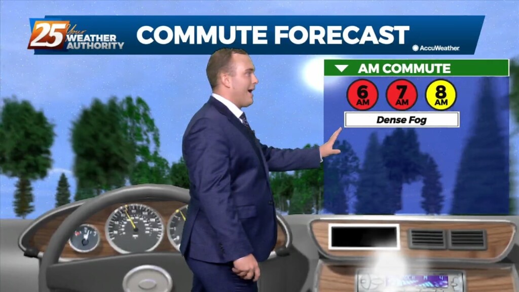
Dense morning fog will continue to be a factor through the weekend as overnight low temperatures will bottom out in the upper 50s to low/mid 60s. The winter…
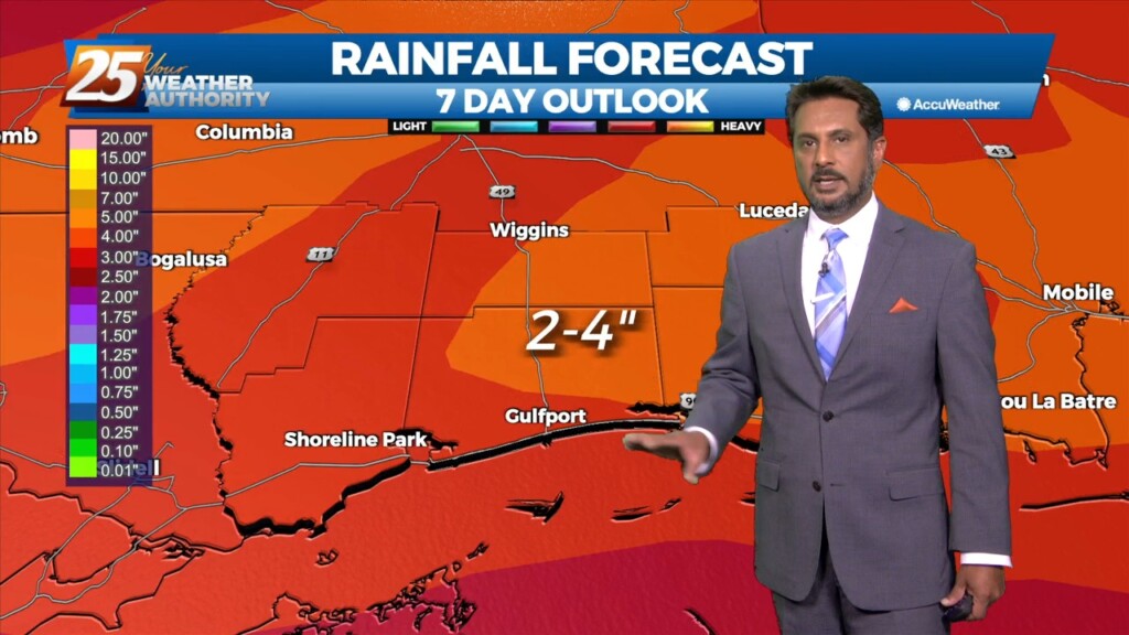
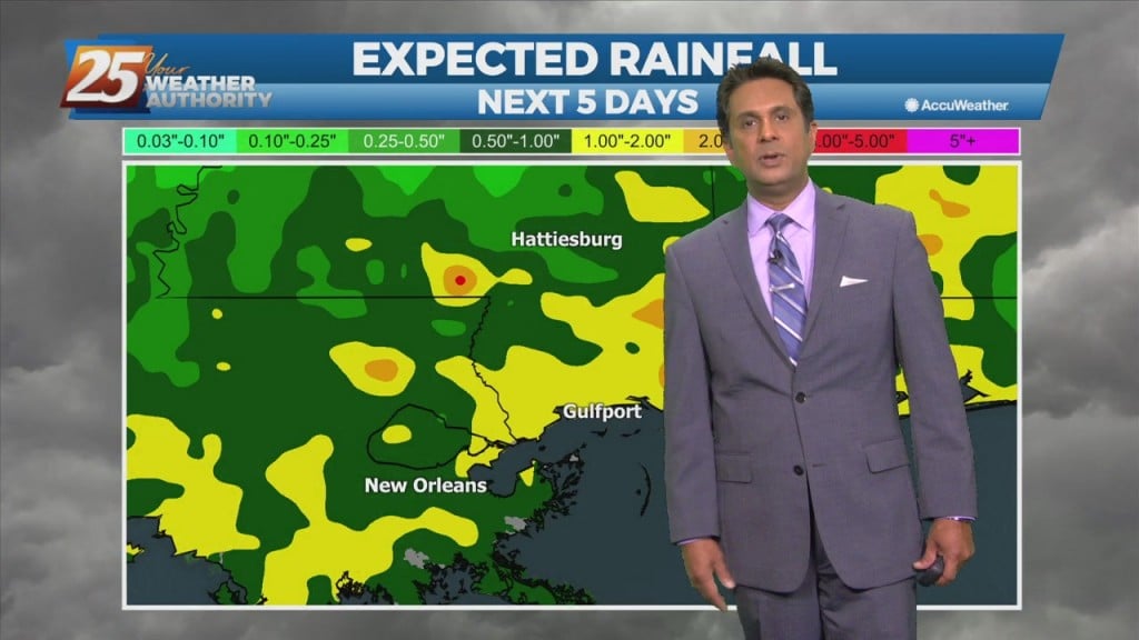
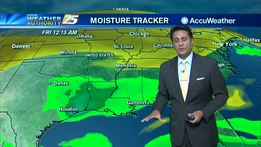
A fetch of low-level Gulf moisture riding north over a stationary frontal boundary will continue to bring cloud coverage to the area along with above seasonal…
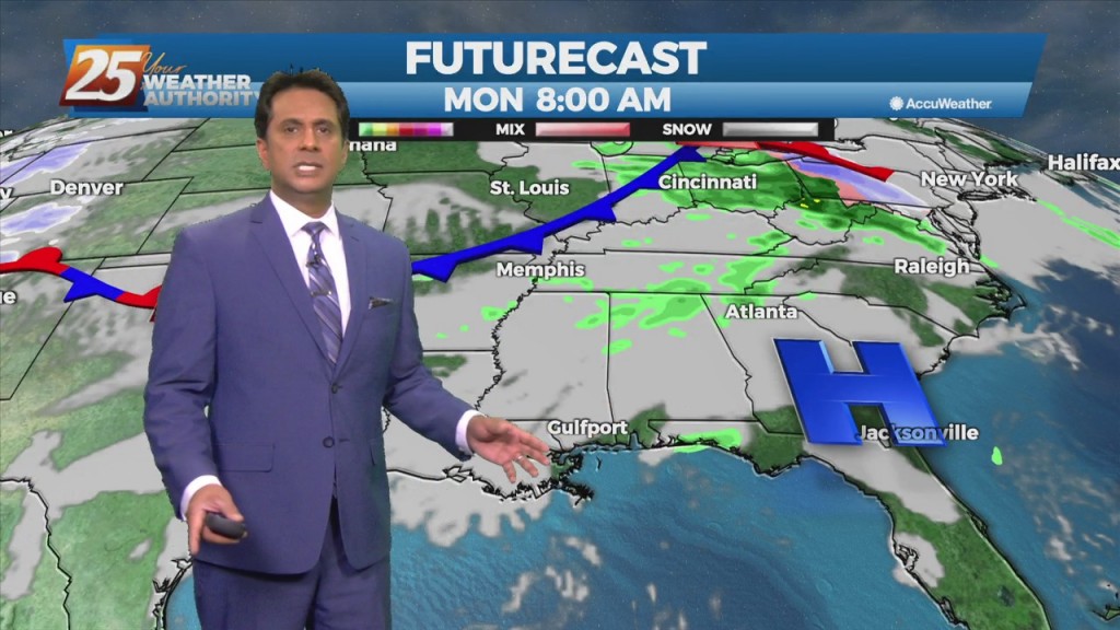
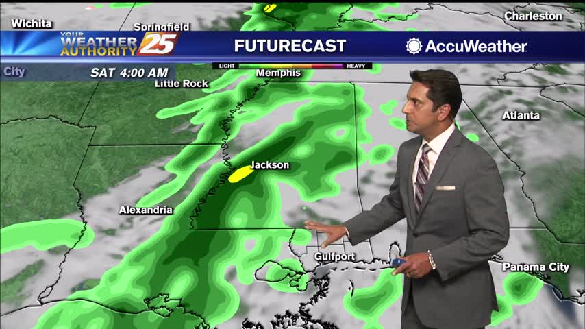
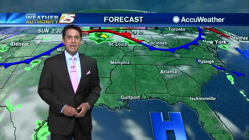
At the surface, high pressure really doesn't give way over the next 24 hours. A n upper-level disturbance will move from Texas across the area Saturday…
Main weather issue over the next few days will be the threat of fog during the overnight hours through mid-morning. Not much change in forecast parameters for the…
A west-northwestly flow will remain in place through the next 36 hours while an upper level disturbance moves through the upper and middle MS Valley today. Upper level…
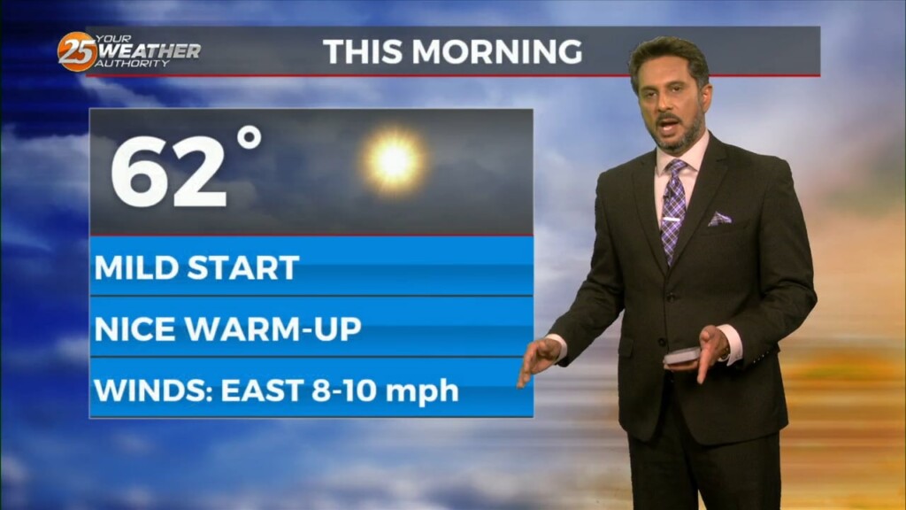
Another cold start to the day but warmer than we have seen over the past week...
Sunshine with MUCH warmer temperatures ahead through the workweek...
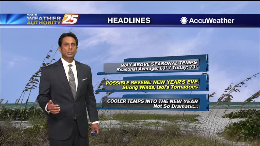
A very nice afternoon ahead with high temperatures way above seasonal norms...
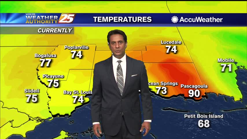
A very warm start to the day as the WAY ABOVE seasonal temps will continue...
A warm and humid afternoon ahead as cloud coverage will continue to increase...
Thinker clouds moving in from the west with a slight chance for a late afternoon shower...
After a warm and humid start to the day/workweek, temperatures area now in the upper 80s to 90 degrees...
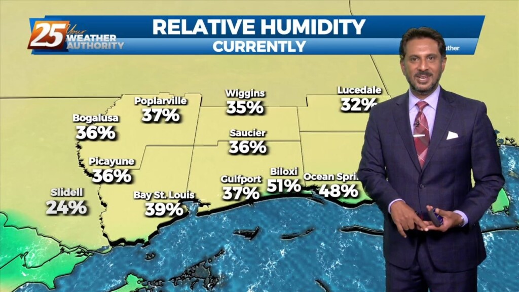
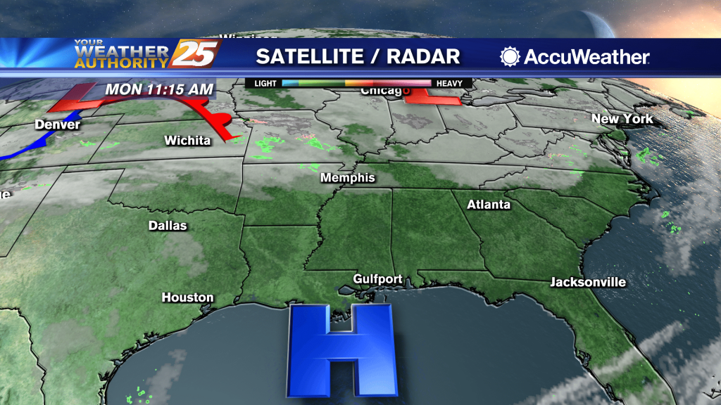
It's a humid start to the day with areas of patchy fog for your Monday morning commute...
As the humid flow continues, warmer overnight temperatures are in the area...