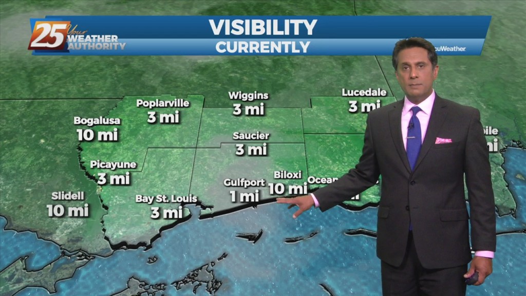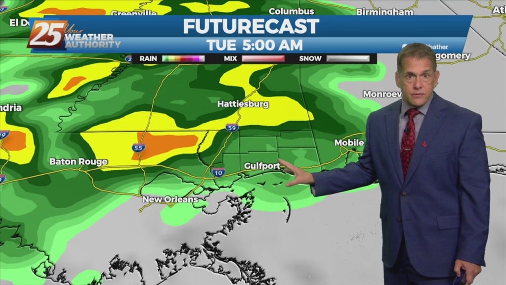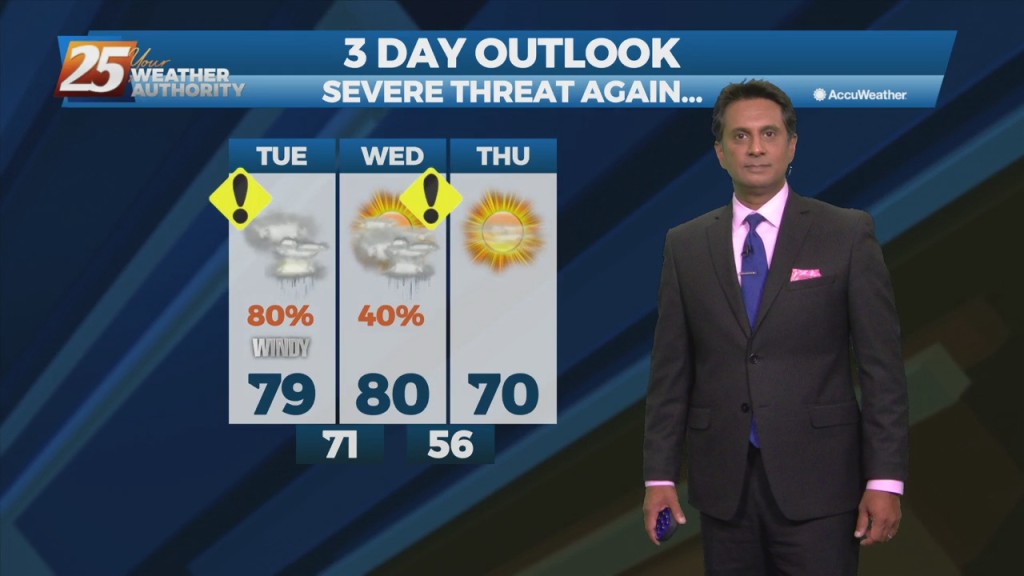
4/5 – Rob Knight’s “Calming Conditions” Afternoon Forecast
The threat for severe weather and flash flooding has diminish by isolated showers and even a few late afternoon t-storms. Tonight will bring a lull in activity until another system moves across the area Wednesday afternoon/evening. This strong cold front to progress southeastward across the lower MS Valley bringing another threat for severity…a low-end threat Wednesday afternoon/evening. ..with the best…