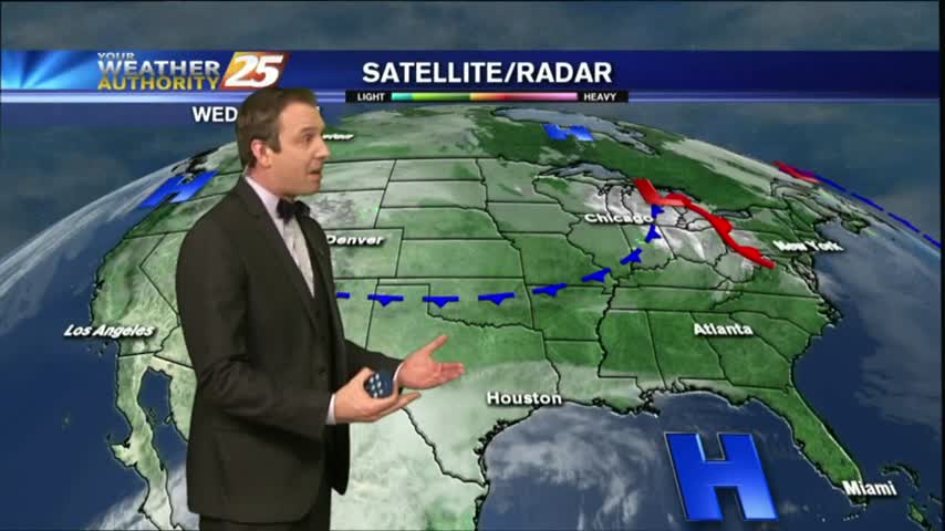
12/20 Ryan's "Finally Clear" Wednesday Forecast
The fog finally lifted in all South MS areas for the afternoon, and the sun came out for the first time in days! We'll see more rain before Christmas though, so watch the full forecast for the details.
The fog finally lifted in all South MS areas for the afternoon, and the sun came out for the first time in days! We'll see more rain before Christmas though, so watch the full forecast for the details.
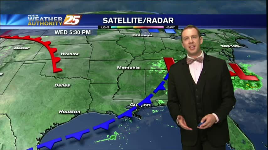
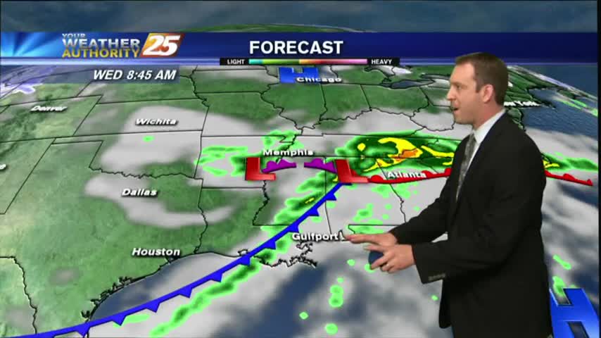
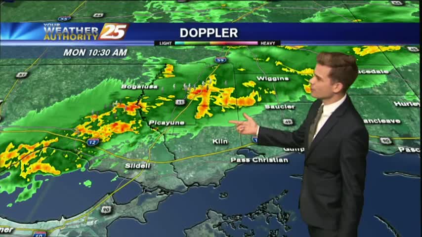
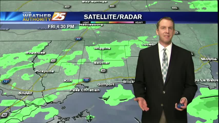
Light rain lingers through the viewing area as the cold front overhead moves to the east and begins to become more of a stationary boundary...
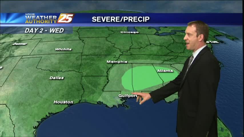
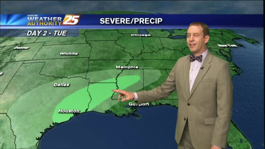
As a cold front approaches the area...the THREAT FOR SEVERITY continues...SLIGHT/MARGINAL...
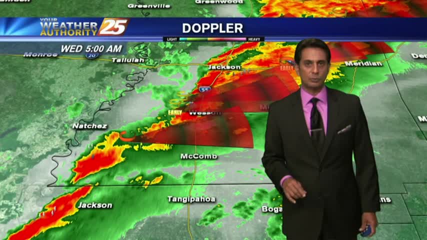
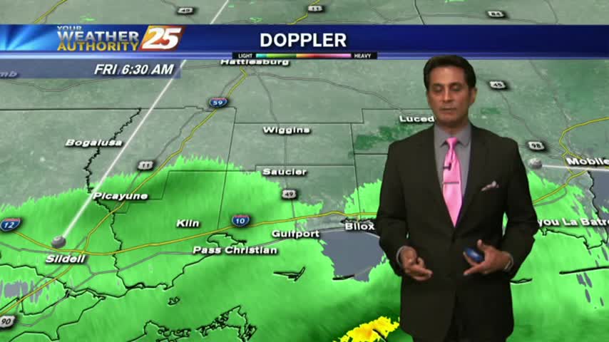
FOGGY with T-STORMS moving into the area from the west with the associated cold front. The area is under a MARGINAL THREAT for SEVERITY...
Dense fog advisories remain in place for all six coastal counties and the surrounding area, but after tonight's frontal passage we shouldn't see those again for a few days. Rain will return before the weekend though, details within.
A cold front is poised to move through overnight, but we'll "enjoy" a widespread and dense fog until the late morning tomorrow. Expect some clearing, but more rain before the weekend. Details within.
Dense fog and isolated showers continue in the area.
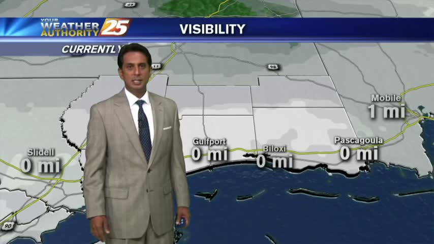
Fog was BAD yesterday morning...downright HORRIFIC this morning. PLEASE be careful with your commute...
Dense fog advisories were issued earlier, and the fog has already moved in. Expect it to linger through the night, into the morning, and even into the afternoon in isolated areas; watch the full forecast for details.
Moisture moved in over the weekend and has now transitioned from rain to fog, which will remain though the night. Watch the full forecast for the details.
Heavy showers and fog continue to cause a nasty afternoon.
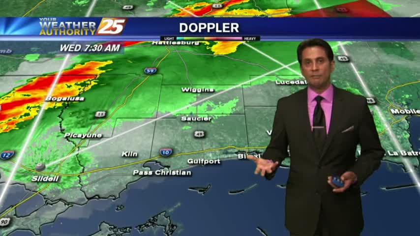
A VERY WARM/HUMID start to the workweek with rain and DENSE FOG, along with an ADVISORY in effect through mid-morning...
Dense fog for your morning commute and a few thunderstorms in the area.
It'll be colder tonight than it's been the last few, but not the coldest weather we've seen recently. Inland areas will flirt with freezing tonight, but we'll be back in the 70s by Sunday. Details within.
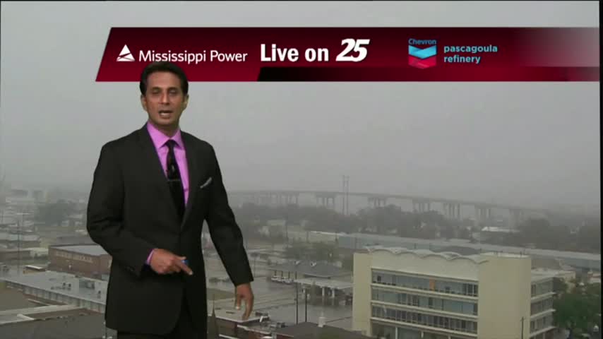
It was as gloomy as expected and just a little colder and wetter. Expect all of that to change as we warm drastically through tomorrow and active weather moves in. Click the link for more.
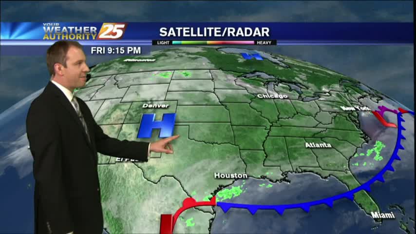
Light rain continues to move across the area towards the NE, most of it not making it to the surface...
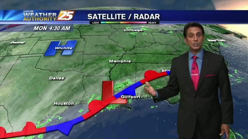
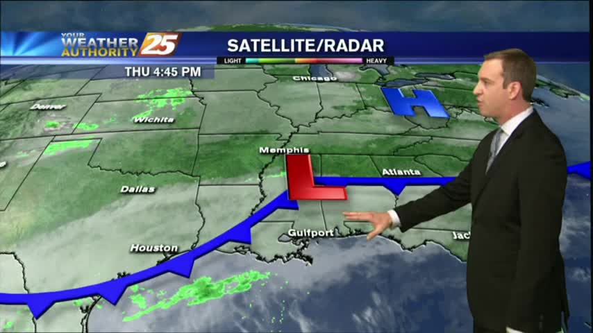
Warming temps continue to move into the region. A cold front is now to the south of the viewing area...with rainfall moving NE into south Mississippi..
You wouldn't know it from the temperature or satellite presentation, but a cold front is moving through the area and will bring cooler temperatures into the weekend. Watch the full forecast for more.
Warming trend continued through today and will into the night, but more slight cooling is right around the corner. Watch the full forecast for details.

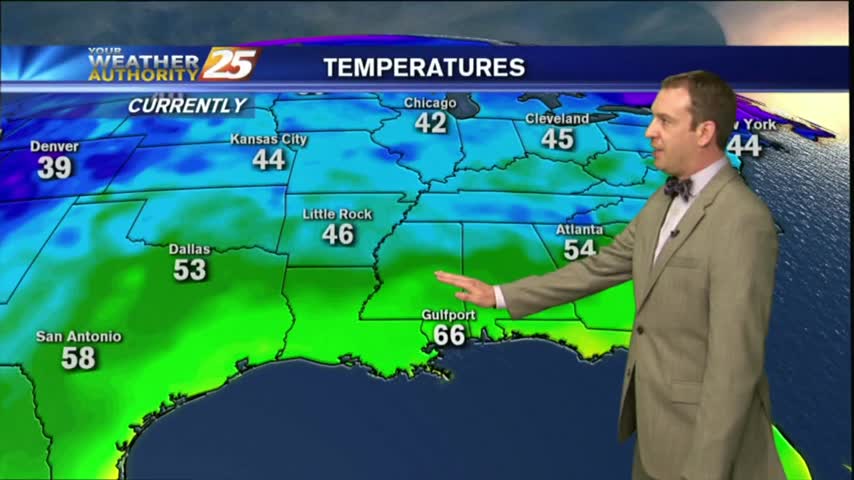
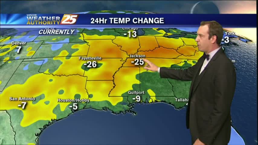
After a warmer start this morning compared to the frigid conditions from yesterday...temps continue to climb into the low/mid 60s...

A MUCH WARMER start this morning compared to the VERY FRIGID conditions just 24 hours ago...
Cooling trend ended this afternoon, and now we're beginning a 24 hour warming trend before our next quick cool-down. Click here for the full forecast.
Today may have been cooler, but that trend ends now as we head into a much warmer evening. We'll see a few similar shifts this week, so watch the full forecast for details.
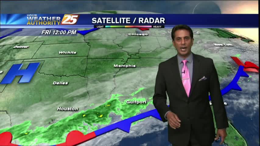
Another cool sunny day, but rain and warmer temperatures are on the way.