4/3 - Payton's Tuesday Afternoon Forecast
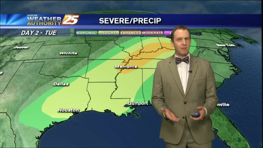
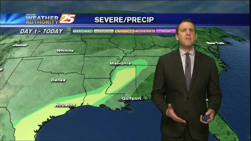
Slight chance for severe weather tonight, and an active weather pattern over the next week.
Slight chance for severe weather tonight, and an active weather pattern over the next week.

A warmer start to the day as a humid air mass moves in from the GOM in advance of an approaching cold front...

It was still a nice day in South MS today, but more humid and hotter than it was over our beautiful Easter weekend. Rin moves in soon though....
It was a sunny and drier weekend, but we're starting to see more clouds and higher humidity moving in. Won't be long before rain returns too....
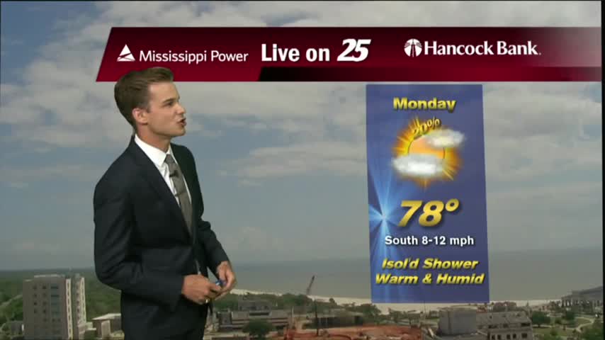
Warm and humid today, but the best rain chances hold off for a few more days.
With a humid air mass south of a cold front in northern Mississippi, we have areas of patchy dense fog...
Happy Easter! Another beautiful weekend, but the post frontal weather is slowly coming to an end..moisture is returning and rain chances are in the forecast.
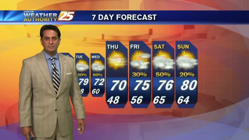
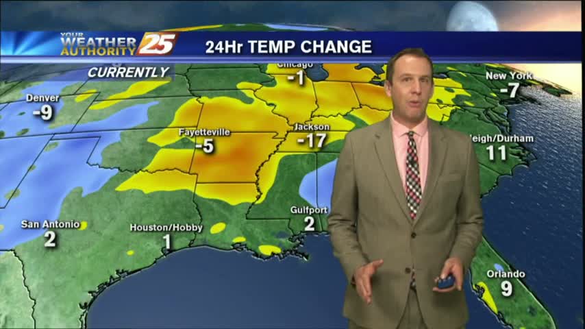
Rain has moved on, and while skies cleared a lot today, tomorrow will be much better!

We may have had a rough day yesterday, but today cleared up nicely and it's looking even cooler/drier tomorrow!

After patchy fog and mid-level clouds earlier this morning, partly cloudy skies continue as temps warming into the 70s...

The cold front is now east with a weak boundary moving through the area, along with areas of patchy fog...
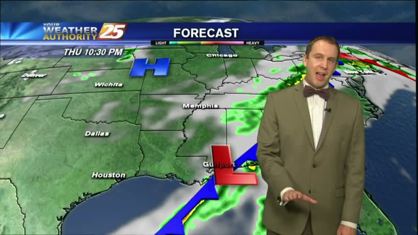
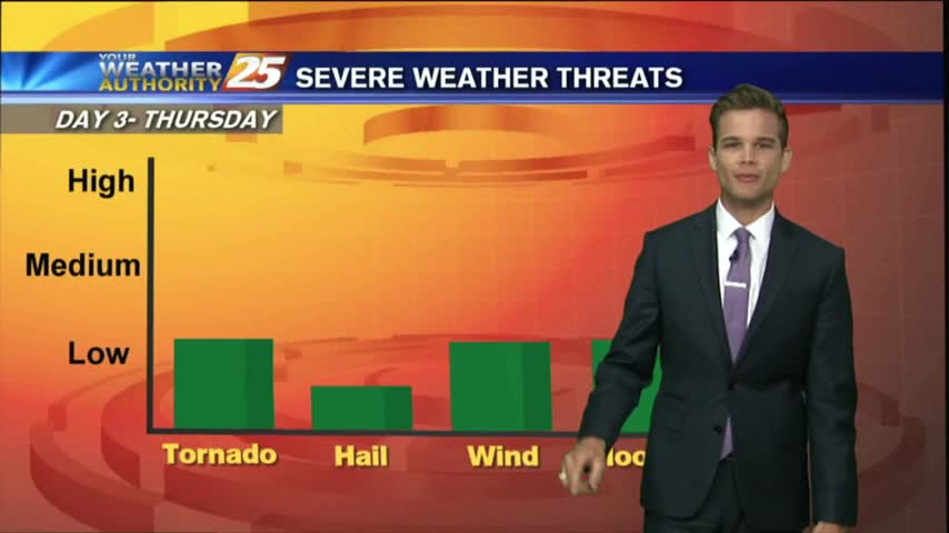
Today's severe weather didn't quite pan out, but we still saw a few inches of rain across the Coast. Great weather moving in though....
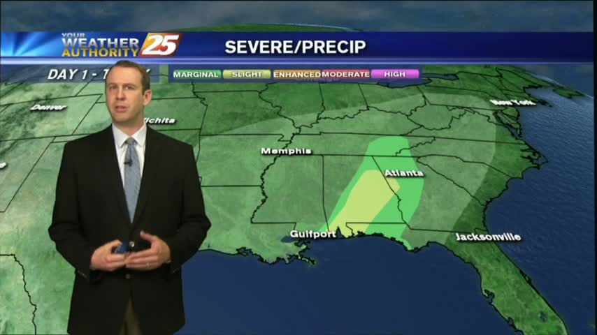
The severe threat today didn't pan out in South MS, but we still saw plenty of rain. Clearer skies are ahead though....

The activity with the cold front has fizzled out quite a bit but still moving across the area...

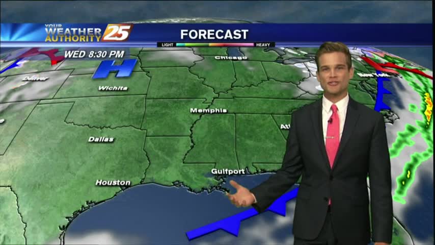
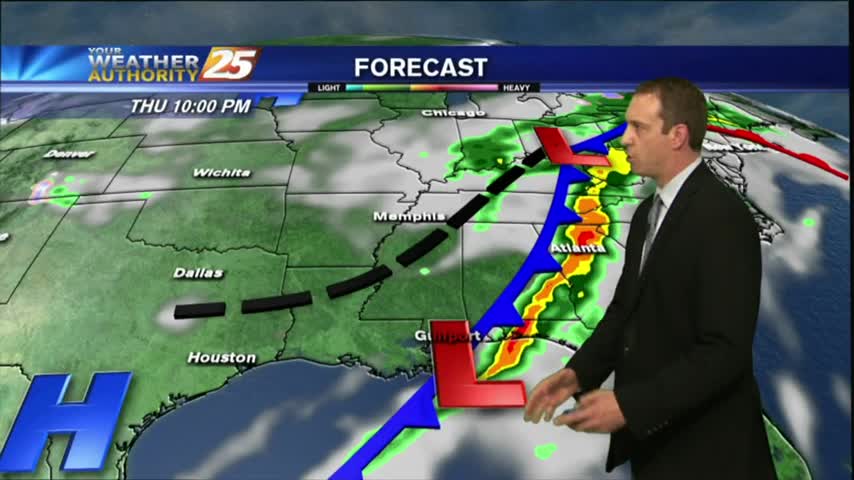
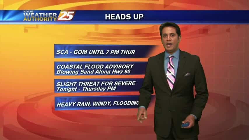
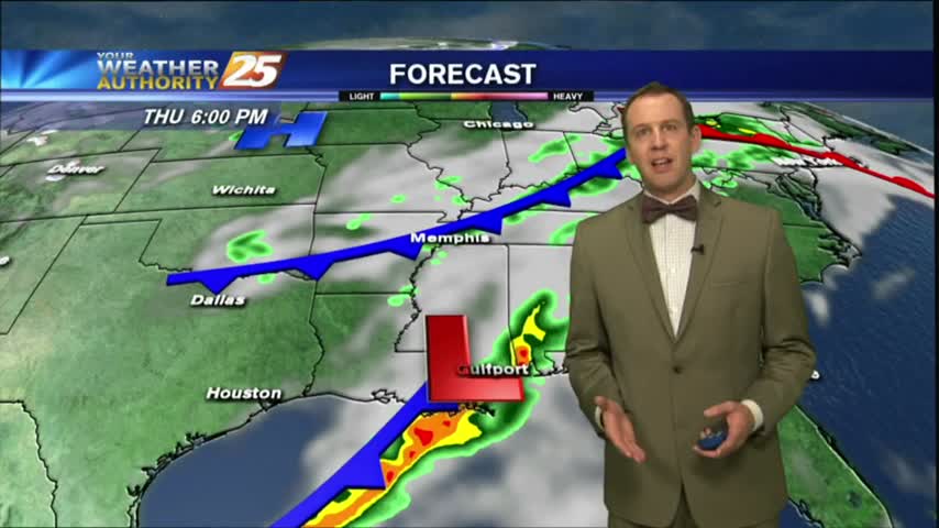
A warm/humid and windy start to the day with a POTENTIALLY SEVERE cold front approaching from the west...
It's still fairly calm now, but a severe weather threat is moving in for tomorrow afternoon....
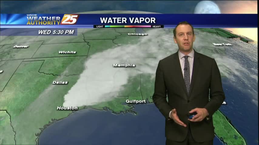
It remained cloudy and warmed a few degrees as we expected, and the potential for severe weather is still on for tomorrow....

Just a few showers this afternoon, but the chance for severe thunderstorms are in the forecast for your Thursday.
Another warm, humid and breezy start to the day with a cold front approaching from the west...
Another warm and humid day down with a few more to go before a sunny and drier Easter weekend....
The humidity and clouds just keep coming for the next few days, but the holiday weekend is looking much clearer....
Another breezy day, but most of the area will stay dry. Best rain chances hold off until Thursday.
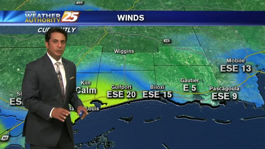
A warm/humid and windy start to the day with these conditions expected to continue...
It was beautiful last week, started getting warm and humid over the weekend, and is now cloudy and humid where we'll stay until rain later in the week....