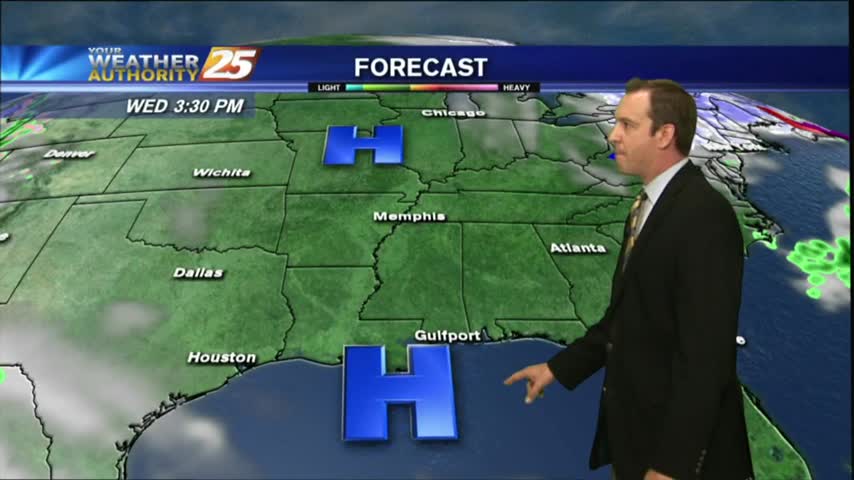
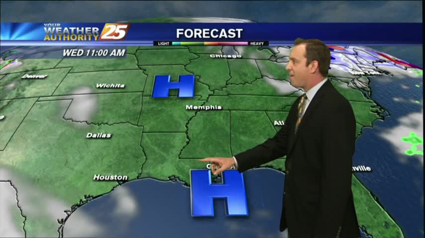
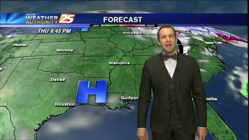
3/13 - Payton's Tuesday Afternoon Forecast
The winds have calmed today, and the weather over the next few days will be picture perfect.

The winds have calmed today, and the weather over the next few days will be picture perfect.
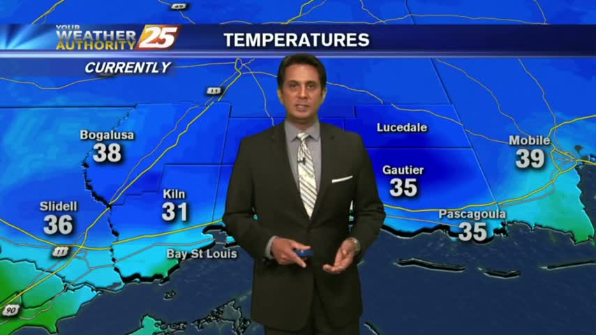
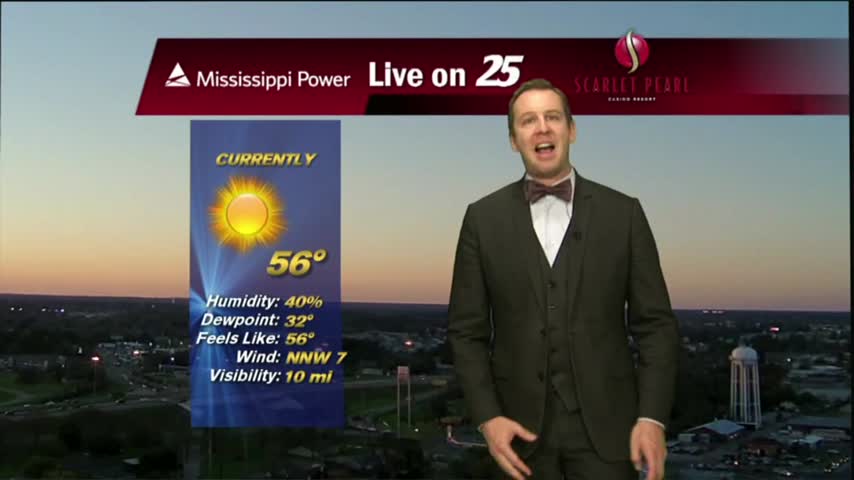
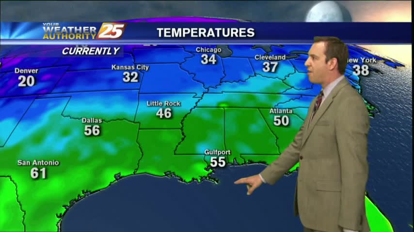
A clear and COLD start to the day with temps in the low/mid 30s inland, mid/upper 30s along the coast...
It was a breezy and cool afternoon, but things are finally calming down. Get ready for a week full of beautiful days, with a little rain at the end....
Sunday's stormy start has brought clear skies for Monday, with beautiful conditions expected all week long....
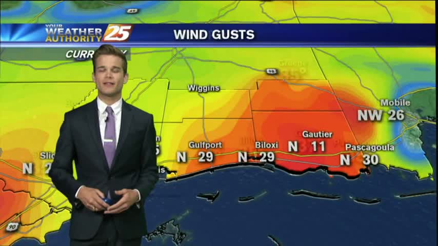
It was a very windy start to the day with gusts over 20 mph. The winds will begin to calm later this evening, which leads into a great forecast for most of the week.
A colder and windy start to the workweek with a few clouds which will erode quickly...
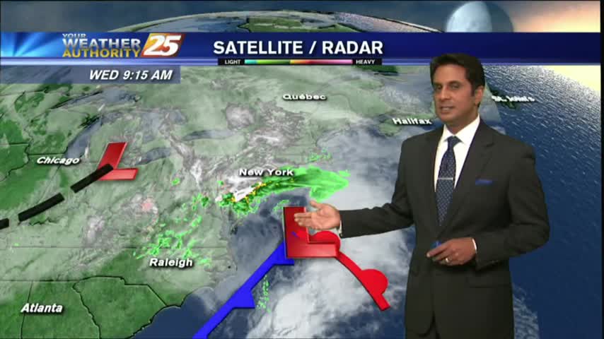
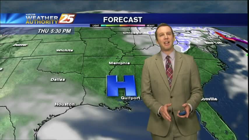
Heavy showers and thunderstorms from this morning have moved out of the area, and a front will bring breezy conditions to start the workweek.
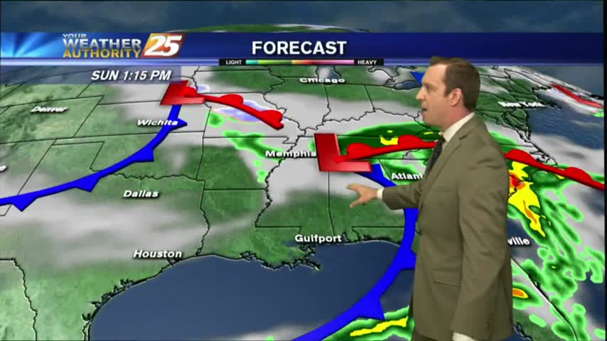
Clouds are finally building overhead after a long string of clear days, and we'll see rain as early as tomorrow afternoon....
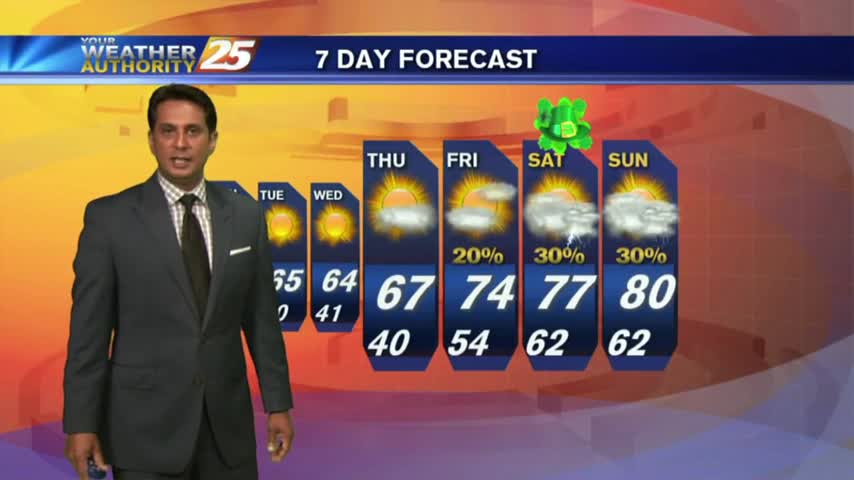
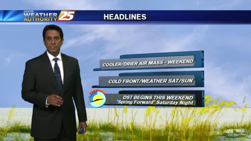
One last sunny and dry day before a rainy, potentially stormy weekend, but another beautiful work week is ahead....

Warming temperatures under beautiful blue skies as the humidity is beginning to return to the area...
It's another COLD start heading into the weekend with inland areas under a FROST ADVISORY...
Tonight'll be the coldest night we've seen in quite some time, but expect a warmer afternoon tomorrow.
It remained clear and dry today, with another great day ahead for tomorrow, but rain moves in over the weekend.

After a FRIGID start at a few locations, temps are warming nicely with upper-level clouds moving cross the area...
Thin upper-level clouds are moving into the area from the NW, with COLD temps as a few locations are in the low 30s...
Skies remain clear and the air remains dry as high pressure continues to dominate most of the country, but rain isn't far away....
Today was as beautiful as expected, and high pressure continues to dominate. Expect a few more gorgeous days before a rainy weekend.
After a CHILLY start to the day, a sunny, cool and breezy afternoon is on-tap...
Clear skies overnight has brought a chilly start to the day, temps in the low 40s...
There's still a little cloud cover near the coastline, but by tomorrow we'll see cloudless skies which will linger for a few days.
As the front moved through this morning it brought rain, but is now bringing much cooler and drier air.
The cold front has moved through and now sunshine will take it's place!

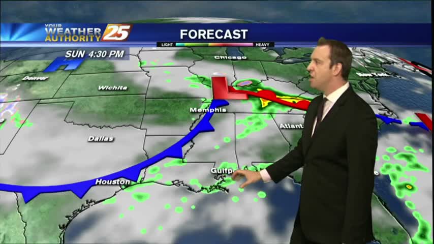
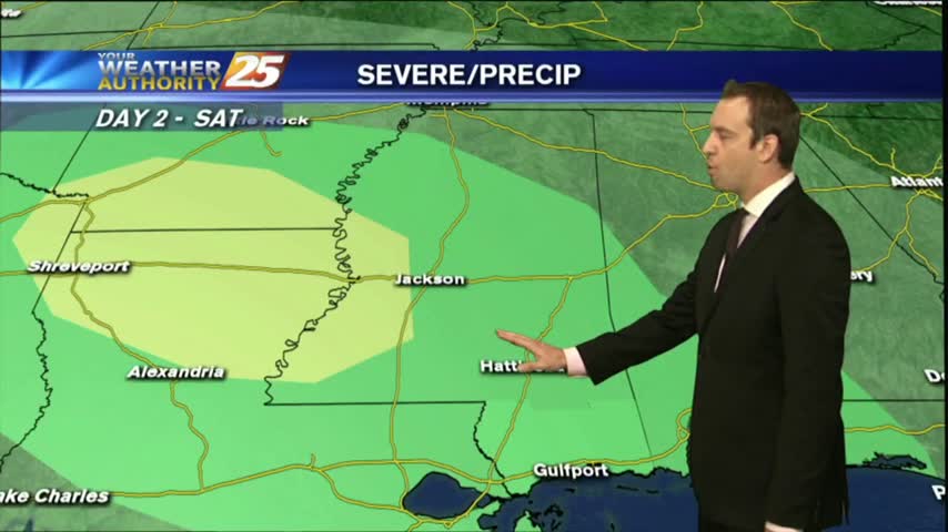
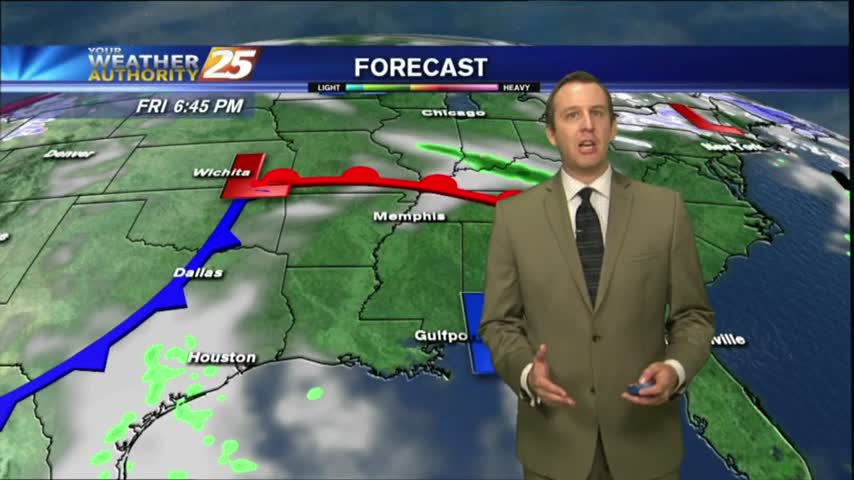
With a cold front moving across the area, showers/t-storms are in south Mississippi...
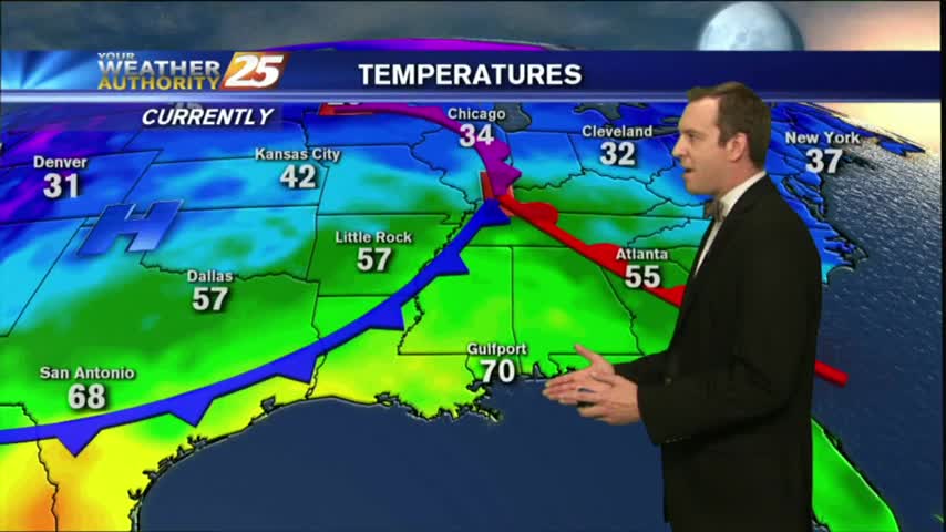
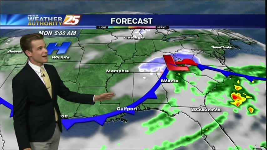
The humidity has been increasing seadily throughout the day as a cold front moves in from the Northwest, and showers and thunderstorms are expected overnight. Watch the full forecast for the details.