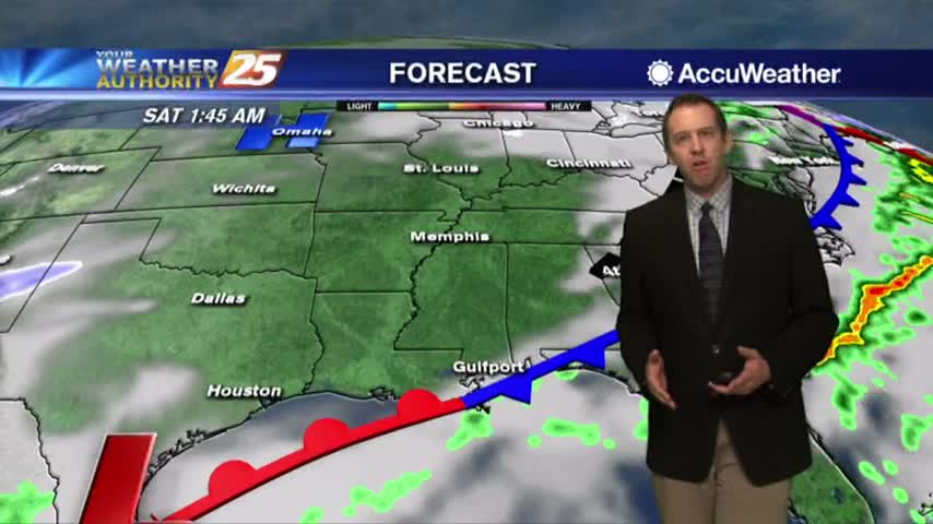
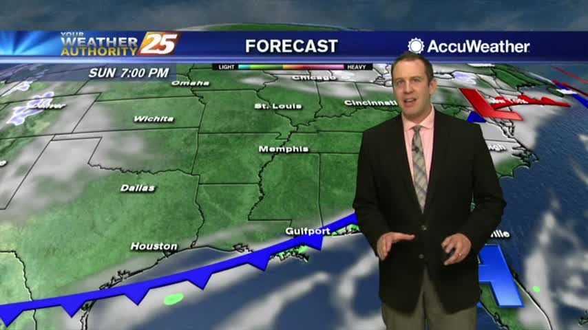
12/28 Ryan's "Clear For Now" Friday Evening Forecast
Last night's front stalled just to the North and dumped nearly a foot of rain in parts of Central MS, but finally moved through this morning. Don't expect much clearing though....
Last night's front stalled just to the North and dumped nearly a foot of rain in parts of Central MS, but finally moved through this morning. Don't expect much clearing though....
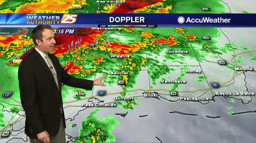
The heavier rainfall has moved east but spotty showers and t-storms will continue this afternoon into tonight...
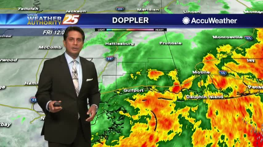
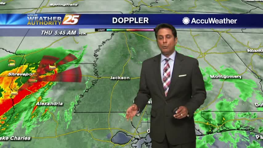
A VERY WET start to the day as HEAVY RAINFALL continues to move across the viewing area...

The rain we expected moved into MS and brought deadly flooding to the North, but stalled before moving over the Gulf Coast....
The rain we've been talking about for days has finally arrived, and is bringing some potentially dangerous weather along with it....
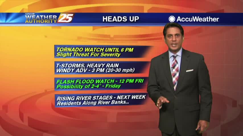
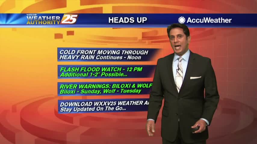
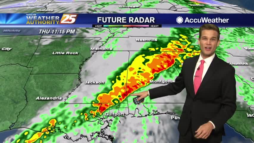
Rainfall is developing in the area in advance of a cold front west of Baton Rouge, our area is under a TORNADO WATCH...
As the first batch of rainfall move to the NE, VERY WINDY CONDITIONS continue to affect the viewing area...
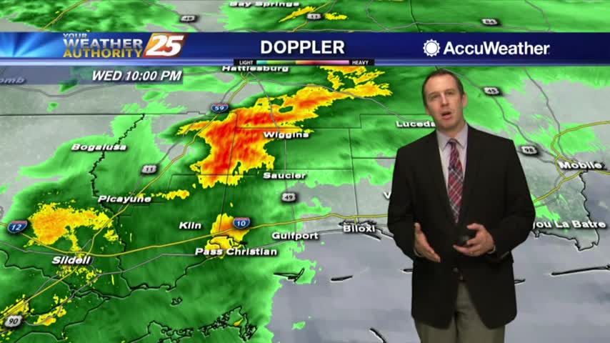
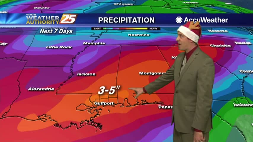
The rain will continue to increase through the night along with the winds ahead of tomorrow's cold front, which could bring severe weather....
Our stretch of quiet weather is coming to an end very soon, and some severe storms could be on the way....
Enjoy today, because rain is in the forecast.
One final day of nice weather before the bottom falls out tomorrow.
The weather has been getting warmer and more humid each night, and we're nearing a long stormy period....
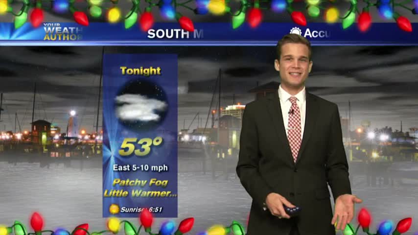
The sun has set on Christmas Day, but Christmas night is just starting and is looking cool and calm while just a bit sticky....
Merry Christmas, Gulf Coast!
Merry Christmas Eve Gulf Coast! Santa is almost here, and Christmas Day is looking dry!
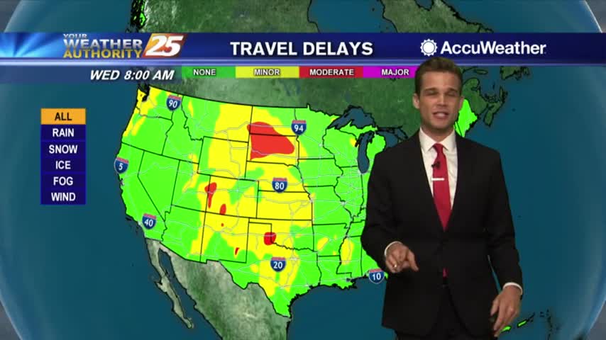
Merry Christmas Eve everyone! Don't expect any active weather for your Christmas festivities, but it does move in right after and may complicate travel....
Gorgeous Christmas Eve Day!
Merry Christmas Eve! Nice Weather Today
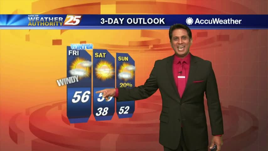
Warm weekend...but will it cool off for Santa??
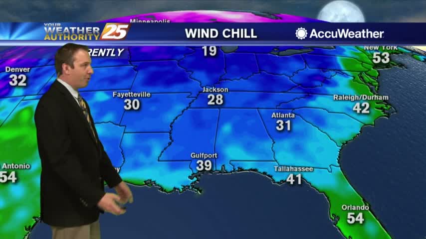
The cloudy skies that've been keeping us warmer are moving on, so get ready for the coldest and driest night of the week....
The warm and humid conditions of the last few nights are gone, and now we're in for a drastic cool-down....
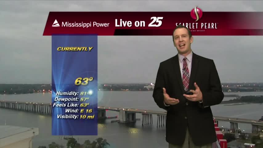
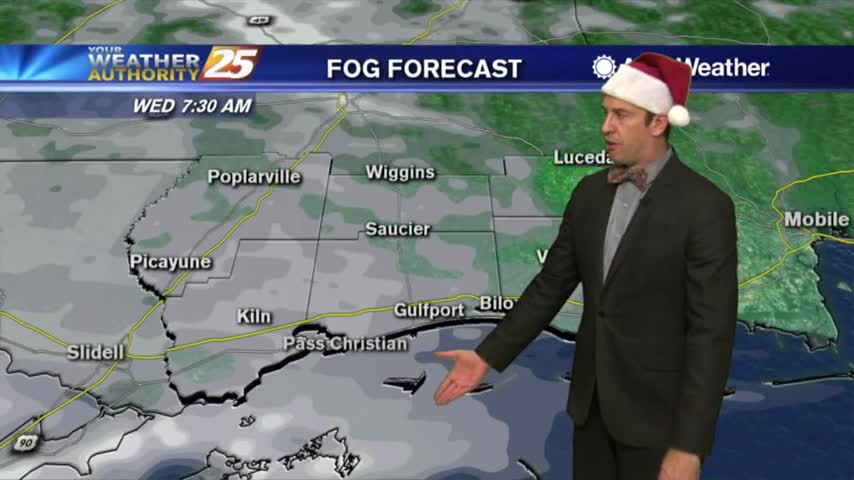
Low-level clouds continue to dominate the area as winds have been gusting into the 20 mph range...

Light rain has moved east of the viewing area as the cloud coverage will continue through midday...
Today started gloomy and dry, but the rain moved in later and continues now. Drier days ahead though....