03/23 Ryan's "Warmer Week" Monday Night Forecast
We'll see some hot afternoons ahead as warm, moist air piles up ahead of a front, but we'll see some slightly cooler and drier days ahead...slightly.
We'll see some hot afternoons ahead as warm, moist air piles up ahead of a front, but we'll see some slightly cooler and drier days ahead...slightly.
Still a bit on the muggy side, but drier days are ahead...won't be much cooler though.
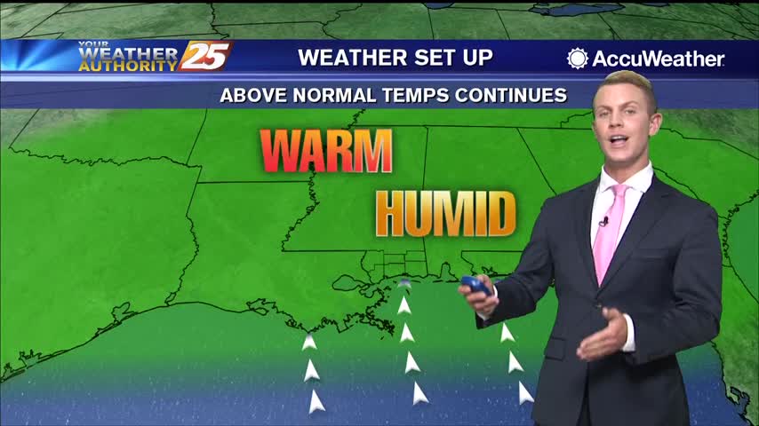
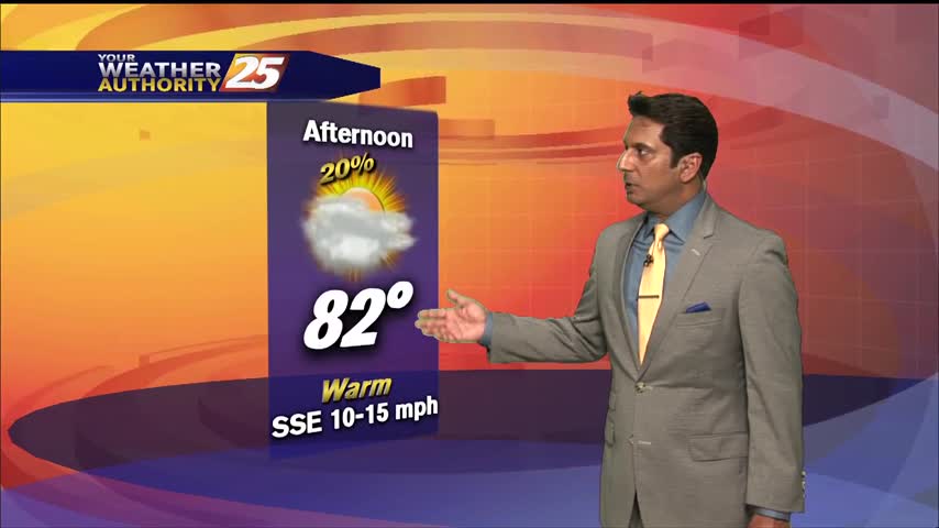
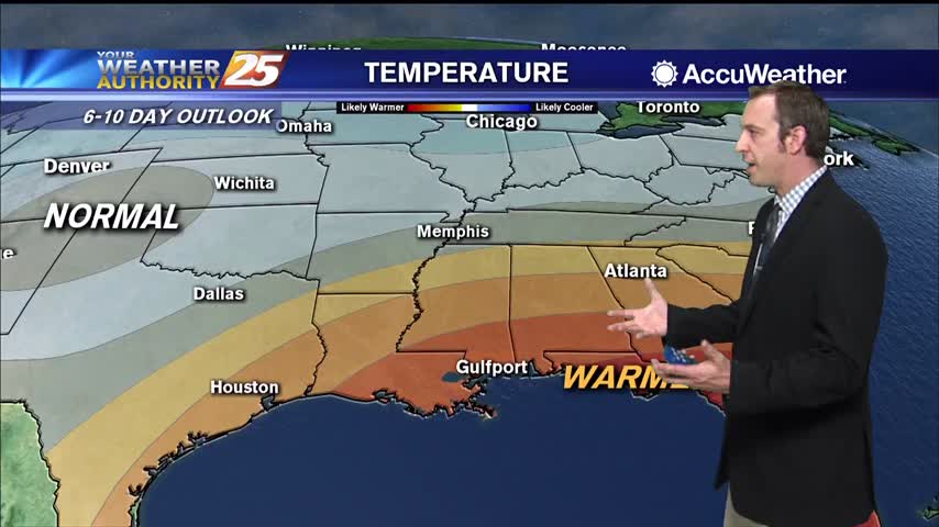
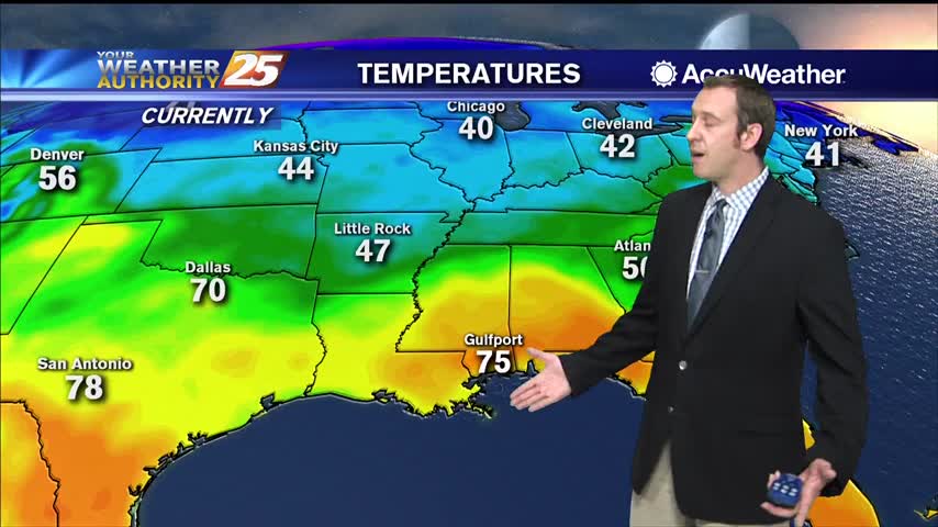
Temperatures are above normal across the Gulf Coast once again. Highs today will reach the mid 80s for most locations in South Mississippi. Our normal high temperature for this time of the year is typically in the lower 70s. Partly…
A warm and humid start with areas of patchy fog affecting south Mississippi...
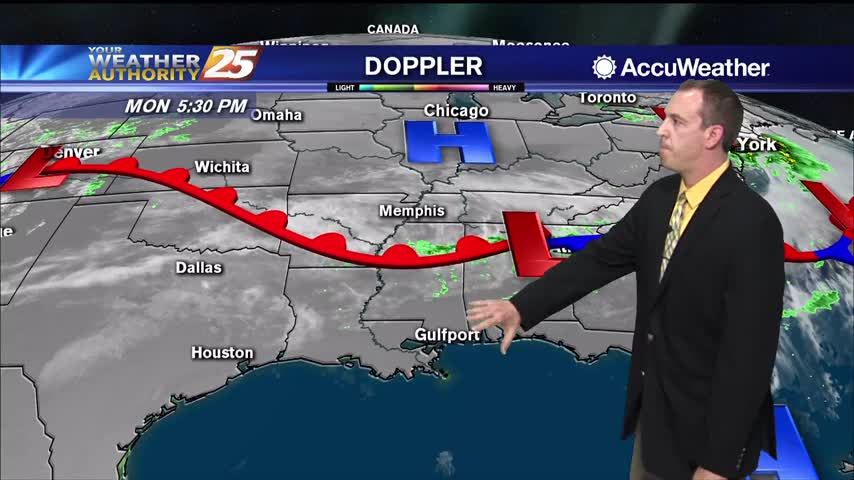
The warm front has lifted north from the coast to just north of the forecast area today with visible satellite imagery and surface observations clearing indicating the southerly low level flow and warm sector. Temperatures have responded with values rising…
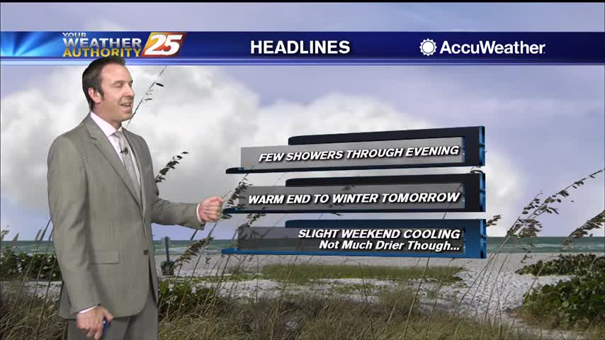
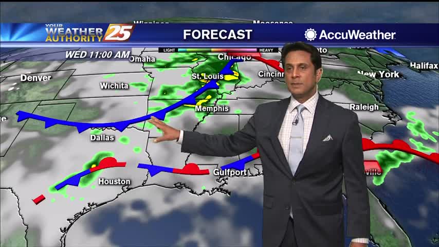
First significant rain we've seen in a while is moving in, and it'll make it slightly cooler for the weekend.
We've seen weeks of similar cloudy, humid days, but changes are finally on the horizon.
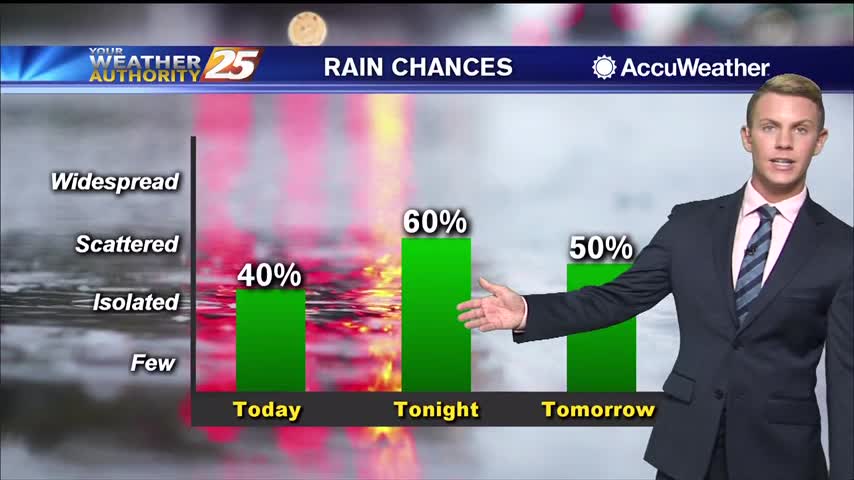
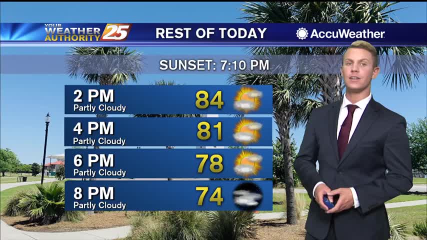
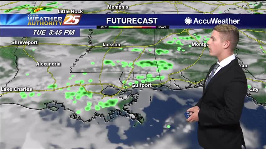
Cloudy skies will continue through the afternoon and early evening with warm and humid conditions. High temperatures will top out in the lower to mid 80s once again. Tonight, rain chances increase to around 60 percent as showers and a…

A humid flow from the gulf has areas of patch fog in south Mississippi...
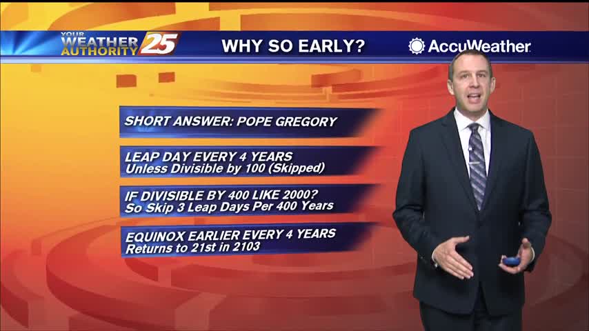
Spring has arrived earlier than usual, and I explain why in the forecast, but cooler weather is on the way as a front moves in.

Spring begins tonight just before 11 PM, earlier than it has in nearly 125 years!
A beautiful final afternoon with sunshine and warm/humid conditions...

A very humid start with areas of dense fog for this final morning of winter...

Tonight is the last full night of winter, as spring begins tomorrow...the earliest it's been in over a century!

Not much has changed in the last few weeks, but it is now getting much warmer and more humid as we begin spring tomorrow.
Warmer than normal temperatures continue across South Mississippi and much of the Gulf Coast. High temperatures are expected to top out in the upper 70s, although some areas will reach the lower 80s. A mixture of sun and clouds is…

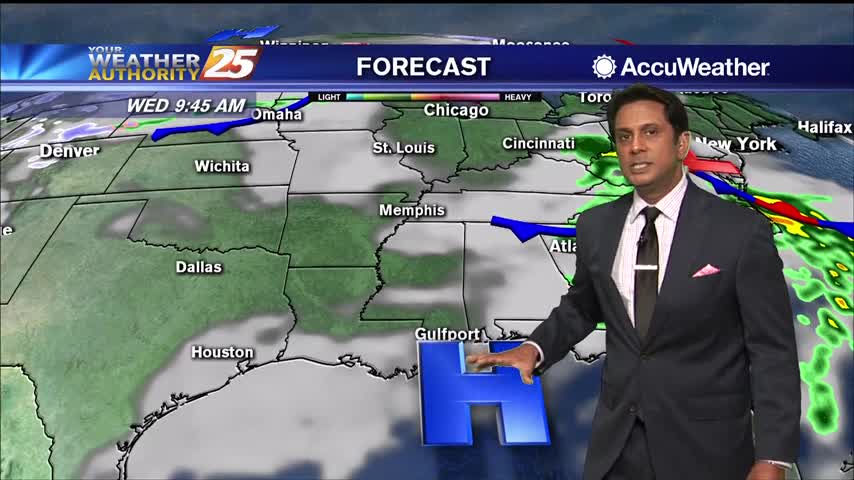
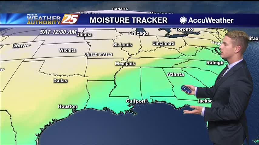
As the southerly flow continue to bring moisture into the region, areas of overnight widespread dense fog will affect South Mississippi through the rest of the workweek. Conditions will be humid with a chance of showers through Thursday. An approaching…

Tomorrow is the last day of winter, and it'll continue to warm as we approach the weekend and a cold front moves in.
Few more clouds today and even a few showers, but expect fewer of them going forward. It will continue warming though.
High pressure over the Gulf of Mexico will persist for the next couple of days. Fog will likely continue to be a nightly and early morning issue due to high dew points from return flow and very light winds. An…
It's been warm and humid for quite some time, and it's only going up as we head toward the weekend.
More of the same as we head into a new week! Expect clouds, high humidity, and at least a few showers.
Warmer than normal temperatures continue across South Mississippi and much of the Gulf Coast. High temperatures are expected to top out in the lower 80s, although some areas will reach the mid 80s. A mixture of sun and clouds is…
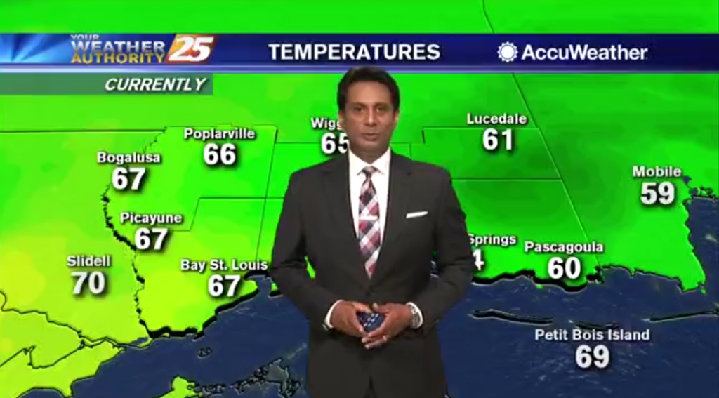
A mild start to the day with areas of light patchy fog mainly in the interior counties...