06/08 Ryan's "Post-Cristobal" Monday Evening Forecast
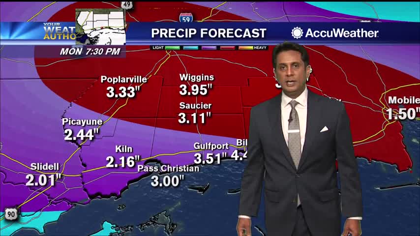
Cristobal has moved inland, but rain will continue for the next few days....
Cristobal has moved inland, but rain will continue for the next few days....
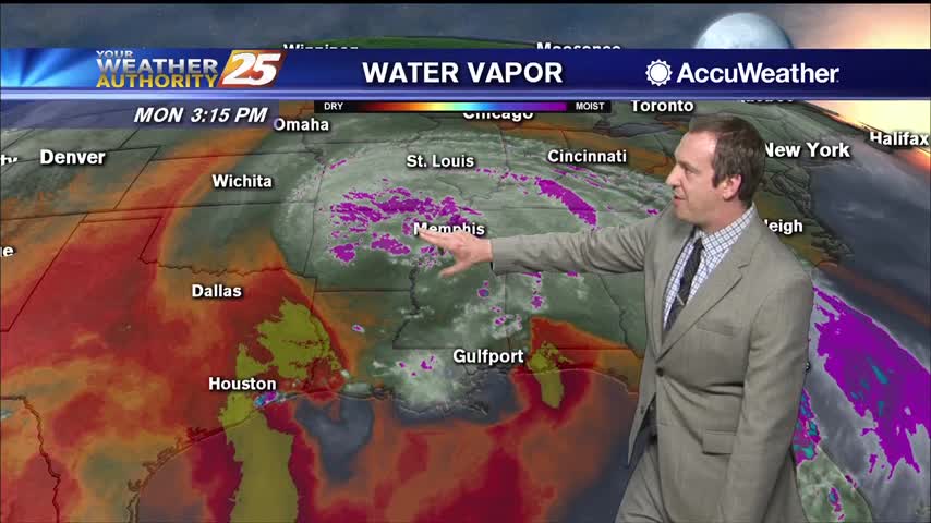
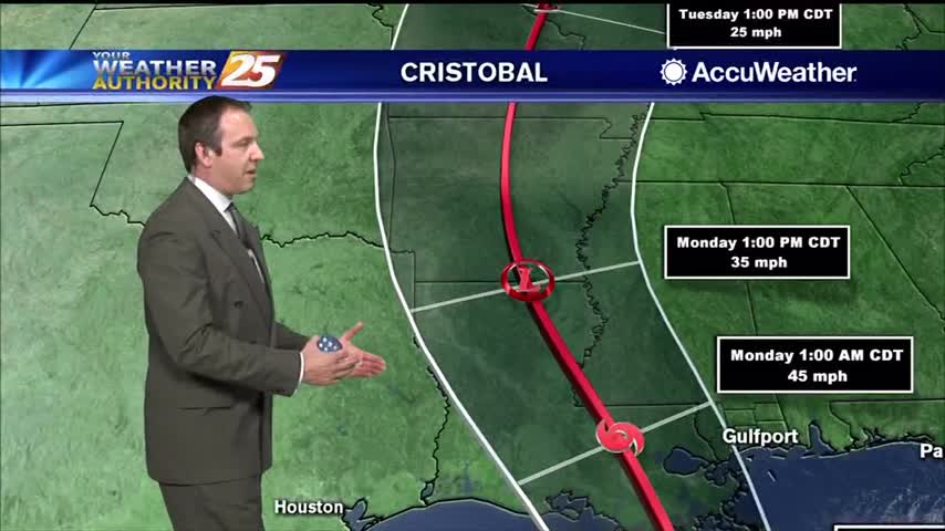
We’re still dealing with the lingering effects of Cristobal, which is now a tropical depression located over northern Louisiana. The system is expected to move into Arkansas soon before quickly traveling toward the Great Lakes region. Coastal flooding continues along…

BILOXI, Miss. (WXXV) — The end of the Biloxi Lighthouse Pier broke away on Sunday afternoon as gusty winds and storm surge from Cristobal battered the coast. The missing section of the pier washed ashore about a half-mile west, near…
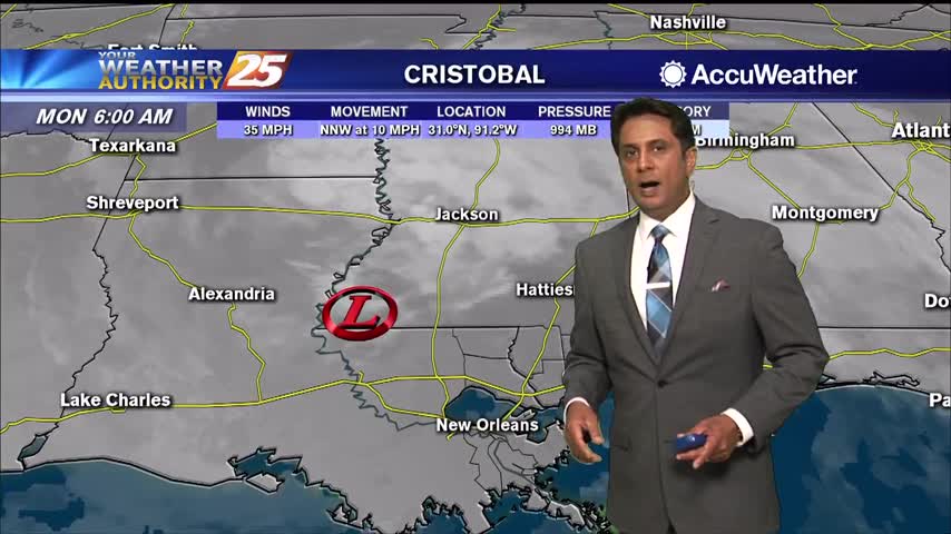
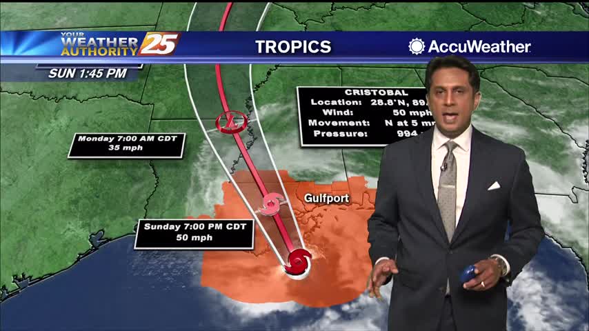
Cristobal now W/NW of Lake Pontchartrain continues to bring HEAVY RAIN and STRONG WINDS to South Mississippi...
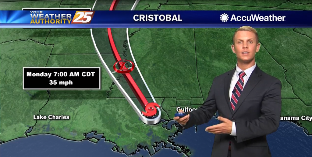
Tropical storm Cristobal made landfall earlier this evening and continues to lift to the northwest across southeast Louisiana. Cristobal will weaken later tonight as it moves north-northwestward across Louisiana through Monday. Tropical storm force winds, especially in gusts, continue to…
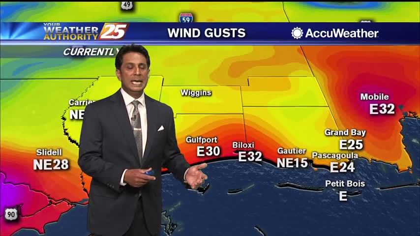
Periods of HEAVY RAIN and STRONG WINDS continue to move into the area...

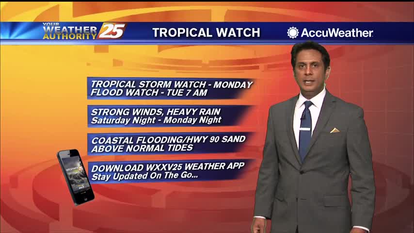
Tropical Storm Cristobal is making its way to the Coast and some counties are already feeling the effects with flooding causing roads to close down along the coastal area. The Mississippi Department of Transportation (MDOT) said U.S. Highway 90 in…
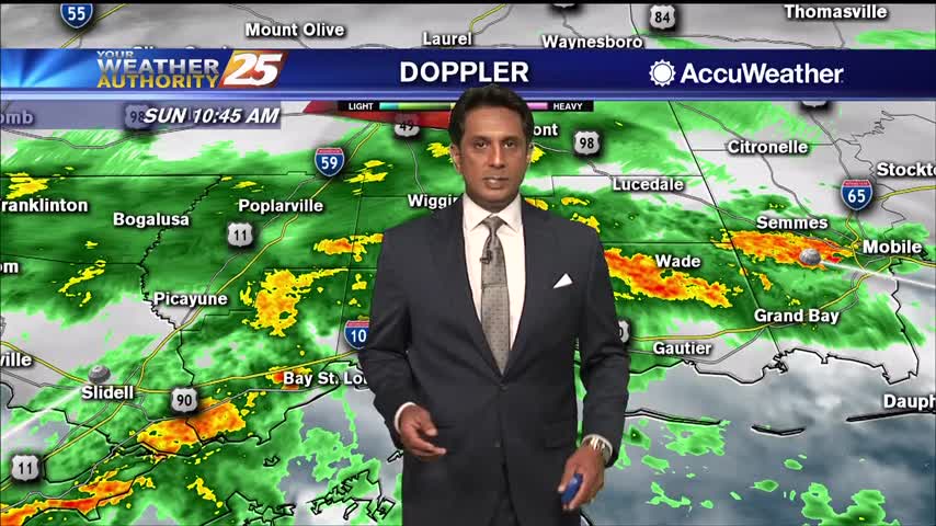
Feeder bands of heavy rain and strong winds continue to move ashore South Mississippi...
South Mississippi continue to be under a TROPICAL STORM watch...
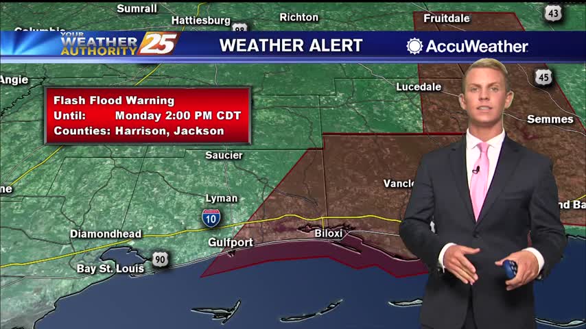
Numerous areas in South Mississippi dealing with flash flooding and flooding along Hwy 90...
TS Cristobal continues to move closer to the SE Louisiana coast with landfall a bit earlier than projected...
TS Cristobal continues to move North towards the SE Louisiana coast...
Feeder bands moving across south Mississippi bringing heavy rains and strong winds...
Didn't see much rain today, but we'll see nearly a foot by Monday as tropical storm Cristobal moves in and slowly pushes inland.

Today was nice and sunny with a couple of isolated showers, but tropical influences will bring heavy rain and strong storms to the Gulf Coast for the weekend.
A very HOT day as the humid flow continues to move in from the Gulf of Mexico...

A very warm and humid start this morning with areas of patchy fog...
More afternoon rain today and tomorrow, but a tropical system will drive our active weather over the weekend.
Didn't see many afternoon showers today, but we'll rarely be completely rid of them as summer rolls around....
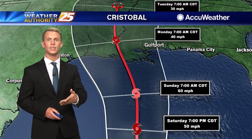
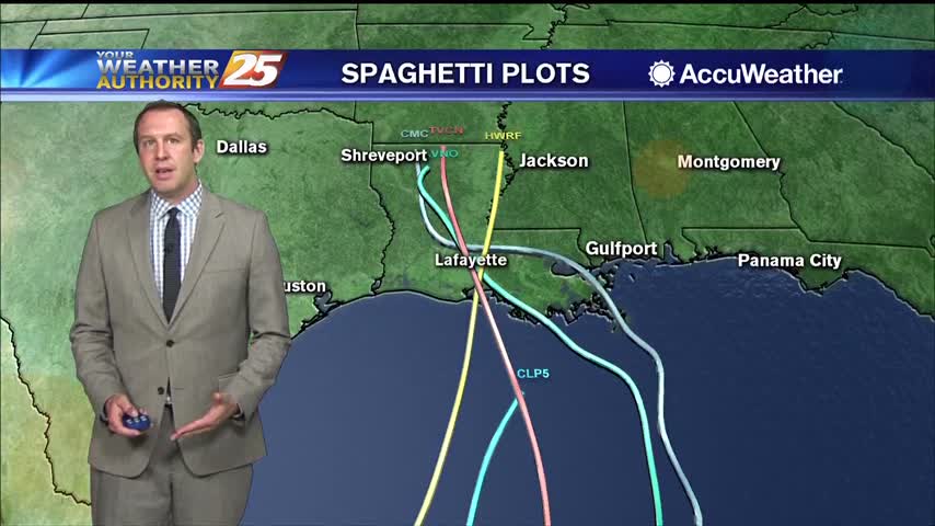
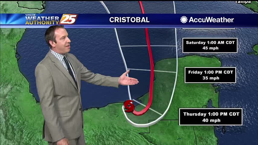
12 p.m. Thursday Tropical Update: Cristobal is now a tropical depression and is moving slowly over Mexico. Most models show the system regaining tropical storm strength when it moves back over the Gulf on Friday. The National Hurricane Center's forecast…
A summertime pattern is in place through Friday. Southeasterly surface winds will help to enhance the moisture and warm air advection from the Gulf flowing into our area. High precipitable water values also indicate the potential for heavy rainfall during…
Earlier rain has given way to partly cloudy skies and humid conditions, but the afternoon rain moves back in quickly tomorrow.
Wet conditions earlier today as showers and thunderstorms moved through, but the evening has cleared some.

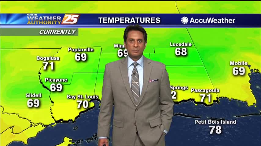
Overnight lows will be warm with temperatures only dropping down to the upper 60s to lower 70s. Tomorrow, rain chances increase to 70 percent as coverage of storms becomes more widespread. It will be warm and muggy with highs will…