10/3 - Rob Knight's "Sunny & Warm" Monday Afternoon Forecast
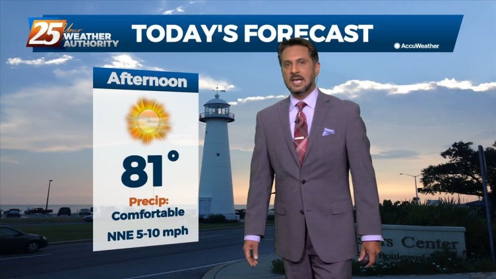
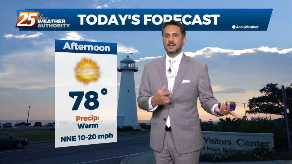
After a cool start, temperatures have warmed into the upper 70s/low-80s. A quiet weather pattern will continue through the workweek prior to the next frontal boundary…
After a cool start, temperatures have warmed into the upper 70s/low-80s. A quiet weather pattern will continue through the workweek prior to the next frontal boundary…
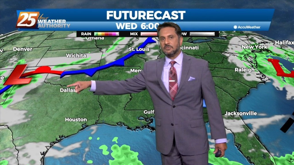
As an area of high pressure sneaks into the area on the backside of distant low pressure, a warmer pattern takes hold. It’s only a small adjustment…
As high pressure sneaks into the area on the backside of a cut off low over the northeast, heights rise slightly which means slightly warmer temps…
From a meteorology standpoint, we are still between a trough to the east and a ridge to the west. This is bringing winds out of the north carrying cool…
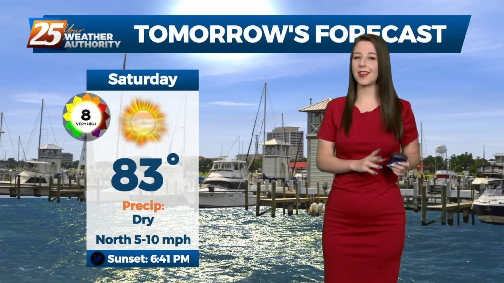
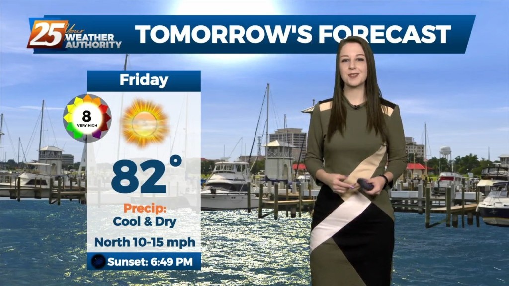
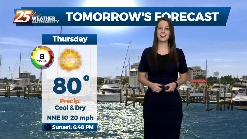
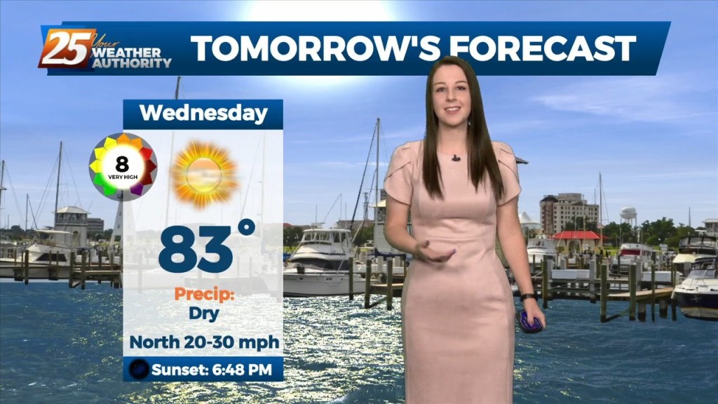
Dry fall like weather conditions will continue for the area today and tomorrow (and through the whole forecast period really). A few areas such as near…
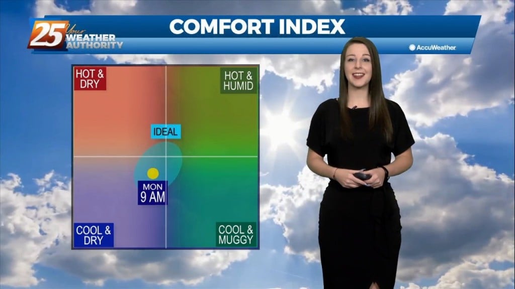
We could not ask for more pleasant weather heading into the 1st weekend of October. It has been breezy and dry with the minimum relative humidity dropping from…
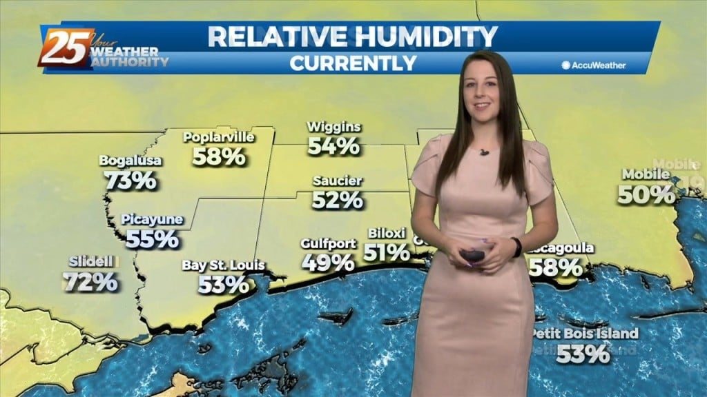
As Ian continue to affect the region with a combined flow from the NNE, the drier air will shape the forecast through the weekend. Low relative…
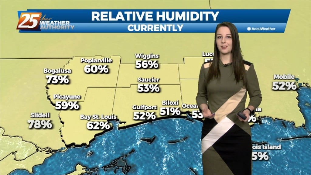
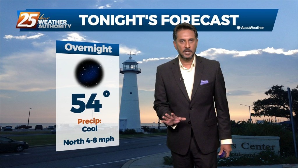
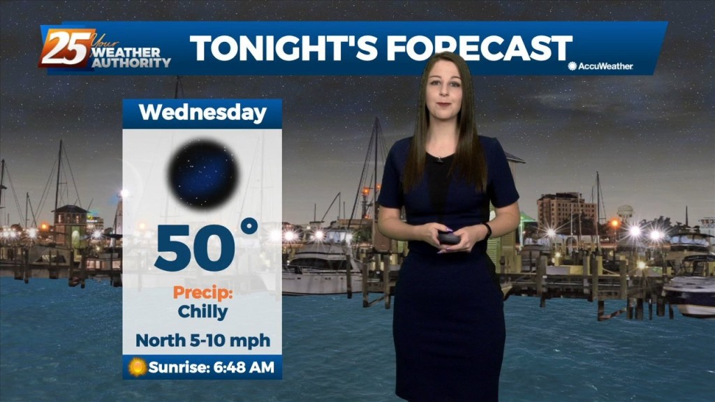
The pleasant, calm, and chilly conditions continue this evening. It has been breezy and dry with the min RH dropping from near 40% to as low as 25%. Lowest…
We could not ask for more pleasant weather right now. Honest to goodness Fall like weather out there and it should continue through the weekend and into…
Fall is in the air! No rainfall is expected for the next few days. We are still experiencing some impacts across the area from pressure gradient…
Fall is in the air! No rainfall is expected for the next few days. We are still experiencing some impacts across the area from pressure…
Tonight through the rest of the week... Fall is in the air! No rainfall is expected for the next few days. We are still experiencing some impacts across the…
Today has been another early fall like day with lows in the 50s and highs in the 80s with dry conditions expected. We still have some minor impacts due…
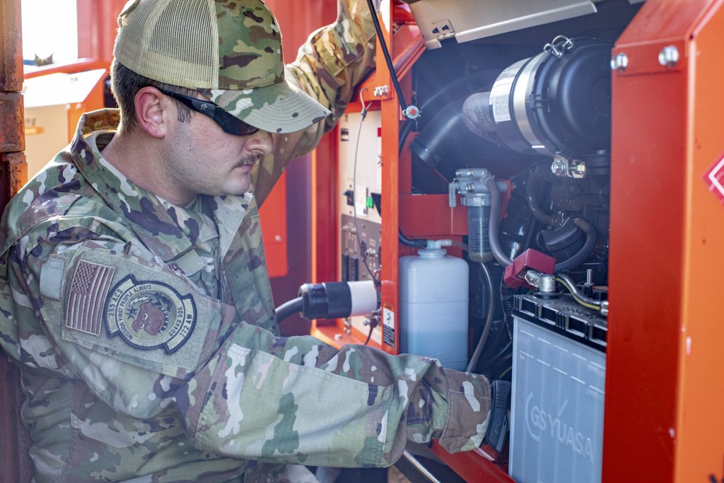
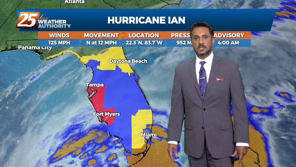
Gov. Tate Reeves on Wednesday approved a request for assistance from the state of Florida as Hurricane Ian is making its way north through that state. Approximately 20 soldiers and airmen of the Mississippi National Guard from Meridian and Gulfport…
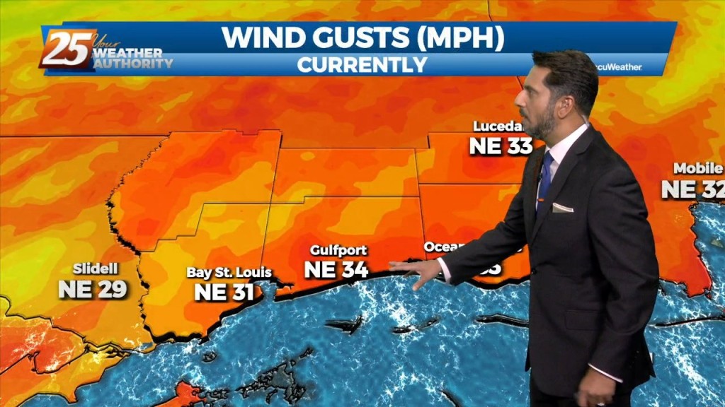
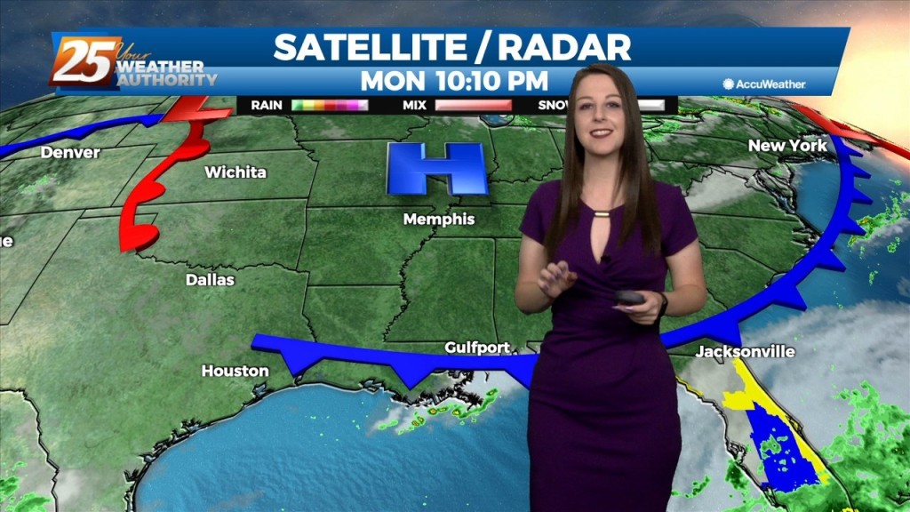
Strong northerly flow will be in place over the region for the next few days. While we are entering a Spring Tide, the new trends in the…
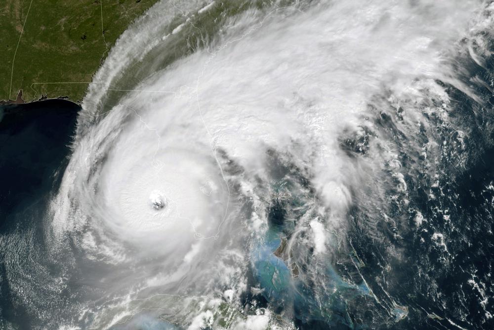
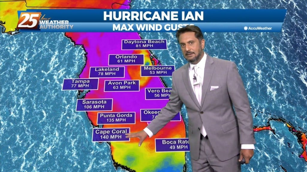
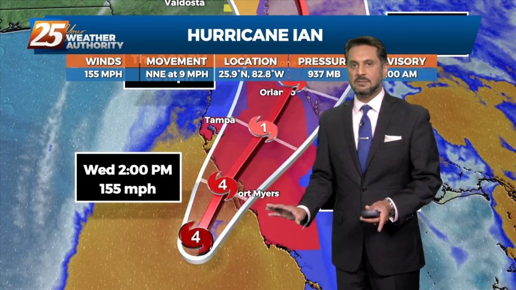
By CURT ANDERSON ST. PETERSBURG, Fla., (AP) — Hurricane Ian’s most damaging winds began hitting Florida’s southwest coast Wednesday, lashing the state with heavy rain and pushing a devastating storm surge after strengthening to the threshold of the most dangerous Category 5…
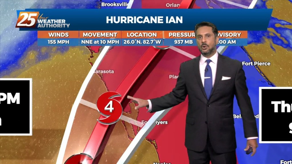
Here is an 8 AM (CDT) Update on Major Hurricane Ian before landfall later this afternoon.
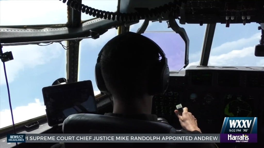
Hurricane season is in full swing and with Hurricane Ian about to hit Florida, it's prime time for the brave group we call the Hurricane Hunters. Captain…
Drier and cooler temperatures are here, and Fall-like feeling is in the air! No rainfall is expected for the next few days. And while the Hurricane Ian is…
Drier and cooler temperatures are here, and Fall-like feeling is in the air! No rainfall is expected for the next few days. And while the tropical system…
Tonight through the rest of the week... Drier and cooler temperatures are here, and Fall-like feeling is in the air! No rainfall is expected for the next few days.…
High pressure to the north moving closer will provide for lovely conditions through the rest of the workweek. A less humid flow and cooler temperatures will continue…
RED FLAG WARNING & SMALL CRAFT ADVISORY IN EFFECT... The cold front is now well south of the area with a cooler/drier air mass moving into…
The cold front will continue to bring in drier conditions and cooler temperatures. No rainfall is expected for the next few days. And while the tropical system in the…