
9/13 - The Chief's "BEAUTIFUL CONDITIONS" Tuesday Morning Forecast
The base of the upper level disturbance and surface cold front is now in the northern Gulf of Mexico. Other than some outer coastal convection south of…
The base of the upper level disturbance and surface cold front is now in the northern Gulf of Mexico. Other than some outer coastal convection south of…
As a cold front makes its way through the area this evening, we can expect the lowest overnight lows we've seen all summer. Temperatures will bottom out in the…
A cold front will continue pushing through the area this evening with noticeably drier air behind it. Surface ridging will build in behind it which will allow…
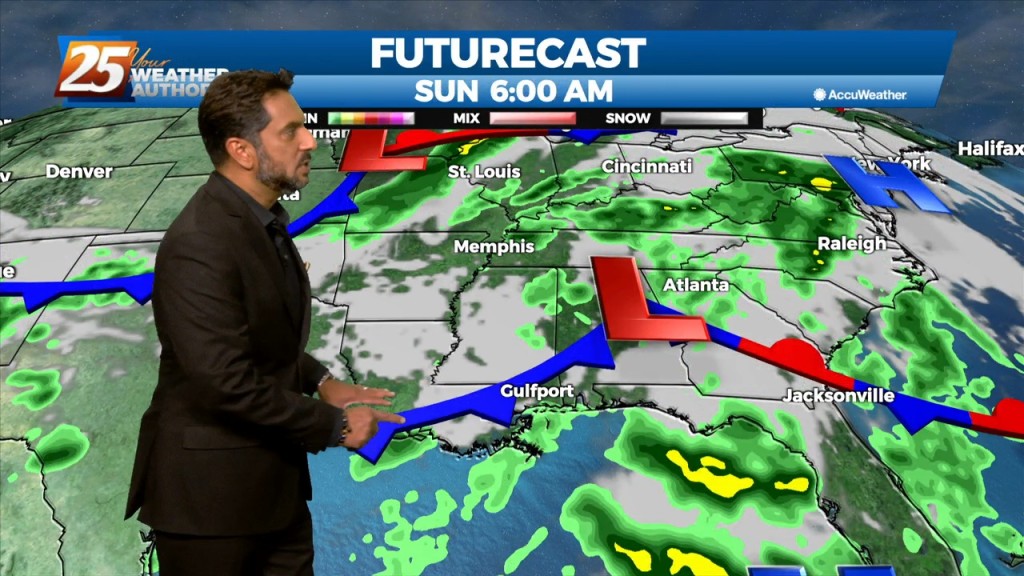
The main story is a cold front overhead moving SE. The upstream support will press east allowing the high to surge the front south and east through our…
Early this morning, we will continue to see decaying showers over coastal Mississippi, with a remnant boundary possibly leading to a few re-developing isolated showers…
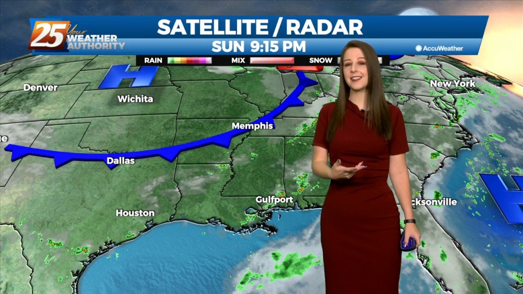
The main headline for the short term is a front is actually coming to the Central Gulf Coast! This cold front is currently located upstream of the…
Tomorrow, we'll only see slight changes as the overall pattern shows little change. The upper low will still be in place overhead, but likely weakening at this…
Tomorrow will be quite similar as the overall pattern shows little change. The upper low will still be in place overhead, but likely weakening at this point. Model suggests…
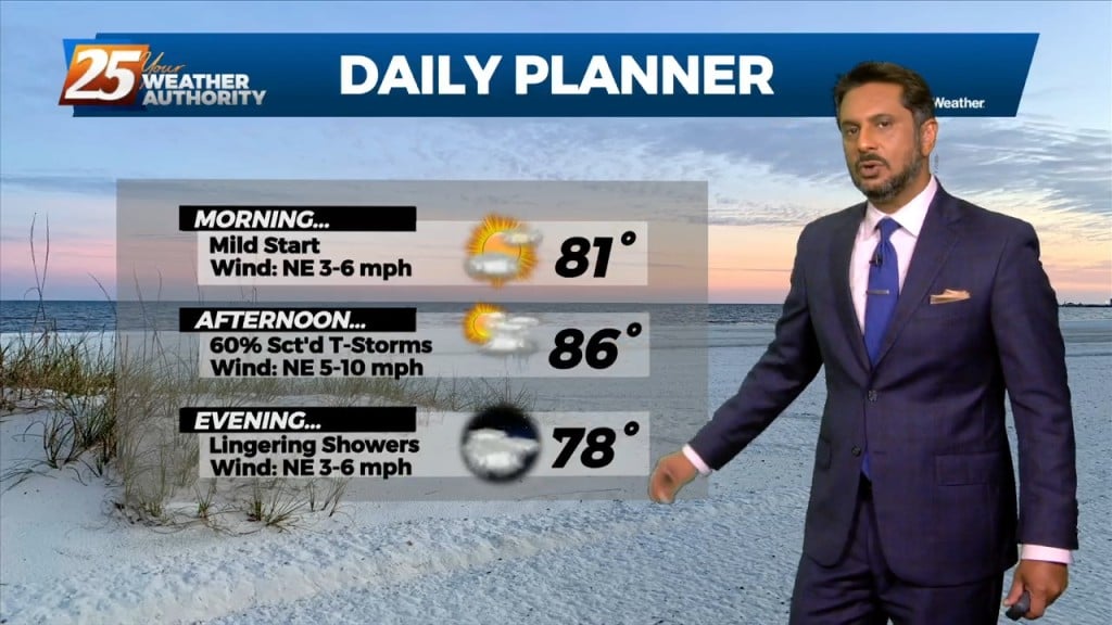
A stationary front draped along the coast east through the central Florida panhandle will continue to bring showers/t-storms. A few showers could bring heavy rain as rain rate will…
The same closed mid to upper-level low pressure remains parked over our area, centered generally over SE LA. The same corridor of deeper moisture continues along progressive…
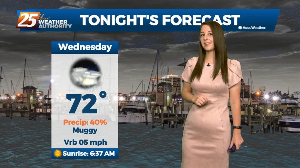
We could see some lingering showers and thunderstorms this evening. Heading into tomorrow, an upper low will be completely closed off at this point and meandering around…
Starting out in the upper levels, a broad ridge centered near the 4- Corners region extends from California to beyond the Great Lakes. A trough sagging southeast…
These people are gonna break something. And...when we say "These People" of course we mean ROB KNIGHT!
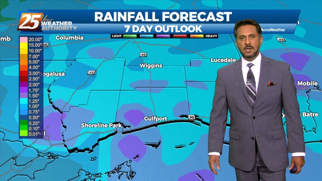
Through the end of the week, an upper level low is expected to influence the area, enhancing rain chances for the region. There are still some…

Tonight, we're seeing some lingering showers, mainly west of highway 49. Through the end of the week, an upper level low is expected to influence the area, enhancing rain…
Tonight, some scattered showers and storms will be possible,especially in the northernmost areas. Through the end of the week, an upper level low is expected to influence…
A trough of low pressure along the NW'tern Gulf of Mexico will slowly push SE as an upper low pressure system and training cold front moves through…
Why is Rob Knight eating CANDY CORN on air??????????
The area is still under the influence of upper level weakness which is slowly moving east while further west has a large area of high pressure with…
Mississippi is still under the influence of upper level troughing which is slowly moving east while further west has a large ridge with a cutoff low. This trough…
Mississippi is still under the influence of upper level troughing which is slowly moving east while further west has a large ridge with a cutoff low. This trough has…
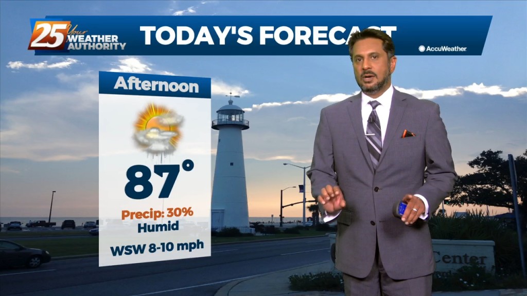
Winds will shift to a more light to moderate southerly direction by later today. This flow will help spread abundant gulf moisture back into the region and should allow…
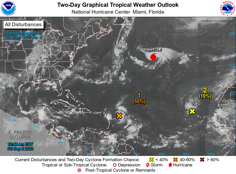
MIAMI (AP) — Tropical Storm Danielle strengthened into a hurricane Friday morning — the first of an unusually quiet storm season. The storm is not currently a threat to any land. The storm’s maximum sustained winds were clocked at 75 mph…
Going into Labor Day weekend, the general thought is that the dry pattern we’ve enjoyed (although hotter) will likely come to an end this weekend. Aloft,…