09/24 Ryan’s “Getting Cloudy” Wednesday Forecast
It's getting cloudy out there as a front closes in, which will bring some spotty rain tonight ahead of our wettest day in a while tomorrow.
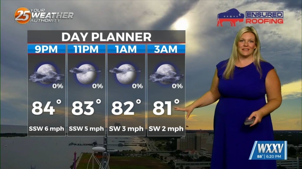
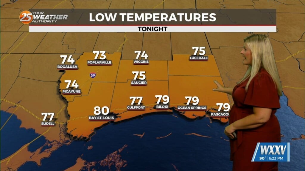
Today started relatively clear, but it’s getting cloudy as a cold front approaches from the northwest. That means we’ll start with mostly sunny skies, but see the cloud cover steadily increase through the afternoon and into the evening. Eventually that will lead to the potential for spotty shower activity as we head into the heat of the day and hit our high of 89 degrees, but I expect the more consistent rain to hold off until we head through the overnight hours and into Thursday. Thursday will be cloudy and wet from start to finish, but shower and thunderstorm activity will be on and off. The front will pass through by Friday morning, bringing much cooler morning lows and sunny days, though highs will remain above normal by a few degrees.
Tropics: Gabrielle is the only active storm at the moment and remains a major hurricane. It will weaken as it moves further northward, becoming non-tropical by the start of next week as it approaches Spain. The two “invests” are likely to form, with one becoming Humberto later today while the one over the Caribbean takes a little longer. This one also still has a chance of encountering the East Coast, but no South Mississippi impact.