10/5 – Jeff Vorick’s “Cold Front Inbound” Thursday Evening Forecast
Cloud cover will remain in place this evening as a more unsettled setup will be in the area. Breezy conditions will subside by sundown and rain chances will remain stray at best up until 8 -10 PM or so. A batch of rain with embedded thunderstorms will make its way through South Mississippi overnight with coverage of 40-50% or so.
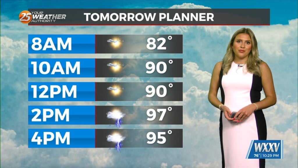
That round of rain will clear out through the morning hours and there will be dry time tomorrow. The cold front will not bring its drastic changes until Friday night. Isolated thunderstorms will be possible tomorrow afternoon and it will be breezy at times. It will be much cooler this weekend with cool starts through the beginning of the week and very comfortable afternoons.
The true cooler air will arrive for this weekend. Also, it will be windy Saturday so be sure to secure any loose objects. On the water, a Small Craft Advisory will be in effect Friday night through at least Sunday morning. On land, a Red Flag Warning will be in effect Saturday from 11 AM until 7 PM due to low humidity and elevated winds.