3/22 - Jeff's "Final Shows, Thank You Mississippi Coast Viewers!" Friday Night Forecast
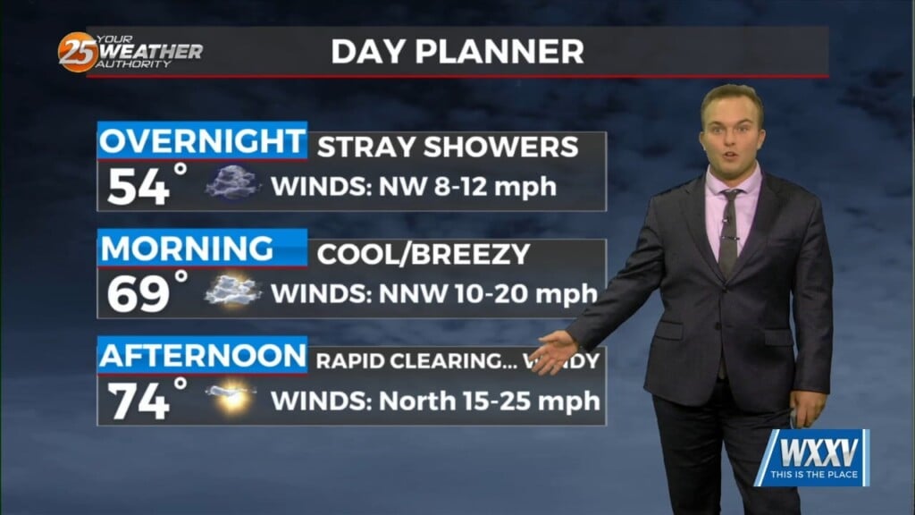
A 20-30% chance of showers cannot be ruled out tonight but any rainfall will be quick in nature. A cold front works through…
A 20-30% chance of showers cannot be ruled out tonight but any rainfall will be quick in nature. A cold front works through…
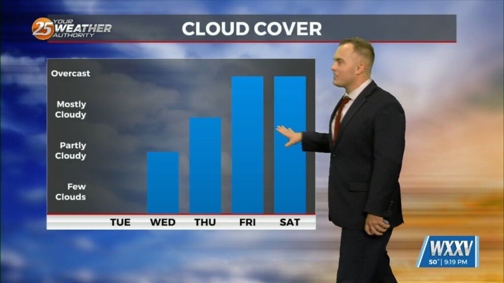
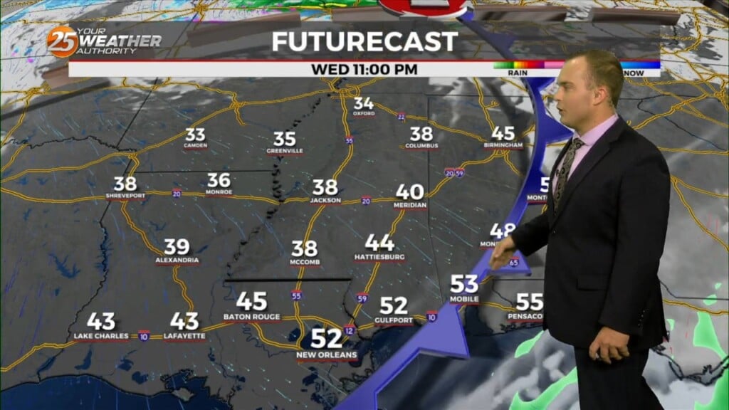
Cloudy skies remain through a good portion of the afternoon with a 20% chance of light showers as well. Skies will clear out somewhat towards this evening and…
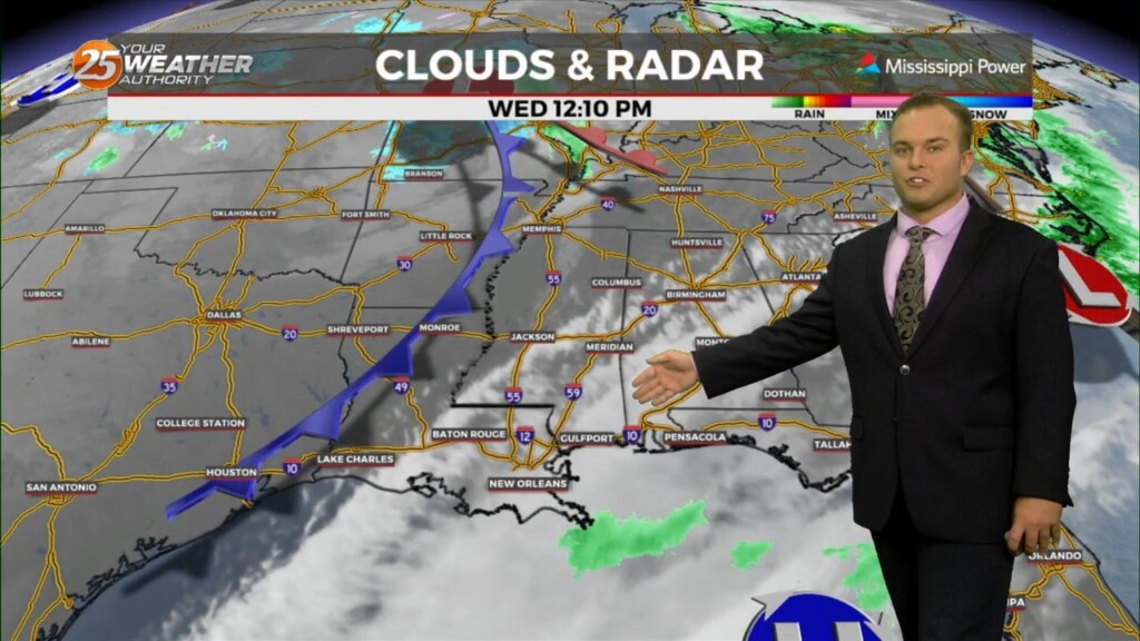
More clouds are around to start your Wednesday. A cool start will turn into a warm one today with temperatures reaching the 70s by…
Skies will clear out for the most part tonight while temperatures remain cool if not chilly. Lighter winds and the clearer skies will yield efficient cooling so…
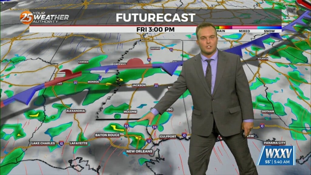
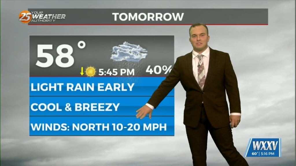
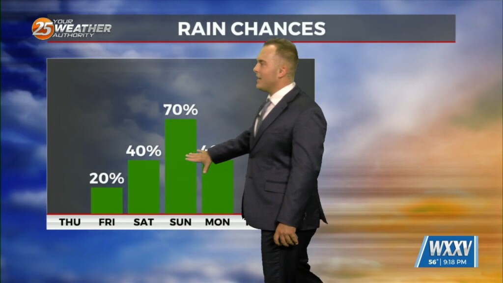
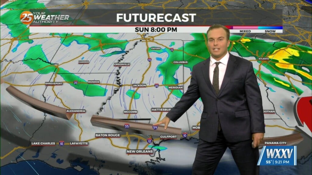
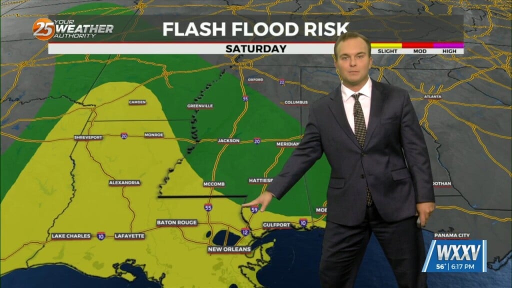
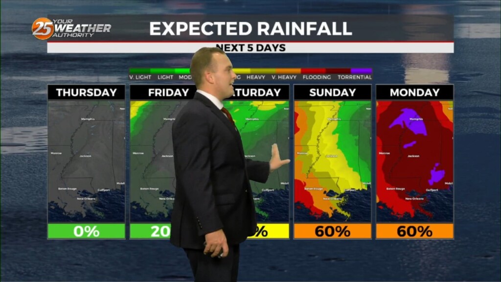
Some dry time arrives overnight but by the time your Saturday could be beginning, light rain will be in the area coinciding with/shortly after a cold front…
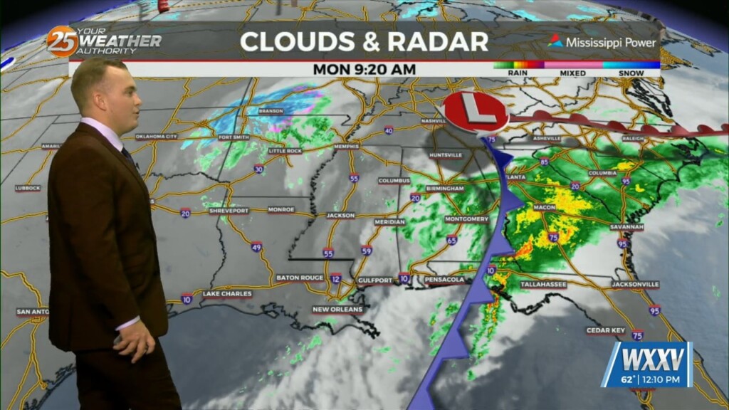
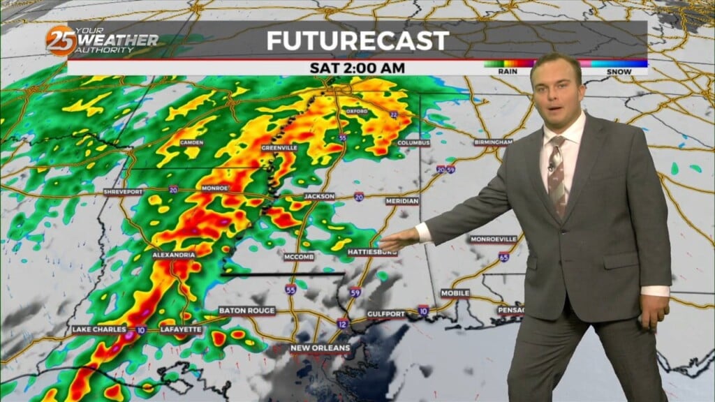
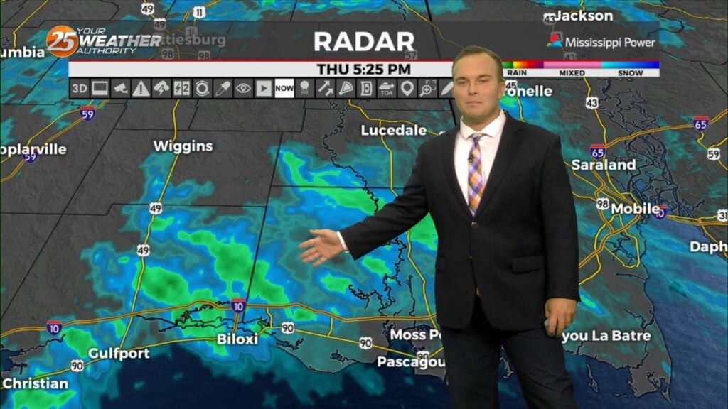
A shield of mist and light rain continues to plague our area as a pair of storm systems interact. Light rain will be around into some parts…
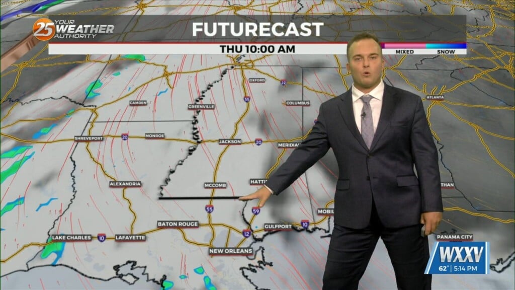
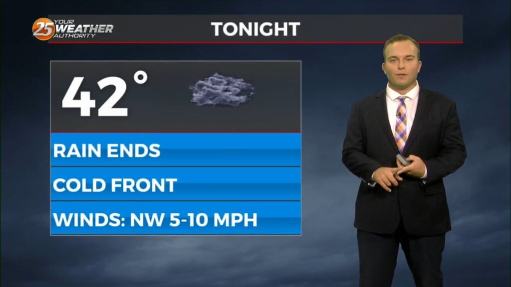
A cold front moved through the area this morning which brought an end to the rainfall. This afternoon, some sunshine will emerge but the main concern…
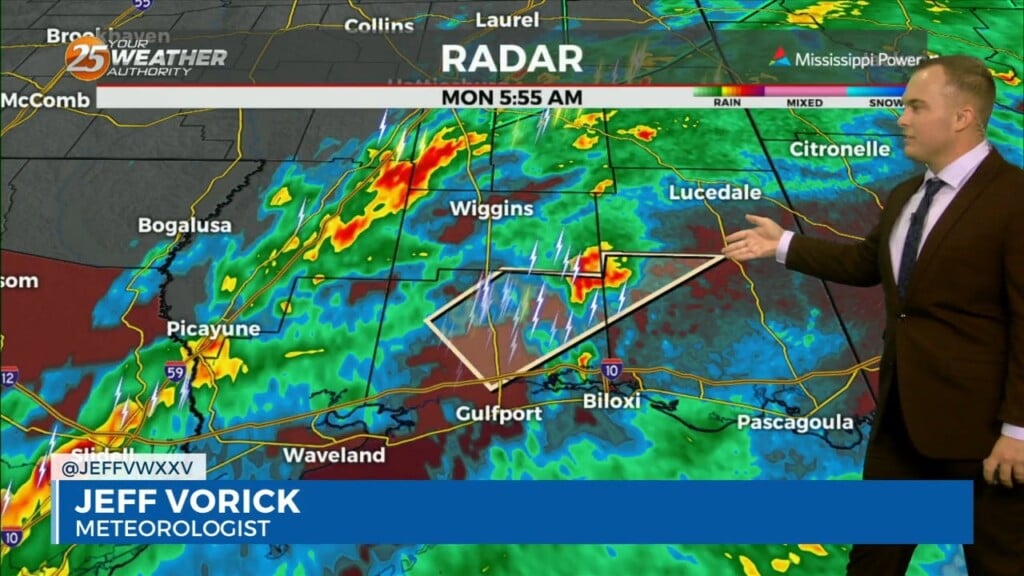
The threat of severe weather will come to an end this morning and the Tornado Watch for Stone, Jackson, Harrison, & George County will be…
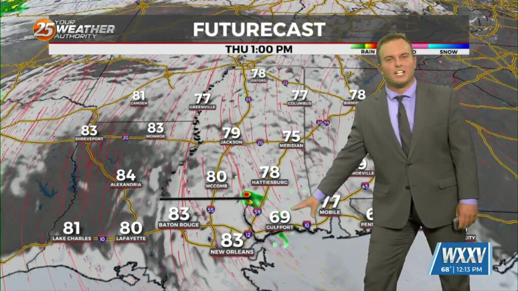
Temperatures will be a few degrees warmer to start your Thursday. More clouds will be around as a more active subtropical jet stream will contribute…
Another nice day will give way to a fairly pleasant and mild evening tonight. Temperatures will be slower to drop as the overall weather pattern turns more mild.…
Temperatures will be chillier out the door for your Tuesday morning and northerly winds will make it feel like the 30s. Expect sunny skies and breezy conditions tomorrow…
Skies will rapidly clear out this evening as an area of low pressure departs our region. Temperatures will drop to chilly readings overnight thanks to northerly winds…
Skies gradually clear out overnight and there will be the possibility of patches of light fog out the door tomorrow morning. Fog and clouds dissipate rapidly…
It remains quiet this evening as upper-level cirrus clouds continue to stream in. Skies will clear out overnight which could lead to the…
Rain chances early this evening will be put to bed temporarily while fog has the possibility of forming again. A Dense Fog Advisory will be in effect from…
A cold front passes through the area tonight bringing a wind shift and another shot of cold air. North/northwest winds will be around to start your Friday and…
Spotty rain/drizzle will be possible at times this evening into tonight. Some reduced visibility may be found if mist picks up and the cloud deck falls…
Cloud cover is present this afternoon with mid-level and upper-level clouds overhead. Temperatures will be near-average this afternoon with low-60s. Winds will remain southwesterly for a few hours…
While it is a few degrees colder than yesterday out the door this morning, temperatures are near average in terms of low temperatures are concerned. Mostly…
It will be cold overnight but outside of very patchy frost, temperatures will be slightly more manageable. Light winds will provide for a slight wind chill factor…
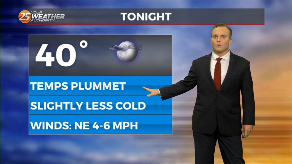
Skies clear out this evening which will help temperatures plummet again. Despite the overall moderating trend being underway, it will be a cold night again with some spots…
It will be chilly and windy overnight as a cold front is well past our area. Some light rain will work into South Mississippi towards daybreak and…
A cold front has moved through our area and big changes are taking place behind it. Temperatures are already much cooler compared to earlier and…
Winds will settle down overnight and it will be slightly warmer as compared to last night. Winds should remain elevated enough to avoid fog trouble for…