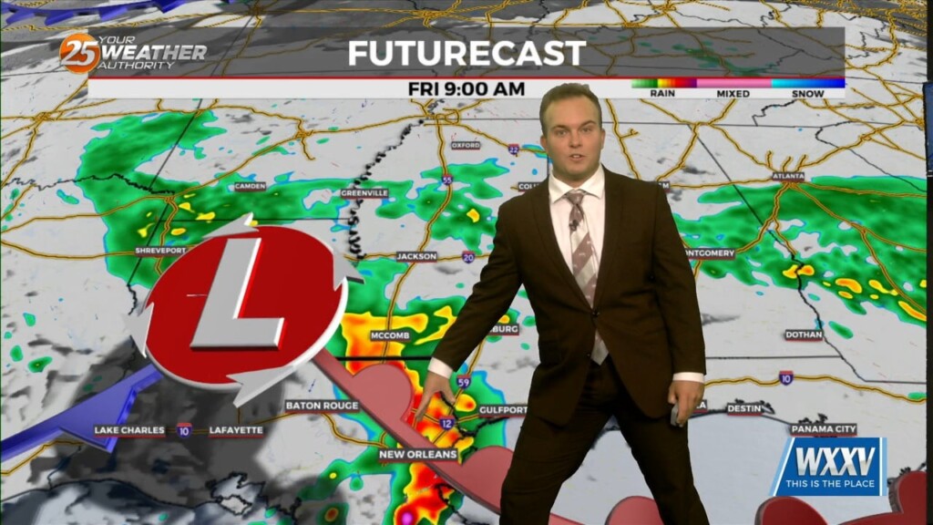
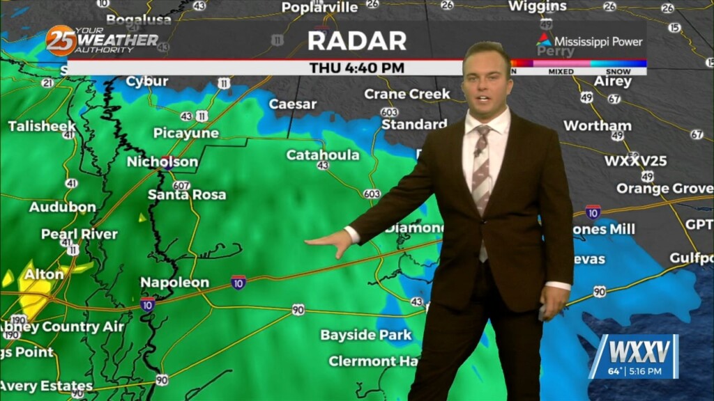
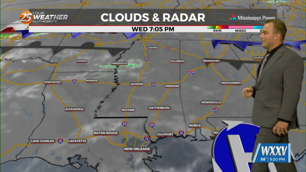
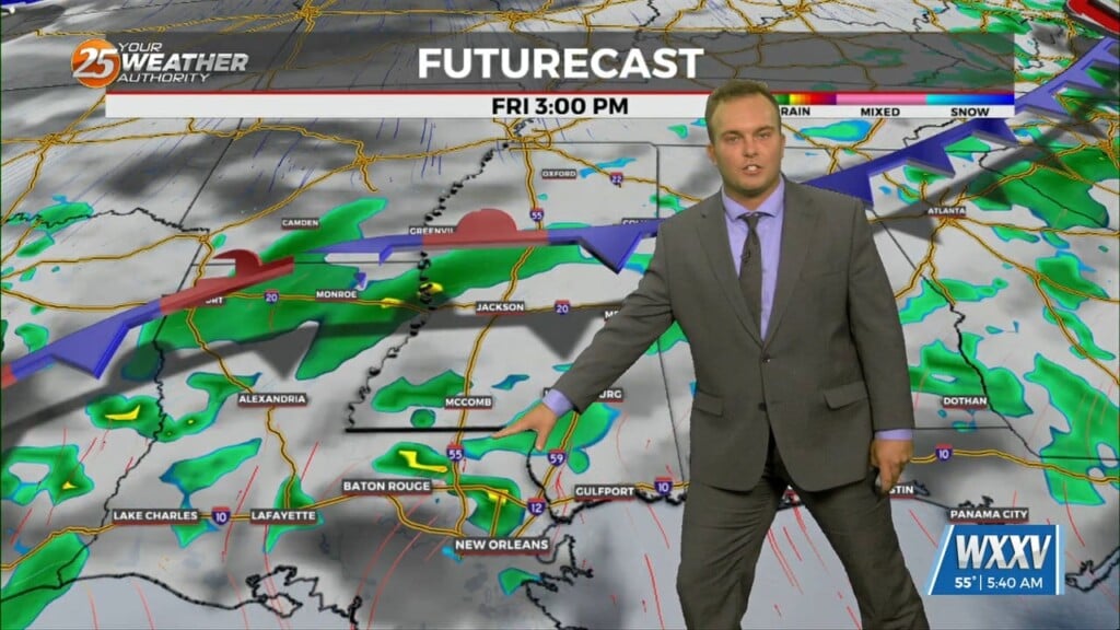
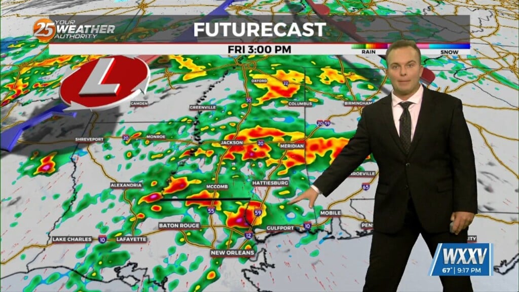
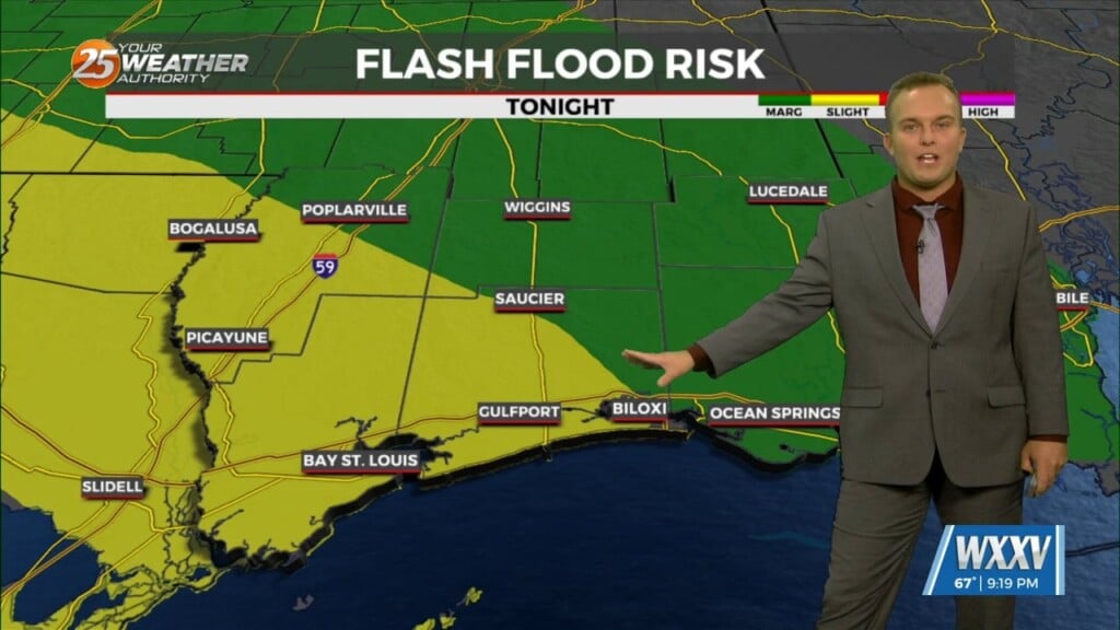
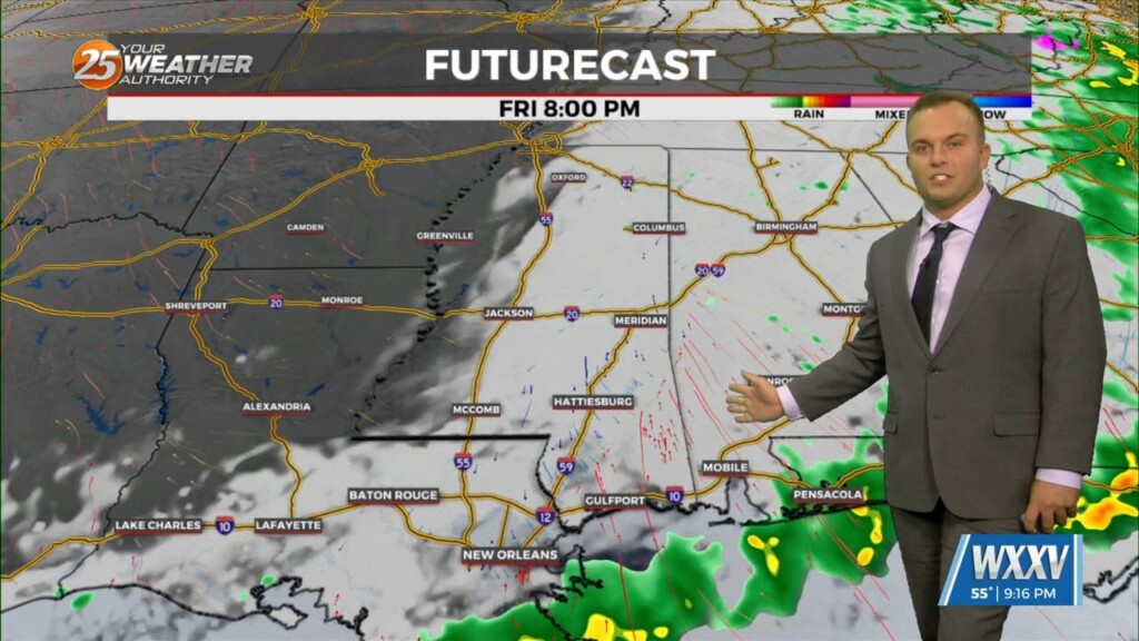
5/23 - Britt's "Wet Work Week" Monday Afternoon Forecast
An area of low pressure located of across Central Alabama is producing showers and thunderstorms that are expected to move to the north and east. This low…
Primary Menu
About
Connect With Us
An area of low pressure located of across Central Alabama is producing showers and thunderstorms that are expected to move to the north and east. This low…
An area of low pressure located of across Central Alabama is producing showers and thunderstorms that are expected to move to the north and east. This low pressure system…
An area of low pressure located of across the Northern Gulf of Mexico is producing showers and thunderstorms that are expected to move to the north and…
Today will be quiet, humid, and warm with HI readings mostly in the mid to upper 90s and a few 100s. Saturday the chance for rain will increase. Southwest…
Tonight’s environment condition could be unstable enough for isolated to scattered showers and thunderstorms to develop through the overnight hours, likely with less than 30 percent coverage of…
Aside from a normal start to summer and high temps well above normal values, we will throw several thunderstorms on the pile for Thursday night into Friday…
The next trough in line, starting out farther south than the Monday one, begins digging south and east over the southern Rockies on Tuesday. At the same…
The warm front is now to the NE placing the area under the warm/moist unstable sector of this system. The synoptic and mesoscale pattern continues to support…
A brief dry period today will change overnight as the stationary front drifts north, along with a vigorous cold front approaching from the NW. Rain will move back…
A stationary front to the east will continue to be the focal point for showers and t-storms again today. The development over land will be elevated so we are…
Low pressure is currently over southern Indiana with a cold front southwestward to near Memphis and Shreveport. As the surface low continue to lift northeastward, the cold front will…
Over the course of the evening a front will move closer to the region and is expected to start impacting the area with increased shower and thunderstorm activity tomorrow.…
The main concern for today will be the front moving into the area this afternoon. The front is expected to enter the western portion of the region about…
Tonight's stronger front brought severe weather, including a tornado, to South MS, but it'll quiet significantly in these post-storm hours. This was due to the strong front moving in…
The severe risk today rose from level 2 (slight), to level 3 (enhanced) earlier today. This is due to the strong front moving in with a decent low level jet, that can create rotating storms. The chances of seeing tornadoes…
Expect stormy weather to linger in South Mississippi through the evening, but it will eventually clear out. Exactly when is still a bit up in the air though. It…
I have a professional interest in active weather and even I wish it would stop raining, but it won't and our Flash Flood Watch has even…
Setting up to be another mostly dry night, but no surprises earlier this afternoon as we saw more showers and thunderstorms moving in once again. There were a few accumulations of 4"…
No surprises this afternoon as we saw more showers and thunderstorms moving in. There were a few accumulations of 4" or more, but overall it wasn't too bad compared to several days…
Tropical Storm Claudette started the weekend off, and even after it has moved on we're left with more rain. Flooding issues abound across South MS as the scattered showers and thunderstorms have lingered. One area of Harrison County near d'Iberville…
We're looking forward to a sunny, beautiful weekend, but we'll have to get through another wet, humid, and grey start to the week first.
Another warm, humid, and wet start to the week, though it will finish much more on the dry and sunny side as last week did....
First line of storms passed through without any severe weather and the threat has diminished, but we'll still see at least a few thunderstorms through the night.