8/24 - The Chief's "When Will The OPPRESSIVE Heat End" Thursday Morning Forecast
Yet another hot day is anticipated across the central Gulf region today as high pressure remains situated to our north with a general…
Yet another hot day is anticipated across the central Gulf region today as high pressure remains situated to our north with a general…
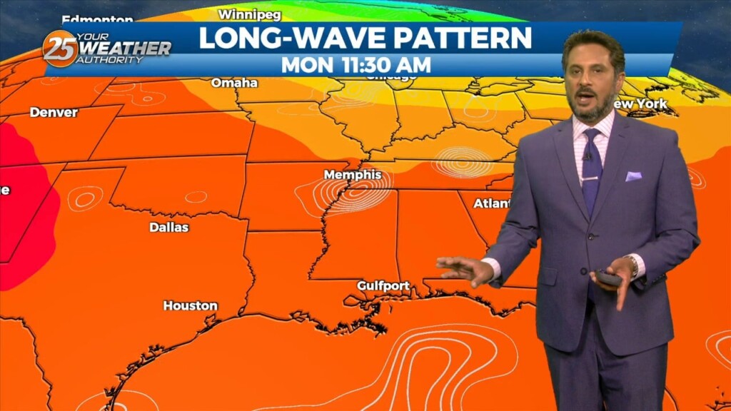
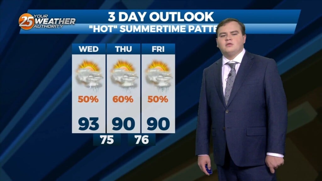
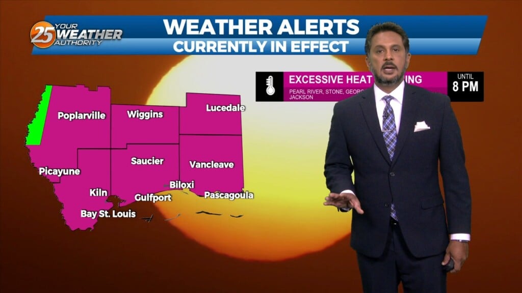
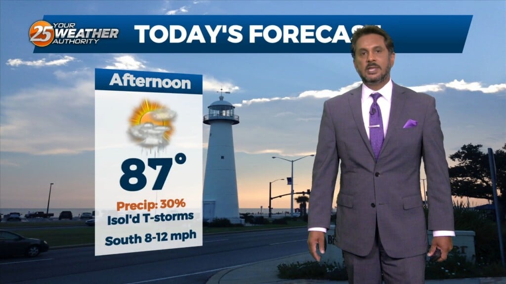
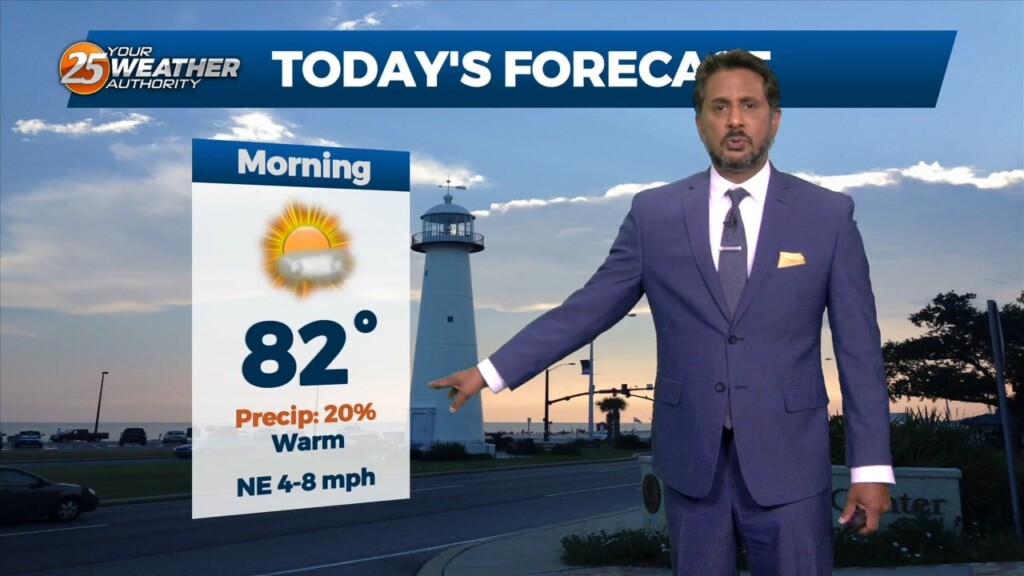
An EXCESSIVE HEAT warning is in effect as this OPPRESSIVE summertime pattern continues. An easterly wave is currently located from Appalachia Bay FL down…
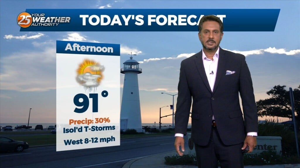
With little in the way of upper level support across the central Gulf States, expect only limited rain chances through mid-week…with another hot afternoon ahead. Models…
Earlier this morning, the MCS continues to decay as it moves south of our marine waters. Expect a few more isolated showers or storms…
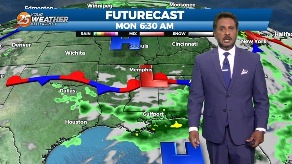
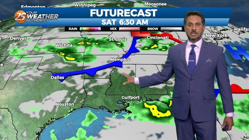
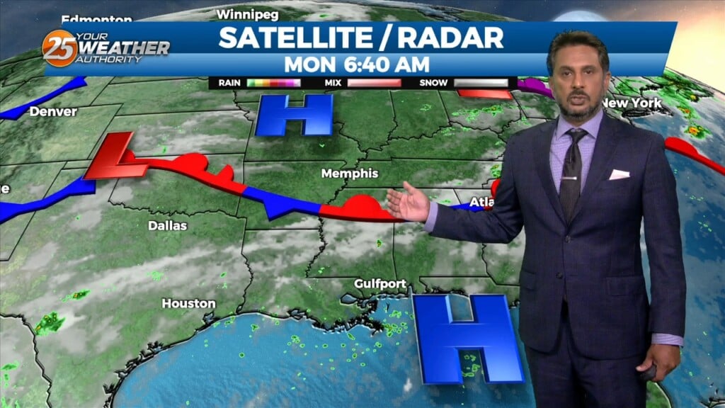
This morning there is an area of low pressure situated over the AR/LA/TX region with a decaying stationary front north of our area. Out ahead of…
Just like the past couple of days there is as stationary front to the north of our area this morning. In the Gulf of Mexico high pressure…
Currently there is a stationary front to the north of the I-20 corridor with showers and thunderstorms to the south of it. This afternoon will bring partly cloudy…
Overnight activity has now diminished across the area. Currently there is a stationary front to the north of the I-20 corridor with showers and thunderstorms to…
Another afternoon filled with the chance of showers and thunderstorms today. This afternoon high pressure will generally remain in place across the area, especially over the northern Gulf of Mexico. There is just enough of a weakness across the lower…
Not as much activity on radar when compared to this time yesterday morning. Expect things to continue to be fairly quiet throughout the rest of…
Happy Independence Day! Scattered showers and an occasional rumble of thunder have developed and moved across the area this morning moving to the NE. Isolated activity will continue…
This afternoon, the Bermuda high “High Pressure” extends westward across Florida into the northern Gulf of Mexico. A front is extended from Lake Erie into Oklahoma which…
At the surface, the Bermuda high “High Pressure” extends westward across Florida into the northern Gulf of Mexico. A front is extended from Lake Erie into…
Just like the past couple of days…high pressure is still centered off the coast, and doesn’t look to be going anywhere today. The area…
High pressure is currently centered just south of the central Louisiana coast. High pressure isn’t going anywhere through Friday night, meaning not much is going…
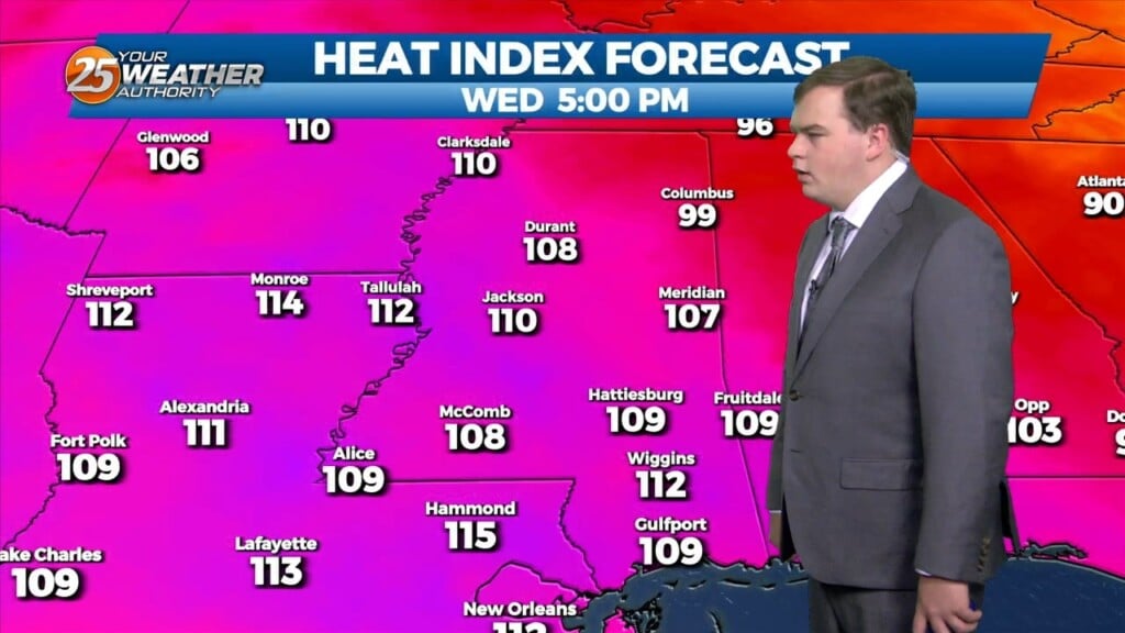
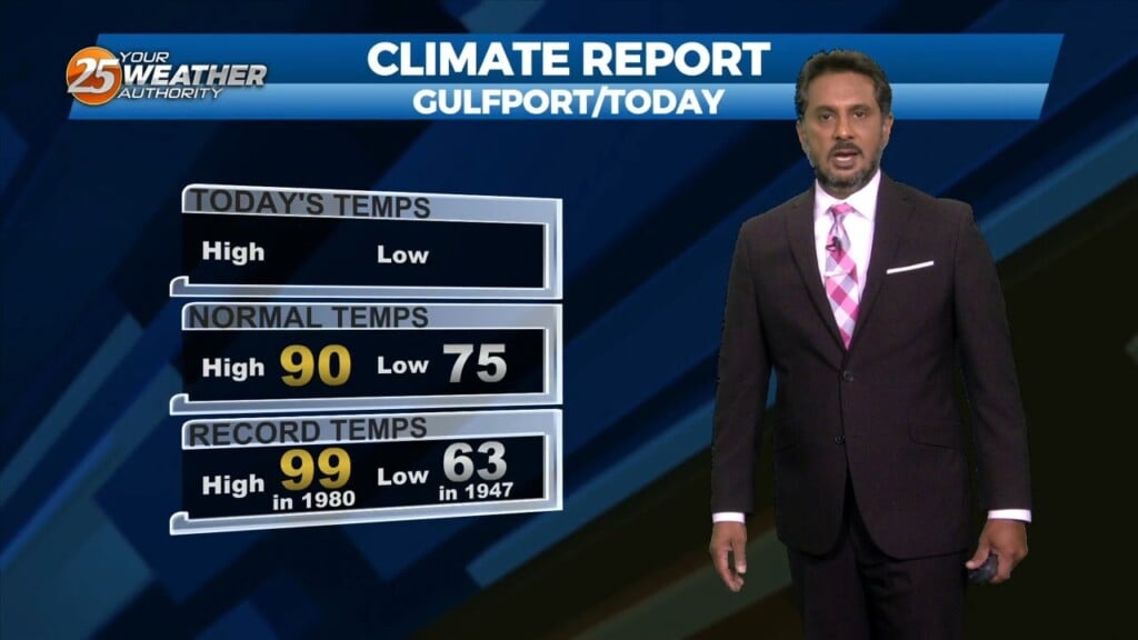
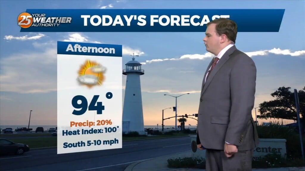
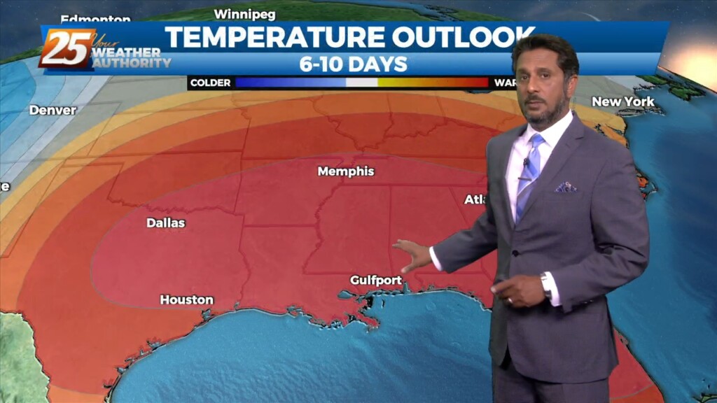
An EXCESSIVE HEAT WARNING is in place for today and Excessive Heat Watch for tomorrow, with the expectation that it will upgrade to a warning for tomorrow.…
Main concern through Wednesday will be the heat, with a secondary concern… the threat for thunderstorms which could bring a low end threat for severe potential.…
This afternoon there is a chance for showers and thunderstorms. This is because there is a stationary front overhead. However it will begin to get…
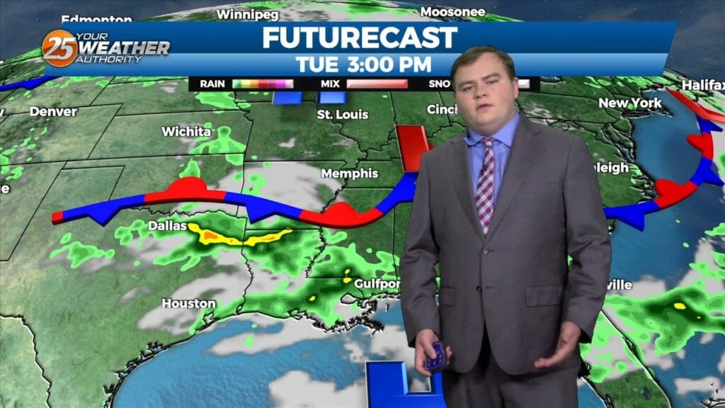
A stationary front overhead will begin to get displaced by an area of low pressure currently out west. This new disturbance will provide a new front…
Only a few small changes in the upper pattern this morning, with an area of low pressure over New England with another over Nevada.…
A very persistent pattern of afternoon showers and thunderstorms due to a boundary in the area will last through Wednesday, given that no significant…
Mid-level dry air is moving into the area from the west this morning on the backside of the exiting upper level disturbance retrograding back to the…
More of the same summer-like weather will persist today despite the mid-level high pressure gradually waning. Convective temperatures in the upper 80s to low 90s will be…
Today our area will reside between a strong upper level high pressure over the western Caribbean and southwest Atlantic and a strong upper level…