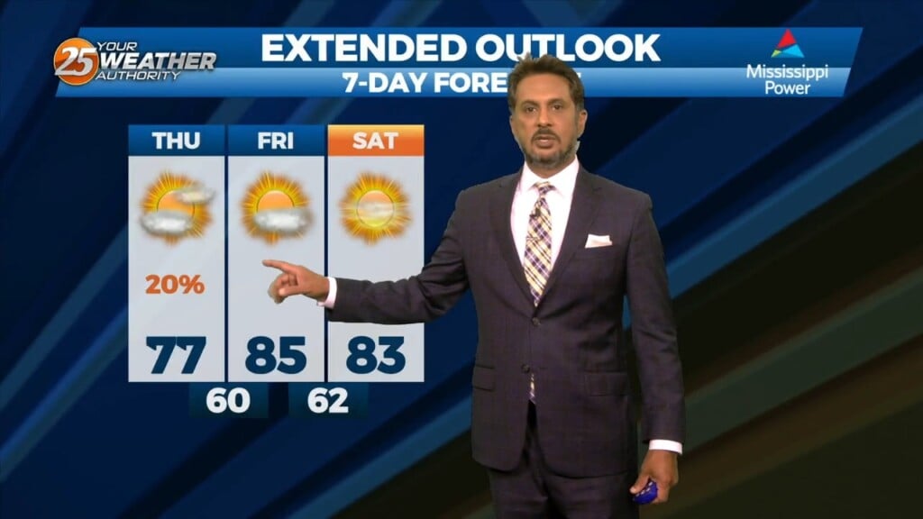
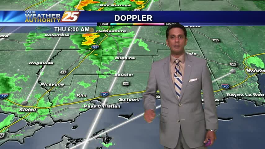
10/19 - The Chief's "Approaching Cold Front" Thursday Morning Forecast
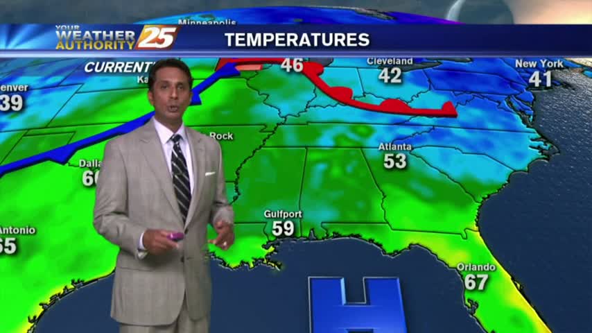
An area of upper level high pressure is centered over the Appalachians and over Nevada this morning with a sharp disturbance running from the Great Lakes to…
An area of upper level high pressure is centered over the Appalachians and over Nevada this morning with a sharp disturbance running from the Great Lakes to…

A weak backdoor frontal has dropped south in to the area and will be a focal point for a few afternoon showers/t-storms. To the south of…
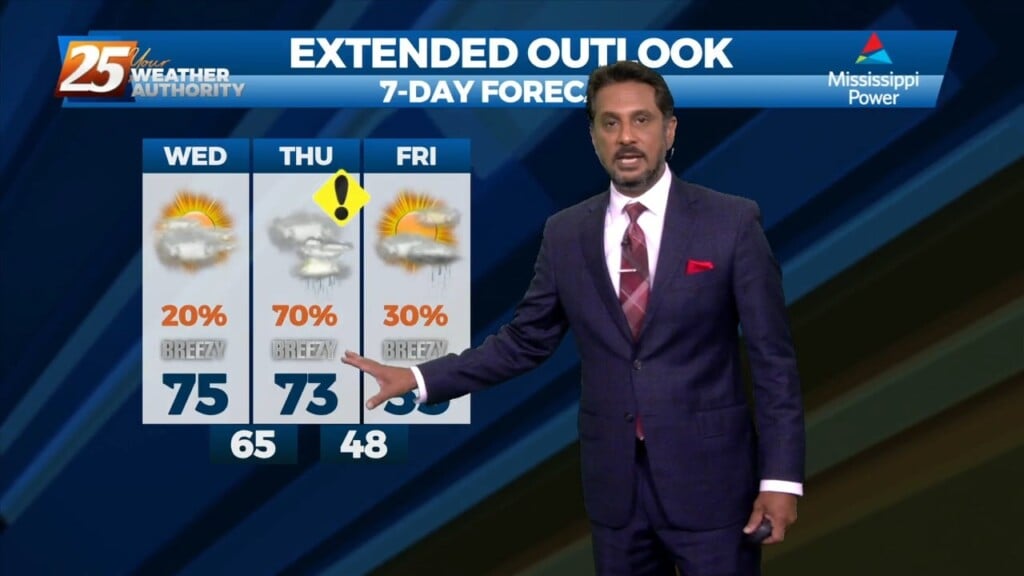
The cold front that was moving toward the area yesterday slammed the brakes and stalled to the west. The next front will actually make it through…
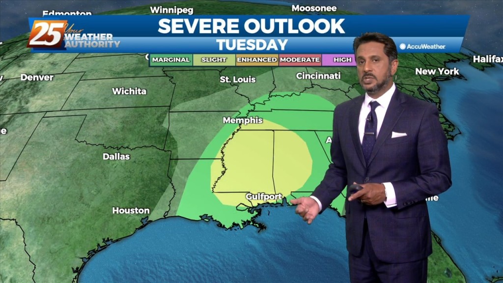
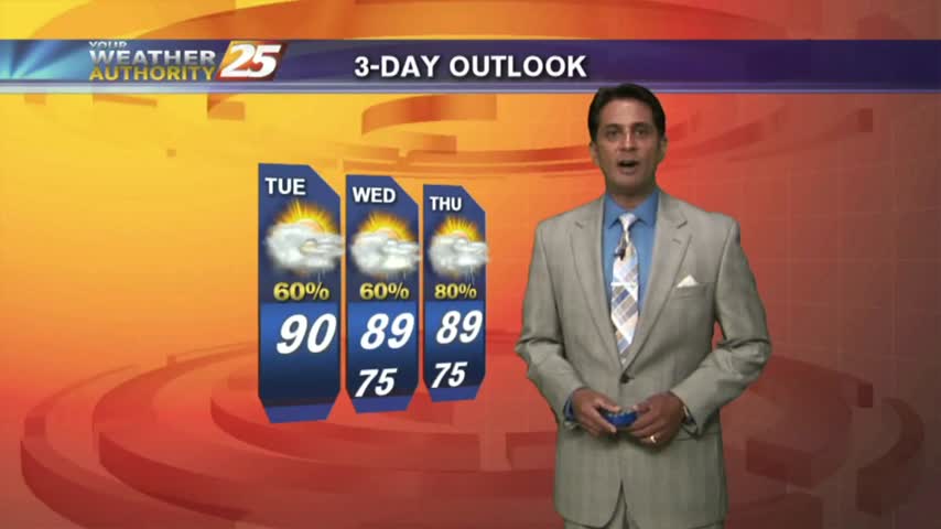
The main weather impacts for the local area come in Tuesday as an upper level disturbance digs south through the 4 Corners region will begin heading…
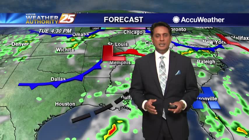
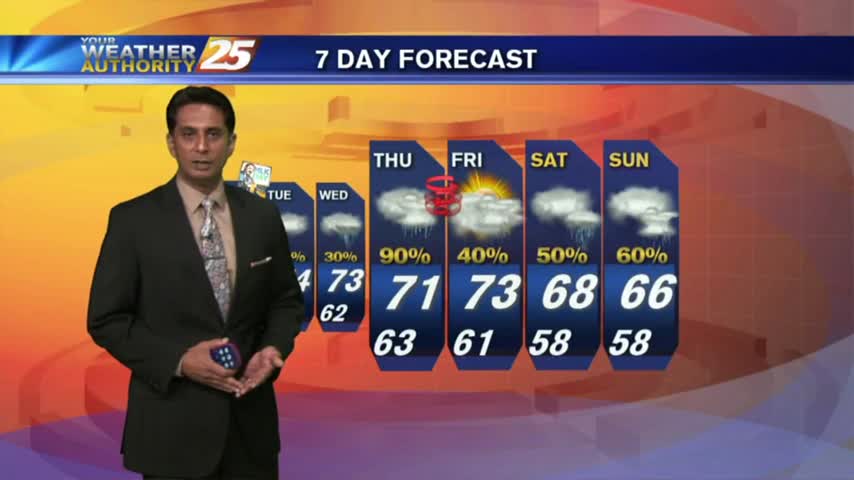
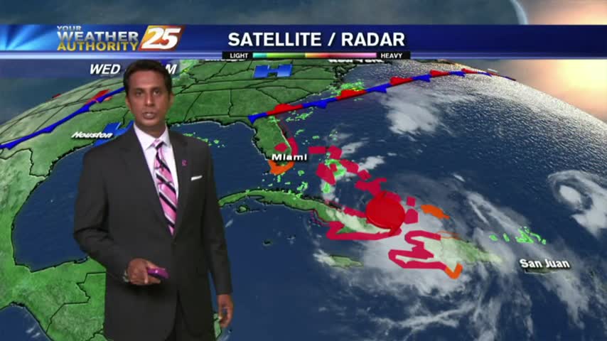
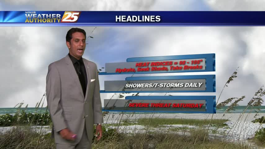
Any significant weather impacts in the short term for most of the area should be limited to the daytime hours today. As a tropical wave south moves towards the Florida Big Bend area, expect scattered t-storms through today with any…
The low humidity from last week is out of the area as a typical Summertime pattern returns...
Another WARM/HUMID start to the day with areas of patchy fog and isolated rain moving in from the Gulf/Sound...
A warm and humid start to the day as isolated rain moving in from the south is dissipating before hitting the coastline...
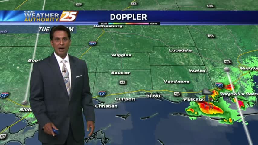
A HUMID start to the day with areas of light patchy fog and isolated showers/t-storms moving in from the south...
After a WARM/HUMID weekend with DENSE morning FOG...fog is out of the area but rain is now moving in from the south...
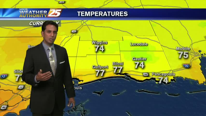
As temps have been slowly warming over the past few days...areas of light fog have developed this morning.
Another dry but humid start to the day as high-pressure dominance of the Gulf south continues...
Light showers moving across the area under cloudy skies...
A mild and humid start with light rain moving into our NW viewing area...