
6/14 - The Chief's "Getting HOTTER Into The Weekend" Friday Morning Forecast
Activity will remain suppressed today and tomorrow as high pressure becomes centered over the region. Very dry air aloft associated with subsiding air will…
Activity will remain suppressed today and tomorrow as high pressure becomes centered over the region. Very dry air aloft associated with subsiding air will…
The old frontal boundary is stalled near the coast this morning and drapes inland near Terrebonne Parish westward to Beuregard Parish. The back end of this front…
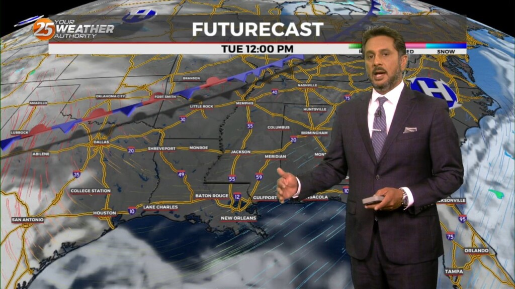
A cold front is currently slowly moving south through the area this morning. This boundary will be very important for this forecast, as it will…
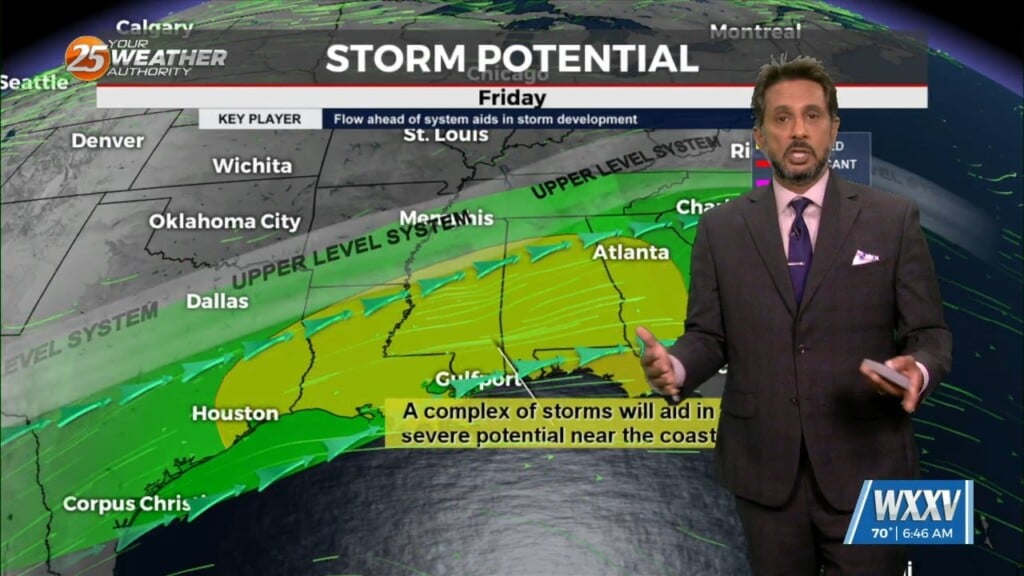
A rather zonal/progressive upper level flow will continue through the morning and into the afternoon hours across our region. Later today and…
Finally…winds will begin to weaken today dropping below advisory thresholds. But there will still be gusts to 25mph at times and even higher winds up…
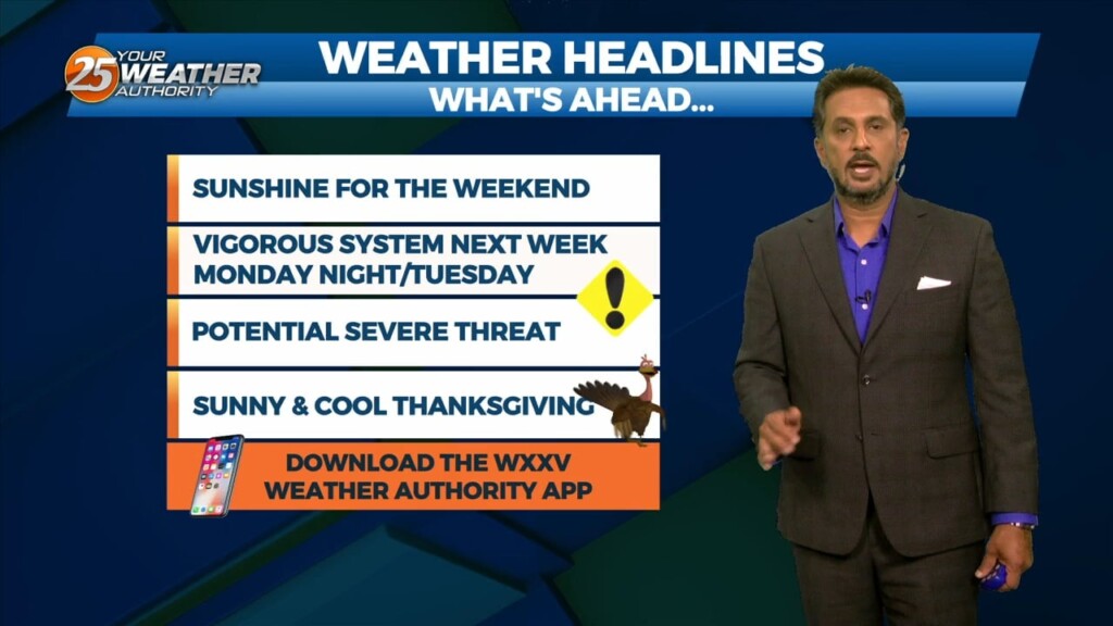
For the next few days and through the weekend the word is...WARM. So basically today, April 25th, is probably not the perfect date this year as…
A stable layer in the low-levels of the atmosphere is eroding, Which thus far has protected us so far, but this is currently leaving and…

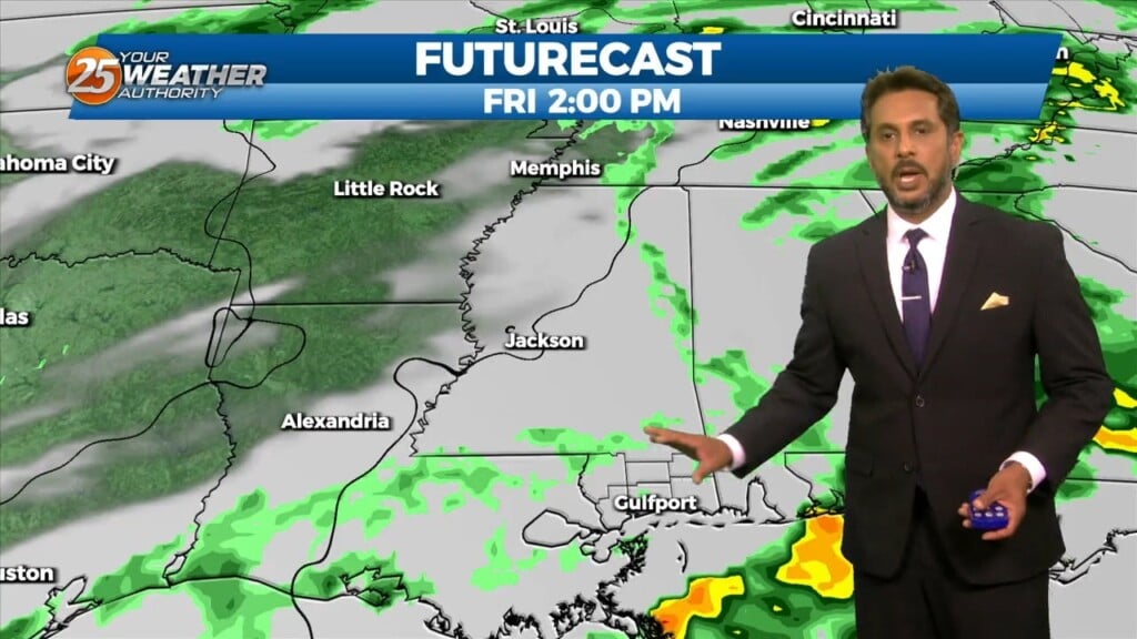
A cold front has cleared the area with cloud coverage clearing from west to east. The upper-level feature will also move through the area today…
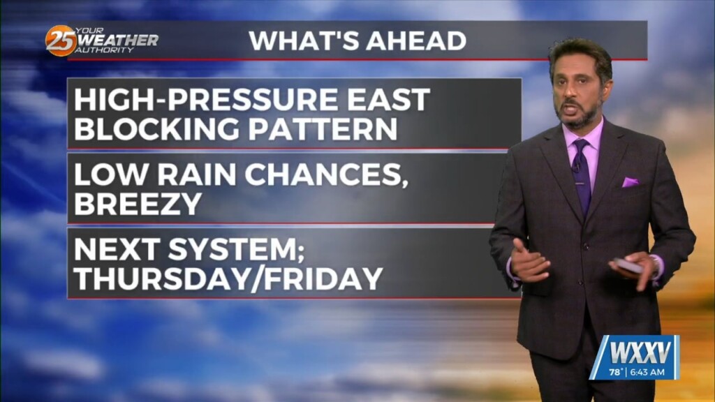
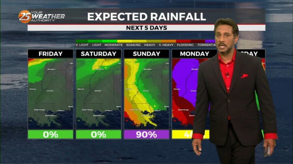
No significant changes in forecast though the weekend. An area of low-pressure along the W’tern Gulf will bring higher rain chances for the start of the weekend.…
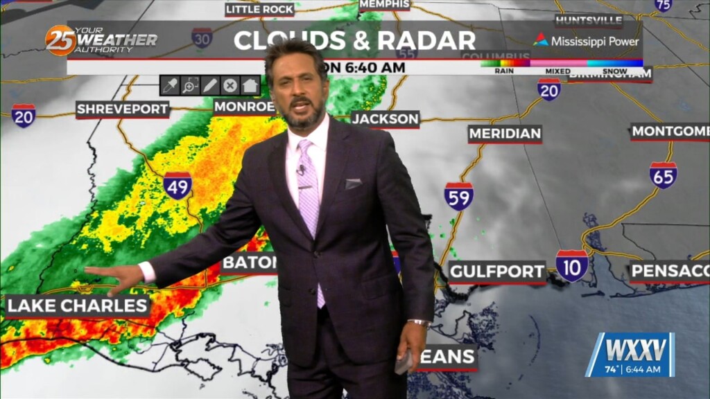
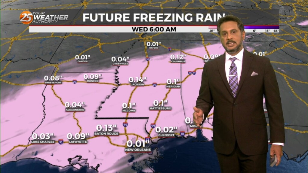
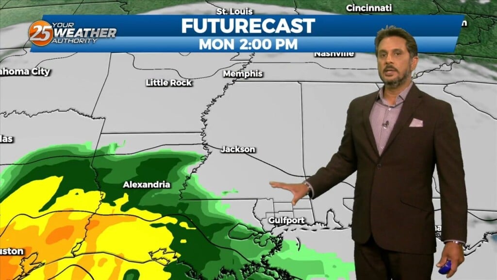
Expect a very active 24 to 48 hours in store with multiple impacts some of could bring severity to the area. Widespread moderate to heavy…
A large upper level disturbance encompasses about the northern half of the country, with relatively zonal flow across the southern half of the country. The next…
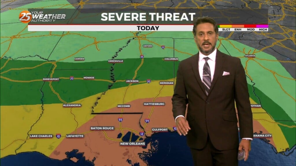
Heading into this afternoon, a severe storm may not even be a probability but a certainty for some areas. There will be a lot going…
A very progressive upper level wave pattern will keep things rather unsettled through the short term period as a series of disturbances pass…
The main focus is once again on the possibility of a light freeze in areas that may not have experienced a freeze, then on the…
The biggest forecast challenge in the short term is the temperature forecast and the threat of a light freeze for many areas that may have not seen…
Weak upper level high pressure is currently over the southern Gulf of Mexico with a weakness moving eastward through Kansas. A stronger disturbance was…
The general upper high pressure over the lower and middle Mississippi River Valley extends off the eastern seaboard. At the surface, high pressure was centered…
The current large scale pattern has an upper level closed low-pressure moving into the desert southwest and broad high pressure over the Caribbean, combining…
A departing surface high pressure will continue to induce light north to northeast flow, low Dew-points, and clear skies through this morning. Upper-level clouds will continue to…
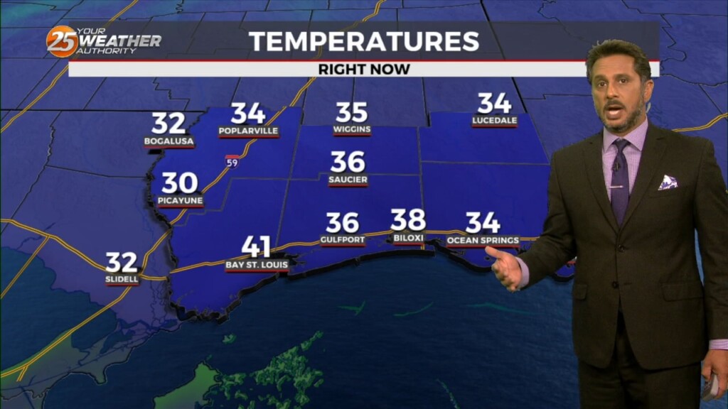
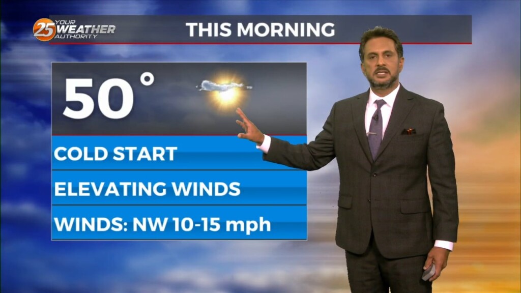
The winds will begin to relax from west to east across the region this morning. Along with clear skies and calmer winds, temperatures have dropped well…
High pressure centered off the South Carolina coast will continue to shift east today, with a return of southerly flow and an increase in…
It’s a warmer start this morning but still cold across the region. Surface flow will begin to transition today as the high continues to migrate east and…
The midweek upper disturbance is now over Florida with weak high pressure over Texas. A northern stream disturbance extends from Hudson Bay to Lake Superior to the…
High pressure has shifted well to the east of the area, with a weakness running from the Great Lakes to near Phoenix. At the surface, a…