
6/17 - The Chief's "Tropical Rain/T-Storms" Monday Morning Forecast
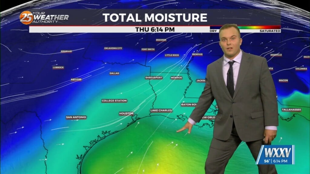
An area of high-pressure is currently centered over the Carolinas this morning, with a weakness along the southern plains. This is combining with the Central American flow to…
An area of high-pressure is currently centered over the Carolinas this morning, with a weakness along the southern plains. This is combining with the Central American flow to…
A cold front has a surface low-pressure system in Manitoba this morning with a front from there through Wisconsin to Missouri to around the…
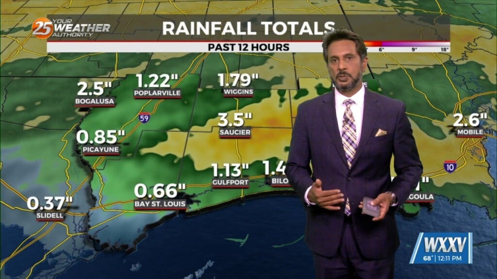
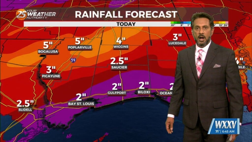
THREAT FOR HEAVY RAINFALL AND SEVERITY. The Flood Watch will remain as rainfall amounts are still coming in from 3 to 6 inches with the…
The upper flow is now supportive and subsequent lower level flows are also lining up to support the training of HEAVY RAINFALL. The first of 2 rounds…
A stable layer in the low-levels of the atmosphere is eroding, Which thus far has protected us so far, but this is currently leaving and…
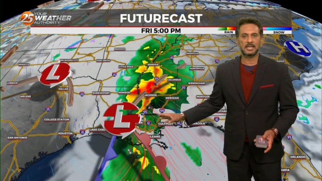
Expect increasing clouds and a mild start temperatures-wise for your Friday. While it will be rain-free at the start of the day, rain chances begin as soon…
Pleasant conditions will be around this evening but expect increasing clouds and a mild start for your Friday. The big focus becomes the potential for…
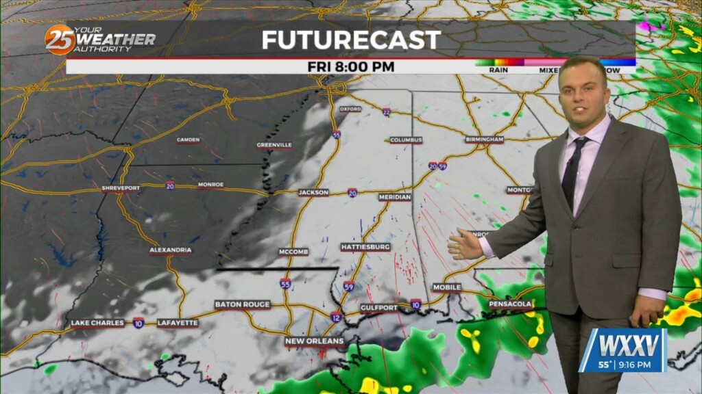
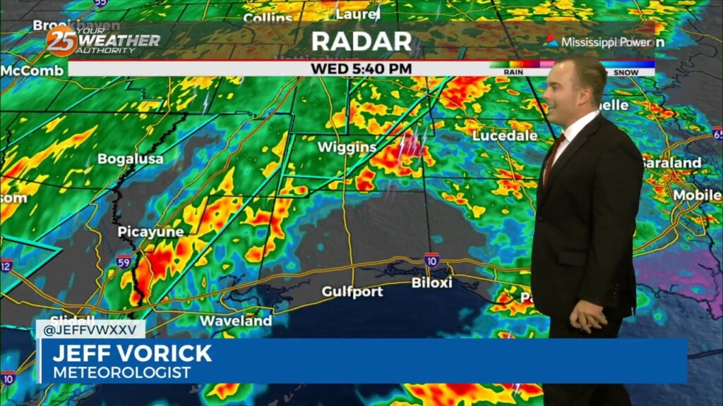
While there will be some dry time overnight, rounds of showers and thunderstorms will continue. Expect coverage of 40-60% on average with thunderstorms remaining below severe limits…

Coverage of rain in the form of showers and thunderstorms picks up this evening and you can expect thunderstorms capable of heavy rain overnight. Some thunderstorms…
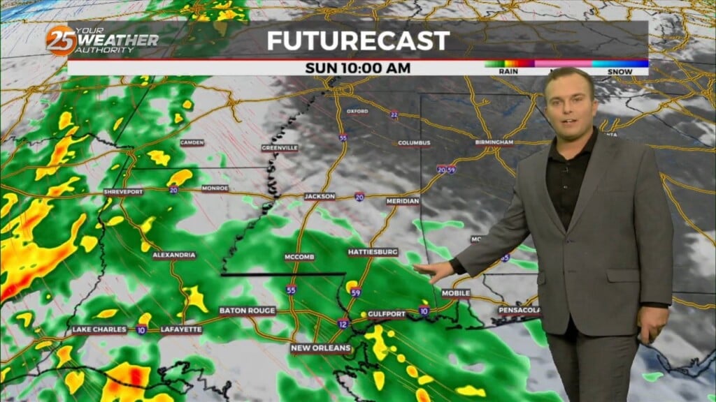
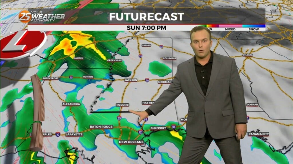
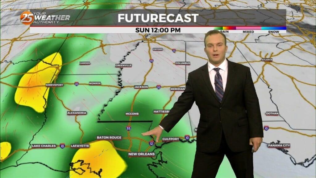
UNSETTLED is the word for the next several days. Heavy rainfall will tapper slowly through the day. Very few severe storms are expected with this…
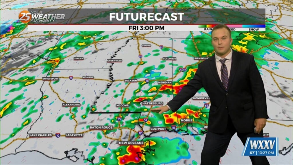
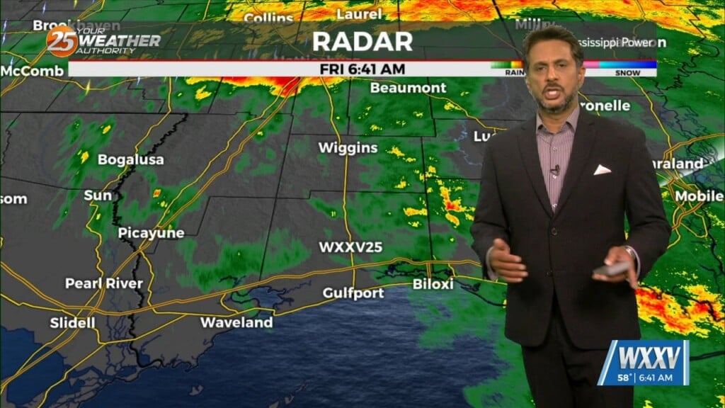
Rain will be moving into the area prior to sunrise Friday. Expect coverage of showers and embedded thunderstorms to peak during the morning hours, and rainfall to…
Cloudy skies remain into tonight and winds will begin to pick up. Moisture/humidity will be on the upswing ahead of the first of several disturbances that will…
A lovely day is ahead with mild temperatures and sunny skies. A few upper level non-rain producing clouds will move through from time…
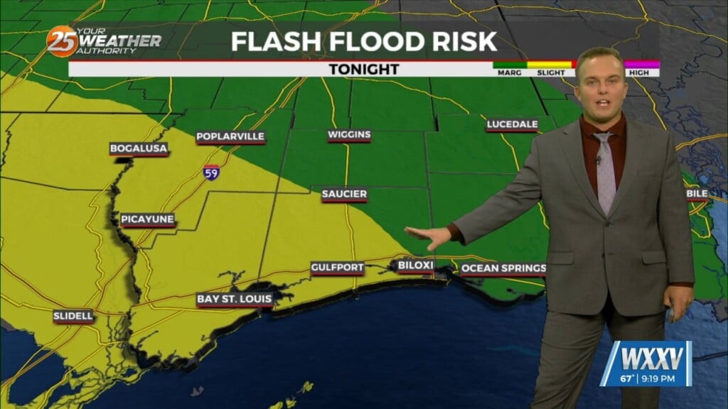
The primary concern through Saturday morning will be the threat of additional flash flooding from heavy rainfall and high rainfall rates. This concern is driven…
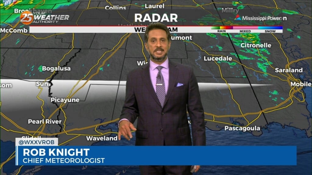
Isolated to widely scattered thunderstorms can be expected overnight. Sea fog will also create reduced visibility if you're not already finding it from rain. Coverage of rain will…
Rounds of heavy rain will very slowly come to an end tonight. Flash Flood Warnings are in effect for Pearl River County & Hancock County until…
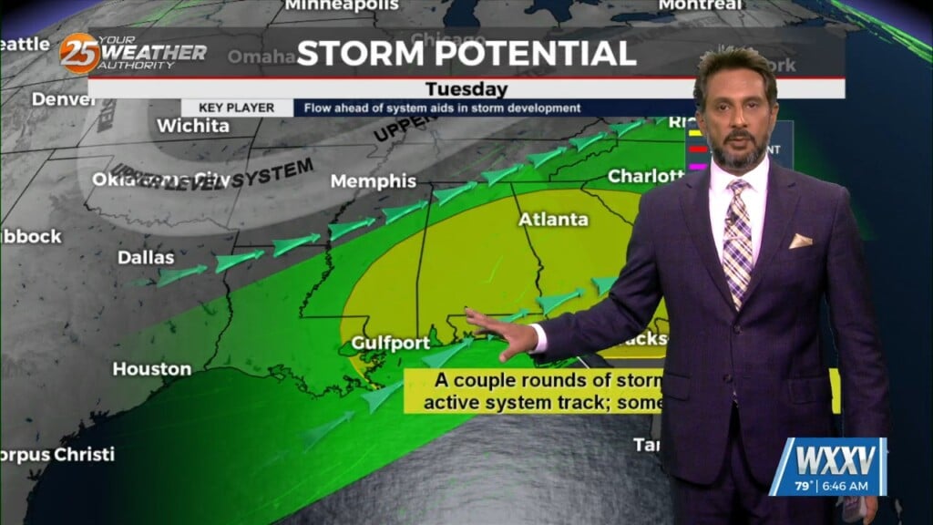
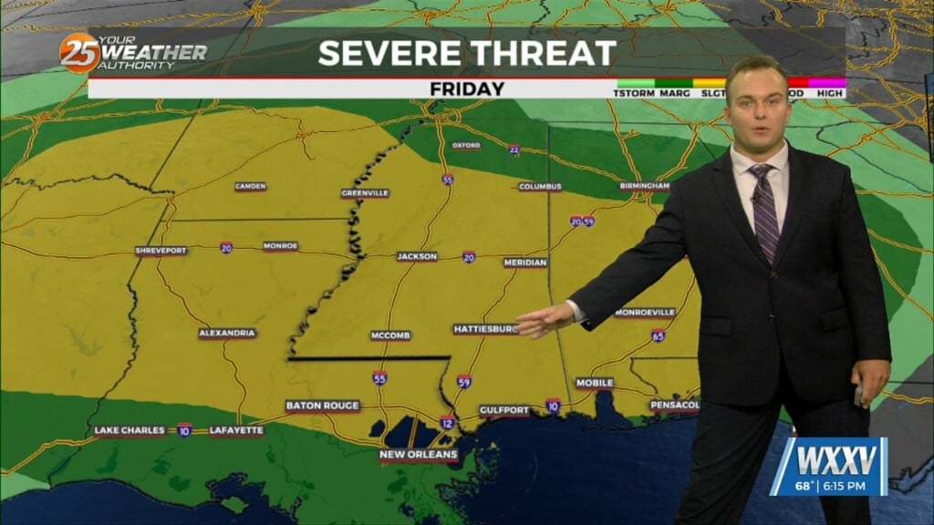
Expect a very active 24 to 48 hours in store with multiple impacts some of could bring severity to the area. Widespread moderate to heavy…
This afternoon will be rather quiet with cloud coverage and isolated rain later today and that along with some daytime warming should get…
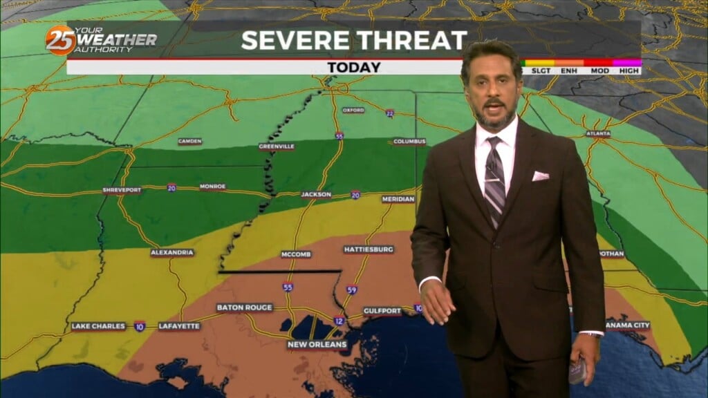
Heading into this afternoon, a severe storm may not even be a probability but a certainty for some areas. There will be a lot going…
I will try to keep things as simple and non-confusing as possible by keeping headlines to what is necessary and only ramping up to the highest…
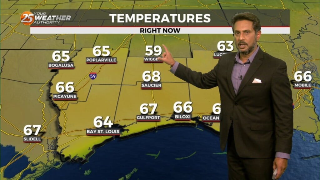
Saturday will start with mild temperatures and sunshine will be present through much of the day. Expect partly cloudy skies and breezy conditions at times but…
A stunning day will be capped off by a mild evening and overnight with upper-level clouds streaming in. Temperatures will mostly be in the 50s out the…
Temperatures will be more pleasant overnight with the pattern changing. Some spots along the beachfront may stay warmer than the 50-degree mark. Clouds will be around overnight…
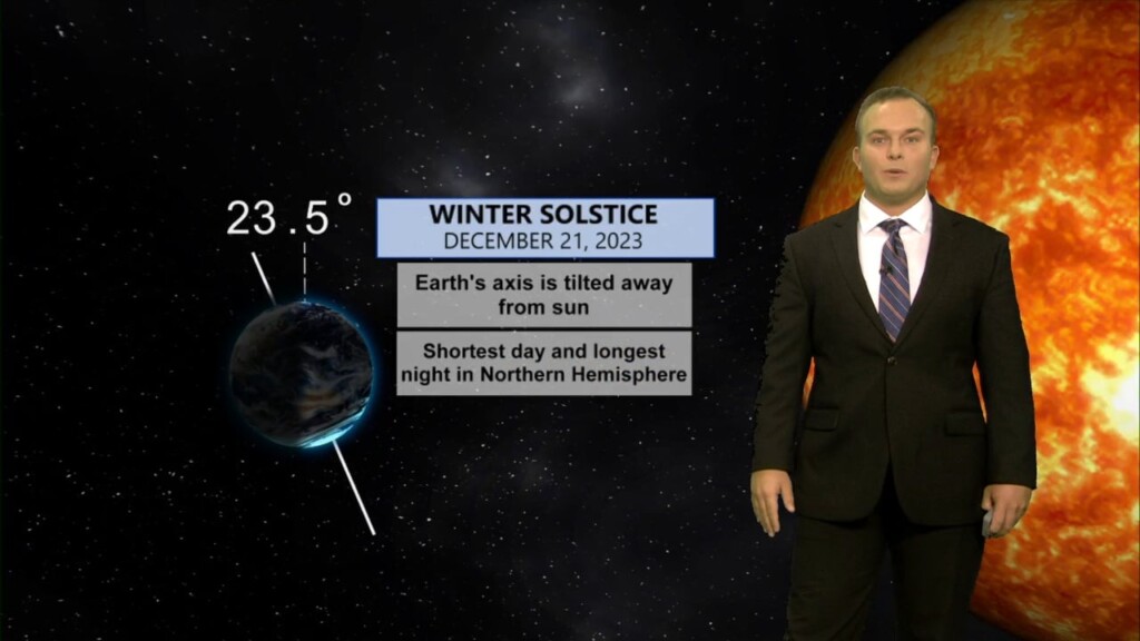
Winter begins at 9:27 PM. Tonight will feature some cloud cover and an overall milder feel. Temperatures will not be as cold as previous nights though with some…