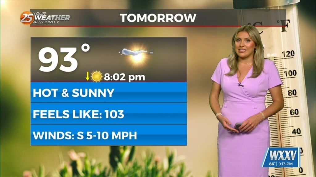
03/05 Ryan’s “Transitioning” Thursday Evening Forecast
The local weather will be transitioning after this morning’s front moved through. Cooler, drier air is moving in quickly, so expect rapidly clearing skies and falling temperatures. Tonight’s low will bottom out near 46 on the waterfront, but inland areas will fall into the lower 40s. So chilly, but no where near freezing.
Tomorrow afternoon improves dramatically from every other day this week!
Expect cloudless, sunny skies with an afternoon high near 66. Northerly winds keep it nice and dry, though these begin to shift south as early as Saturday evening. This sets up a familiar pattern, where clouds begin to gather by the start of the workweek after a nice weekend. It won’t be until Monday that significant cloud cover arrives, but rain arrives shortly after.


Leave a Reply