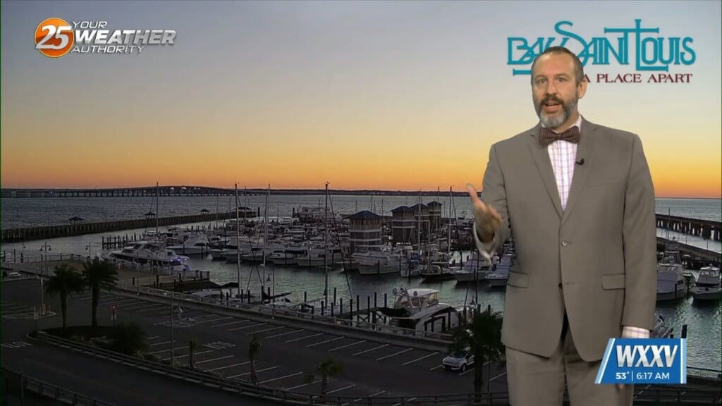
11/15 Ryan's "Finally Fall" Friday Morning Forecast
Things are finally going to feel like fall after a warm, dry October and a quite humid first couple of weeks of November! Yesterday's front has lows down into…
Things are finally going to feel like fall after a warm, dry October and a quite humid first couple of weeks of November! Yesterday's front has lows down into…
Feels-like temperatures in South Mississippi on Monday were well over 100 degrees, with many more days of extreme heat on the way. This can be concerning for families, especially…
Skies will clear out for the most part tonight while temperatures remain cool if not chilly. Lighter winds and the clearer skies will yield efficient cooling so…
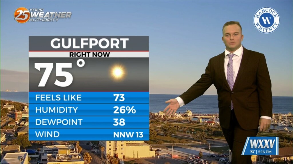
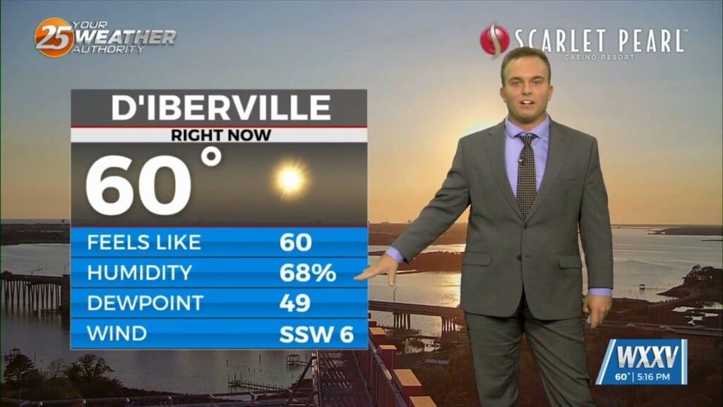
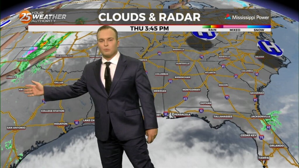
Friday featured a warm one for the Mississippi Coast as Gulfport Biloxi International Airport recorded a record high temperature. Winds back off this evening and any remaining clouds…
It will be cool but much less cold as compared to last night. Some patches of dense fog will develop across the Mississippi Coast ahead of daybreak…
Temperatures will be cool but fairly pleasant this evening as the colder pattern loosens its grip. As we get into the overnight hours, there will be the possibility…

Thursday starts off cool/chilly but it will be milder than the last couple of mornings. Cloud cover will be around through the day tomorrow as an active…
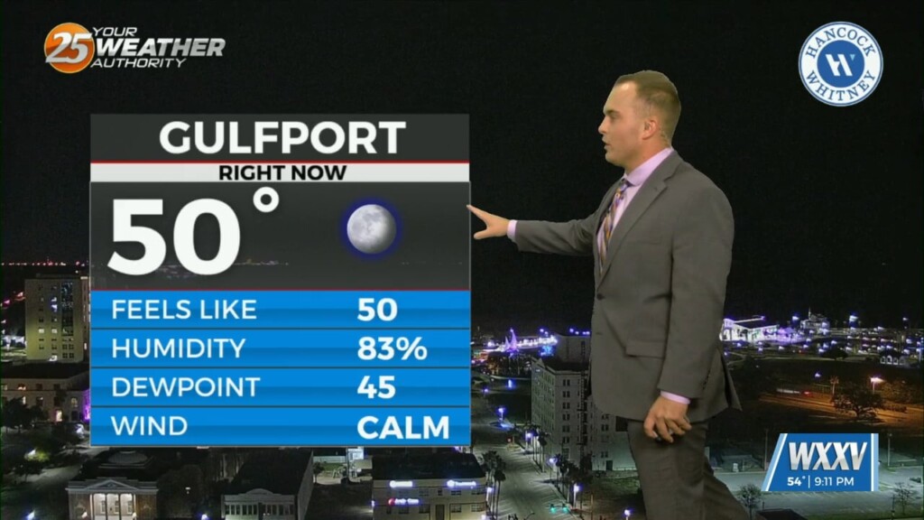
Relatively nice conditions we experienced this afternoon will give way to a cool evening. Temperatures overnight will not be as chilly as this morning and winds will be…
Temperatures overnight will be slightly below average so it will be chilly to start Ash Wednesday/Valentine's Day. Expect a few clouds to partly cloudy skies Wednesday as an active…
Expect temperatures to drop fairly quickly this evening as winds relax and skies remain mainly clear. It will be chilly if you have any remaining Mardi Gras…
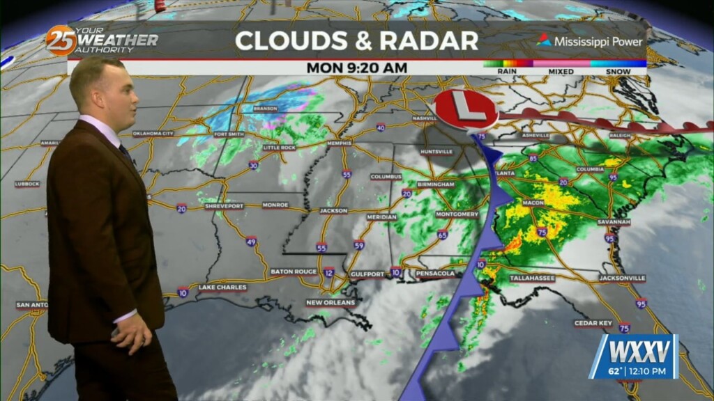
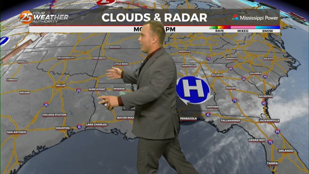
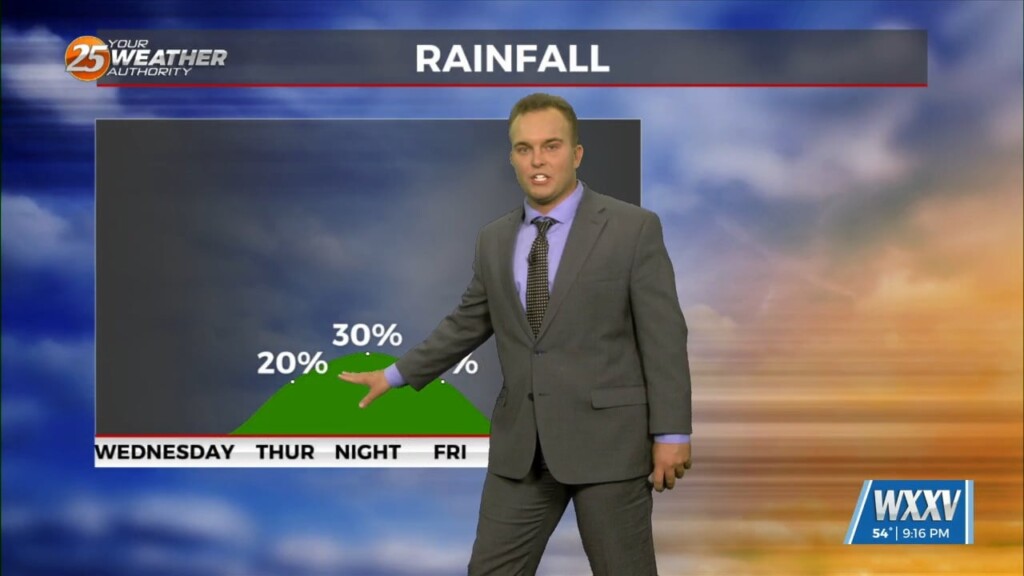
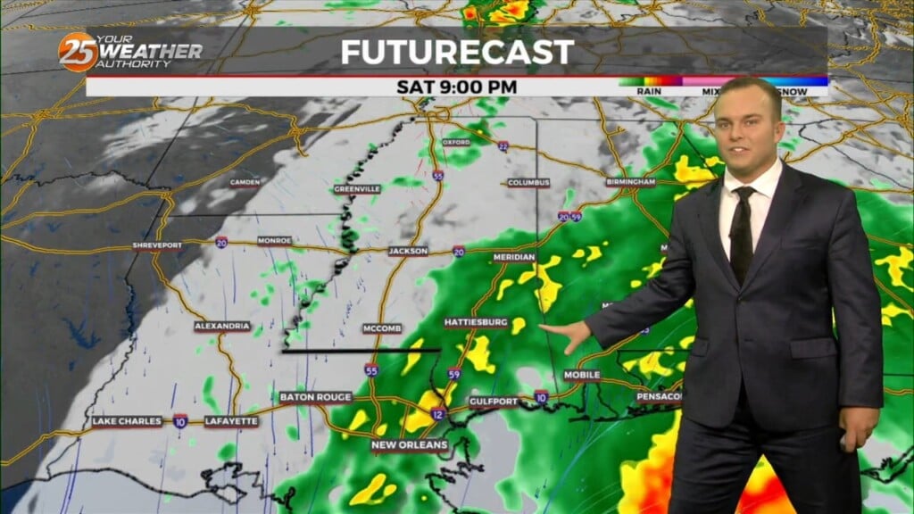
A cold front moved through the area this morning which brought an end to the rainfall. This afternoon, some sunshine will emerge but the main concern…
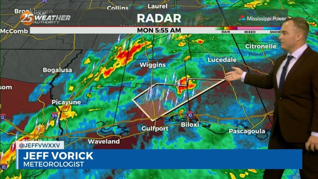
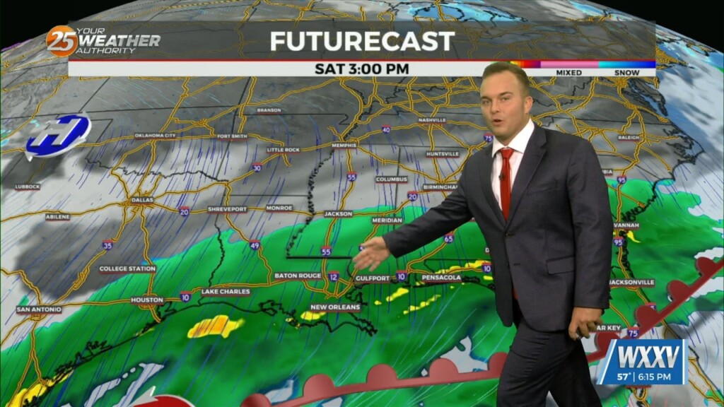
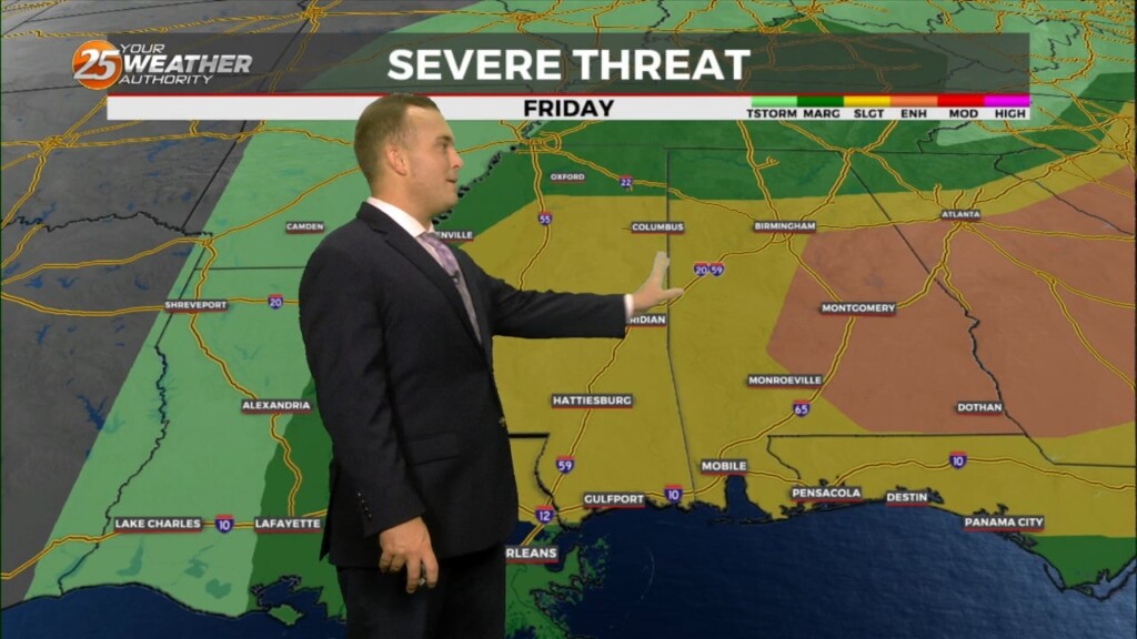
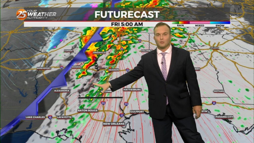
The threat of severe weather will come to an end this morning and the Tornado Watch for Stone, Jackson, Harrison, & George County will be…
Skies gradually clear out overnight and there will be the possibility of patches of light fog out the door tomorrow morning. Fog and clouds dissipate rapidly…
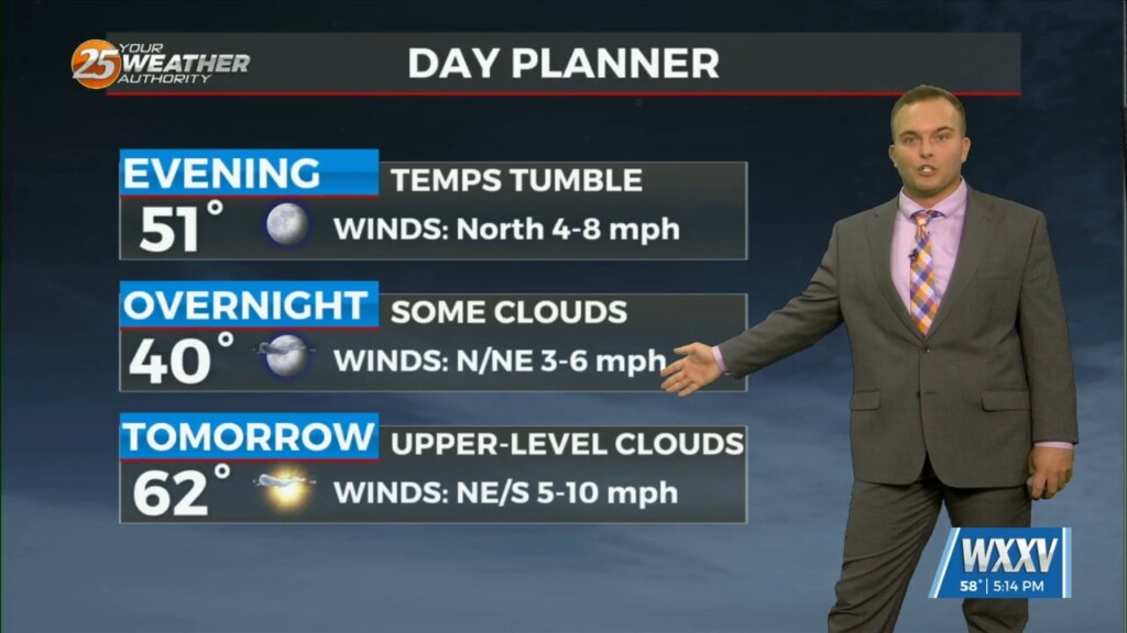
It remains quiet this evening as upper-level cirrus clouds continue to stream in. Skies will clear out overnight which could lead to the…
Temperatures will be colder overnight compared to what we started with Wednesday. Clouds will increase tonight into tomorrow as an active branch of the jet stream will stream…
After a warm afternoon, temperatures will drop pretty quick this evening. Clouds increase overnight and temperatures will bottom out just below seasonal averages with 30s inland and…
A weak cold front, packing no moisture and only a wind shift, makes it through our area overnight. Winds will turn to a north/northwesterly origin and become…
Pleasant and cool conditions this evening will give way to winds picking up in the wake of a cold front overnight. This front will be lacking…
It will be slightly less cold overnight and along with that, some clouds will move in and winds will be fairly light out of the…
Some clouds begin to move in tonight and winds are gradually shifting direction. However, temperatures will still end up being cold overnight albeit not as frigid…
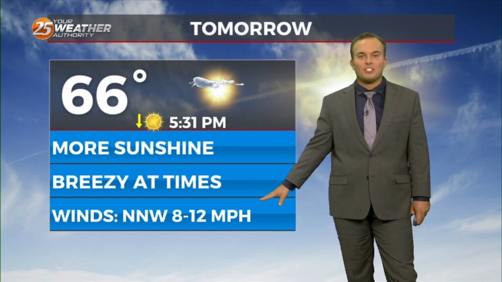
Partly cloudy skies and breezy conditions remain overnight. Temperatures will be fairly mild compared to earlier this week. Friday will feature more sunshine and windy conditions at times.…
Cloudy skies this evening will clear out somewhat overnight while winds will remain elevated. Expect mild temperatures out the door for your Friday while winds will…
Winds remaining a factor overnight and increasing cloud cover will help keep temperatures milder with about 5 degree warmer readings to start your Thursday. For tomorrow, expect…
Breezy conditions will subside somewhat this evening while partly cloudy skies are expected overnight. Temperatures will be milder with generally 40s across South Mississippi. Thin upper-level clouds…