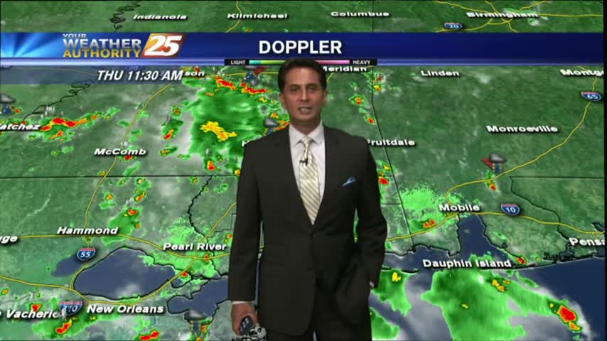
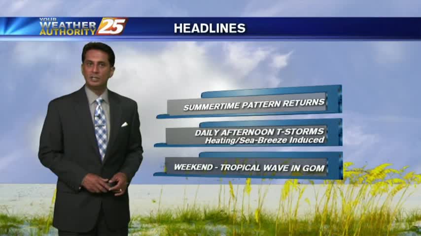
7/13 - Rob's "Midday News" Afternoon Forecast
Showers have been hugging the coast since prior to sunrise...with the activity moving onshore, continuing to develop...
Showers have been hugging the coast since prior to sunrise...with the activity moving onshore, continuing to develop...
Another warm/humid start to the day with overnight showers/t-storms over the n'tern GOM/Sound moving north into the Southern 6...
Isolated showers/t-storms have been moving in since midnight and will continue through much of today...
A warm/humid start to the day with isolated showers south of the barriers moving NE and developing into t-storms...
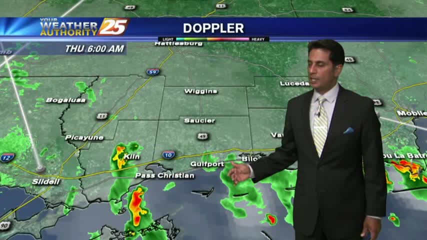
After a cooler and dry Sunday morning the moisture flow is back in the area. Currently under rain-free conditions, poised to change later this morning...
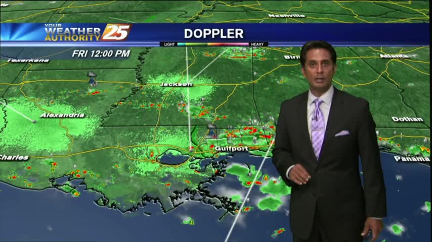
After overnight and early morning activity over the sound, showers/t-storms continue to flare-up along the viewing area...
Another warm/humid start to the day along with isolated showers developing over the sound moving north...
The fireworks went off without any issues from mother nature last night, but the pattern will begin to change...
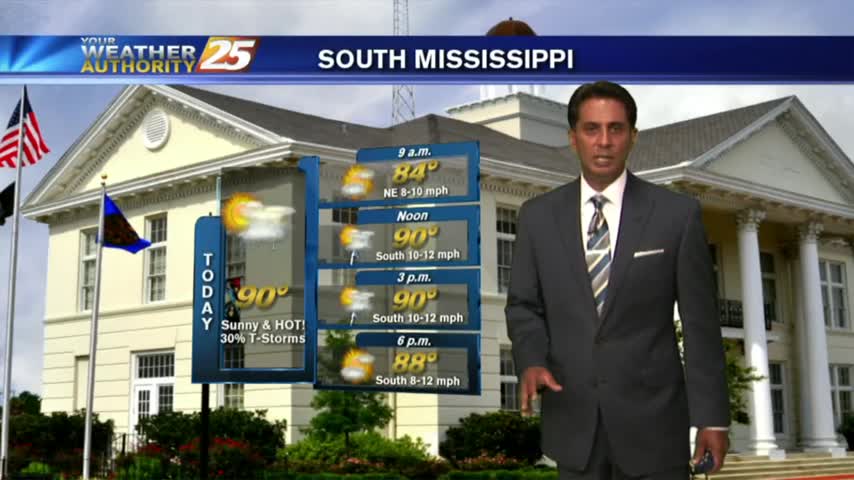
A warm/humid start to the day/workweek with DANGEROUS HEAT INDICES to affect the Mississippi Gulf coast...

After a rain-free start to the day, minimal activity has been popping up along the Southern 6/northern Gulf of Mexico...
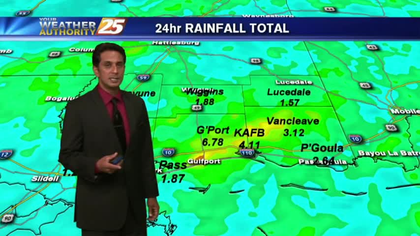
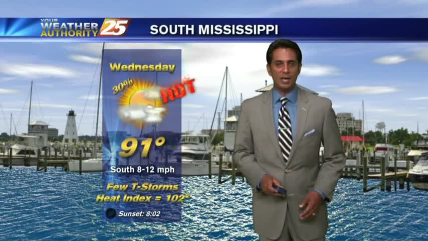
After torrential rainfall yesterday with as much as 6" of accumulation, it's a drier (rain-free) start to the final day of June. ..
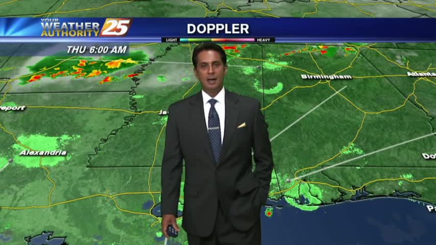
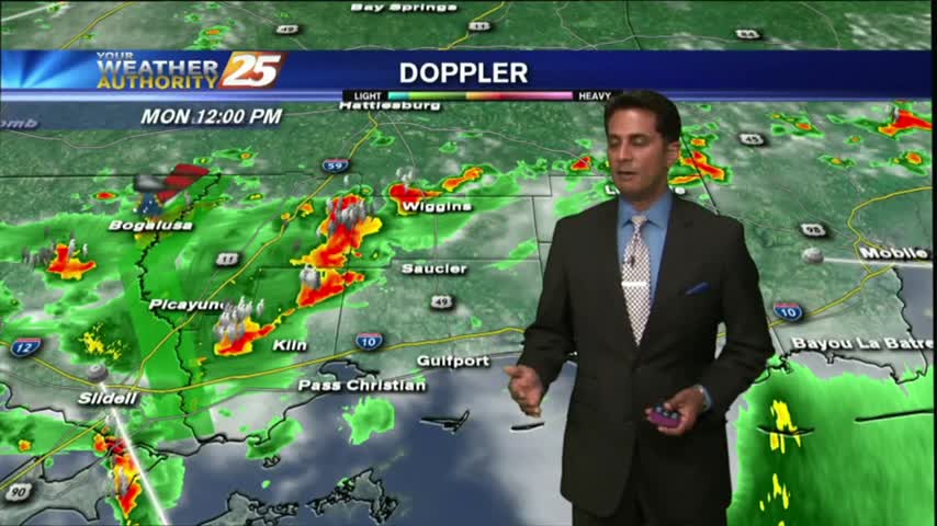
HEAVY RAINFALL has been in the area since last night...and will continue though tonight as a FLASH FLOOD watch continues...
After a couple of dry days with very low humidity, the moisture flow has begun with rain moving in from the south...
Skies are mostly cloudy with a mild start to the day as lower humidity continues across the region...
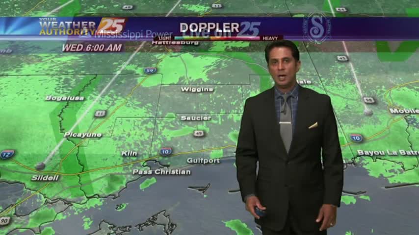
It's a much DRIER start to the day as a weak cold front moved through the area overnight...now stalled over the sound/N'tern Gulf of Mexico.
After a rain-free start to the day...isolated activity to the west is moving east and into the viewing area...
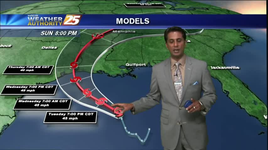
As the remains of CINDY moves through Arkansas, the moisture flow continues to bring bands of showers to the area...
HEAVY RAIN has tapered-off quite a bit but the activity is still in the area with several watches/warnings still in effect...
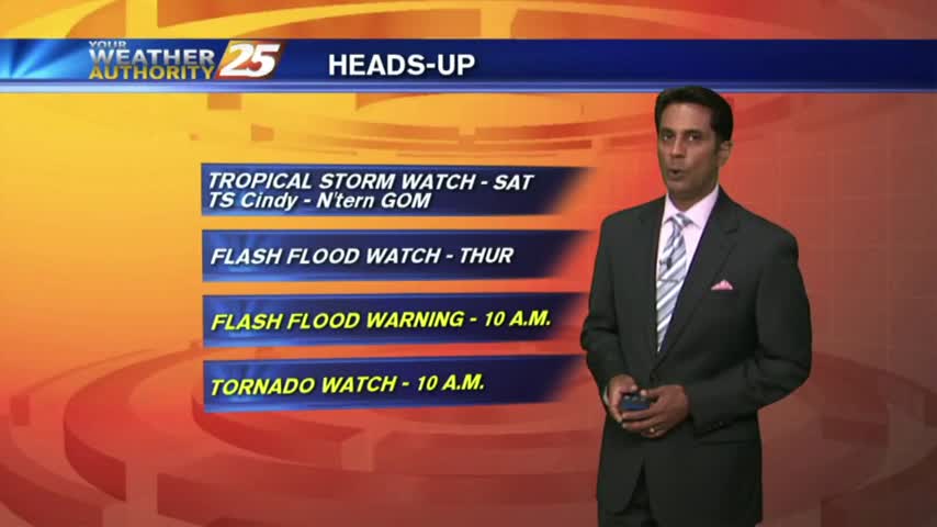
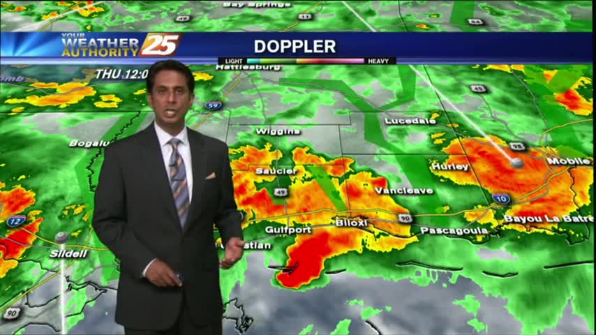
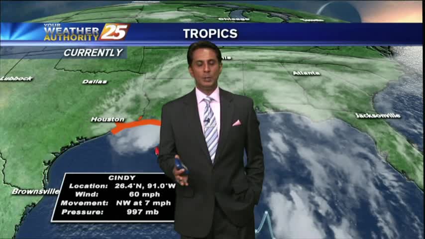
A BUMPY start to the day with HEAVY RAIN...and a TORNADO WATCH. TROPICAL STORM effect will continue...
Light to moderate rainfall has been in the area since prior to sunrise and will continue through the duration of this event!
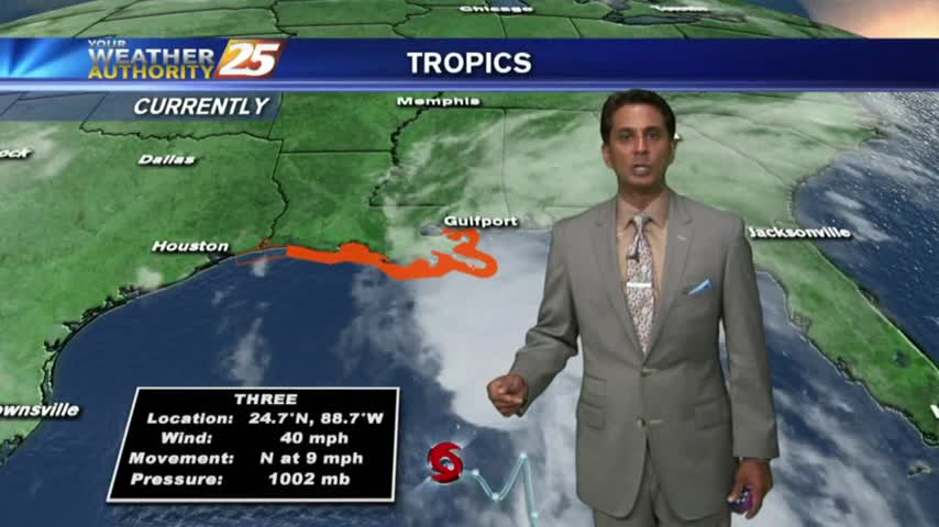
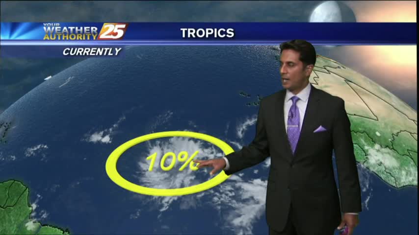
It's a warm/humid start with rain moving in from the SE, with TD #3 in the central Gulf of Mexico...
Another warm & humid start to the day as ALL EYES continue to focus on a DEVELOPING TROPICAL system in the W'tern Caribbean...
Overnight t-storms dissipated prior to sunrise but have redeveloped once again...
After a brief period of sunny skies and low humidity, a very TROPICAL AIR MASS is back in the region with showers/t-storms moving in