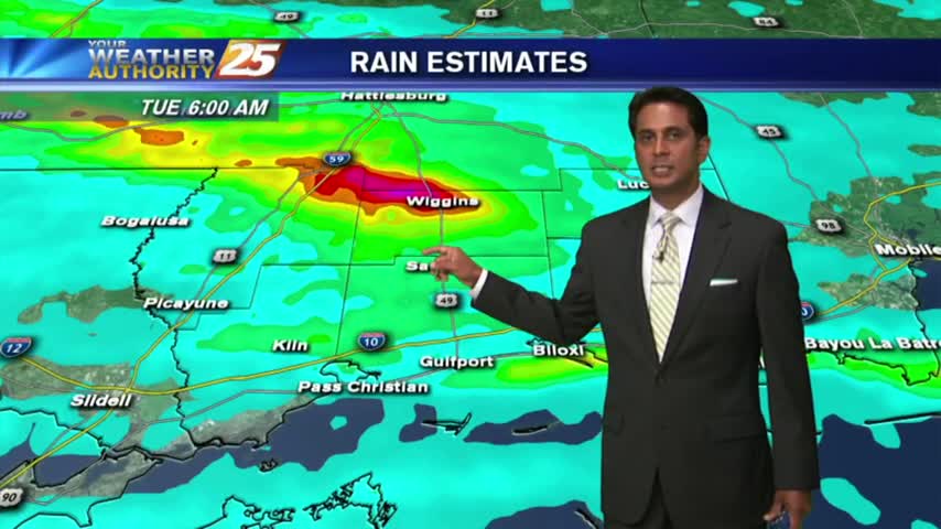
8/15 - Rob's "Heavy Rain Potential" Tuesday Forecast
Naturally...it's a WARM/HUMID start to the day as showers/t-storms to the south begin to develop and move into the area...
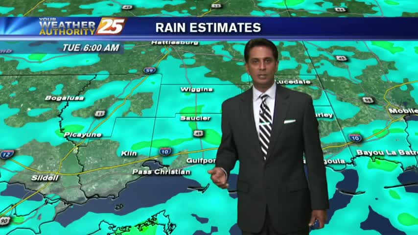
Naturally...it's a WARM/HUMID start to the day as showers/t-storms to the south begin to develop and move into the area...

A WARM morning along the Gulf Coast as showers/t-storms are beginning to move in from the south...

As the very tropical air mass continues to dominate the region, isolated showers/t-storms are moving in from the south...
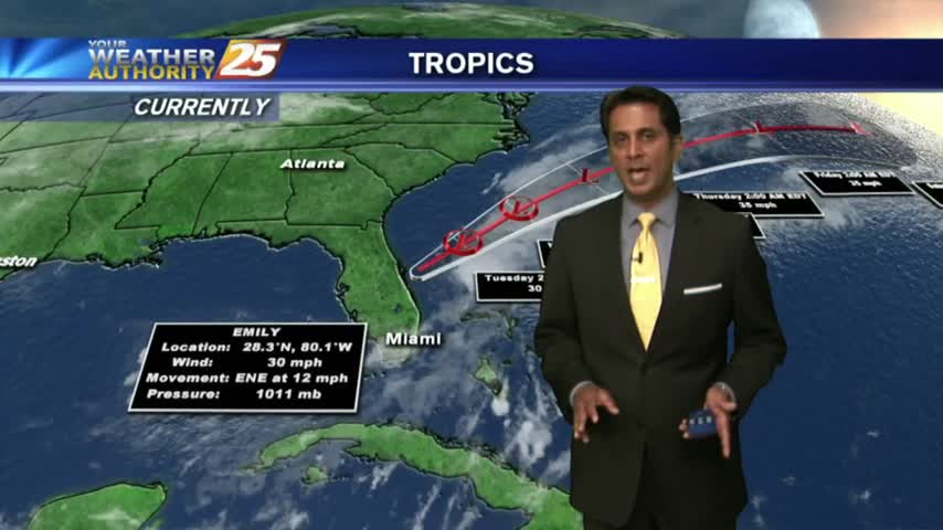
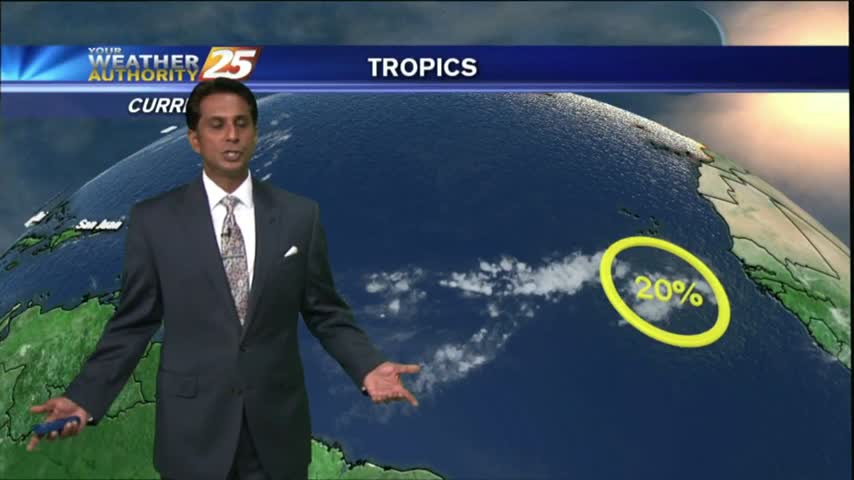
As TS Franklin moves west across the bay of Campeche, it's a warm/humid start to the day with light rain moving in from the GOM.

As we continue to keep an eye on TS FRANKLIN moving across the Yucatan peninsula, a VERY TROPICAL air mass continues to dominate the region...

After clear skies overnight, the clouds along with isolated showers are moving in from the south...
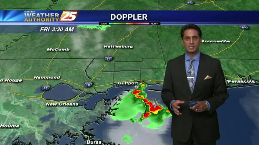
As the majority of energy stayed south yesterday, the activity has moved into south Mississippi this morning...
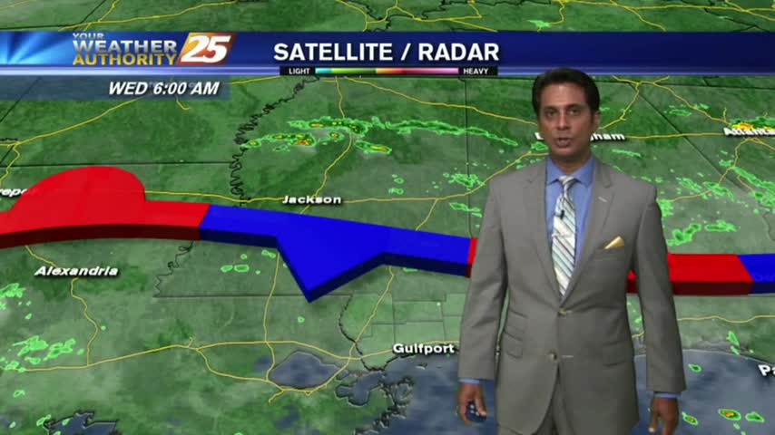
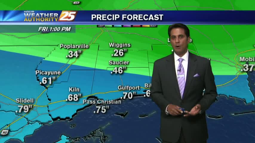
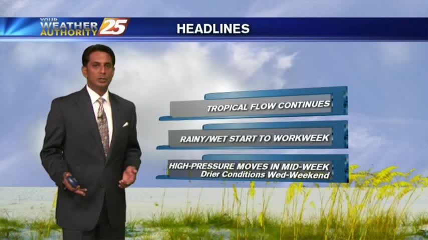
A quasi-stationary front will move into the area from the central Gulf of Mexico later this evening...the WET PATTERN will begin.
A more humid start to the day with partly/mostly cloudy skies moving in from the west...
A pleasant start to the day with several reporting sites in the mid/upper 60s, under clear skies...
Another warm start to the day with HOT & HUMID conditions. Changes are expected through the final weekend of July with an approaching cold front...
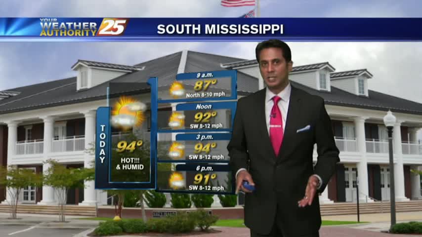
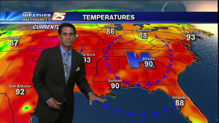
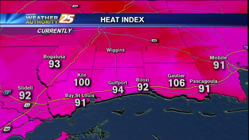
Skies continue to be clear as the mercury climbs into the low/mid 90s...but feels SO MUCH hotter with the heat index.

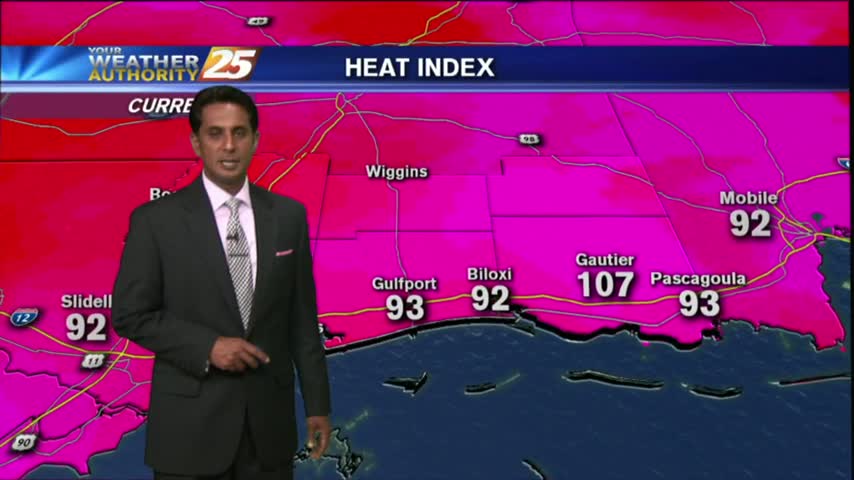
Another warm and humid start to the day, but rain-free. DANGEROUS HEAT will be in the region through Friday evening...
After a rain-free start to the day, HOT and HUMID conditions are along the Mississippi Gulf Coast...

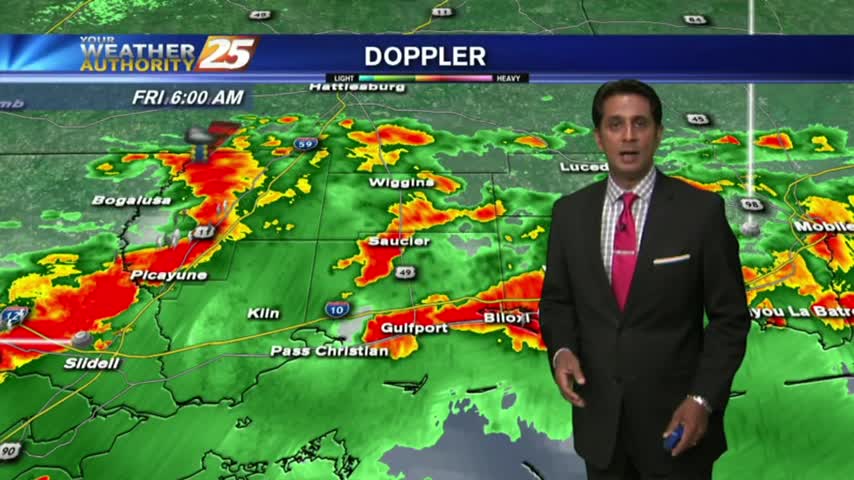
After very WET conditions the past few days, a drier patter is beginning to move into the region which will dominate through the rest of the workweek...
A DRIER start to the day but similar to yesterday, activity will develop and move across the viewing area from west to east...

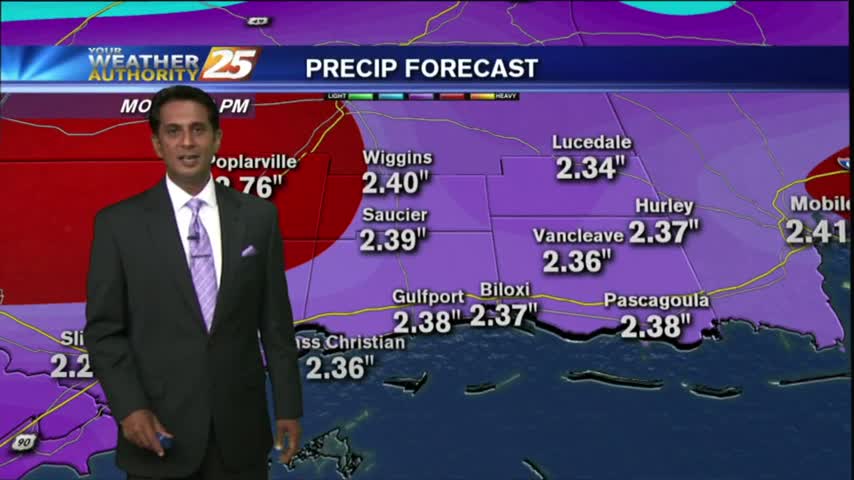
Overnight showers/t-storms continue to affect the viewing area as we kick off the workweek...
This morning brought partly cloudy skies to the area with isolated t-storms to the south. With daytime heating, the activity will develop on shore this afternoon...
A warm and humid start to the day/weekend with isolated activity to the south over the sound/northern Gulf...
After a rain-free and clear start to the day, heating and moisture flow has triggered a few clouds along the coastal counties.
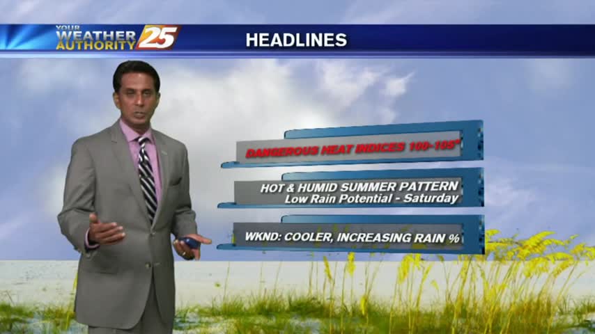
A warm and humid start to the day...but rain-free. MAIN CONCERNS today through the weekend will be DANGEROUS HEAT INDICES...

As with the past couple of weeks, overnight activity over the water is moving north into the coastal counties...

As the tropical air mass continues to dominate the region, showers/t-storms from last night continues to move in from the south...
Another morning with showers/t-storms over the sound/northern Gulf of Mexico moving into the Southern 6...