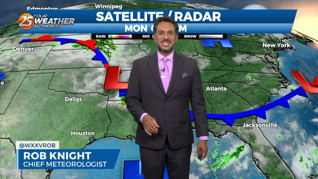
9/11 - The Chief's "Hot & Humid Flow Returns" Monday Morning Forecast
Upper level high pressure is currently entered over the Gulf of California extending northward through the northern Rockies. Weakness extended from the Appalachians into…
Upper level high pressure is currently entered over the Gulf of California extending northward through the northern Rockies. Weakness extended from the Appalachians into…
High Pressure continues to be centered near El Paso, Texas this morning, extending northward through the Plains States. At the surface, high pressure was centered over…
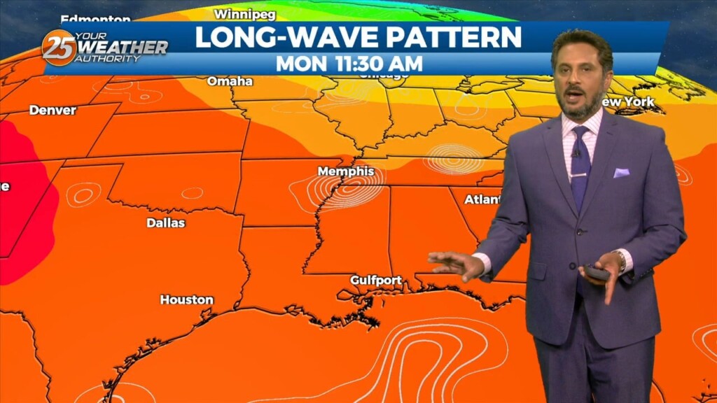
As we head toward the equinox, the upper pattern is becoming more active across the northern half of the US. Upper level high pressure was noted…
Confidence in the forecast/conditions continues to take hits as convection is just not developing like initially anticipated. Even with the arrival of rich low-level moisture and…
The stubborn high pressure continues to remain centered over the I-35 corridor from Kansas through much of north and central Texas this morning.…
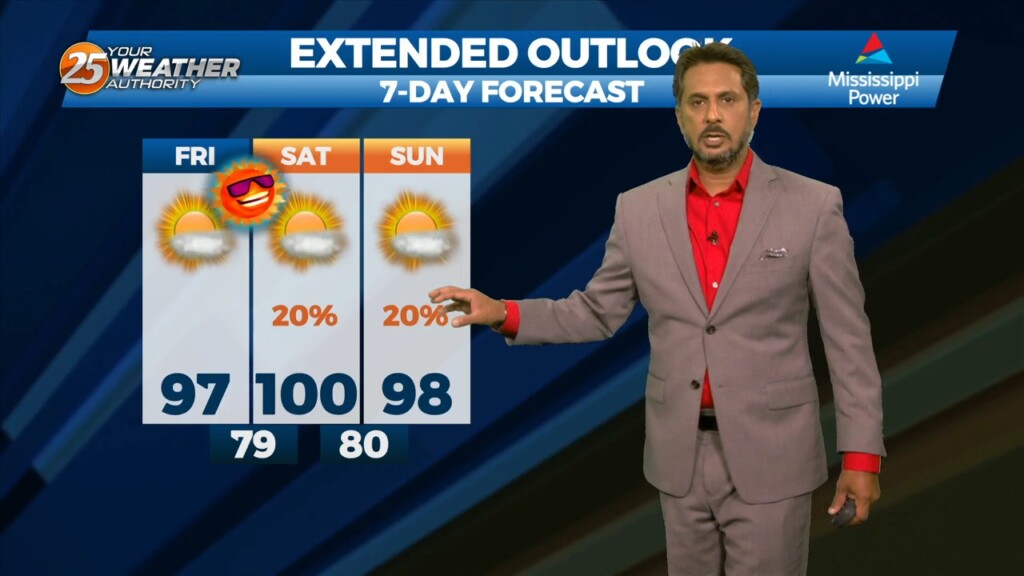
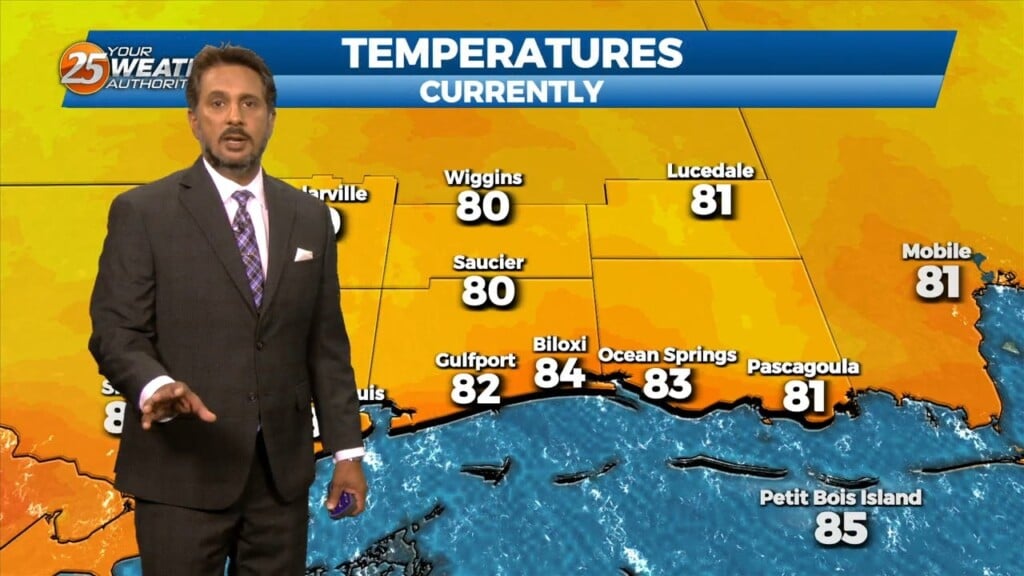
Yet another hot day is anticipated across the central Gulf region today as high pressure remains situated to our north with a general…
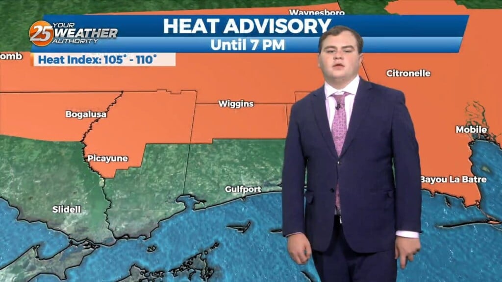
An EXCESSIVE HEAT warning is in effect as this OPPRESSIVE summertime pattern continues. An easterly wave is currently located from Appalachia Bay FL down…
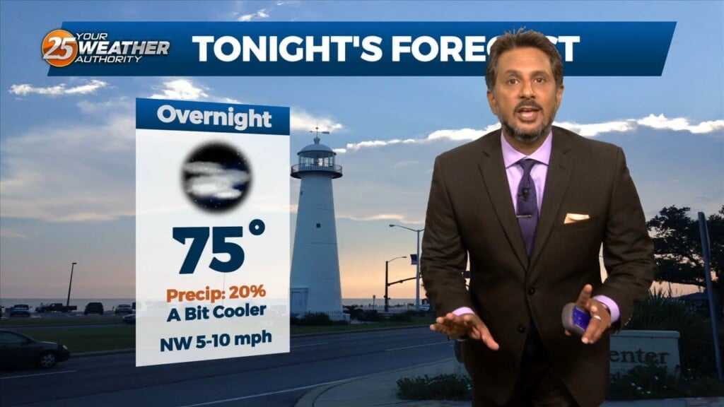
The nice "cooler" temps yesterday were courtesy of the tropical wave that became TS Harold. The back end of this is exiting stage left for us…
Upper high pressure centered near Kansas City this morning, with an easterly wave over the central Gulf of Mexico. Very isolated showers and a thunderstorm or…
A strong upper disturbance is near Chicago early this afternoon, extending southwest to near Oklahoma City. At the surface, a cool (NOT COLD) front extended from…
A strong upper disturbance is near Chicago early this morning, extending southwest to near Oklahoma City. At the surface, a cool (NOT COLD) front…
High pressure continues to be centered near the Texas-Louisiana border, with a cold front moving into the lower Tennessee valley this morning. The front is expected…
Earlier this morning, the MCS continues to decay as it moves south of our marine waters. Expect a few more isolated showers or storms…
The pattern has change slightly as the cold front overhead dissipated overnight. The lower dew-points will remain with us as drier air will once again…
A stalled stationary front just north will push south by early afternoon bringing subtle (nice) changes. This will also keep most activity over the marine areas…

Some light showers continue across the area, mainly near the coast and over the coastal waters…with more of the same on tap for today. We will…
Spotty Showers continue through the area this morning, as radar is indicating activity in the vicinity. This activity will continue through this morning with the activity…
Outflow boundary is firing new cells this morning where it meets the surface front just to the N/NW of our area. Stability should begin to increase over…
A few scattered showers have developed across the region early this morning, which will continue to develop into t-storms as we progresses towards midday. Today looks…
There is plenty to talk about in the first 24-48 hours with a challenging forecast ahead. An impulse riding SE along a stationary front to the…
A blocking pattern remains across the eastern half of the country with an upper ridge over the Great Lakes. Yesterday’s double barreled upper low, as expected, has…
Showers and a few thunderstorms continue over portions of the Gulf waters this morning. This area is also the most favored for convection a disturbance south…
Under a further amplifying disturbance, the region will remain on the dry side of this feature. The best lift and instability will be through the Gulf South.…
Some weak marine convection has developed near and east of the mouth of the MS River this morning. A few lightning strikes have occurred, but…