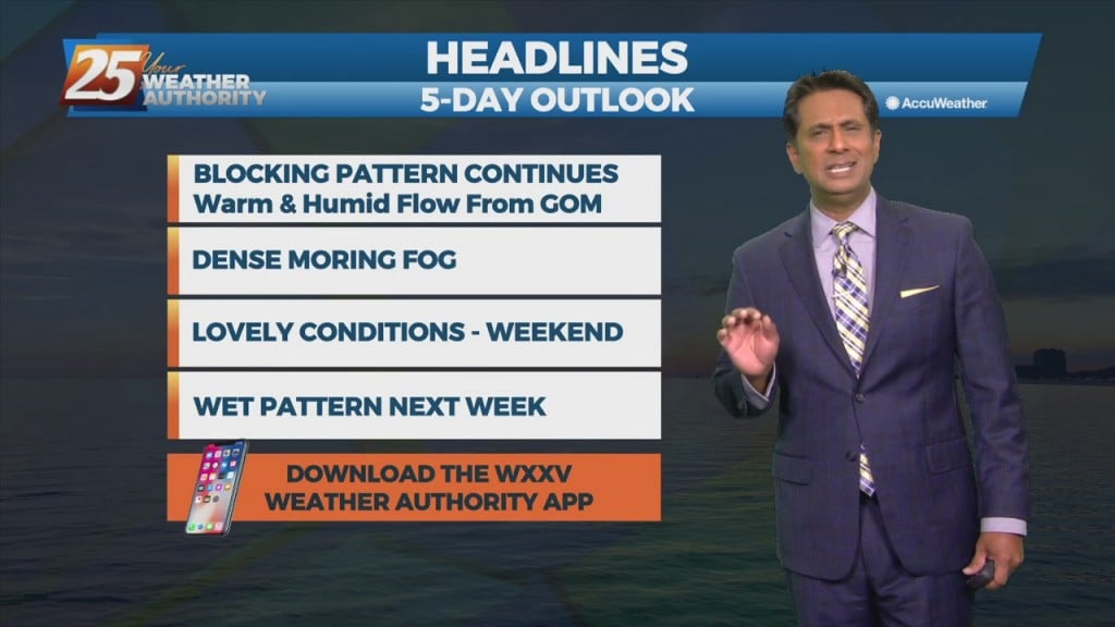
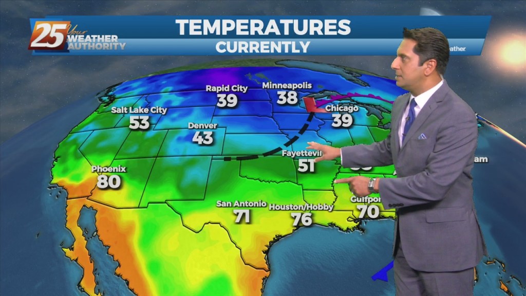
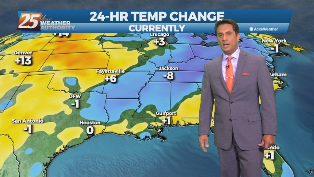
12/2 - Rob Knight's "VERY WARM" Thursday Afternoon Forecast
Not much change in forecast parameters for the next 24 hours, with fog threat being rather high again overnight tonight. There should be enough air movement Friday…
Not much change in forecast parameters for the next 24 hours, with fog threat being rather high again overnight tonight. There should be enough air movement Friday…
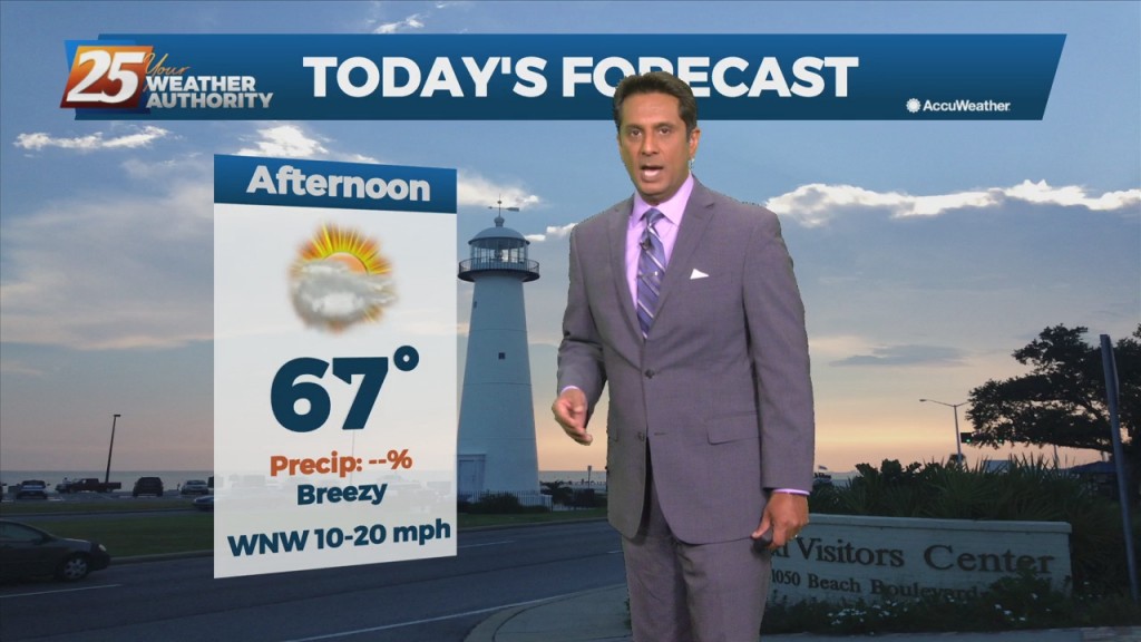
A west-northwestly flow will remain in place through the next 36 hours while an upper level disturbance moves through the upper and middle MS Valley today. Upper level…
As the warmer air begins to move into the area, fog will be a concern over the next few successive nights as conditions begin to strongly support…
The pattern will put the area in a region dominated by high-pressure. So a quiet weather pattern with slowly moderating temps expected through midweek. Guidance is generally in good…
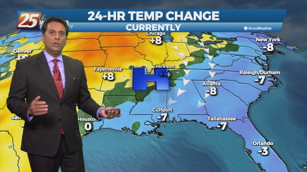
Winds are gusting to around 20 mph and will continue to stay elevated through this evening. The story for tonight will be the near freezing temperatures for areas…
Rapidly increasing temperatures today will jump by several degrees along with increasing cloudiness. Low level moisture will also begin to return as a cold front to the…
Clear skies and high-pressure to the north will shape the forecast though Wednesday evening. Colder and drier air mass will begin to modify later today with the…
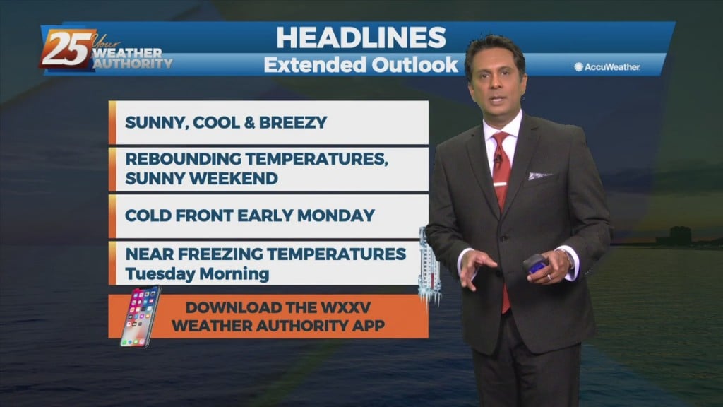
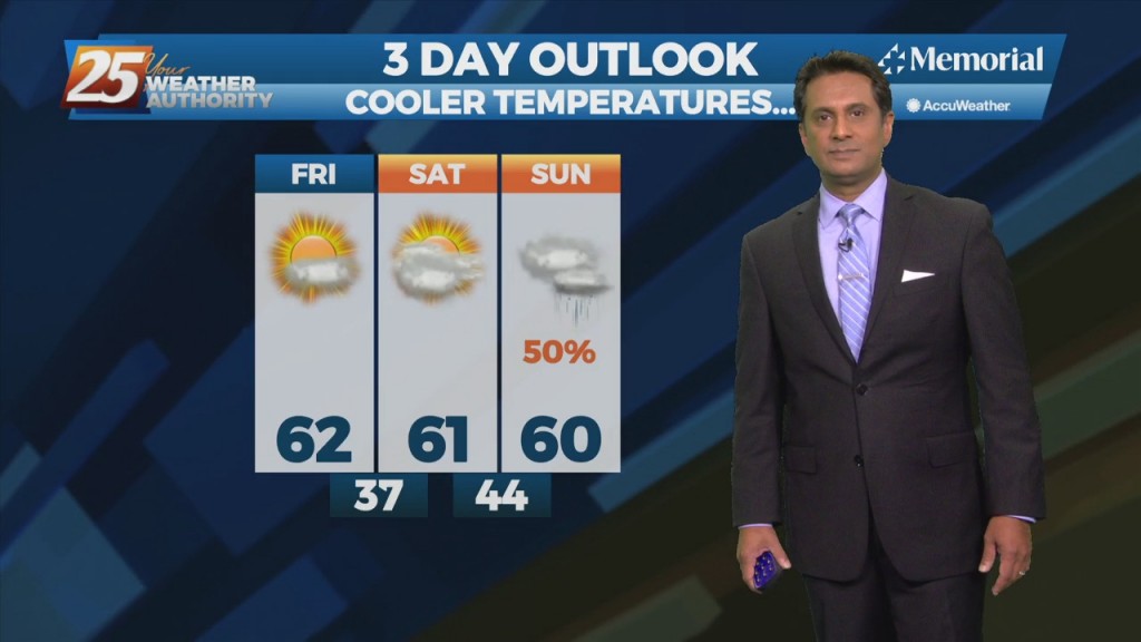
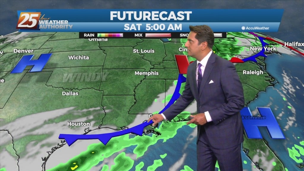
Breezy conditions behind last night's cold front will gradually diminish later in the evening. Low temperatures tonight into Saturday morning will be the coolest of the short term,…
Rain chances will gradually decrease through this afternoon as a cold front moves east. An increase in northeasterly flow will become breezy this evening through Friday evening. Much…
HOT temperatures this afternoon then our attention shifts to the west as our next cold front approaches early Thursday. A few light showers may develop Wednesday night…
Surface moisture flow will gradually in advance of the next pressure system. Tonight, the area will see more in the way of DENSE FOG with potentially an…
Today and Tuesday will bring sunny skies and light winds as highs/lows each day becoming a few degrees warmer than previous days. Thursday, an upper level disturbance…
Another upper-level disturbance to the NW will move through tonight with a reinforcing shot of cooler/drier air mass through the region. Upper level high-pressure over the southeastern states…
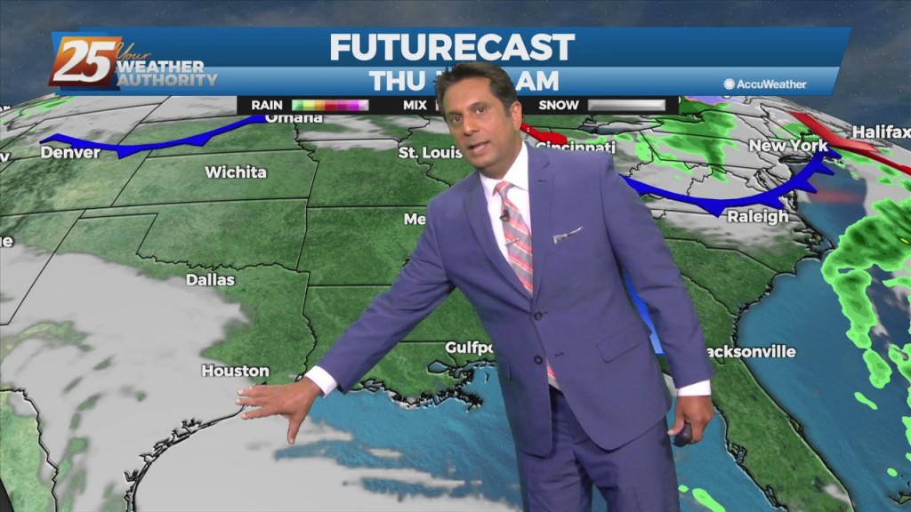
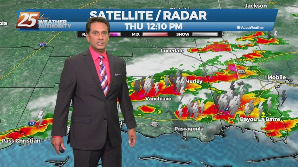
A cold front west will quickly sweep through our area Thursday, it will be accompanied by a few showers and thunderstorms. Moisture and instability is limited and unfavorable for any extremely heavy rainfall but it cannot be ruled out. Also…
A cold front from the west will move SE. As a blow-up in activity is expected in the NE GOM, our area will see light rain. A…
A lovely afternoon ahead with plenty of sunshine. A cold front will move through the area Wednesday night into Thursday morning bringing a continuation of dry weather…
Cloud cover has been tricky to forecast as there have been large patches of solid cloud cover intermixed with clear areas. Overall, these intervals of clouds and clear skies…
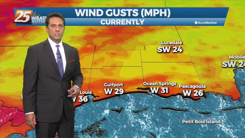
Windy conditions will remain in place today with winds sustained near 25 mph through tonight. A Wind Advisory is in effect for the entire area until 7 PM. An…
A cold front will continue east with a line of convection ahead of it by early to mid-afternoon. While the very warm and moist airmass is expected to…
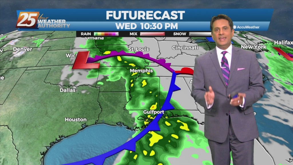
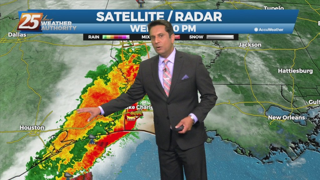
We continue to see a severe weather/heavy rain threat Wednesday afternoon and Wednesday night with much cooler weather to follow. An approaching cold front Wednesday will bring the…
A weak cold front overhead will get an additional push further SE this evening/overnight. There is no cool down with this system but slightly drier air will…
A shallow cold front continues to move SE through the region. Sufficient moisture in place with enough instability to support showers and a few thunderstorms will continue this…
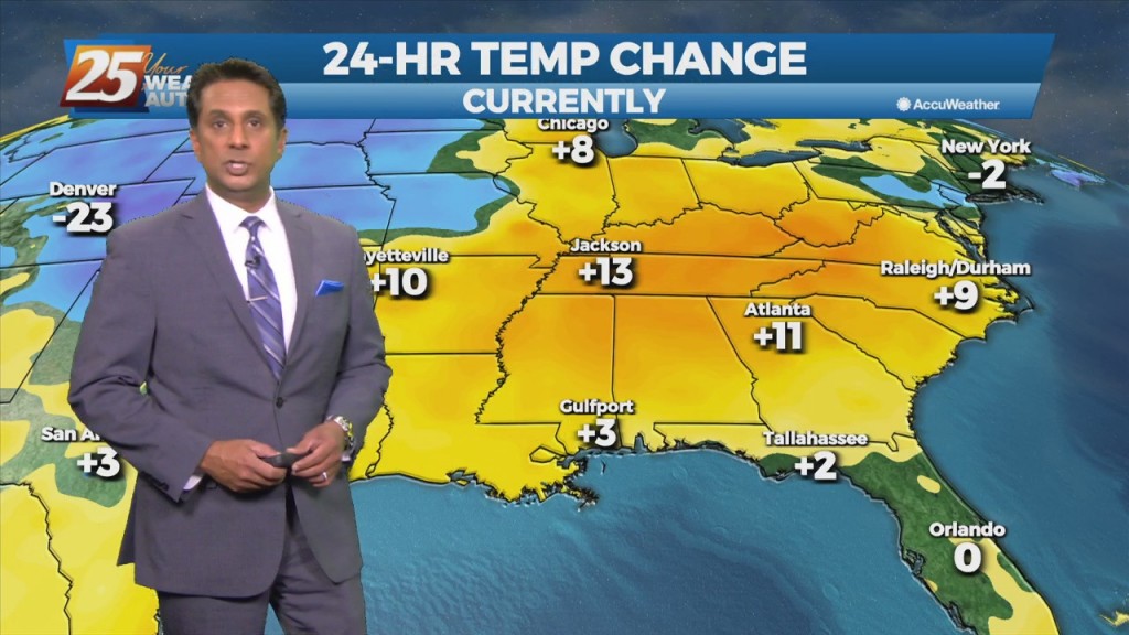
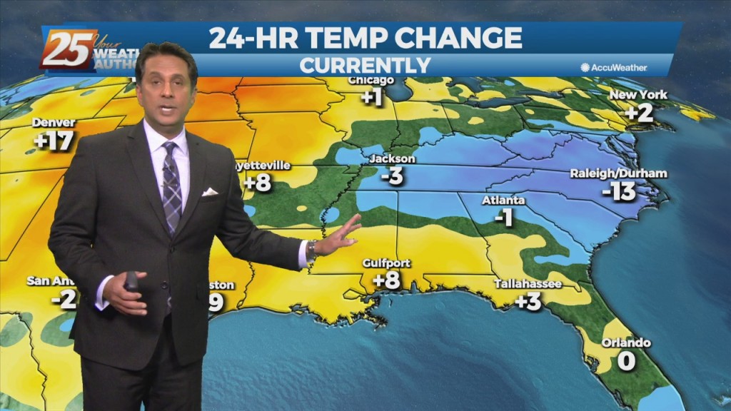
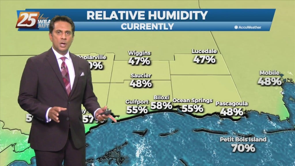
Weak high-pressure will track across the Mississippi Valley today and Tuesday. This will be the start of moderating temperatures. Highs to remain below normal this afternoon, reaching climatological normal tomorrow. Dew-points will be back in the 60s by the end…
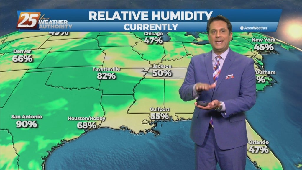
Warm & humid will continue today as an area of low-pressure along a cold front near Wichita Falls will race northeastward toward Lake Ontario by midnight tonight. The associated cold front is expected to reach northwest Louisiana by mid to…