12/14 - Rob Knight's "Cloudy & Damp" Friday Morning Forecast
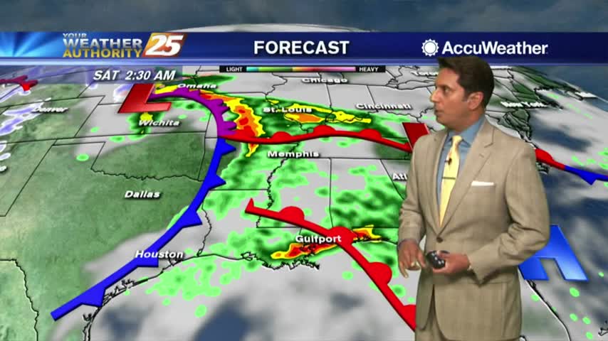
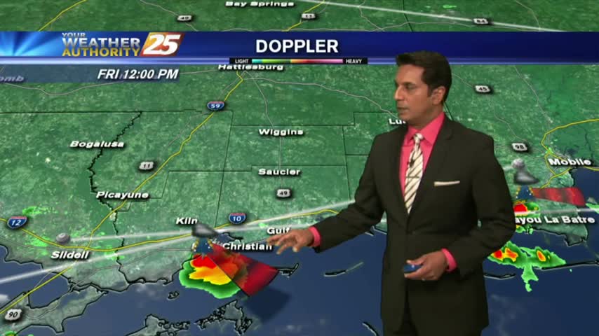
The system affecting the Gulf coast is starting to die out but clouds and spotty rainfall continues...
The system affecting the Gulf coast is starting to die out but clouds and spotty rainfall continues...

A warm/humid air mass is affecting the viewing area in advance of a low-pressure which will move in Saturday...
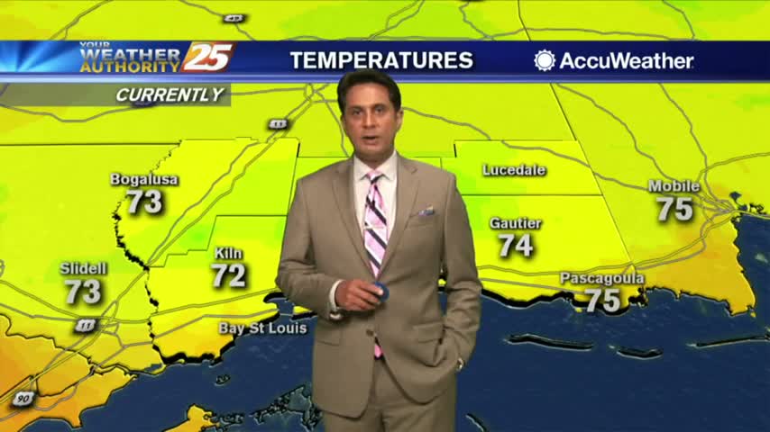
Much warmer temperatures this afternoon in advance of an approaching warm front later this evening...

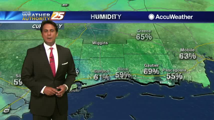
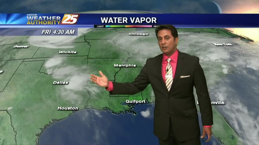
A warmer start to the day as the cloud coverage has moved into south Mississippi...
After a cloudy start, skies continue to clear nicely as the breezy conditions move in...

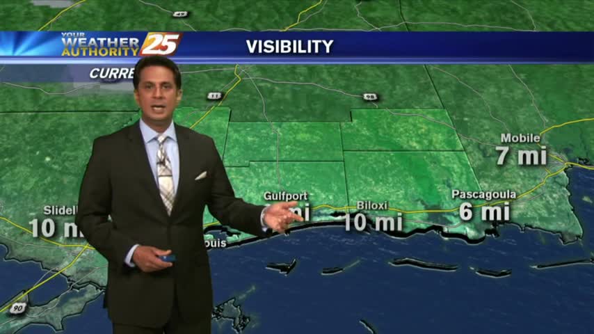
A cloudy start to the day but conditions will improve this afternoon...

A warm and humid start to the day with a few light showers moving in from the GOM...

A mild start to the day as we continue to keep an eye on the tropics and Hurricane Florence making landfall in North Carolina...
A much drier start to the day with lower rain potential heading into the weekend...

After a clear start, the clouds have developed with showers & t-storms becoming more prevalent...
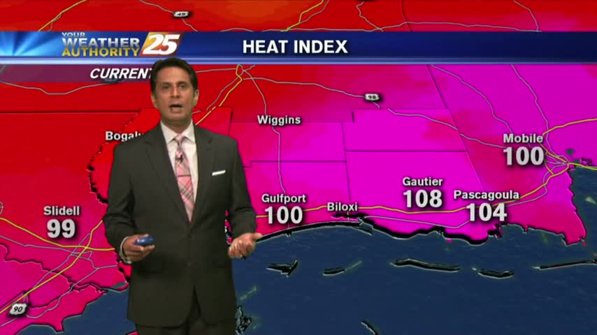
The drier air mass in departing as the humid flow from the GOM is moving in, making the HEAT INDEX a factor...
Clear skies from last night continues as we're watching a few showers/t-storms to our south over the outer-coastal waters...
A warm start to the day but it is rain-free. Clouds moving south into the area will thin through midday...

After a clear start to the day, daytime heating has flared up low-level clouds along the coastal counties...

Minimal activity over the sound this morning will continue to push towards the west...

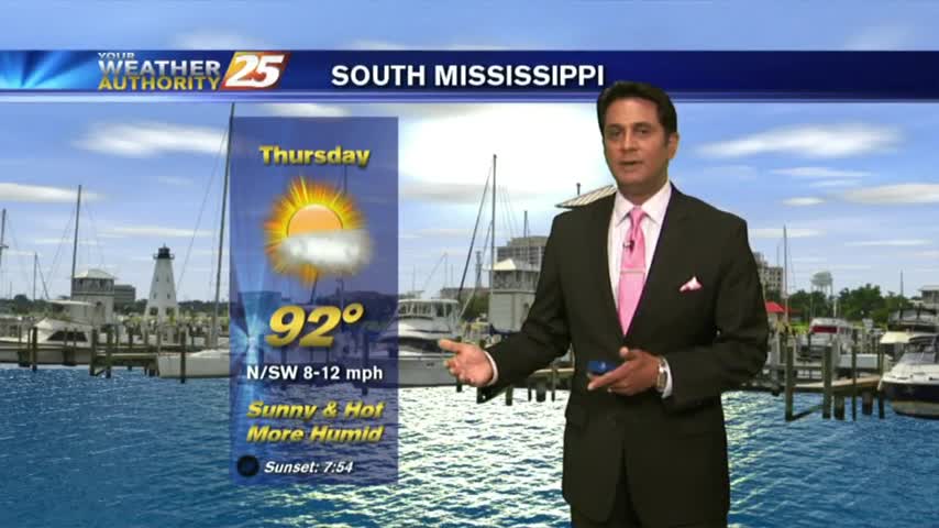
Summer is definitely in the air as morning low temps are in the upper 70s to low 80s...

As the very saturated environment continues, activity is already in the area before sunrise...

A nice start to the day/weekend as clear skies prevail with a north wind and temps in the upper 60s/low 70s...

A HOT day with the sea-breeze developing isolated activity along the southern coastal counties...
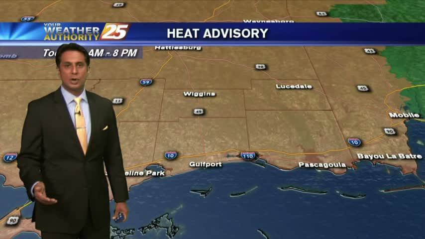
Another WARM start to the day with very high HEAT INDICES in play for the weekend...

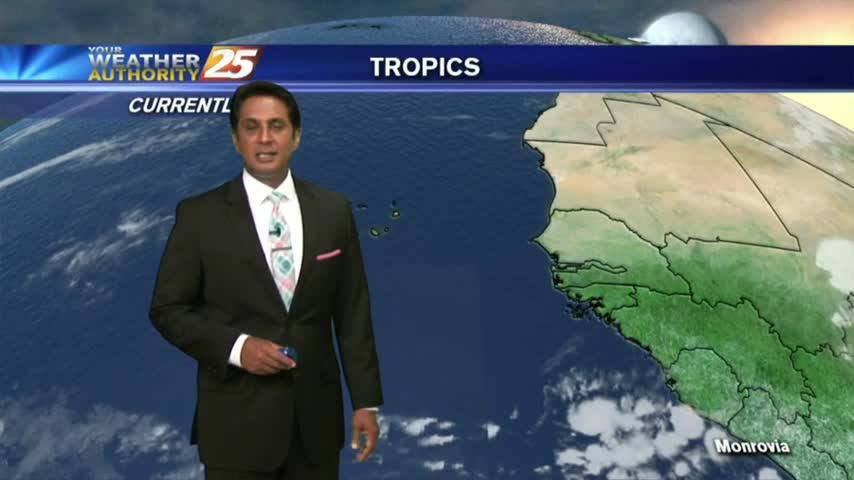
Sunrise activity diminished but starting to pop through the viewing area as daytime heating continues. TS ALBERTO is now in the Caribbean sea...
Isolated activity beginning to pop as temps warm into the upper 80s...
Overnight t-storms over the sound continue to move south, away from he area as drier air moves in...
A HUMID start with areas of patchy fog east of Hwy 49...as we head into the Mother's Day weekend...