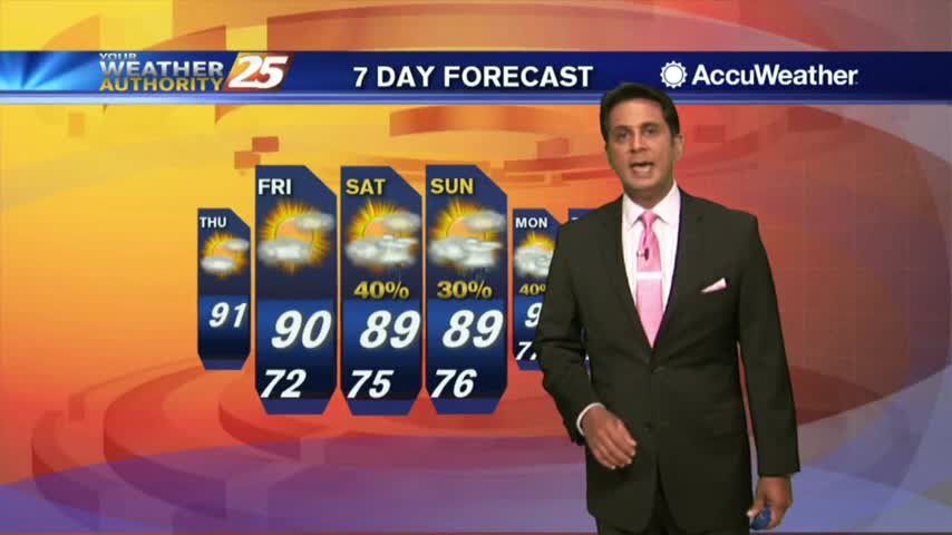
12/6 - Rob's "Warming" Thursday Afternoon Forecast
After a FRIGID start to the day, the return flow has begun with warming temps ahead...
After a FRIGID start to the day, the return flow has begun with warming temps ahead...
Another FRIGID start to the day but the warmer air mass will begin to move in later today...

After a FRIGID start to the day, the slow warm up will begin this afternoon...

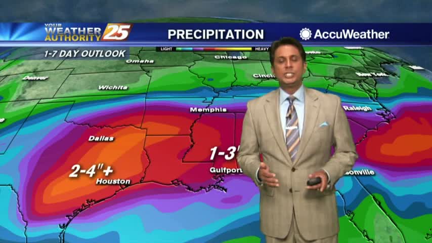
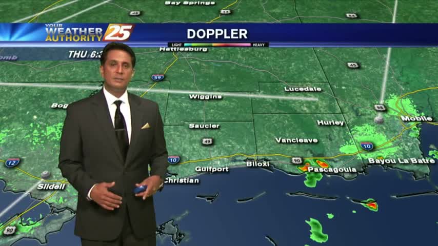
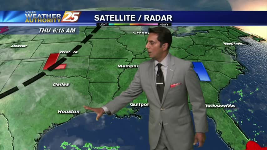
HEAVY RAIN is moving into south Mississippi from the SW...

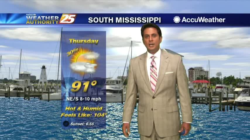
A HOT afternoon with the Heat Indies already in the low 100s as ambient temps are in the upper 80s...
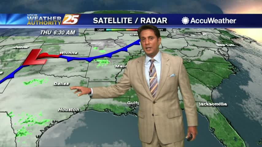
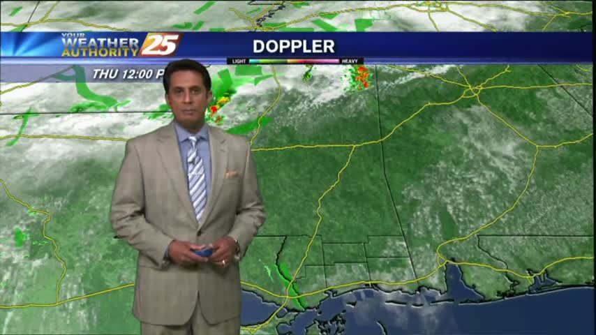
A few showers south of the coast line are dissipating as they move towards the beach...
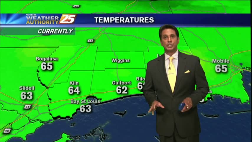
A LOVELY start to the day as drier air has allowed for overnight temps to drop into the 60s...
Similar to yesterday morning, isolated showers from the northern GOM, moving NE are dissipating along the beach...
Isolated showers/t-storms are beginning to pop with more activity this afternoon...
After a CHILLY morning temperatures are warming nicely, with the warm-up to begin tomorrow...
Another CHILLY morning but major changes ahead as an area of high-pressure overhead begins to move SE...
After a FRIGID morning, the cold air is moving out of the area...hopefully for the season!
After a HUMID start to the day with areas of very light fog, the WARM/HUMID and now BREEZY conditions continues...
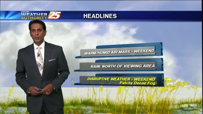
After a warm/humid start to the day, above seasonal temperatures continue with mostly cloudy skies along the viewing area...
Another cool start to the day but the humidity has already begun to increase heading into the weekend...