11/26 Ryan's "Thanksgiving" Thursday Night Forecast
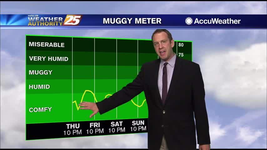
Thanksgiving is almost behind us, though not much will change over the next few days as warmer, more humid air lingers....
Thanksgiving is almost behind us, though not much will change over the next few days as warmer, more humid air lingers....
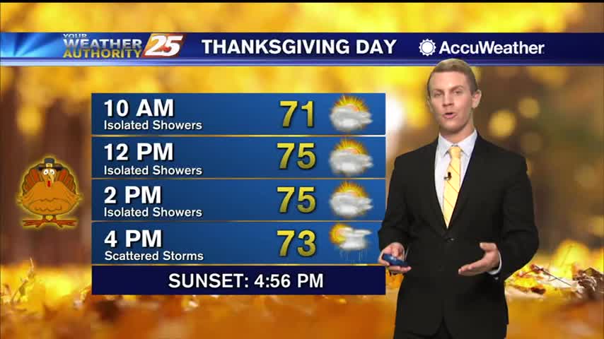
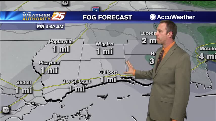
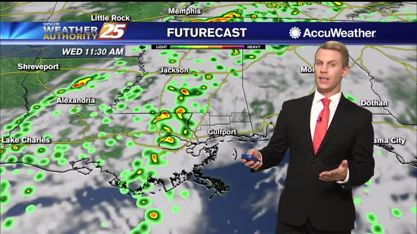
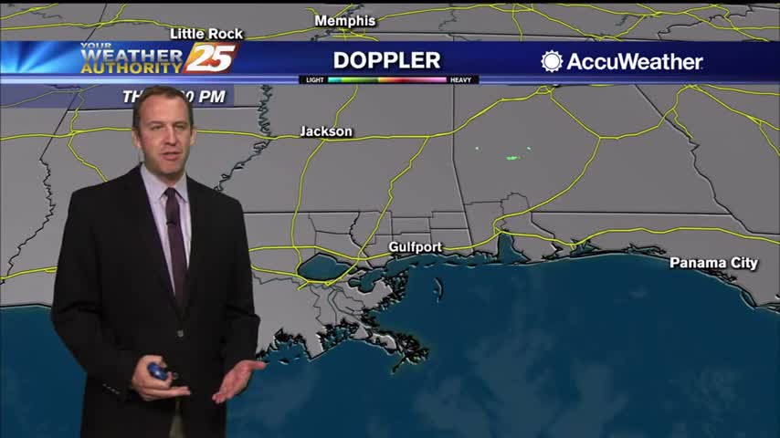
Thanksgiving Day should see less rain and be continued mild to warm, but it won’t be an ideal day for outdoor plans as some morning drizzle and fog, and spotty showers and a few thunderstorms will be around the area…
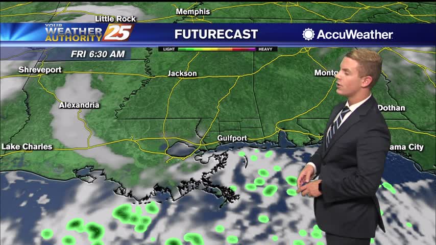
Saw a few showers as a cold front moves in, but it's going to lead to days of cloudy weather as it stalls.
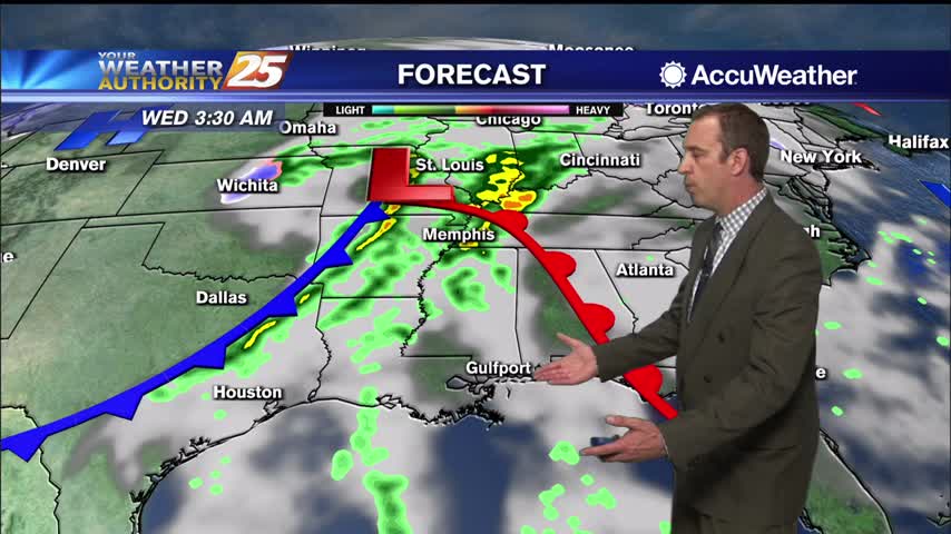
The cold front is here and it's brought rain, but we won't be seeing the cooler, drier air on the other side just yet.
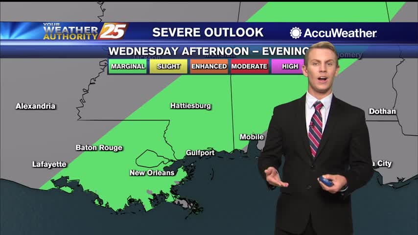
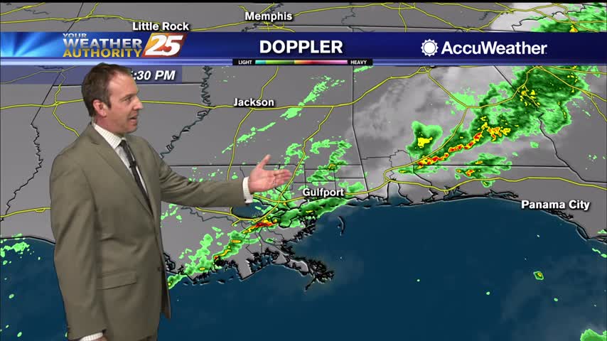
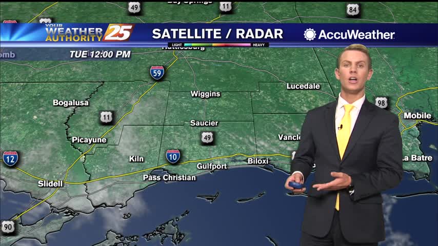
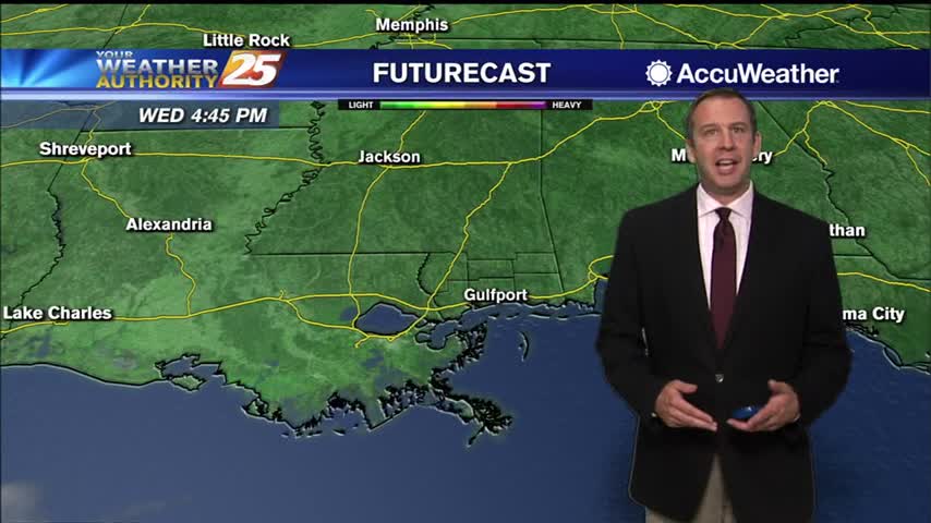
Today through this evening, the Storm Prediction Center has placed our area of the Gulf Coast and a large portion under the Southeast under a marginal risk for severe weather which is a level one out of five on their…
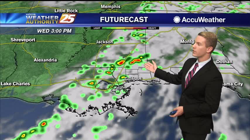
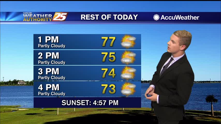
We’re starting off the day much warmer than what we did yesterday. It will be warm and muggy with some showers pushing into the area for the second half of the day. Temperatures will be in the mid to upper…
A complete 180 in only 24 hours as last night's chilly, dry air is rapidly being replaced by warm, muggy air as a new frontal system moves in....
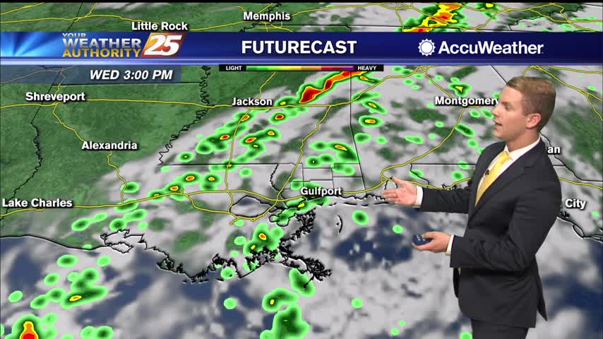
Expect a big difference between last night and tonight as warm, moist air moves in; leading to a cloudy and wet end to the week.
It’s looking quiet and not as chilly this afternoon and tonight, with some areas almost 15-25 degrees warmer than this morning! But by Wednesday, our attention begins to shift to the west at a relatively strong low pressure system moving…
Many locations early this morning are starting off on the chilly side thanks to clear skies, calm winds leading to maximized cooling processes at work. We are on the path towards another gorgeous day today. We are starting to see…
A cold front moved through on Sunday, but we'll only get one chilly and dry night before things warm up fast!
Cold front has brought some cooler and drier weather to start things off, but a few fronts will darken this week's skies.
A brief, slight cool down is expected to continue throughout the rest of the day in the wake of the weak dry front with highs ranging from the lower 60s over the northwestern portions of the forecast area to the…
A brief, slight cool down is expected during the day on Monday in the wake of the weak dry front with highs ranging from the lower 60s over the northwestern portions of the forecast area to the lower 70s across…
With an extremely dry and sunny week behind us, we move into a more cloudy, warmer, and more humid week ahead as several fronts move in.
A lovely autumn weekend is ahead as high-pressure NE of the area will shape the forecast. A dry cold front will move through the area Sunday night then east of the area Monday, but moisture will begin to return fairly…
Finally starting to feel some of those changes moving in as warmer, more humid air begins to creep in....
Still looking and feeling pretty nice today, but we're starting to notice things changing as warmer, more humid air moves in.

Nice and cold tonight again thanks to cooler and drier air, but warmer and more humid air is knocking on the door....
Things'll be slow to change this week, but they eventually will after several more calm, sunny days.
Lows the next couple of nights should easily reach the lower to mid 40s inland and the mid 50s closer to marine influences. Highs will be in seasonably mild ranges, generally upper 60s to lower 70s through thursday now that…

Just as cool as last night and even drier, but it won't last forever....warmer, more humid days lie ahead.
Much more fall like for the next 24 hours or so, but a warming trend is on the way...as is higher humidity.
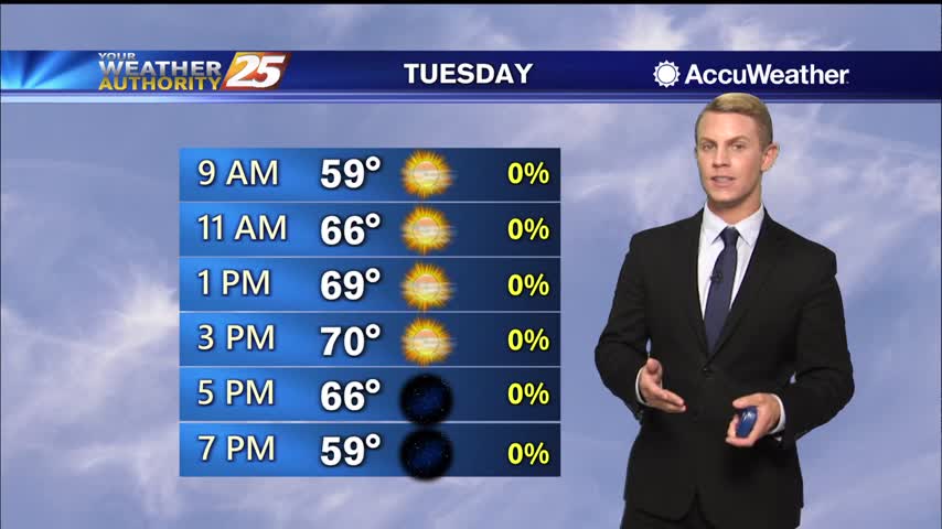
Lows the next couple of nights should easily reach the lower to mid 40s inland and the mid 50s closer to marine influences. Highs will be in seasonably mild ranges, generally upper 60s to lower 70s through Wednesday as a…