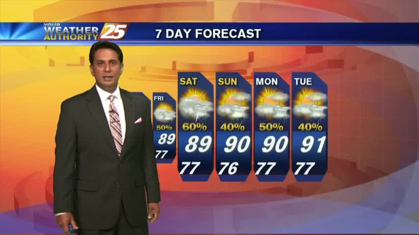
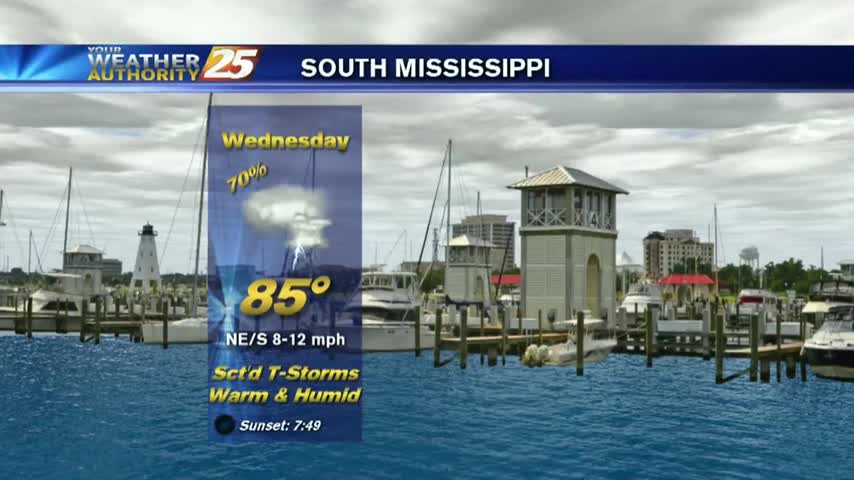
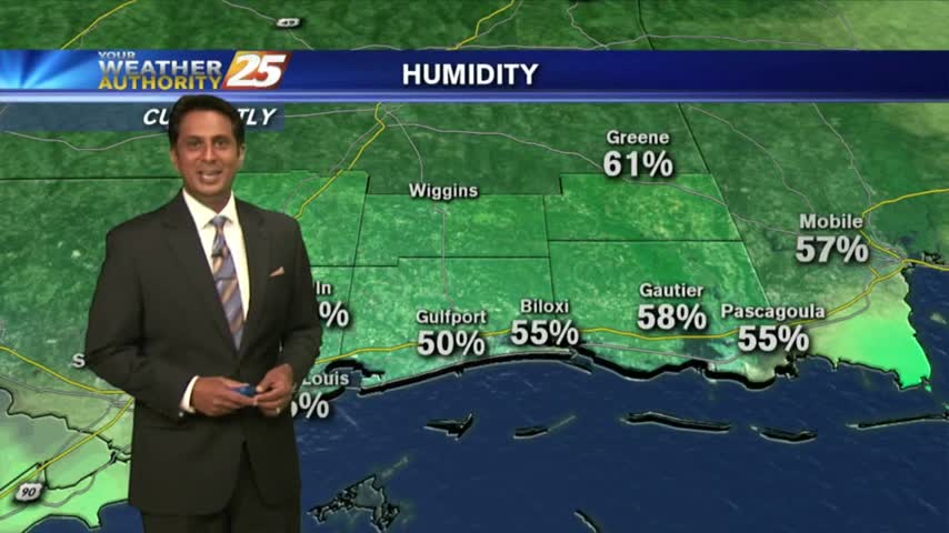
8/24 - Rob Knight's Final Weekend of August Forecast
After a clear start to the day and mild temps, it's going to feel hotter this afternoon with more of a humid wind flow...
After a clear start to the day and mild temps, it's going to feel hotter this afternoon with more of a humid wind flow...

Another LOVELY start to the day with lower humidity and several locations with temps in the 60s...
After a BEAUTIFUL start to the day, temps continue to warm with the humidity dropping off...
In the wake of the cold front, mostly clear skies continue as drier air is moving into the region...
A weak cold front is overhead moving south with a drier air mass beginning to move in...
Overnight clouds have cleared to the SE, with warm & humid conditions to start off the day...

It's a warm start to the day with mid/upper level clouds moving in from the NW and thinning...
Isolated showers/t-storms south of the area overnight has been slowly moving north into the coastal counties...
The stationary front is overhead and beginning to dissipate as minimal activity is to our south...
After a clear start to the day with a north wind, a few low-levels clouds have developed as the winds begin to switch...
This morning we have another cold front approaching the region which will move the drier air out of the area...
After a VERY HOT weekend, we have light showers from I-20 down to the coast...moving to the south.
After HEAVY RAINFALL yesterday, we are under mostly cloudy skies with another round of potentially heavy rain to come...
After a clear start to the day, daytime heating and moisture has flared-up cloud coverage along the coastal counties...

After a clear start to the day, daytime heating has flared up low-level clouds along the coastal counties...
Activity along the coast earlier this morning has moved SW and dissipated...but will redevelop later today.

This morning we have isolated activity south, moving into the viewing area...

We are still under rain-free conditions for now...as the heat indices are again in the triple digits...
Another morning with a few light showers moving into the area from the northern Gulf of Mexico...
A tad bit warmer this morning with isolated activity south, moving into S. Mississippi...
A WARM start with HOT temps and high heat indices again this afternoon...

After a rain-free and HOT weekend, it's a warm and humid start to the workweek...
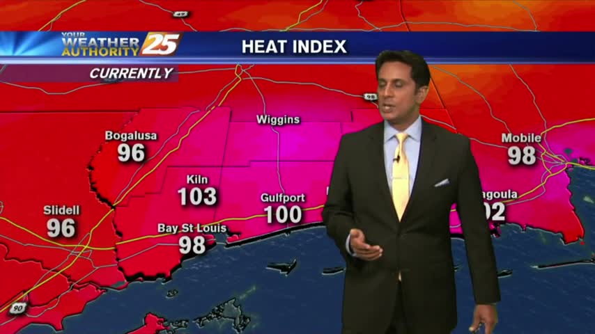
Things are getting HOT out there as the HEAT INDEX is now pushing 100 degrees...
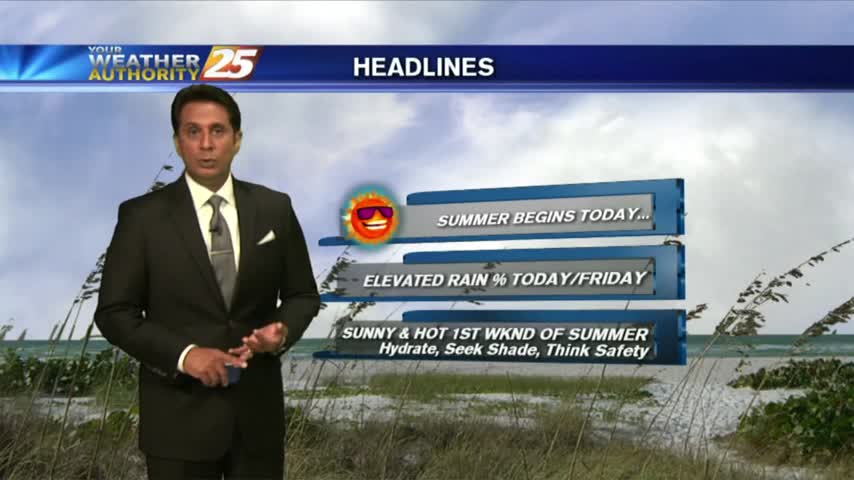
A VERY WARM start to the new season as several locations are in the low 80s this morning...