02/13 Ryan's "Wonderful" Wednesday Night Forecast
Today was the clearest and coolest day we'll see until next week as things get warmer and more cloudy through the weekend....
Today was the clearest and coolest day we'll see until next week as things get warmer and more cloudy through the weekend....
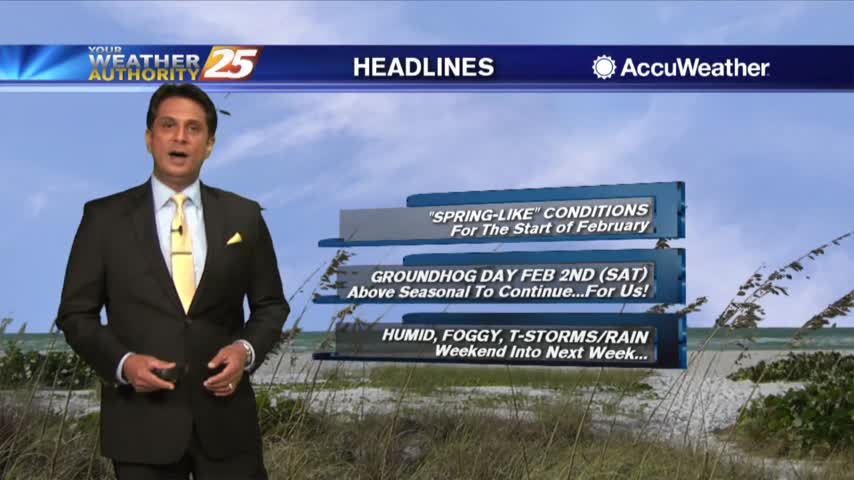
We can say goodbye to lows in the 30s for a while as more "spring-like" weather moves in over the weekend....
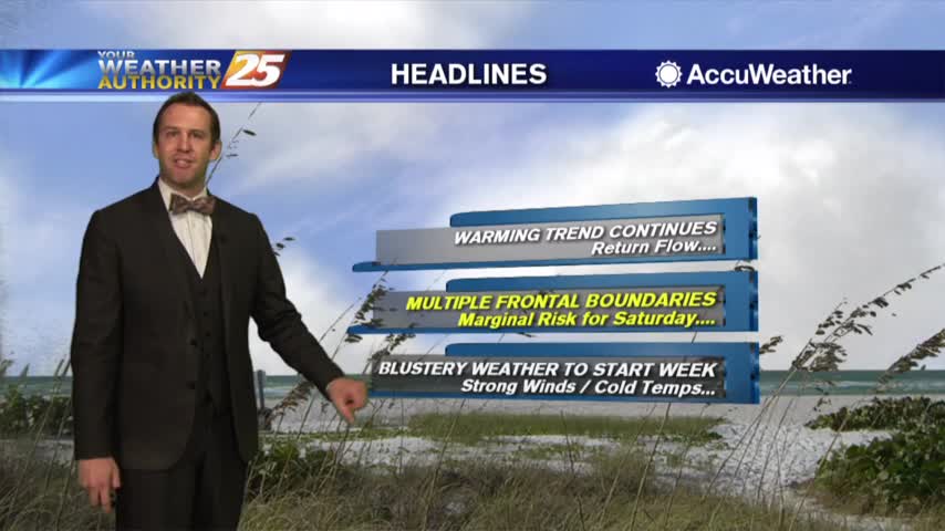
After a very cold start to the day, the return flow has begun with MUCH WARMER temps ahead...
It's warming from where we were last night, but still going to be quite cold tonight. A long warming trend is coming though....
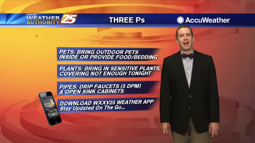
No chance of rain or wintry weather tonight, but hard freeze conditions move in....
No winter weather moved into South MS this morning, but brutally cold, sub freezing conditions are expected for several hours overnight....
Tonight will be as clear and cold as the last few have been, but we will warm up through the weekend....
A little upper level cloud cover dotted the sky earlier today, but won't help us any tonight as chilly conditions move in....
Today's cloud free skies were nice and I hope you enjoyed them because increasing cloud cover through the night will linger into the weekend....
Last night's cloud cover cleared quickly into the morning, but will come back overnight as active weather moves in....
After a chilly start to the day, temperatures continue to warm under beautiful blue skies...
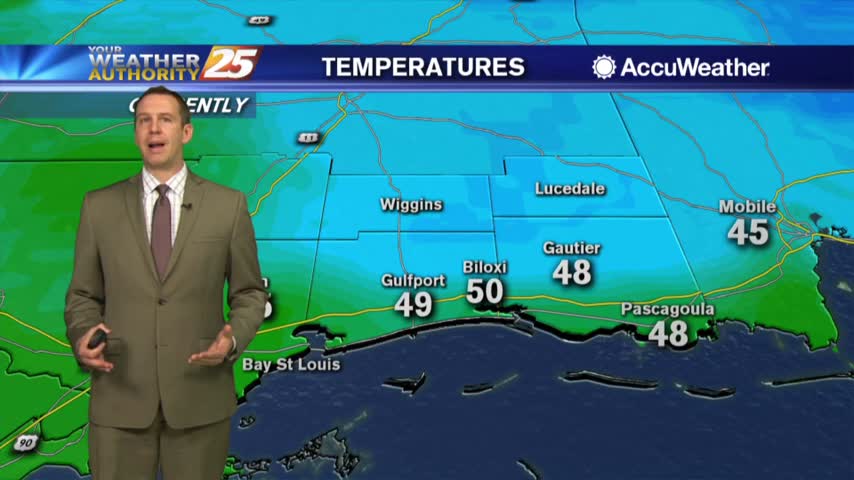
We saw little to no cooling from just after lunch today until after 11 PM, but inland areas will flirt with freezing again while we stay just above that line on the Coast later tonight....
Grey and gloomy skies have lingered from the weekend, but skies begin to clear after a chilly night....

After a FRIGID start to the day, the slow warm up will begin this afternoon...
It's still going to be a bit chilly over the next few nights, but a warming trend will bring sunny and mild Autumn weather for the weekend....
After a FRIGID start to the day, temps are warming but struggling to get into the 50s...
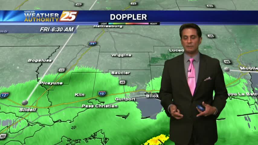
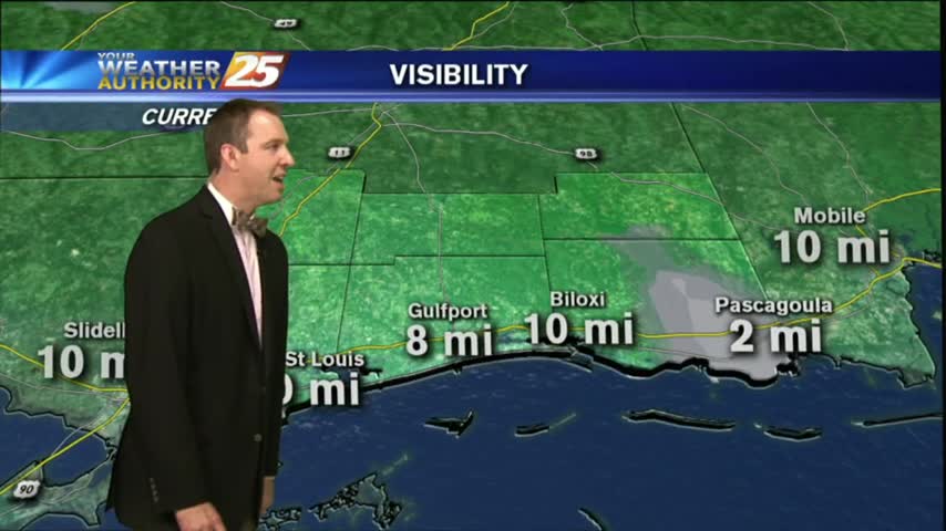
Patchy fog has been developing over the last few hours, and will continue to do so throughout the night and into Tuesday morning. Click this link to watch the full forecast for the details.
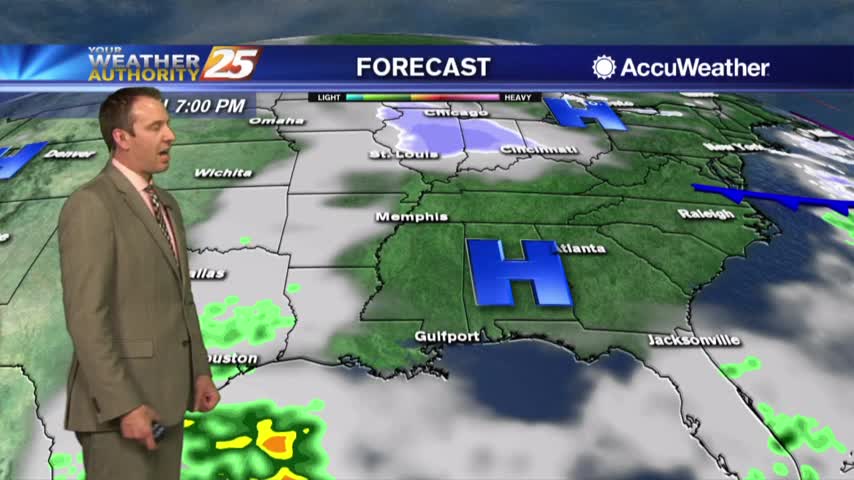
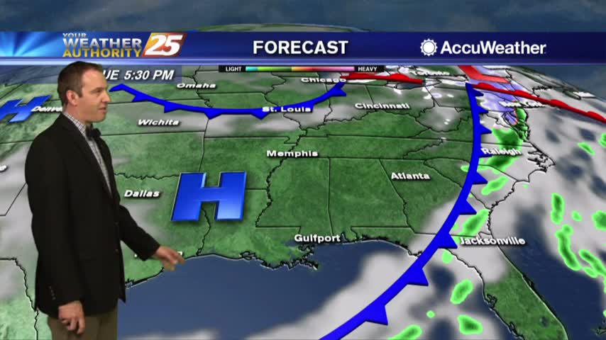
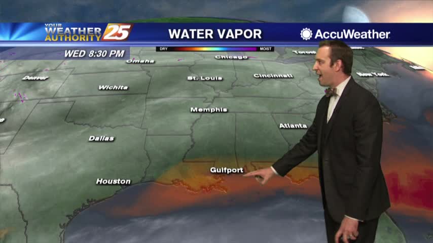
The showers and storms moved in as expected last night, and while the rain may have moved on, the moisture will remain for most of the week. Click this forecast link for more details.
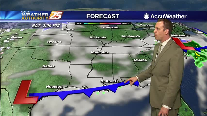
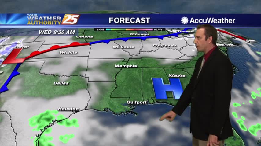
Warming temps continue to move into the region. A cold front is now to the south of the viewing area...with rainfall moving NE into south Mississippi..
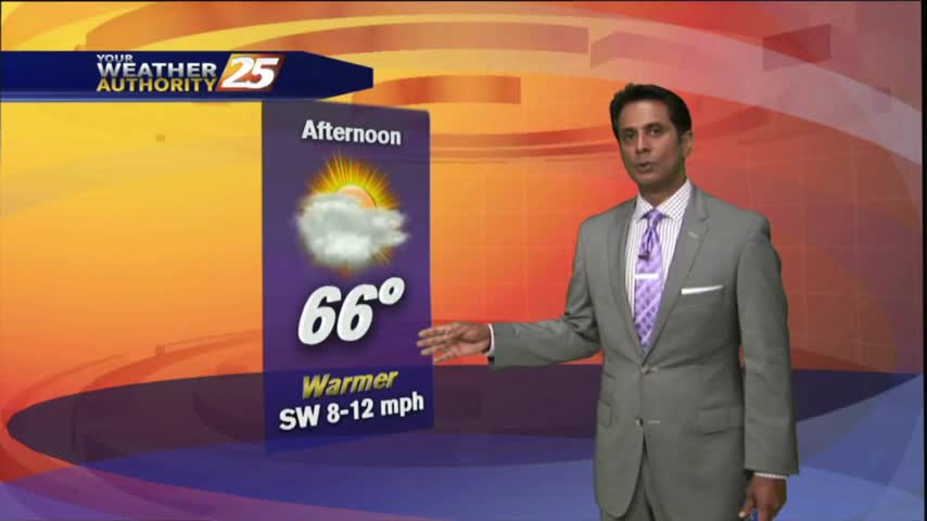
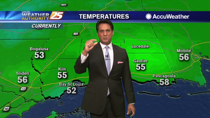
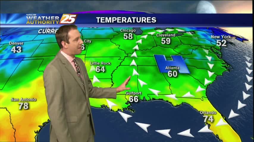
After a warmer start this morning compared to the frigid conditions from yesterday...temps continue to climb into the low/mid 60s...
It will be considerably warmer tonight that it was last night as moisture continues to pour in, meaning fog will become more of an issue in the coming nights. Watch the forecast for details.
A weak cold front moved through the area Saturday night, bringing some COLD temperatures to kick-off the final week of November...
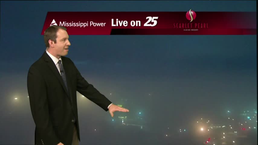
The fog has already begun to develop in South Mississippi, and will continue over the next few nights as the temperature and humidity continue to gradually rise. Watch the full forecast for details.
Today was almost a carbon copy of yesterday, and even cooled by a degree! Expect that trend to start going the other way until the weekend; watch the full forecast for details.