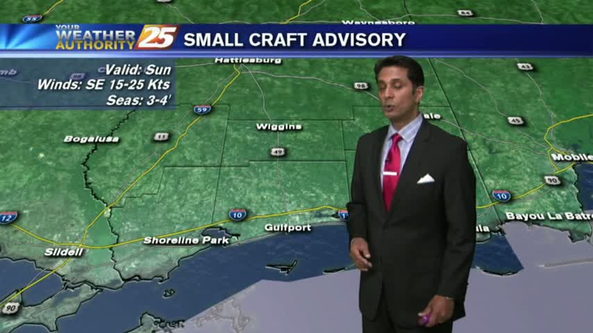
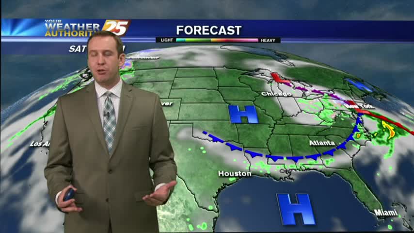
3/24 - Rob's "Potentially SEVERE" Weekend Forecast
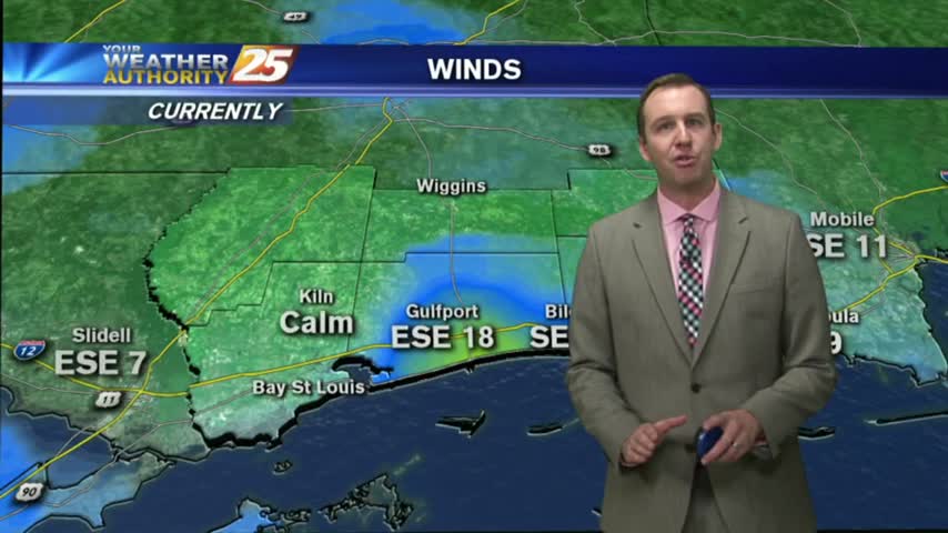
A tightening gradient brought WINDY conditions to the region yesterday, which continued overnight and into this morning...
A tightening gradient brought WINDY conditions to the region yesterday, which continued overnight and into this morning...
The clouds moved in during the afternoon and will remain until this weekend's storms. Be sure to watch the full forecast for all the details.
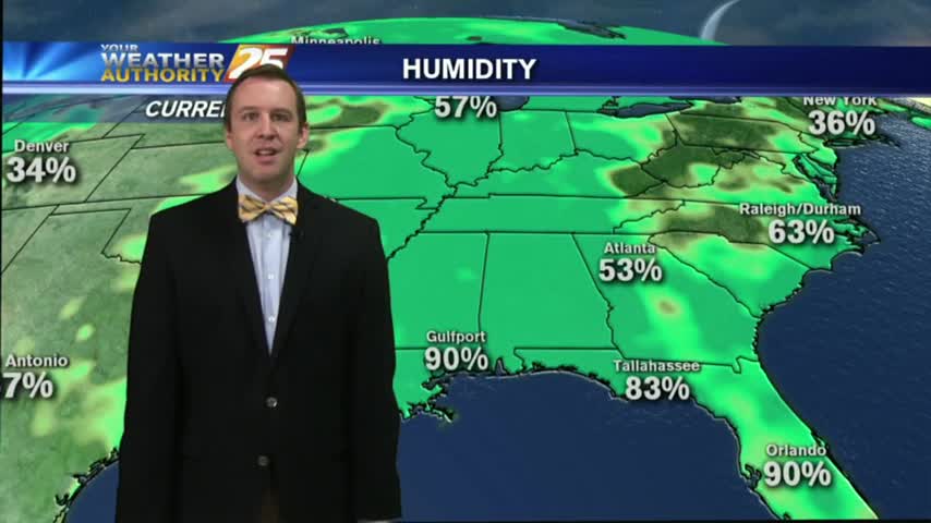
Yesterday's front brought slightly cooler & drier conditions for the evening, but warm & humid conditions continue into tonight with mostly cloudy skies. Watch the forecast for more.
It's setting up to be another foggy morning on the Gulf Coast tomorrow, but more sun and warm temperatures are expected tomorrow. Watch the forecast for details.
This afternoon was as gorgeous as predicted, and the next few days are looking very similar, even possibly a bit cooler! Watch the full forecast for details.
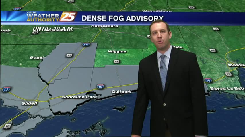
The first day of Spring brought coastal temperatures into the 80s today, and tonight will be even foggier than last night. These conditions continue for much of the week, so watch the forecast for details.
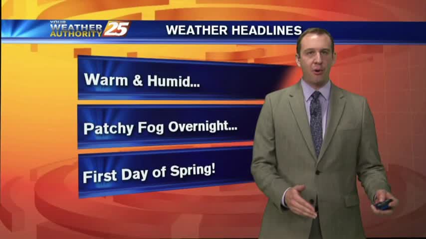
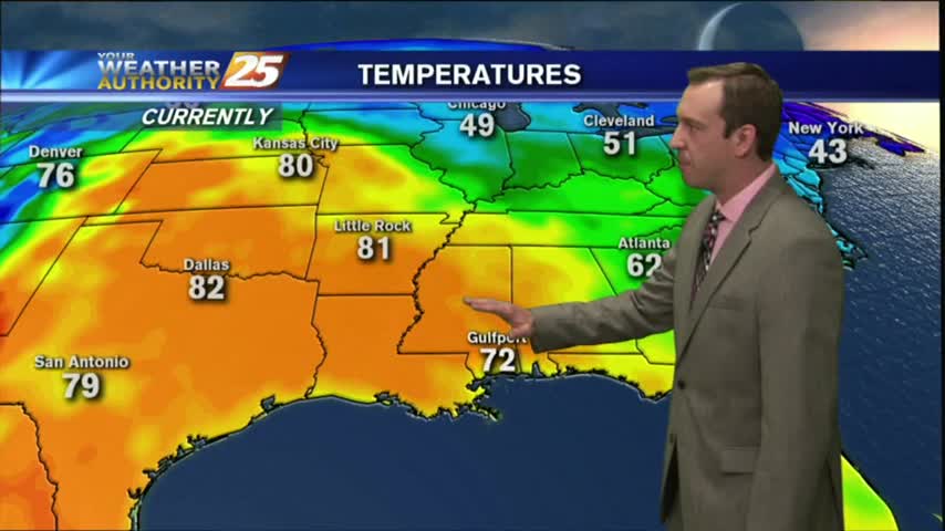
Tonight is the last night of Winter but don't expect any "winter-like" conditions as warm & humid weather moves in for the long haul. Watch the full forecast for details.
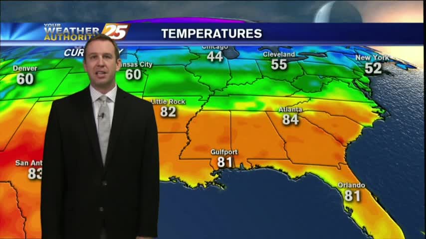
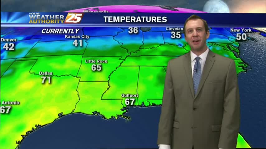
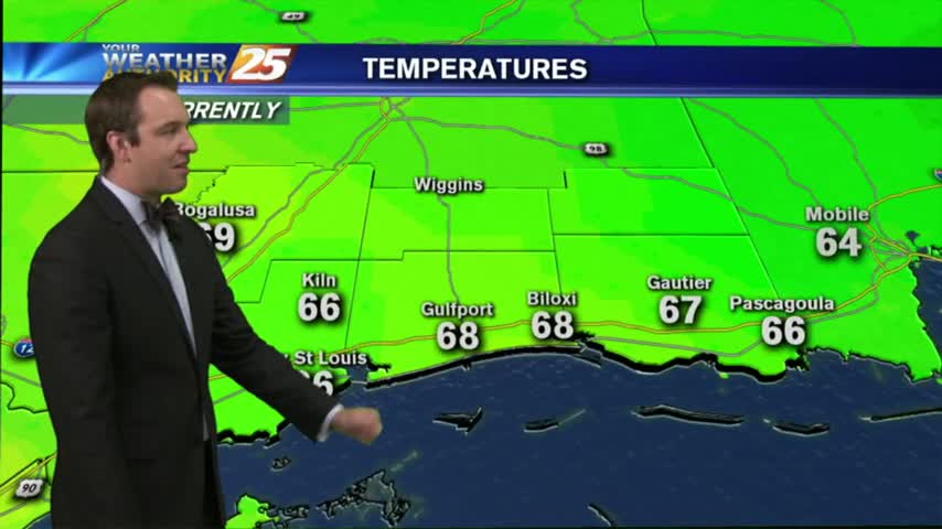
Two nights ago, some counties were under a freeze warning with coastal temps dropping into the 30s. Today, we're closer to the 60s tonight, with even warmer temps ahead. Watch the full forecast for the details.
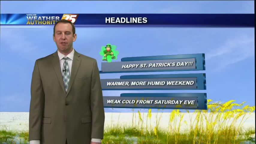
I hope everyone enjoyed their gorgeous St. Paddy's Day weather! Expect the beautiful days to keep coming with almost no chances of rain. Watch the full forecast for more details.
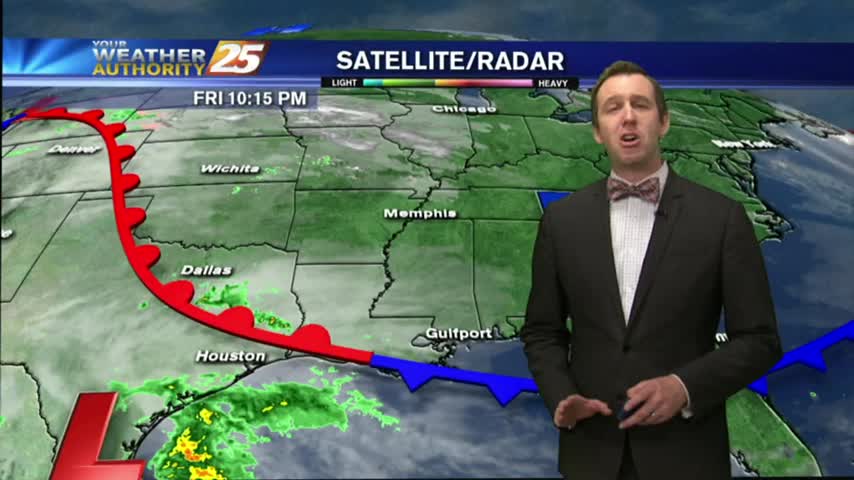
A few sprinkles moved through earlier today ahead of a very weak boundary, but more rain will move through for the weekend. Details inside.
After a nice two day break from the cloudy and warm days we began the week with, the clouds are gathering again. Watch the forecast to find out when that means rain.
We're about done with our short break from the cloudy and humid start to the week, and a cloudy and rainy weekend is expected. Click the forecast link for more.
This morning starred out with a few clouds and cool temps, with both increasing this afternoon...
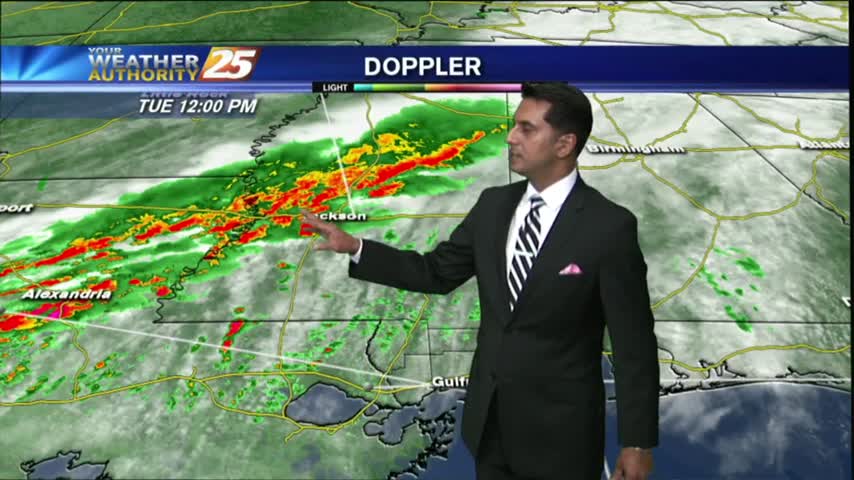
After light showers earlier this morning, isolated t-storms are beginning to develop to the west...
Overcast skies continued this afternoon, but still didn't see much rain. Showers are beginning to move in from the SW, and rain is expected to increase ahead of a cold front tomorrow. Watch the full forecast for details.
It's my first evening on the Sunday night show! Today remained overcast as expected and a few showers are starting to pop up. Click the forecast link for more information.
A south wind in advance of an approaching cold front continues to get stronger. Breezy, warm & humid conditions to start off Ash Wednesday...
The weather cooperated nicely today, keeping things cooler with the cloudy skies but remaining rain free. Click the forecast link to learn about tomorrow's storms and the weekend's conditions.
It's the last day of the carnival season and the weather cooperated fairly well! Tonight's cloudy skies will continue into tomorrow with showers and storms ahead of an evening cold front. Check out the forecast for details.
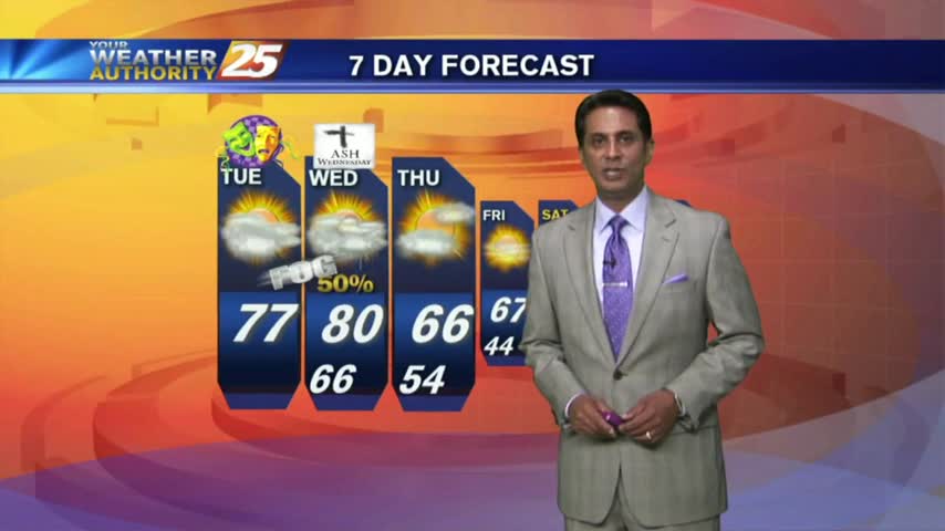
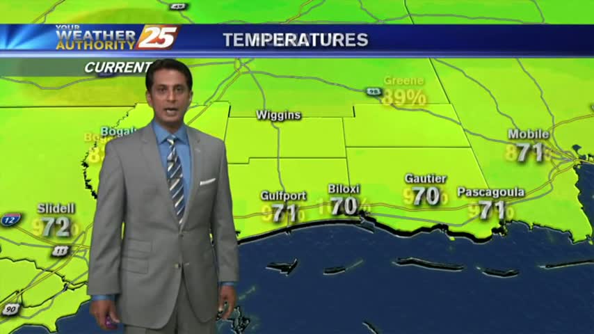
Fat Tuesday is starting off with VERY WARM conditions for this time of the year, along with areas of DENSE FOG...
Storms moved North of most of South Mississippi today, but Mardi Gras is expected to be much drier. Watch the forecast for details.
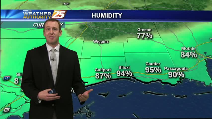
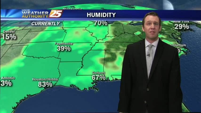
As low-level humidity continues to stay very high...areas of PATCHY DENSE FOG has developed along the southern 6...
Morning rain cleared for a decent afternoon, but clouds are moving back in for the evening. Everything is looking good for the parade festivities this weekend though. Details inside.
After a clear and cooler afternoon, we're heading for a warm and more humid evening. Watch the forecast for details.