7/11 - Rob's Tuesday Morning Forecast
A warm/humid start to the day with isolated showers south of the barriers moving NE and developing into t-storms...
A warm/humid start to the day with isolated showers south of the barriers moving NE and developing into t-storms...
After a cooler and dry Sunday morning the moisture flow is back in the area. Currently under rain-free conditions, poised to change later this morning...

Another warm/humid start to the day along with isolated showers developing over the sound moving north...
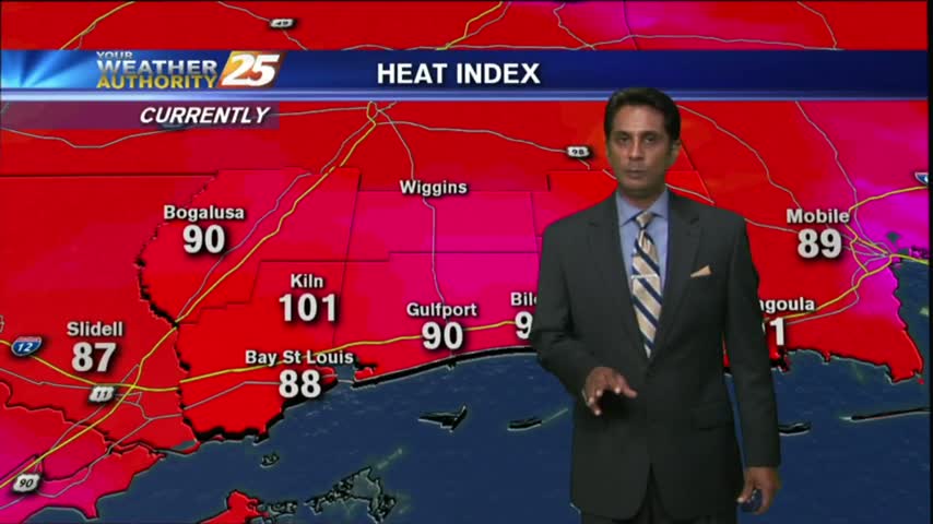
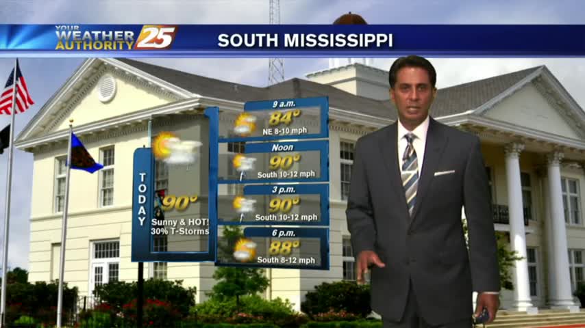
Temperatures continue to warm with the HEAT INDEX poised to be between 100-105 degrees this afternoon...and through much of the workweek.
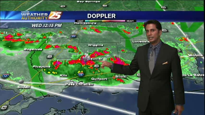
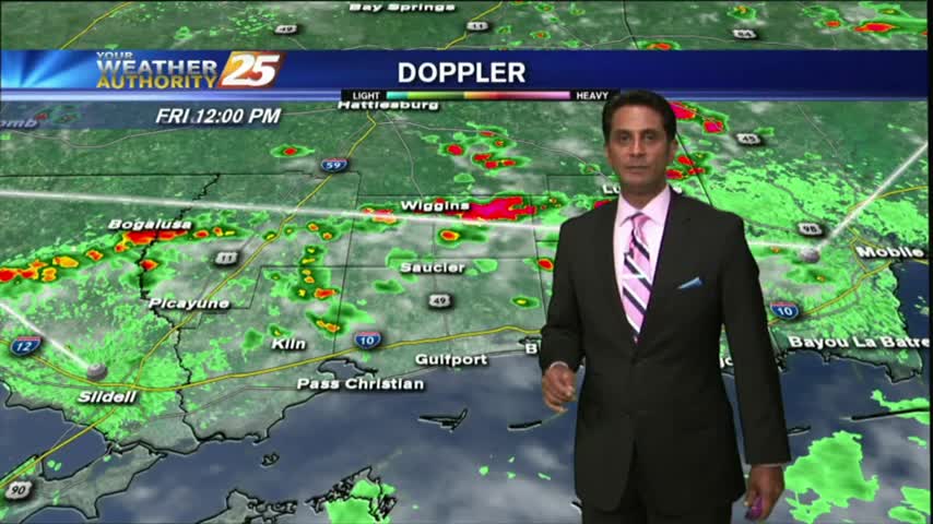
Isolated activity has been moving into the area from the south since prior to sunrise...with the activity on the increase this afternoon.
After a couple of dry days with very low humidity, the moisture flow has begun with rain moving in from the south...
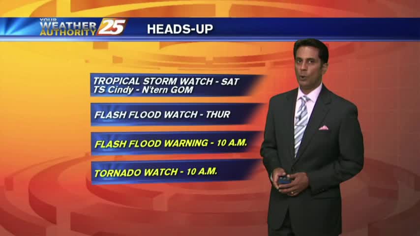
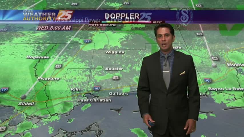
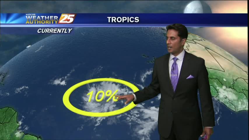
A BUMPY start to the day with HEAVY RAIN...and a TORNADO WATCH. TROPICAL STORM effect will continue...
Overnight t-storms dissipated prior to sunrise but have redeveloped once again...
With a very strong tropical air mass dominating the region, overnight t-storms have moved east with a very HUMID start to the day...
After a brief period of sunny skies and low humidity, a very TROPICAL AIR MASS is back in the region with showers/t-storms moving in

After a beautiful weekend with sunny skies and drier air, the tropical air mass is moving back into the region...
After a bit of a break earlier this morning, showers continue to move in and develop along the viewing area.
After a rain-free start to the day under partly cloudy skies....the clouds and activity has moved back into the viewing area...
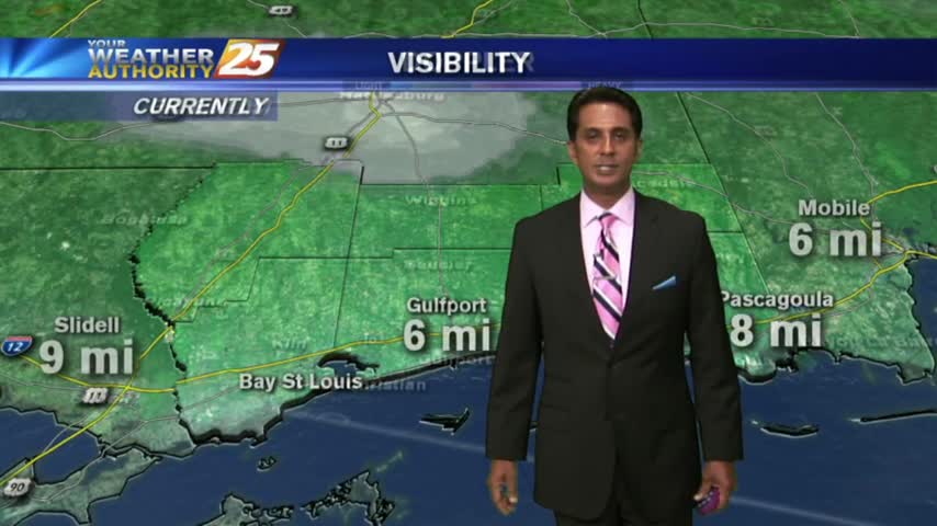
A break from the rain this morning...BUT areas of PATCHY DENSE FOG have developed along the Southern 6...

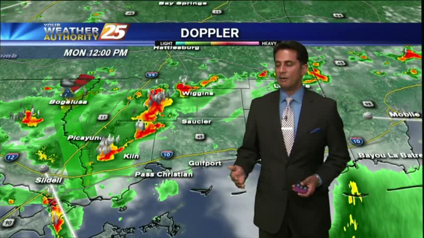
It's a gloomy start to the workweek/Memorial Day with showers/T-Storms, which continue from last night...

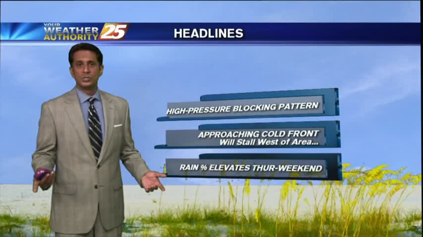
A MUCH WARMER start to the day as high-pressure begins to provide for a return-flow and more humid conditions going into the Memorial day weekend...

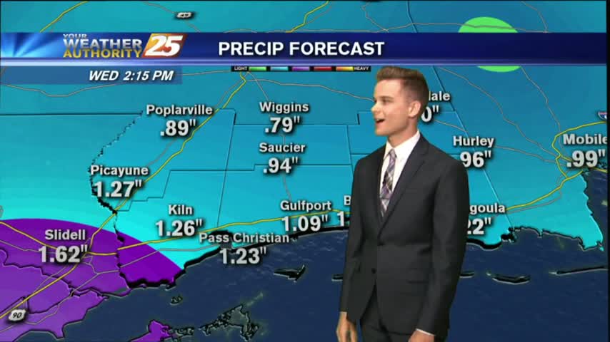
It's a WARM/HUMID day long the Mississippi Gulf Coast with the potential for HEAVY RAIN through the weekend...
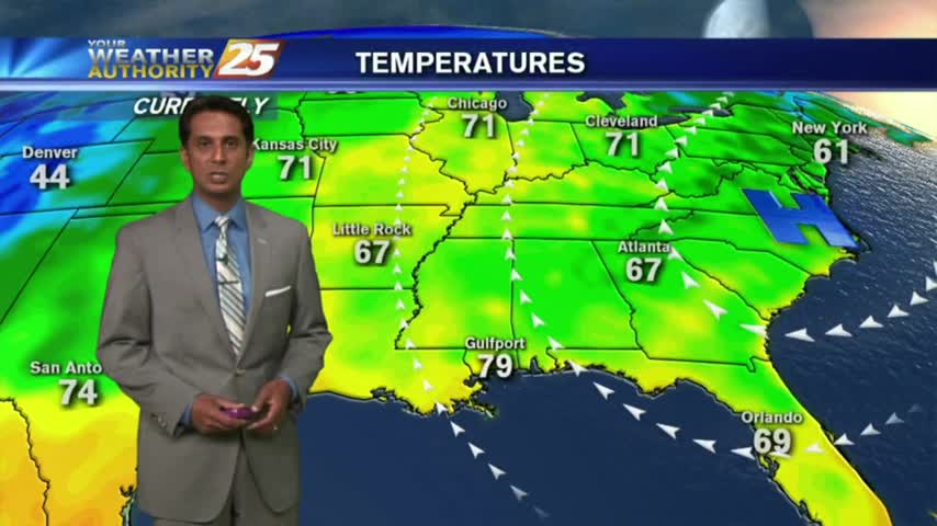
After a warm/humid start...a tightening gradient east of the Rockies continue to elevate winds, now gusting into the upper teens/low 20 mph range.
Another Warm/Humid start to the day with areas of PATCHY DENSE fog along the coastal counties...
After a few morning clouds and patchy fog, a low-deck of clouds have now formed along the coastal counties...
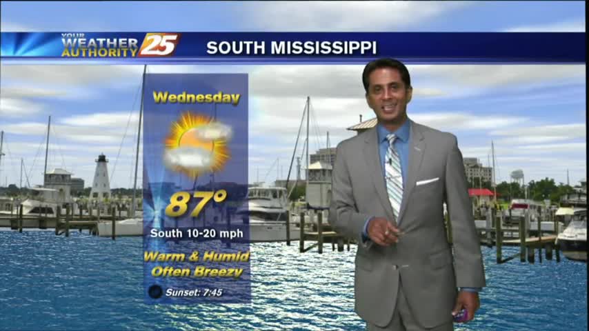
Another humid start with areas of patchy fog as an area of high-pressure continues to block the Gulf Coast...
A warm/humid start to the workweek along with areas of PATCHY FOG along the Southern 6...
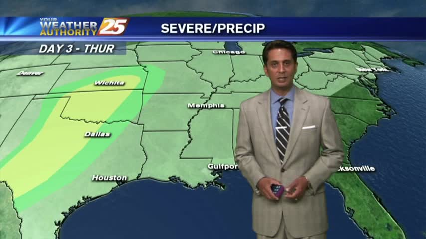
A line of T-Storms moving into the area in advance of an approaching cold front...

A warm/humid and BREEZY start to the day, along with areas of patchy fog along the coastal counties...