3/8 - Jeff's "All Clear/Cold Front" Weekend Forecast
The Tornado WATCH for our area has been canceled. Our area is ALL CLEAR from the threat for severe weather. There will be the chance for scattered showers…
The Tornado WATCH for our area has been canceled. Our area is ALL CLEAR from the threat for severe weather. There will be the chance for scattered showers…
A Tornado WATCH is in effect until 9 PM. Showers and thunderstorms, some capable of being severe, will be around into some parts of this evening.…
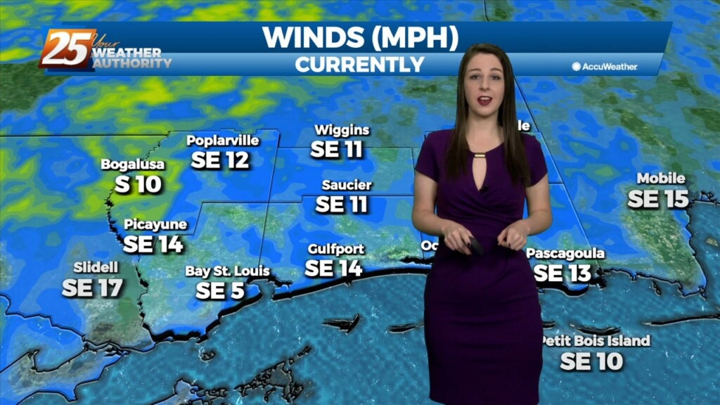
The biggest concern in the short term is the potential for severe through the remainder of this afternoon and overnight tonight ahead of an approaching cold front. Already…
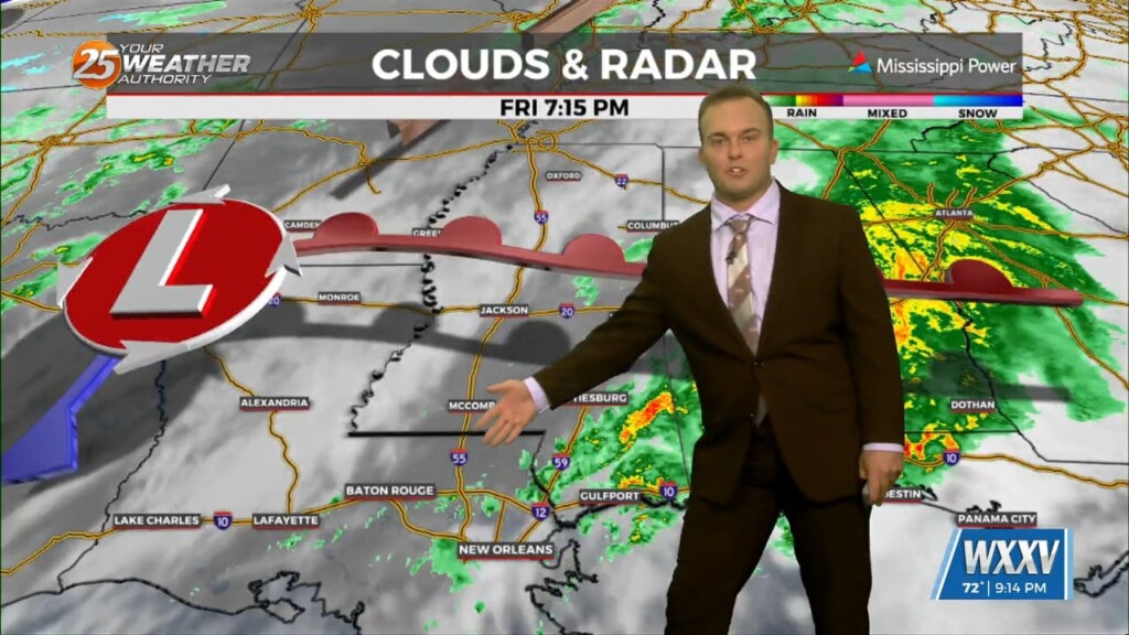
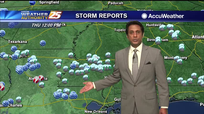
This is the time frame that will be looked at the most. A warm front will lift out of the gulf and move over the area around noon…
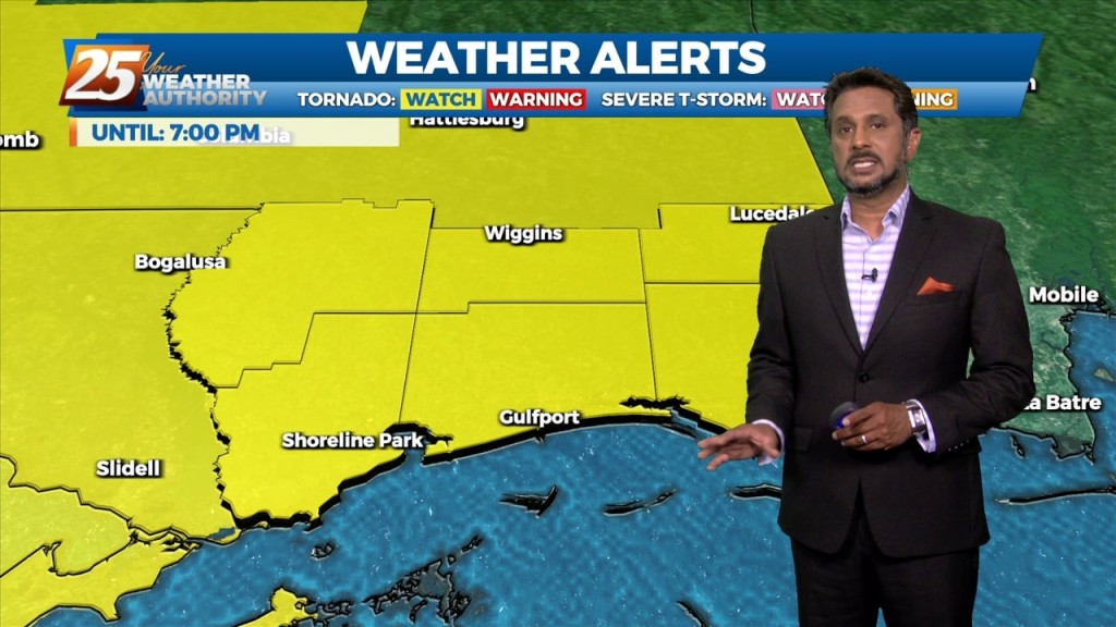
Issued By New Orleans/Baton Rouge - LA, US, National Weather Service Affected Area: Mississippi Sound Description: THE NATIONAL WEATHER SERVICE HAS ISSUED TORNADO WATCH 558 IN EFFECT UNTIL 7…
The warm front is now to the NE placing the area under the warm/moist unstable sector of this system. The synoptic and mesoscale pattern continues to support…
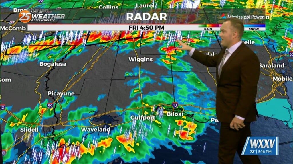
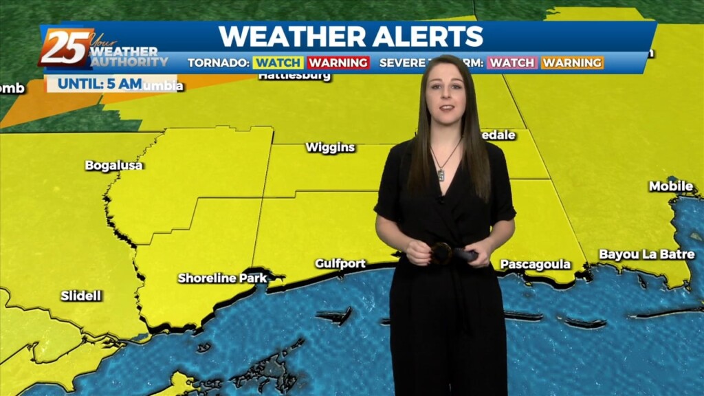
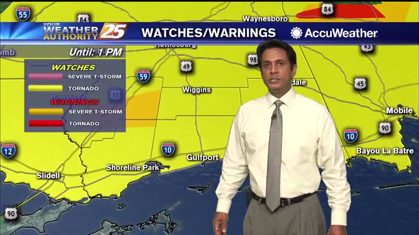
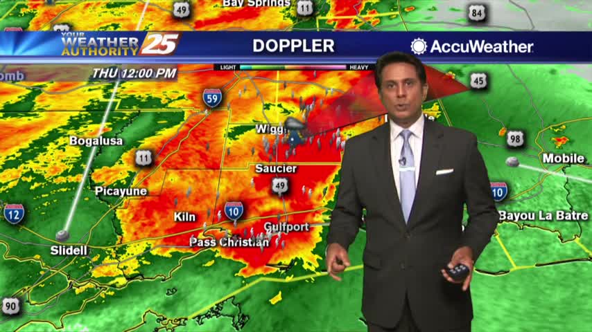
The area is under an ENHANCED/MODERATE threat for severity...especially noon through midnight A TORNADO WATCH IS IN EFFECT UNTIL 7 PM... Looking at the main event,…
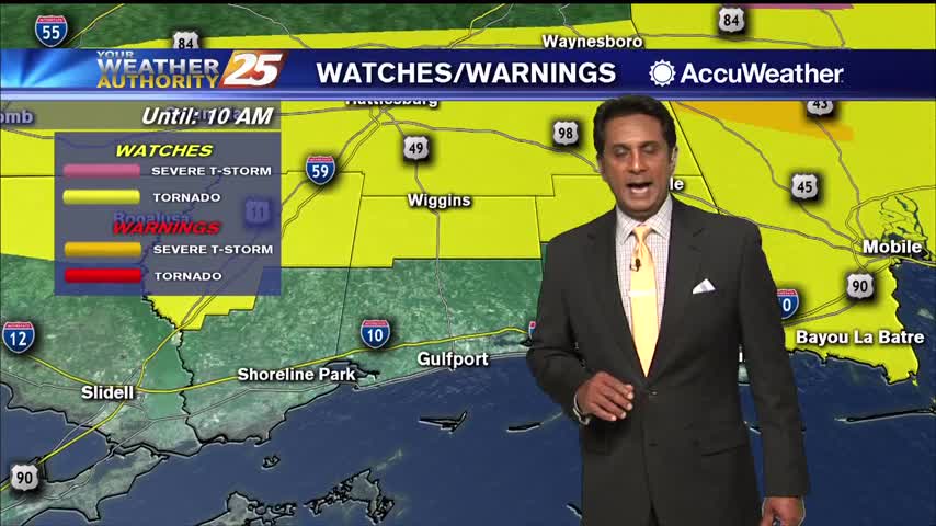
A vigorous system is in the area moving to the east. The area is under a TORNADO WATCH until 10 AM. All form of SEVERITY will…
With IDA to the NNW moving towards north central Mississippi, expect gradual improvement through today. Widespread rain across the area will continue and gradually decrease to scattered showers later today as Ida tracks slowly to the north. After the center…
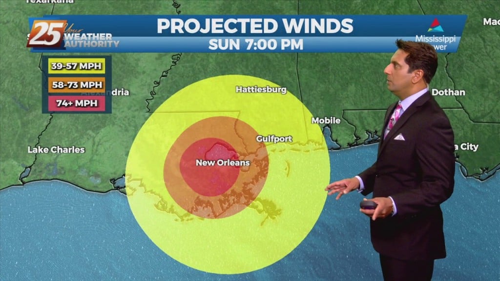
The NWS Doppler radar imagery and data from an Air Force Reserve Hurricane Hunter aircraft showed that Ida made landfall around 1655 UTC along the southeastern coast of Louisiana near Port Fourchon with estimated maximum winds of 130 kt and…
The NWS Doppler radar imagery and data from an Air Force Reserve Hurricane Hunter aircraft showed that Ida made landfall around 1655 UTC along the southeastern coast of Louisiana near Port Fourchon with estimated maximum winds of 130 kt and…
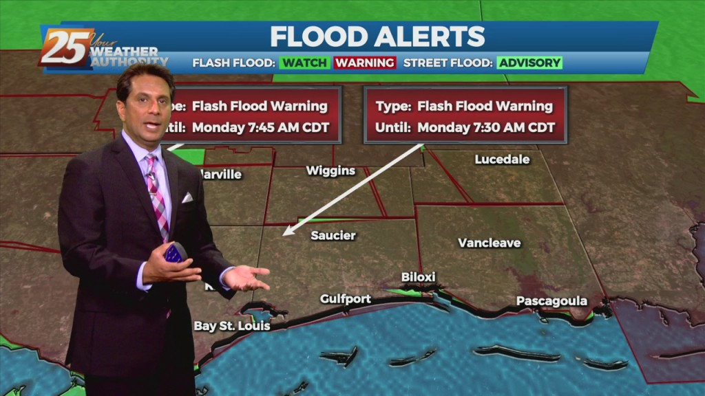
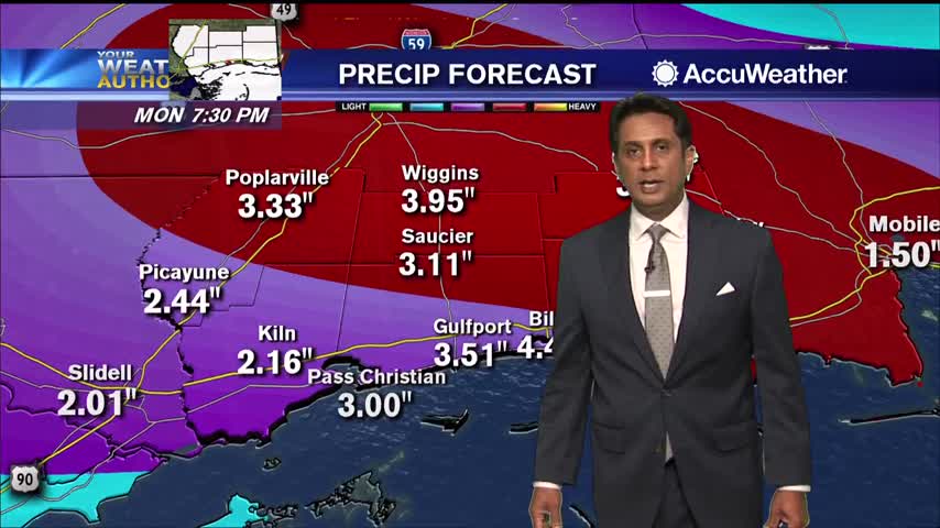
Hurricane Ida continues to move through SE Louisiana, moving towards the NW. South Mississippi will continue to see coastal flooding, gusting winds and the threat for tornadic activity as feeder bands move through the area. Winds will get worse late…
Hurricane Ida made landfall at 11:55 am in Port Fourchon, Louisiana’s southernmost port. As this storm continue to move NNW, conditions in south Mississippi will continue to go downhill. Coastal Mississippi will see more flooding as winds from the east…

Tropical Storm Cristobal is making its way to the Coast and some counties are already feeling the effects with flooding causing roads to close down along the coastal area. The Mississippi Department of Transportation (MDOT) said U.S. Highway 90 in…
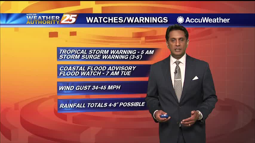
South Mississippi continue to be under a TROPICAL STORM watch...
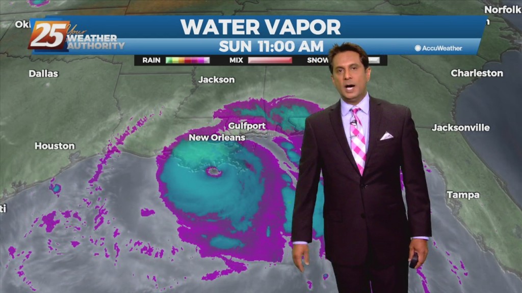
TS Cristobal continues to move closer to the SE Louisiana coast with landfall a bit earlier than projected...
TS Cristobal continues to move North towards the SE Louisiana coast...
After a bumpy morning, the cold front will clear the area this afternoon...
A very windy start to the day with multiple watches in effect as a vigorous system approaches...
What will likely be the most impactful weather of the week is expected take place over the next 24 hours. An upper-level low pressure system is currently tracking across northern Mexico. A frontal boundary that moved into the region yesterday…
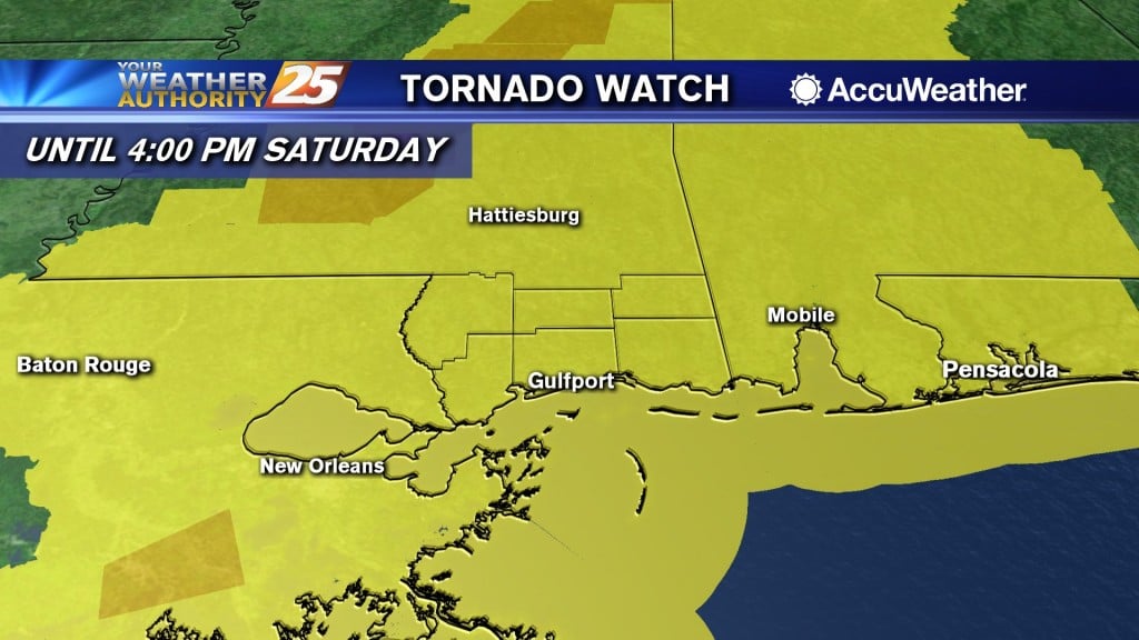
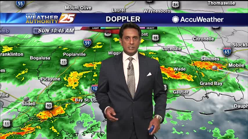
(WXXV) — The National Weather Service has issued a Tornado Watch for South Mississippi. The Tornado Watch is in effect until 4:00 PM Saturday for Pearl River, Jackson, Stone, Harrison, George, and Hancock Counties. Additionally, Tornado Watches stretch across the…
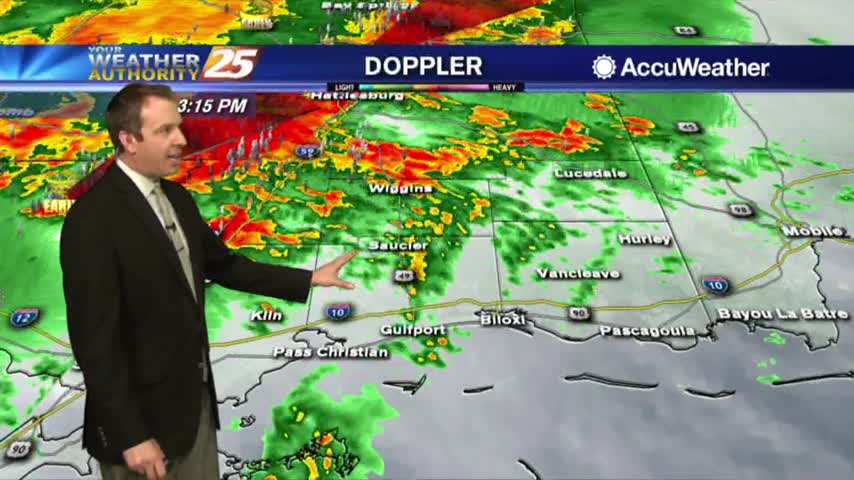
Showers and t-storms continue to move into south Mississippi with a TORNADO WATCH in effect through 3 PM...
The rain we've been talking about for days has finally arrived, and is bringing some potentially dangerous weather along with it....
TORNADO WATCH UNTIL 7 PM