03/19 Ryan's "Early Spring" Thursday Night Forecast
Spring has arrived earlier than usual, and I explain why in the forecast, but cooler weather is on the way as a front moves in.
Spring has arrived earlier than usual, and I explain why in the forecast, but cooler weather is on the way as a front moves in.
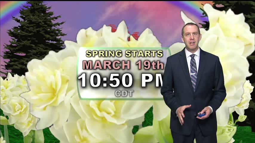
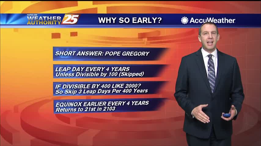
Spring begins tonight just before 11 PM, earlier than it has in nearly 125 years!
Not as cloudy as day as it's been, but they move right back in tonight along with more dense fog.
Today was a bit more sunny in the afternoon, but light cloud cover still lingered and will build back in tonight along with more dense fog.
We're heading into a nice weekend after a grey, muggy week, but a few chilly nights lie ahead.
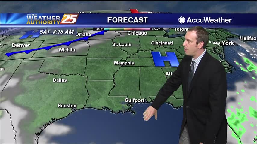
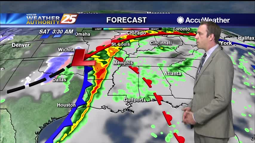
Active weather has moved on, so expect changing improving conditions heading into the weekend.
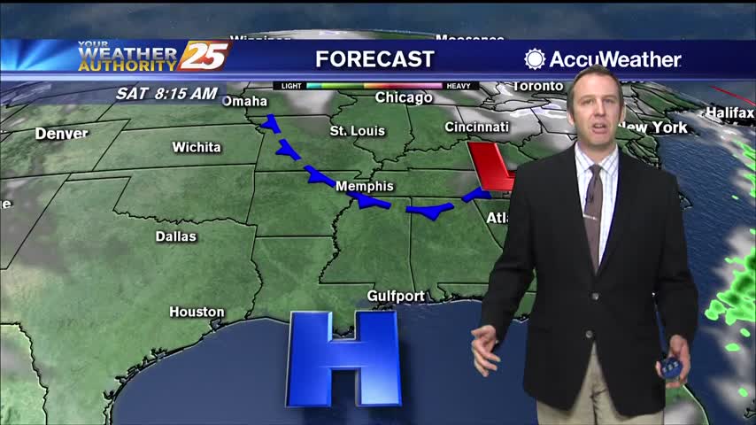
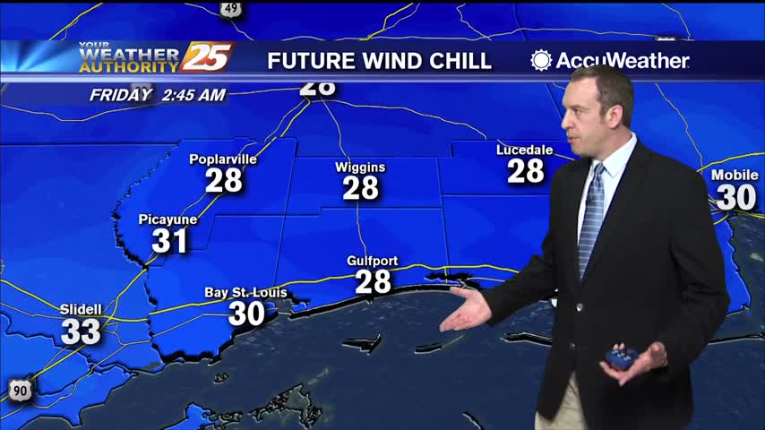
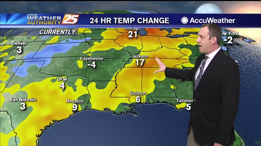
Get ready for another cold one, but I expect it to be slightly (a degree or so) warmer than last night. Warming increases into next week, into the low 70s by Tuesday.
We'll see another very cold night after a cool, sunny afternoon, but warmer days are ahead.
Clouds remain for now, but will slowly clear through the night. Expect a sunny and dry weekend ahead, but clouds return soon after.
After a stormy start to the day, lingering cloud cover will slowly clear through the night as colder, drier air moves in.
The rain is wrapping up as the cold, dry air filters in, leading to quite a chilly night.
Starting to see some clearing after a few stormy days, which will lead to some chilly nights and sunny afternoons!
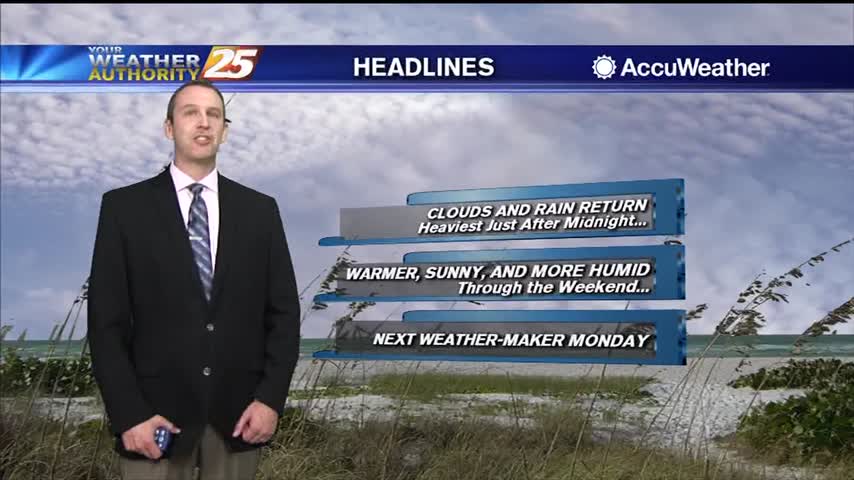
The clouds arrived earlier today and have continued to thicken, but the rain is still a few hours away.
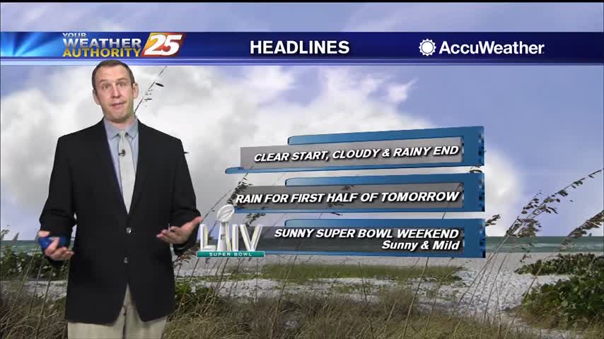
Today started clear after some rain yesterday, but the rain comes back again overnight just in time for Friday.

Changes are finally moving into South MS, but they'll take some time to take hold.
Our predictable pattern has finally changed, but you won't see much difference until next week.
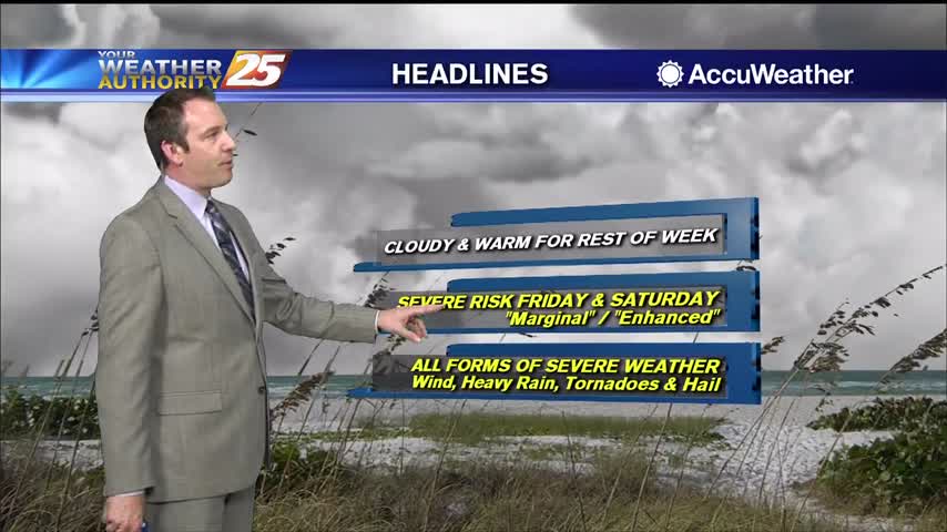
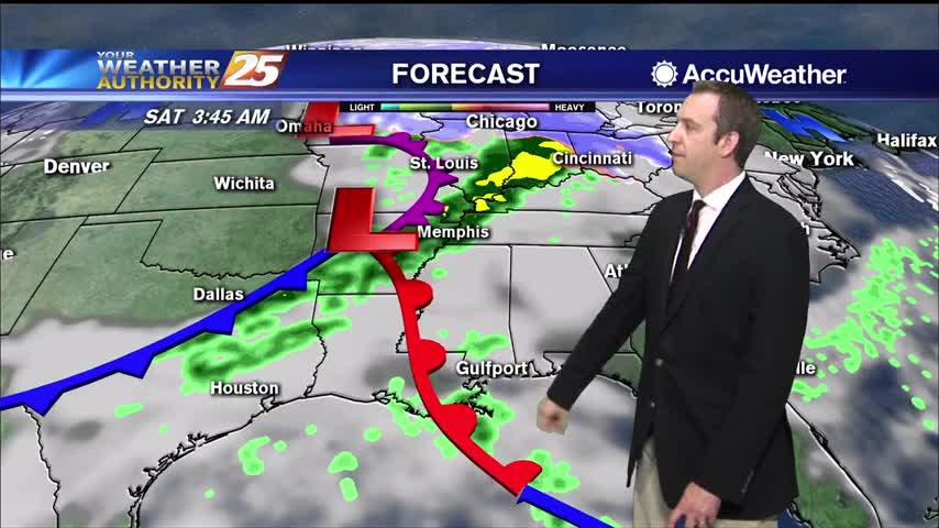
The cloudy skies have moved in and aren't leaving for the rest of the week. We're also gearing up for some potential weekend severe weather.
The clouds have moved in and aren't going to leave any time soon, but the rain will hold off a few more hours.
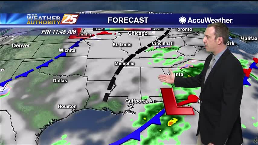
Still waiting on the first active weather of 2020 as a stalling front will carry rain into most of Friday.
We're still waiting for the first active weather of the new year, which has slowed considerably since yesterday.
We won't see much of the last full moon of the decade due to active weather moving in, but it doesn't look like anything serious.
We saw a few hours of sun yesterday evening, but rain chances and cloud cover are increasing through the night.
So far only cloud cover and the temperature has increased each day this week, but rain chances are added to the list tomorrow!
A little more cloud cover moved in today, but still saw plenty of sun and mild temperatures. Rain is right around the corner though....